

Beinn Ghlas
Good walks are even better shared.
NM9525 : Beinn Ghlas
Rude Health Photo source
Overview
Beinn Ghlas
Elevation: 1103 meters
Beinn Ghlas, perched majestically in the Scottish Highlands, is a Munro that beckons hikers of all skill levels. Known as the 'Grey Mountain', it provides a stunning backdrop against the striking blues of Loch Tay.
Geology
The mountain’s composition of schist and granite not only gives it its rugged features but also tells a tale of geological tumult shaping the landscape into the wonder we see today. As you hike, take a moment to observe the unique rock formations; they're practically nature's art exhibition!
Routes
East Ridge Route
The East Ridge route is the most frequented path to the summit. Starting from the Ben Lawers visitor centre, this route weaves through grassy terrain and rocky paths, perfect for those who love a bit of variety in their trek. Expect to be greeted with stunning panoramas of the surrounding peaks.
Distance & Duration
- Distance: Approximately 10 km round trip.
- Time: Roughly 4 hours, depending on your pace (and your selfie stops!)
Summit Features
Upon reaching the summit, you will be rewarded with a small cairn, a traditional marker for hikers. It's the perfect place to pause and absorb the views. Don’t forget to take a snap for the 'gram; your friends may not believe you conquered this beauty!
Terrain Type
Expect a delightful mix of rocky paths and grassy slopes, with a few boggy patches for good measure. Proper footwear is essential unless you fancy a surprise mud bath.
Views
The summit rewards your efforts with breathtaking views of Loch Tay and the majestic Ben Lawers range. The landscape unfolds like a patchwork quilt, especially during the late spring when the heather is in bloom. Early risers or those who linger until sunset can enjoy magical lighting conditions that transform the hills.
Hazards
Be aware that Scottish weather loves to be unpredictable. Conditions can change without warning, so it's crucial to be prepared for rain, wind, or even unexpected sunny intervals. The terrain can also be slippery, particularly after rain, so watch your footing!
Nearby Summits
- Ben Lawers (1214 meters) - A mighty neighbour and another Munro worth climbing.
- Meall Corranaich (1069 meters) - A companion peak that offers another view of this picturesque area.
Access
Parking
The closest car park is located at the Ben Lawers visitor centre (grid reference NN 661 383), which provides easy access to trailheads.
Public Transport
Public transport options are limited; it’s advisable to drive or grab a taxi to reach the visitor centre.
Nearby Town
The attractive village of Killin is the nearest settlement, offering all the essentials a hiker might need.
Facilities
You'll find public toilets at the visitor centre, with several cafés in Killin for a well-deserved treat after your climb.
History
The name 'Beinn Ghlas' reflects its rocky, grey appearance, and the area is steeped in folklore and historical significance dating back centuries. Ancient burial sites dot the landscape, reminding us of the rich human history that accompanies this natural beauty.
In conclusion, Beinn Ghlas is not just a hike; it's an adventure through history, a testament to nature's artistry, and a heart-pumping workout. Lace up your boots, bring a snack, and enjoy the beauty of the Scottish Highlands!
Explore routes near Beinn Ghlas
Walks starting near this hill. Open a route to check its map, distance and full itinerary.
Crinan Canal: Bellanoch and Dunardry towpath return
View route
Beinn Ime from Succoth
View route
The Cobbler from Succoth Carpark
View route
Glen Kin group walk
View route
Route planning notes
These notes describe possible approaches. Check a route's map and access information when planning your walk.
East Ridge Route
The most popular and straightforward route, starting from the Ben Lawers visitor centre. Offers stunning views and is well marked.
Make a day of it, together
Find someone to share the walk with, or organise a day out along a route you like.
Photo Gallery
View all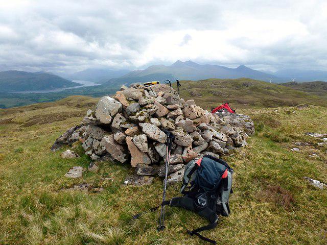 Photo could not load
NM9525 : Beinn Ghlas
Rude Health
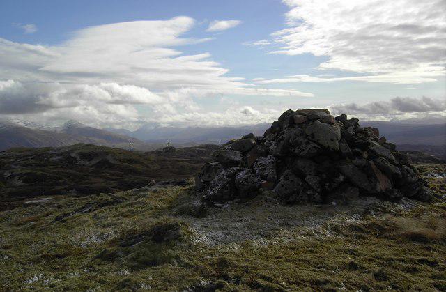 Photo could not load
NM9525 : Beinn Ghlas Cairn
Colin Kinnear
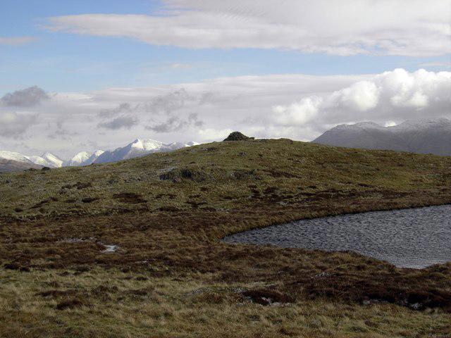 Photo could not load
NM9525 : Beinn Ghlas Summit
Colin Kinnear
Hill facts and local notes
Classifications
Elevation
512m
1,680 ft
Prominence
265m
Coordinates
56.3817, -5.3099
NM957259
OS Map
49
Explorer: 360N
At the Summit
The summit features a small cairn that provides a perfect spot for a photo op. You might even spot a few fellow hikers enjoying the view!
Terrain & Geology
Beinn Ghlas is primarily composed of schist and granite, showcasing the typical rugged geology of the Scottish Highlands. This gives the mountain its characteristic steep slopes and beautiful glens.
Views & Scenery
From the summit, hikers are treated to breathtaking views of Loch Tay, Ben Lawers, and the surrounding peaks of the central Scottish Highlands. Keep an eye out for wildlife too!
History & Heritage
Name Origin
Beinn Ghlas translates to 'Grey Mountain', aptly describing its rocky façade and sometimes overcast weather.
Historical Significance
The area is rich in history, with ancient burial sites and connections to local folklore. It's a site of natural beauty and cultural importance.
Getting There & Facilities
Parking
The nearest parking is at the Ben Lawers visitor centre (grid reference NN 661 383), which provides a large car park and access to several routes.
Public Transport
Limited public transport available; the nearest bus stop is in Killin. Consider driving or arranging a taxi for access to the visitor centre.
Nearby Facilities
Visit the Ben Lawers visitor centre for information and toilets. Cafés in Killin provide a welcoming stop for refreshments.
Safety Information
Known Hazards
- Weather can change rapidly; be prepared for all conditions. Slippery rocks and boggy patches can be treacherous, especially after rain.
General Safety Tips
- Check weather conditions before setting out
- Carry appropriate clothing and equipment
- Let someone know your planned route
- Take a map, compass, and GPS device
- Carry emergency supplies: food, water, first aid kit, torch
Hills
Some common questions about the hills answered
Are there group walks up Beinn Ghlas?
Many walkers use Walkmates to join or organise walks with others. You can check for group walks around Beinn Ghlas through the maps
Are there other walkers around Beinn Ghlas?
Activity varies by location and time, but Walkmates lets you see whether others have shared walks or shown interest in this area. Find other people through the walking friends search walking friends for Beinn Ghlas search or of course create your own walk for Beinn Ghlas
Can I organise a walk to Beinn Ghlas?
Yes. If there aren’t any walks listed already, you can create a walk and make it available for others to join.
If you're signed up to Walkmates, you can create a walk to Beinn Ghlas.
How do I find a walk up this hill?
There are often multiple ways to walk this hill, depending on experience and route preference. Walkmates helps you explore walks and routes that others have shared.
Can I suggest a new route up Beinn Ghlas?
Yes. You can suggest or create routes to share with others. Walkmates focuses on the social side of walking, so routes are used to help people organise walks and explore areas together, rather than as detailed navigation tools or route libraries.
Other uses really appreciate knowledgeable walkers sharing their routes. Share your favourite route to Beinn Ghlas here
The is an error or something incorrect about this hill. How do I let you know?
We always strive to keep the information on Walkmates as accurate as possible. If you find an error, please let us know through the contact form and we'll aim to correct it as quickly as possible
Community Discussion
Comments
Location
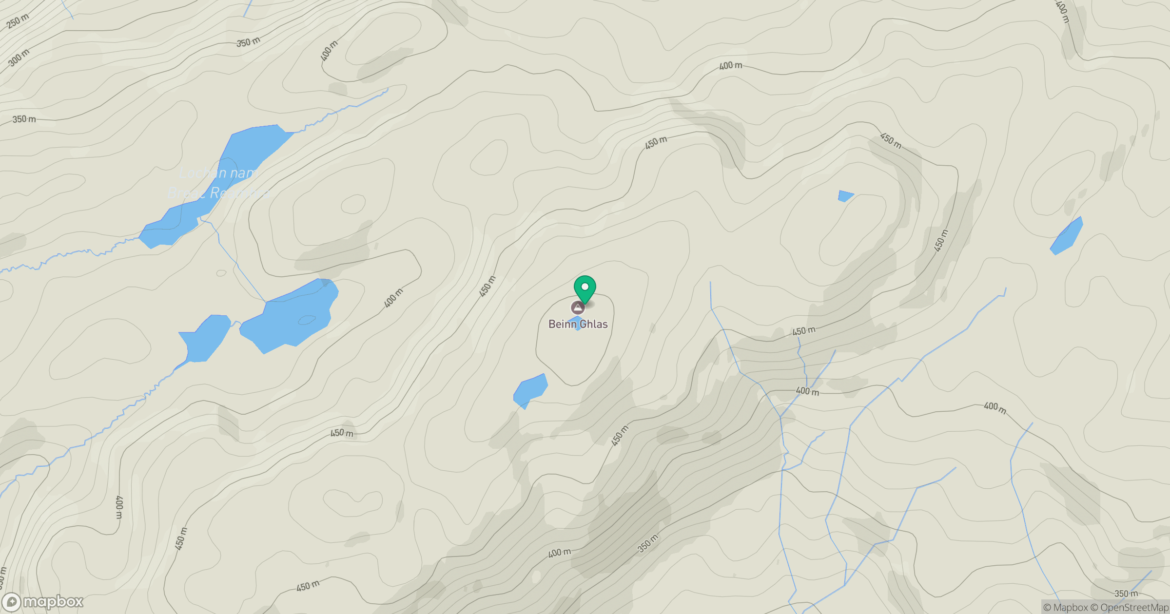
Grid reference: NM957259
View on OpenStreetMapOpens a map in a new tab, centred on the hill.
No comments yet. Be the first.