
Cruach Narrachan
Good walks are even better shared.
Overview
Cruach Narrachan: A Hidden Gem in the Highlands
As you approach Cruach Narrachan, be prepared to fall in love with the wild beauty that characterises the Scottish Highlands. Standing proud at 497 meters, it's a Marilyn, but don’t let that fool you—this mountain is anything but unassuming.
Geology
Cruach Narrachan is a splendid example of the geological diversity found in the Highlands. It is primarily composed of granite and schist, remnants of a bygone era when tectonic forces shaped this part of the world. Keep an eye out for fascinating rock formations as you ascend!
The Routes
The most popular route starts at the A83 layby. This 10-kilometre trail (approx. 4 hours) offers moderate challenges, keeping your heart rate up without sending you into a panic. The path takes you through lush glens and rocky outcrops, all the while keeping you company with views that will knock your socks off (if you decide it’s safe to remove them).
Summit Features
Upon reaching the summit, you'll find a neatly stacked stone cairn that completes the picture. It's a calling card for hikers and a beacon of triumph, not to mention a great spot for a well-deserved snack and photo op!
Terrain Type
Expect a glorious mix of rocky outcrops, grassy patches, and the occasional boggy area that loves to hug your boots. Be mindful of where you tread—your footwear will thank you later!
Views from the Top
How about a panoramic view that includes Lochgoilhead and the expansive Firth of Clyde? It’s like nature’s own postcard. The best times to enjoy this spectacle are in spring and early autumn when the skies are more forgiving and the landscape is painted with vibrant colours.
Hazards
While the trail is manageable, the weather can change on a dime, and the rocks may be slippier than they look. Be equipped and smart about your adventure, as fog may scatter your views and sense of direction.
Access
You can park right at the A83 with space for around 10 to 15 vehicles—first come, first served! If you fancy public transport over your motor, buses from Glasgow to nearby Cairndow can get you close, followed by a short taxi ride to the trailhead. The nearest town, Lochgoilhead, is not only charming but also offers essential facilities, from cafes to convenient stores and toilets.
Facilities
Lochgoilhead has got your back—delightful cafes, a small convenience store for any snacks you may fancy, and public toilets for those urgently necessary visits before conquering the summit.
A Brief History
The name 'Cruach Narrachan' translates to 'The mound of the little valley', steeped in rich Gaelic heritage. Historically, this area has been home to various settlements, making the mountain a silent witness to centuries of Highland tales.
In conclusion, whether you’re a seasoned mountaineer or a casual hiker, Cruach Narrachan provides an invigorating adventure set against the backdrop of stunning Scottish scenery. Just remember to pack your sense of humour along with your map!
Happy Hiking!
Explore routes near Cruach Narrachan
Public walks starting within 80 km of this hill. Nearby does not mean a route reaches the summit; check its map and access before setting out.
Crinan Canal: Bellanoch and Dunardry towpath return
View route
Beinn Ime from Succoth
View route
The Cobbler from Succoth Carpark
View route
Glen Kin group walk
View route
Route planning notes
These notes describe possible approaches, not verified navigable routes or permission to cross land. Check current paths, local access rules and conditions before setting out.
Beinn Ime Route
This popular route begins at the A83 parking area and meanders through scenic glens before ascending the rocky outcrops of Cruach Narrachan.
Make a day of it, together
Find someone to share the walk with, or organise a day out along a route you like.
Hill facts and local notes
Classifications
Elevation
374m
1,227 ft
Prominence
100m
Coordinates
56.2872, -5.3713
NM914156
OS Map
55
Explorer: 359 360S
At the Summit
The summit boasts a small stone cairn, providing a perfect spot for a well-earned rest and a selfie with the breathtaking views.
Terrain & Geology
Cruach Narrachan is primarily composed of granite and schist, typical of the rugged Highland landscape. Its geology provides a glimpse into the ancient tectonic activity that shaped this region.
Views & Scenery
The stunning vistas include Lochgoilhead and the surrounding hills, with the Firth of Clyde stretching in the distance.
History & Heritage
Name Origin
The name 'Cruach Narrachan' is believed to derive from Gaelic, meaning 'The mound of the little valley'.
Historical Significance
The area has historical importance, being a site of past settlements and rich in Highland culture.
Getting There & Facilities
Check current local access restrictions, parking rules and transport timetables before travelling. These notes do not confirm public access to the summit.
Parking
Parking is available at the A83 layby near the start of the Beinn Ime route, capacity for about 10-15 cars.
Public Transport
Buses run from Glasgow to Cairndow, from where a short taxi ride can take you to the trailhead.
Nearby Facilities
Lochgoilhead offers cafes, a convenience store, and public toilets, perfect for a breather before or after your hike.
Safety Information
Known Hazards
- Watch out for sudden weather changes and be prepared for slick rocks and uneven ground. Visibility can drop quickly in fog.
General Safety Tips
- Check weather conditions before setting out
- Carry appropriate clothing and equipment
- Let someone know your planned route
- Take a map, compass, and GPS device
- Carry emergency supplies: food, water, first aid kit, torch
Hills
Some common questions about the hills answered
Are there group walks up Cruach Narrachan?
Many walkers use Walkmates to join or organise walks with others. You can check for group walks around Cruach Narrachan through the maps
Are there other walkers around Cruach Narrachan?
Activity varies by location and time, but Walkmates lets you see whether others have shared walks or shown interest in this area. Find other people through the walking friends search walking friends for Cruach Narrachan search or of course create your own walk for Cruach Narrachan
Can I organise a walk to Cruach Narrachan?
Yes. If there aren’t any walks listed already, you can create a walk and make it available for others to join.
If you're signed up to Walkmates, you can create a walk to Cruach Narrachan.
How do I find a walk up this hill?
There are often multiple ways to walk this hill, depending on experience and route preference. Walkmates helps you explore walks and routes that others have shared.
Can I suggest a new route up Cruach Narrachan?
Yes. You can suggest or create routes to share with others. Walkmates focuses on the social side of walking, so routes are used to help people organise walks and explore areas together, rather than as detailed navigation tools or route libraries.
Other uses really appreciate knowledgeable walkers sharing their routes. Share your favourite route to Cruach Narrachan here
The is an error or something incorrect about this hill. How do I let you know?
We always strive to keep the information on Walkmates as accurate as possible. If you find an error, please let us know through the contact form and we'll aim to correct it as quickly as possible
Community Discussion
Comments
Location
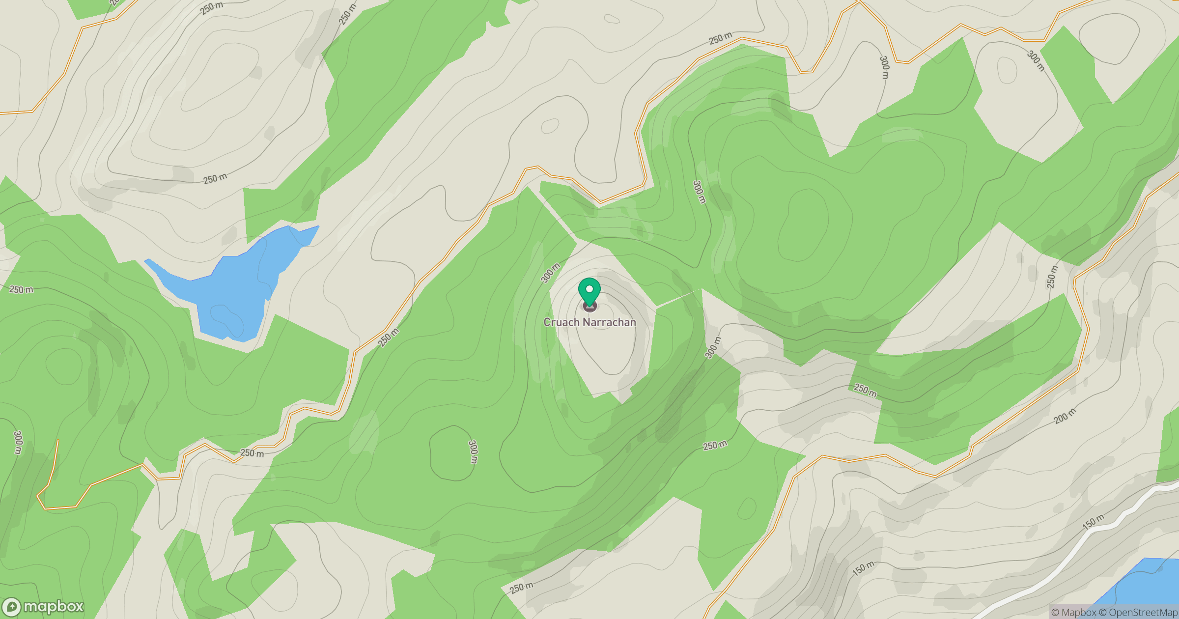
Grid reference: NM914156
View on OpenStreetMapOpens a map in a new tab, centred on the hill.
Hills within 30 km
Straight-line distance, not a walking route or confirmation of access.
No comments yet. Be the first.