

Cruach Maolachy
Good walks are even better shared.
Overview
Cruach Maolachy
Introduction
Nestled in the stunning Scottish Highlands, Cruach Maolachy is a Marilyn that stands at an elevation of 757 meters. Known for its distinctive granite and schist geology, it presents not only a hiking challenge but an appreciation for the ancient forces that shaped our landscape.
Geology
The mountain's structure is a testament to the rugged beauty of the Highlands. Formed during the Caledonian Orogeny, the granite and schist rocks give way to a variety of terrain, from rocky paths to soft grassy slopes. Be prepared for a rocky affair underfoot, particularly on the ascent!
Routes
West Highland Way Approach
A favourite among hikers, this route meanders through lush valleys and offers light-hearted banter with fellow adventurers until the path becomes a more earnest approach to the summit.
East Ridge Route
For those seeking a bit of excitement, the East Ridge presents a moderate scramble that brings you to the top in style. Just keep an eye on your footing and possibly leave the flip-flops at home!
Summit Features
At the summit, hikers are welcomed by a sturdy cairn that serves as both a navigation point and a great backdrop for that all-important summit selfie. Looking around, you'll understand why this area has been inspiring poets and wanderers alike for centuries.
Terrain Type
Expect a mix of rocky terrain interspersed with patches of grass, and a few boggy surprises on the way up. Dressing in layers is smart; ‘better to have it and not need it than need it and not have it’ rings especially true here!
Views
The vista from Cruach Maolachy is nothing short of spectacular. Expect to feast your eyes on Ben Nevis, the Great Glen, and untouched Lochs adorning the landscape. The best seasons to enjoy this view are spring and early summer when wildflowers blanket the area and the likelihood of clear skies increases dramatically.
Hazards
While the landscapes are breathtaking, be mindful of the rocky paths and possible wet conditions. It’s advisable to take care; a slip may leave more than just a bruise on your ego!
Access
Getting to Cruach Maolachy is relatively straightforward. Park at Strontian village, and you’re just a stone's throw from your starting point. For those relying on public transport, bus services from Fort William are available, but do check the timings in advance.
Facilities
Cafes in Strontian are perfect for a post-hike cuppa, as well as public toilets near the village hall, making sure you're comfortable before your adventure.
History
The name Cruach Maolachy, meaning ‘bald hill’, perfectly describes this open, unfettered summit. Historically, this region has been a favourite of hikers and adventurers drawn to the wild beauty of the Highlands.
Conclusion
Cruach Maolachy offers a slice of wonderful Highland nature, seeming to call out for those passionate about the outdoors. So, lace up those boots and set off for an adventure that won’t easily be forgotten!
Happy hiking!
Explore routes near Cruach Maolachy
Public walks starting within 80 km of this hill. Nearby does not mean a route reaches the summit; check its map and access before setting out.
Crinan Canal: Bellanoch and Dunardry towpath return
View route
Glen Kin group walk
View route
Beinn Ime from Succoth
View route
The Cobbler from Succoth Carpark
View route
Route planning notes
These notes describe possible approaches, not verified navigable routes or permission to cross land. Check current paths, local access rules and conditions before setting out.
West Highland Way Approach
A scenic trek starting from the foot of the mountain along the West Highland Way, meandering through lush valleys before the ascent.
East Ridge Route
An exhilarating scramble up the eastern ridge with stunning views on your way to the summit that will have you thinking about that second breakfast.
Make a day of it, together
Find someone to share the walk with, or organise a day out along a route you like.
Photo Gallery
View all Photo could not load
NM8914 : Cruach Maolachy
Patrick Mackie
Hill facts and local notes
Classifications
Elevation
379m
1,243 ft
Prominence
113m
Coordinates
56.2751, -5.4034
NM893143
OS Map
55
Explorer: 360S
At the Summit
The summit is marked by a prominent cairn that offers not just a great photo opportunity, but also a place to contemplate life – and perhaps the meaning of that last snack.
Terrain & Geology
Cruach Maolachy is predominantly composed of granite and schist, providing a unique geological profile that dates back to the Caledonian Orogeny, leaving behind rugged landscapes shaped by ancient glacial activity.
Views & Scenery
From the summit, enjoy panoramic views of Ben Nevis, the Great Glen, and the surrounding valleys full of emerald green and shimmering lochs.
History & Heritage
Name Origin
The name Cruach Maolachy translates to 'bald hill', a fitting description for its rocky summit devoid of trees.
Historical Significance
This mountain has been a favourite amongst local hikers and a breathtaking backdrop for many outdoor activities, showcasing the rugged beauty of the Highland landscape.
Getting There & Facilities
Check current local access restrictions, parking rules and transport timetables before travelling. These notes do not confirm public access to the summit.
Parking
There is parking available at the nearby village of Strontian, roughly 5 km from the trailhead, suitable for several cars.
Public Transport
Regular bus services operate from Fort William to Strontian, making it accessible for public transport users, though a bit of planning is needed.
Nearby Facilities
There are several local cafes in Strontian where you can refuel, as well as public toilets available near the village hall.
Safety Information
Known Hazards
- Care should be taken on the rocky terrain, especially in wet conditions. Remember: 'slip-sliding away' is not a valid hiking strategy!
General Safety Tips
- Check weather conditions before setting out
- Carry appropriate clothing and equipment
- Let someone know your planned route
- Take a map, compass, and GPS device
- Carry emergency supplies: food, water, first aid kit, torch
Hills
Some common questions about the hills answered
Are there group walks up Cruach Maolachy?
Many walkers use Walkmates to join or organise walks with others. You can check for group walks around Cruach Maolachy through the maps
Are there other walkers around Cruach Maolachy?
Activity varies by location and time, but Walkmates lets you see whether others have shared walks or shown interest in this area. Find other people through the walking friends search walking friends for Cruach Maolachy search or of course create your own walk for Cruach Maolachy
Can I organise a walk to Cruach Maolachy?
Yes. If there aren’t any walks listed already, you can create a walk and make it available for others to join.
If you're signed up to Walkmates, you can create a walk to Cruach Maolachy.
How do I find a walk up this hill?
There are often multiple ways to walk this hill, depending on experience and route preference. Walkmates helps you explore walks and routes that others have shared.
Can I suggest a new route up Cruach Maolachy?
Yes. You can suggest or create routes to share with others. Walkmates focuses on the social side of walking, so routes are used to help people organise walks and explore areas together, rather than as detailed navigation tools or route libraries.
Other uses really appreciate knowledgeable walkers sharing their routes. Share your favourite route to Cruach Maolachy here
The is an error or something incorrect about this hill. How do I let you know?
We always strive to keep the information on Walkmates as accurate as possible. If you find an error, please let us know through the contact form and we'll aim to correct it as quickly as possible
Community Discussion
Comments
Location
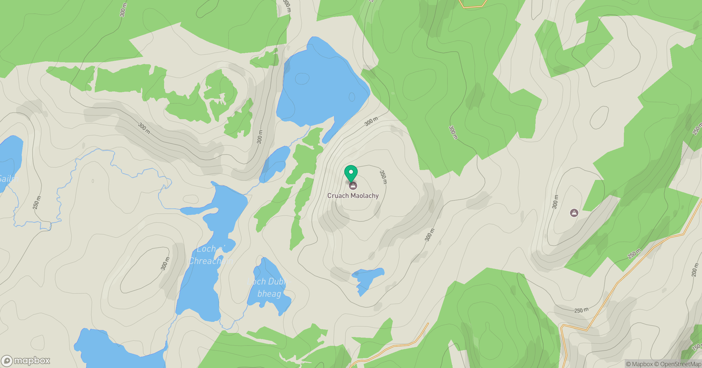
Grid reference: NM893143
View on OpenStreetMapOpens a map in a new tab, centred on the hill.
Hills within 30 km
Straight-line distance, not a walking route or confirmation of access.
No comments yet. Be the first.