
Craigmore Hill (Yeaman summit)
Good walks are even better shared.
Overview
Craigmore Hill (Yeaman summit)
Overview
Nestled in the beautiful Southern Uplands, Craigmore Hill, also known as Yeaman summit, stands at an elevation of 378 meters. This Marilyn offers a moderate challenge with splendid rewards, making it a favourite among local hikers and nature enthusiasts.
Geology
The mountain's Old Red Sandstone formations tell tales of a dynamic geological past, featuring layers that showcase the area's history. The vibrant reddish hues coupled with rocky outcrops make for intriguing exploration and photography.
Routes
Craighlaw Road Route
This easy route provides an accessible pathway to the summit. Starting at Craighlaw Road, the path is well-trodden, ideal for families, and even your furry friends. Clocking in at around 2.5 km, it typically takes about 1.5 hours to ascend.
Summit Features
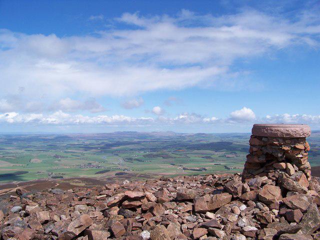
The summit features a notable trig point and a friendly cairn that beckons climbers for a quick photo-op. Whether you’re a seasoned summit-bagger or a casual walker, it’s a perfect place to take a breather (and a snack).
Terrain
Expect a mix of grassy fields and rocky patches; it's a good idea to wear sturdy boots if you want to keep your feet dry. There might be a bog or two about, which can be more fun than it sounds if you're up for a little adventure!
Views
Upon reaching the summit, panoramic views await. The rolling hills exude tranquility, while Galloway Forest Park to the west showcases nature's pristine beauty. On clear days, the sight of the Solway Firth adds a glimmering touch, revealing the Mediterranean-like charm of this hidden gem.
Hazards
While Craigmore is generally safe, be mindful of uneven ground and the odd wet patch. 'Soggy socks' is not exactly anyone’s idea of fun, so be careful where you tread!
Access
Nearest Parking
A quaint parking area at the Craighlaw Road entrance offers a few spaces to get your adventure started. Not a luxury resort, but it'll do!
Public Transport
Public transport options are limited, but local bus services might drop you off reasonably close. Driving is typically the way to go for most.
Nearest Town
Nature enthusiasts will find Newton Stewart to be the closest town, a delightful spot to grab a cuppa after a day of hiking.
Facilities
With minimal amenities on-site, gather your supplies before coming. Newton Stewart features cafes and toilets, so be sure to plan a pit stop!
History
Name Meaning
The name 'Craigmore' translates to 'big rock' or 'great hill', making it a fitting moniker for this prominent feature of the landscape.
Significance
Historically, Craigmore Hill has served as a natural gathering point for wildlife and early communities, with old trails tracing paths through the landscape.
Conclusion
Craigmore Hill is not just another hill on the map; it's a delightful day out in nature, ripe for exploration and adventure. So lace up those boots, pack a picnic, and embrace the beauty that awaits!
Explore routes near Craigmore Hill (Yeaman summit)
Walks starting near this hill. Open a route to check its map, distance and full itinerary.
Mabie Forest Dalshinnie Glen and Loch
View route
Dalbeattie Forest Plantain Loch Trail
View route
Forest of Ae Water of Ae Riverside Trail
View route
Castle Douglas Carlingwark Loch and Lover’s Walk Circuit
View route
Route planning notes
These notes describe possible approaches. Check a route's map and access information when planning your walk.
Craighlaw Road Route
A straightforward path leading from Craighlaw Road to the summit of Yeaman, ideal for beginners and families.
Make a day of it, together
Find someone to share the walk with, or organise a day out along a route you like.
Hill facts and local notes
Classifications
Elevation
194m
638 ft
Prominence
20m
Coordinates
55.0452, -3.6960
NX917736
OS Map
84
Explorer: 313 321
At the Summit
The summit is crowned with a modest cairn and a distinct trig point, providing perfect photo opportunities for social media enthusiasts.
Terrain & Geology
Predominantly composed of Old Red Sandstone, which gives the area its distinctive reddish hue, featuring layered sedimentary rock formations that have weathered gracefully over the ages.
Views & Scenery
From the top, gaze upon the rolling hills of the Southern Uplands, with the stunning backdrop of Galloway Forest Park to the west and the Solway Firth glimmering in the distance.
History & Heritage
Name Origin
The name 'Craigmore' derives from Scots Gaelic, meaning 'big rock' or 'great hill', which is rather fitting, don't you think?
Historical Significance
Historically, the area has been a crossroads for local wildlife and early human settlements, with evidence of ancient pathways.
Getting There & Facilities
Parking
Parking available at the Craighlaw Road entrance, with space for several cars; no amenities.
Public Transport
Limited public transport; visitors often drive, but local bus services may operate from nearby villages.
Nearby Facilities
Facilities are scarce; the nearest cafes and toilets are found in Newton Stewart. Best to fill flasks and pack a lunch!
Safety Information
Known Hazards
- Uneven terrain may pose risks for those not paying attention; boggy patches could lead to wet socks, which is almost always a bad day.
General Safety Tips
- Check weather conditions before setting out
- Carry appropriate clothing and equipment
- Let someone know your planned route
- Take a map, compass, and GPS device
- Carry emergency supplies: food, water, first aid kit, torch
Hills
Some common questions about the hills answered
Are there group walks up Craigmore Hill (Yeaman summit)?
Many walkers use Walkmates to join or organise walks with others. You can check for group walks around Craigmore Hill (Yeaman summit) through the maps
Are there other walkers around Craigmore Hill (Yeaman summit)?
Activity varies by location and time, but Walkmates lets you see whether others have shared walks or shown interest in this area. Find other people through the walking friends search walking friends for Craigmore Hill (Yeaman summit) search or of course create your own walk for Craigmore Hill (Yeaman summit)
Can I organise a walk to Craigmore Hill (Yeaman summit)?
Yes. If there aren’t any walks listed already, you can create a walk and make it available for others to join.
If you're signed up to Walkmates, you can create a walk to Craigmore Hill (Yeaman summit).
How do I find a walk up this hill?
There are often multiple ways to walk this hill, depending on experience and route preference. Walkmates helps you explore walks and routes that others have shared.
Can I suggest a new route up Craigmore Hill (Yeaman summit)?
Yes. You can suggest or create routes to share with others. Walkmates focuses on the social side of walking, so routes are used to help people organise walks and explore areas together, rather than as detailed navigation tools or route libraries.
Other uses really appreciate knowledgeable walkers sharing their routes. Share your favourite route to Craigmore Hill (Yeaman summit) here
The is an error or something incorrect about this hill. How do I let you know?
We always strive to keep the information on Walkmates as accurate as possible. If you find an error, please let us know through the contact form and we'll aim to correct it as quickly as possible
Community Discussion
Comments
Location
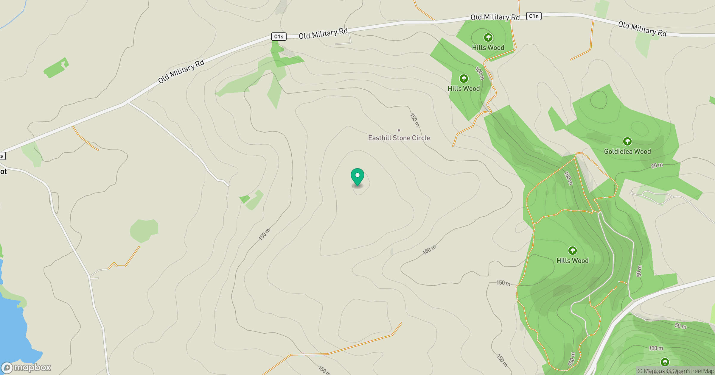
Grid reference: NX917736
View on OpenStreetMapOpens a map in a new tab, centred on the hill.
No comments yet. Be the first.