

Conival
Good walks are even better shared.
NC3020 : Northern ridge of Conival
Hill Walker Photo source
Overview
Conival: A Jewel of the Scottish Highlands
Height: 987 meters
Nestled in the stunning Scottish Highlands, Conival is a prime example of what makes hillwalking in Scotland such a revered pastime. As part of the illustrious group of Munros, this peak warrants the attention of anyone with a penchant for the outdoors.
Geology
Conival's geology is a treat for enthusiasts. With primarily ancient metamorphic schist and gneiss creating the rugged terrain, hikers will find themselves treading through pathways shaped by both ancient forces and more recent glacial activity. So, perhaps, you could say that the mountain has layers – much like a good onion, but hopefully less tear-inducing.
Routes
One of the most popular and accessible routes is the Inverlael to Conival trail. Spanning approximately 12 km, it takes about 5 hours to complete and is graded moderate due to its varied terrain, including some steep sections that will definitely get the heart pumping (in a good way!). This route showcases the Highland's natural beauty, so make sure your camera is at the ready.
Summit Features
Reaching the summit reveals a magnificent stone cairn, which stands proudly on top of the world, offering unparalleled views over the surrounding landscape. Just a word of wisdom: don’t forget to take a moment to soak it all in before attempting to capture the perfect selfie!
Terrain Type
As you ascend, expect to encounter a range of terrain types, from rocky paths to grassy slopes, with the occasional boggy patch. It's a mixed bag of adventure – so sturdy footwear is highly recommended!
Views
The highlight of climbing Conival is undoubtedly the views from the top. On a clear day, you're greeted with panoramic vistas of nearby Munros, including the majestic Ben More Assynt. If you’ve got a warm scarf and a thermos of tea, you’re all set for an afternoon of delight as you gaze upon the stunning landscape that stretches beyond the horizon.
Hazards
Hiking Conival comes with its share of risks. Prepare for potential slippery rocks, changing weather patterns, and those infamous boggy patches that can turn your boots into sponges. Always check the forecast before heading out, and don’t forget to come equipped for the unpredictable Highland weather!
Access
Conival is accessible from Inverlael, which offers a small car park for hikers. Remember, parking can be limited, particularly on weekends, so arrive early! For those relying on public transport, Ullapool boasts a bus service to Inverlael, but be sure to check the timetable; you don’t want to be left waiting for the next ride!
Facilities
Amenities are not available on the mountain, but you can find a number of cafes and public toilets in nearby Ullapool. Make sure you’re well-fed before you tackle the ascent!
History
The name Conival has Gaelic roots, bearing the meaning of 'cone'. This is a fitting tribute to the peak's shape and adds a touch of cultural flavour to your trek.
Conival stands not only as a physical challenge but as a beacon of cultural and natural history, embodying the spirit of adventure that draws many to the Scottish Highlands. Pack your bags, lace up your boots, and embark on an adventure to this splendid Munro!
Last updated: 2023-10-01
Source: Ordnance Survey
Explore routes near Conival
Walks starting near this hill. Open a route to check its map, distance and full itinerary.
Ben Klibreck
View route
Loch Migdale from Torroy: Spinningdale pinewood and loch shore walk
View route
Fairy Lochs Liberator Wreckage Circuit
View route
Beinn Eighe Lancaster Wreckage at Coire Mhic Fhearchair
View route
Route planning notes
These notes describe possible approaches. Check a route's map and access information when planning your walk.
Inverlael to Conival
A popular route starting from Inverlael, winding through scenic moorland before tackling the steep ascent to the summit.
Make a day of it, together
Find someone to share the walk with, or organise a day out along a route you like.
Photo Gallery
View all Photo could not load
NC3020 : Northern ridge of Conival
Hill Walker
 Photo could not load
NC3019 : East Ridge
David Bremner
 Photo could not load
NC3020 : North ridge of Conival
Jim Barton
 Photo could not load
NC3019 : Conival Summit View
Adam Ward
 Photo could not load
NC3020 : Eastern ridge of Conival
Hill Walker
 Photo could not load
NC3019 : Summit cairn/shelter on Conival
Steven Brown
 Photo could not load
NC3019 : Upper rocks of east ridge of Conival
Trevor Littlewood
 Photo could not load
NC3019 : Summit of Conival
Russel Wills
 Photo could not load
NC3019 : Summit shelter cairn on Conival above Inchnadamph
Colin Park

NC3019 : Remains of Trig Pillar
David Bremner
Hill facts and local notes
Classifications
Elevation
988m
3,240 ft
Prominence
102m
Coordinates
58.1357, -4.8835
NC303199
OS Map
15
Explorer: 442E
At the Summit
The summit is adorned with a large stone cairn, which proudly marks the peak of this Munro. On a clear day, it offers a breathtaking view that is sure to take your breath away – but hopefully not literally.
Terrain & Geology
Conival is primarily composed of ancient metamorphic rocks, exhibiting schist and gneiss formations. The Highland geology of this region offers a glimpse into the Earth's formative processes, with rugged landscapes shaped by glacial activity.
Views & Scenery
From the summit, one can gaze at the stunning vistas of the surrounding Munros, including Ben More Assynt and the expansive Loch Awe. It’s a photographer's dream!
History & Heritage
Name Origin
The name 'Conival' is derived from the Gaelic 'Cona' meaning 'cone', likely reflecting the mountain's distinctive shape.
Historical Significance
Conival, like many Munros, has been a cherished landmark for centuries, featuring in both local folklore and the ambitions of avid hillwalkers.
Getting There & Facilities
Parking
The nearest parking area is at Inverlael, where you can find a small car park suitable for a few vehicles. Please park responsibly!
Public Transport
There are limited public transport options; however, the closest bus service runs from Ullapool to Inverlael, though be sure to check schedules beforehand.
Nearby Facilities
While there are no facilities directly on the mountain, Ullapool is well-equipped with cafes and public toilets. Remember to fuel up before your adventure!
Safety Information
Known Hazards
- Potentially slippery rocks, sudden weather changes, and the presence of boggy ground. Always check forecasts and dress appropriately!
General Safety Tips
- Check weather conditions before setting out
- Carry appropriate clothing and equipment
- Let someone know your planned route
- Take a map, compass, and GPS device
- Carry emergency supplies: food, water, first aid kit, torch
Hills
Some common questions about the hills answered
Are there group walks up Conival?
Many walkers use Walkmates to join or organise walks with others. You can check for group walks around Conival through the maps
Are there other walkers around Conival?
Activity varies by location and time, but Walkmates lets you see whether others have shared walks or shown interest in this area. Find other people through the walking friends search walking friends for Conival search or of course create your own walk for Conival
Can I organise a walk to Conival?
Yes. If there aren’t any walks listed already, you can create a walk and make it available for others to join.
If you're signed up to Walkmates, you can create a walk to Conival.
How do I find a walk up this hill?
There are often multiple ways to walk this hill, depending on experience and route preference. Walkmates helps you explore walks and routes that others have shared.
Can I suggest a new route up Conival?
Yes. You can suggest or create routes to share with others. Walkmates focuses on the social side of walking, so routes are used to help people organise walks and explore areas together, rather than as detailed navigation tools or route libraries.
Other uses really appreciate knowledgeable walkers sharing their routes. Share your favourite route to Conival here
The is an error or something incorrect about this hill. How do I let you know?
We always strive to keep the information on Walkmates as accurate as possible. If you find an error, please let us know through the contact form and we'll aim to correct it as quickly as possible
Community Discussion
Comments
Location
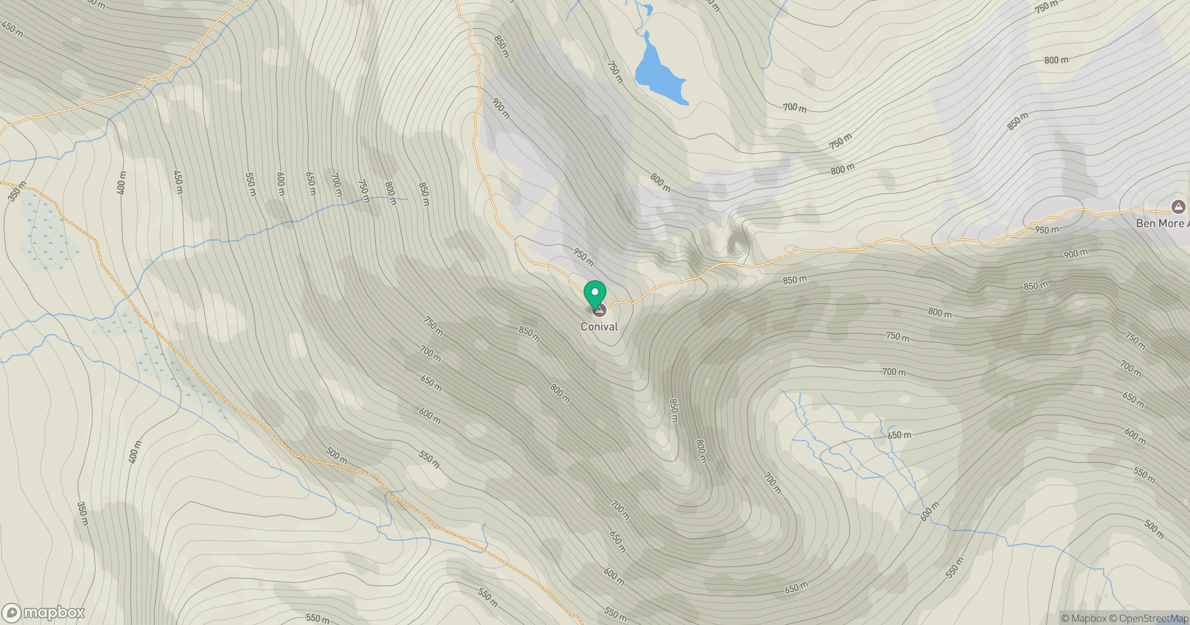
Grid reference: NC303199
View on OpenStreetMapOpens a map in a new tab, centred on the hill.
Nearby Hills
Ben More Assynt
999m
Canisp
847m
Quinag - Spidean Coinich
764m
Quinag - Sail Gharbh
809m
Quinag - Sail Ghorm [Sail Gorm]
776m
No comments yet. Be the first.