

Cnoc nan Gabhar
Good walks are even better shared.
Overview
Cnoc nan Gabhar
Cnoc nan Gabhar, a splendid Marilyn in the wonderful Scottish Highlands, stands proudly at 714 meters tall. Its majestic presence commands attention, its granite formation weathered through centuries. As any seasoned hiker knows, granite can be a hiker's best friend... or worst enemy, depending on the weather!
Geology
The core of this mountain is primarily granite, renowned for its endurance against wind and rain. You’ll find rocky outcrops that add to the scenic beauty, and the charm of the swaying heather only adds to the experience. Striking a balance between rocky terrain and soft heather patches makes this mountain a bumpy yet delightful pursuit.
Routes
Cnoc nan Gabhar Circuit
Starting from the picturesque Inverliever Lodge, this circuit is well worth the 8.5 km trek. It may take around 3.5 hours, so make sure to pack a sandwich or two!
Direct Ascent from A816
For the bold and ambitious, behold the direct ascent from the A816. A steep climb that covers 3 km, it challenges your fitness levels as well as your determination, taking roughly 2 hours. Just remember to do some calf stretches the night before!
Summit Features
At the summit, you’ll be greeted by a stout cairn, ideal for resting your weary legs and snapping those panoramic shots to show the folks back home.
Terrain Type
Cnoc nan Gabhar offers rugged terrain—rocky underfoot with patches of heather and bog. Good footwear is essential; the last thing you want is soggy socks on your adventure!
Views
The trudge up is well worth it when you’re rewarded with breathtaking views of Loch Awe and the distant Cruachan Range. The best time to enjoy these sights? Spring and early summer bring crystal clear days. Just keep an eye out for clouds that seem to have a vendetta against clear views!
Hazards
As is true for many highland joys, Cnoc nan Gabhar comes with its fair share of hazards. Loose rocks and bogs can challenge your footing, and the weather likes to play its tricks. Always check forecasts before you crave high-altitude glory!
Access
Nearest Parking
Park your chariot at the Inverliever Lodge, which makes for a great starting point.
Public Transport
Access via bus from Oban, followed by a short stroll to the starting point, is a viable option for those without wheels.
Nearest Town
Oban is where you can stock up on snacks and, importantly, toilet facilities.
Facilities
Cafes in town serve delightful hearty fare, perfect for a post-hike reward. Flush toilets are also a luxury we don’t forget!
History
Its name reflects not only its natural beauty but its place in local folklore. It's said that Cnoc nan Gabhar has significant ties to the historical patterns of livestock management, forever bounded to the spirits of the hills.
With stunning views, challenging routes, and a league of history echoing through its landscape, Cnoc nan Gabhar stands as a proud beacon for adventurers. So lace up your boots, grab your walking stick and head into the hills; you won't regret it!
Last Updated: 2023-10-10
Explore routes near Cnoc nan Gabhar
Public walks starting within 80 km of this hill. Nearby does not mean a route reaches the summit; check its map and access before setting out.
Goatfell from Cladach
View route
Bishop’s Glen group walk
View route
West Bay walk and talk
View route
West Bay walk and talk
View route
Route planning notes
These notes describe possible approaches, not verified navigable routes or permission to cross land. Check current paths, local access rules and conditions before setting out.
Cnoc nan Gabhar Circuit
This route starts from the nearby Inverliever Lodge and loops around the mountain, providing scenic valleys and lovely views along the way.
Direct Ascent from A816
A more direct approach begins right from the A816, ascending steeply through rough heather and rocky paths. A true leg burner!
Make a day of it, together
Find someone to share the walk with, or organise a day out along a route you like.
Photo Gallery
View all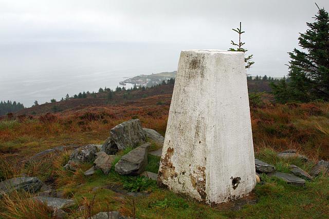 Photo could not load
NR8039 : Trig Point on Cnoc nan Gabhar
Steve Partridge
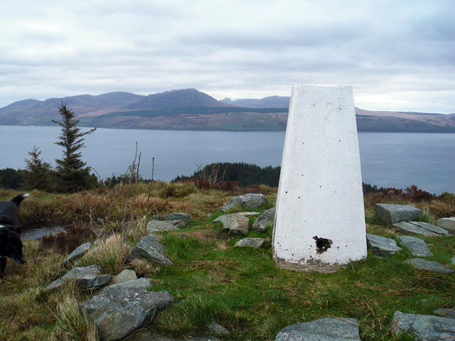 Photo could not load
NR8039 : Cnoc nan Gabhar
Steve Partridge
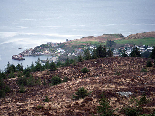 Photo could not load
NR8039 : Carradale East seen from Cnon nan Gabhar
Steve Partridge
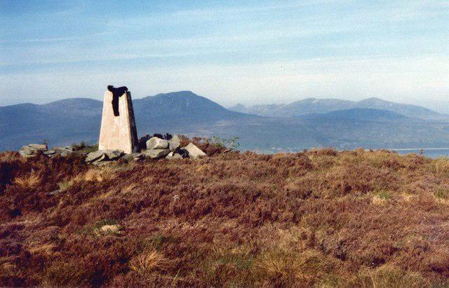 Photo could not load
NR8039 : Cnoc nan Gabhar Trig point and view to Arran
Roger Templeman
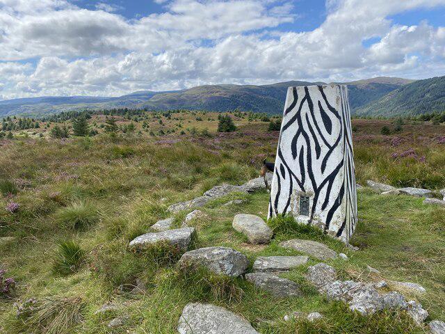 Photo could not load
NR8039 : Carradale Trig Point Flush Bracket S8576
thejackrustles
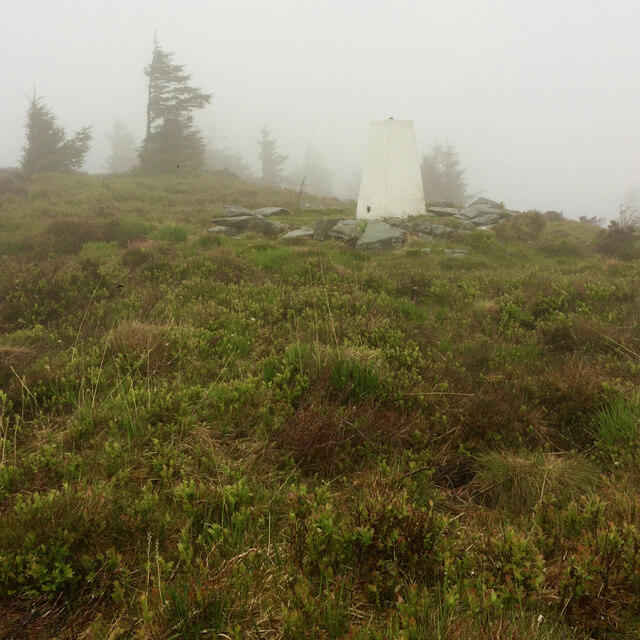 Photo could not load
NR8039 : A misty Cnoc nan Gabhar trig point
Mick Garratt
Hill facts and local notes
Classifications
Elevation
230m
755 ft
Prominence
141m
Coordinates
55.6007, -5.4891
NR802396
OS Map
68 69
Explorer: 356N
At the Summit
The summit is marked by a notable cairn, offering a perfect spot for a selfie to prove you made it to the top. There's also breathtaking views all around—bring a good camera!
Terrain & Geology
Cnoc nan Gabhar is composed primarily of granite, a resilient rock that takes a beating from the elements yet stands strong. The rugged landscape showcases a mix of weathered rock formations interspersed with heather, creating a picturesque yet challenging terrain.
Views & Scenery
From the summit, you can enjoy panoramic views of the surrounding hills, Loch Awe, and even glimpses of the distant Cruachan Range on a clear day.
History & Heritage
Name Origin
In Scots Gaelic, 'Cnoc nan Gabhar' translates to 'Hill of the Goats'. Rumour has it that locals used to have a few caprine friends helping out with the sheep!
Historical Significance
This mountain is a gem for local hikers and has historical significance in the region, often being part of folklore associated with the landscape.
Getting There & Facilities
Check current local access restrictions, parking rules and transport timetables before travelling. These notes do not confirm public access to the summit.
Parking
The nearest parking is available at Inverliever Lodge, where you can leave your car for a day's adventure.
Public Transport
The nearest bus services run from Oban to easily reach the A816. However, be prepared for a short walk to reach the walkers’ path.
Nearby Facilities
Facilities in Oban include several cafes, shops, and public toilets. It’s best to fill up on snacks before heading for the hills!
Safety Information
Known Hazards
- Watch out for loose rocks and boggy areas, especially after rainfall. Also, the weather can change in a heartbeat, so be prepared for sudden showers.
General Safety Tips
- Check weather conditions before setting out
- Carry appropriate clothing and equipment
- Let someone know your planned route
- Take a map, compass, and GPS device
- Carry emergency supplies: food, water, first aid kit, torch
Hills
Some common questions about the hills answered
Are there group walks up Cnoc nan Gabhar?
Many walkers use Walkmates to join or organise walks with others. You can check for group walks around Cnoc nan Gabhar through the maps
Are there other walkers around Cnoc nan Gabhar?
Activity varies by location and time, but Walkmates lets you see whether others have shared walks or shown interest in this area. Find other people through the walking friends search walking friends for Cnoc nan Gabhar search or of course create your own walk for Cnoc nan Gabhar
Can I organise a walk to Cnoc nan Gabhar?
Yes. If there aren’t any walks listed already, you can create a walk and make it available for others to join.
If you're signed up to Walkmates, you can create a walk to Cnoc nan Gabhar.
How do I find a walk up this hill?
There are often multiple ways to walk this hill, depending on experience and route preference. Walkmates helps you explore walks and routes that others have shared.
Can I suggest a new route up Cnoc nan Gabhar?
Yes. You can suggest or create routes to share with others. Walkmates focuses on the social side of walking, so routes are used to help people organise walks and explore areas together, rather than as detailed navigation tools or route libraries.
Other uses really appreciate knowledgeable walkers sharing their routes. Share your favourite route to Cnoc nan Gabhar here
The is an error or something incorrect about this hill. How do I let you know?
We always strive to keep the information on Walkmates as accurate as possible. If you find an error, please let us know through the contact form and we'll aim to correct it as quickly as possible
Community Discussion
Comments
Location
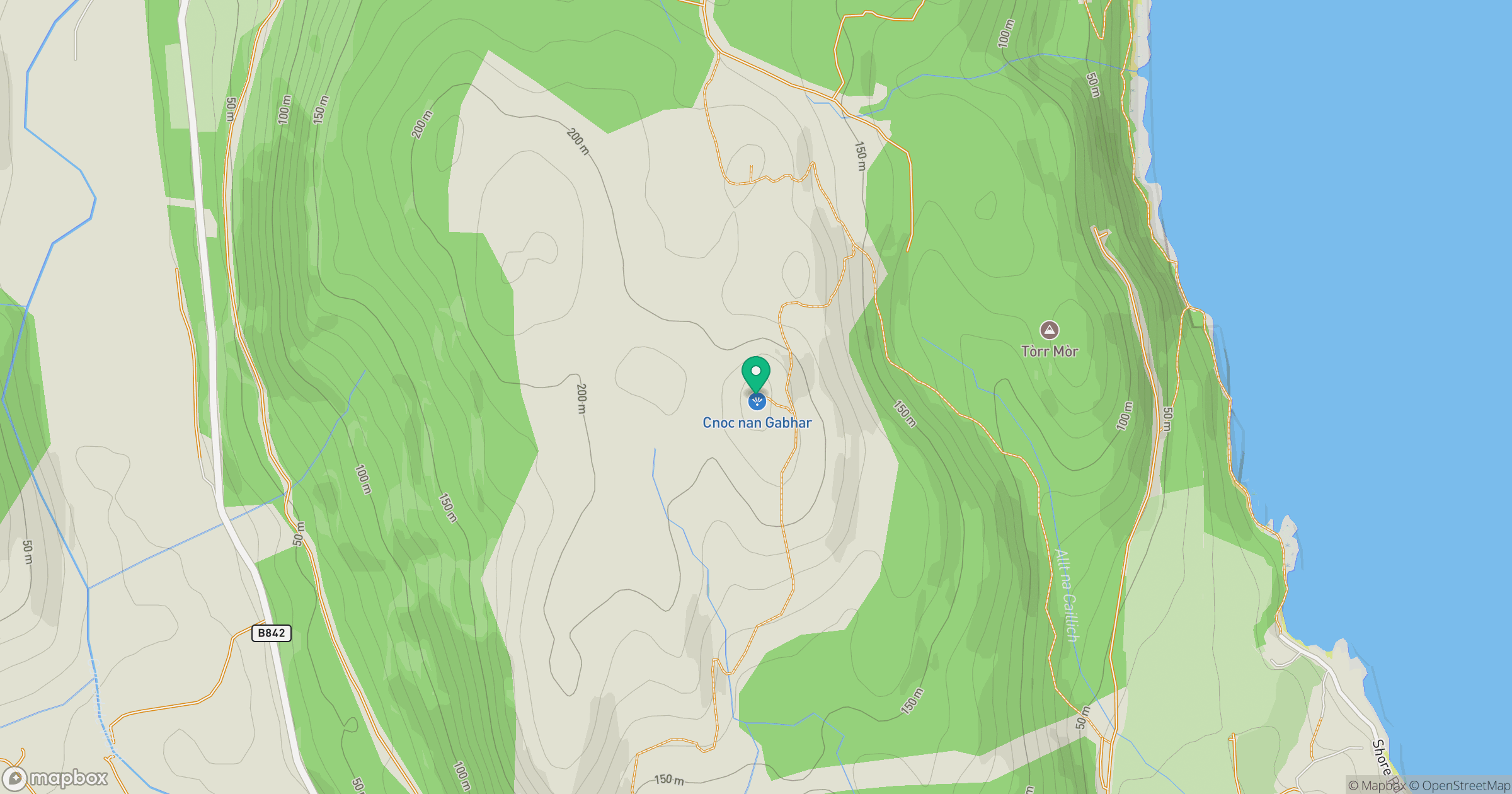
Grid reference: NR802396
View on OpenStreetMapOpens a map in a new tab, centred on the hill.
Hills within 30 km
Straight-line distance, not a walking route or confirmation of access.
Cir Mhor
798m
Goatfell [Goat Fell]
875m
Beinn an Tuirc
454m
Fuar Larach
272m
Beinn Bharrain - Mullach Buidhe
721m
No comments yet. Be the first.