
Cnoc na Caillich
Good walks are even better shared.
Overview
Cnoc na Caillich
Cnoc na Caillich stands proudly at 722 meters above sea level, offering an inviting challenge for hikers. Nestled within the picturesque Scottish Highlands, this Marilyn draws adventurers with its moderate climb and stunning vistas.
Geology
The mountain is primarily formed of ancient Lewisian gneiss, a rock type that tells tales of the Earth's early history. As you traverse its slopes, you might get a sense that you’re walking on something older than your grandmother’s favourite chair.
Routes
The most popular route is the Loch a' Phuill Route. Spanning about 7.5 km and taking roughly 2.5 hours, this path leads you through lush heather fields before the final ascent. It’s moderately challenging, perfect for a Sunday stroll—if your Sundays involve putting your legs through their paces!
Summit Features
At the top, you'll be greeted with a substantial cairn, providing an excellent resting spot and a delightful photo opportunity. The 360-degree views reveal the grandeur of the Scottish Highlands and, on clear days, even the distant Isle of Skye.
Terrain
Expect a mix of grassy slopes with rocky outcrops. It’s a patchwork quilt of nature, occasionally challenging your footing but rewarding you with breathtaking sights at every turn.
Views
If it’s vistas you seek, you won’t be disappointed! The summits of Beinn a' Chroin come into clear view amidst a backdrop that could make a postcard blush. For the best display, late spring and early autumn offer the most colourful landscapes.
Hazards
As always in the Highlands, be wary! Weather can be a fickle friend, turning from sunshine to showers in the blink of an eye. Equip yourself appropriately and tread carefully, especially in wetter conditions.
Nearby Summits
Hiking enthusiasts can combine their journey by visiting nearby peaks like Beinn na Caillich and Beinn Ghrideag, both of which provide additional routes and views to savour.
Access
For accessibility, the nearest parking is conveniently located at the roadside near Loch a' Phuill. However, arrive early as it fills up quickly—everyone loves a good adventure! While public transport options are limited, Portree offers the perfect launchpad for your journey.
Facilities
Portree comes equipped with cafes serving delightful refreshments, shops for any essentials, and toilet facilities to ensure you’re well-prepared before your ascent.
History
The name Cnoc na Caillich not only rolls off the tongue but embodies local folklore, suggesting rich stories woven into the fabric of the landscape. Add a sprinkle of history to your hike!
In summary, Cnoc na Caillich is a gem of the Highlands that promises not just a hike but an experience steeped in nature and culture. Pack your bags and let the adventure begin!
Explore routes near Cnoc na Caillich
Walks starting near this hill. Open a route to check its map, distance and full itinerary.
Fairy Lochs Liberator Wreckage Circuit
View route
Beinn Eighe Lancaster Wreckage at Coire Mhic Fhearchair
View route
Ben Klibreck
View route
Glen Affric: Coire Loch Woodland Trail
View route
Route planning notes
These notes describe possible approaches. Check a route's map and access information when planning your walk.
Loch a' Phuill Route
A scenic route starting from the picturesque Loch a' Phuill, winding through heather and grass before ascending the gentle slopes of the mountain.
Make a day of it, together
Find someone to share the walk with, or organise a day out along a route you like.
Hill facts and local notes
Classifications
Elevation
163m
535 ft
Prominence
31m
Coordinates
57.8554, -5.4416
NG959903
OS Map
19
Explorer: 435N
At the Summit
The summit is adorned with a substantial cairn and offers space for weary hikers to rest, as well as a stunning 360-degree panorama that will make anyone's heart sing.
Terrain & Geology
Cnoc na Caillich is primarily composed of Lewisian gneiss, one of the oldest rock types found in Scotland. This ancient rock provides a fascinating glimpse into the geological history of the Highlands, dating back over 3000 million years.
Views & Scenery
From the summit, you can enjoy sweeping views of the surrounding mountains such as Beinn a' Chroin and the rugged coast of Skye on a clear day.
History & Heritage
Name Origin
Cnoc na Caillich translates to 'Hill of the Old Woman,' a name steeped in local folklore.
Historical Significance
The mountain is not just a natural wonder but has historical significance related to local myths and legends of the land.
Getting There & Facilities
Parking
Parking is available at the roadside near Loch a' Phuill, which accommodates several cars. A friendly tip: arrive early to nab a spot.
Public Transport
The nearest public transport connection is from Portree; however, a car is recommended for easier access.
Nearby Facilities
Facilities are limited on the mountain itself, but Portree offers cafes, shops, and toilets for preamble or postamble refreshments.
Safety Information
Known Hazards
- Variable weather conditions can change rapidly; be prepared with appropriate gear. The terrain can be slippery when wet, and there may be hidden rocky sections.
General Safety Tips
- Check weather conditions before setting out
- Carry appropriate clothing and equipment
- Let someone know your planned route
- Take a map, compass, and GPS device
- Carry emergency supplies: food, water, first aid kit, torch
Hills
Some common questions about the hills answered
Are there group walks up Cnoc na Caillich?
Many walkers use Walkmates to join or organise walks with others. You can check for group walks around Cnoc na Caillich through the maps
Are there other walkers around Cnoc na Caillich?
Activity varies by location and time, but Walkmates lets you see whether others have shared walks or shown interest in this area. Find other people through the walking friends search walking friends for Cnoc na Caillich search or of course create your own walk for Cnoc na Caillich
Can I organise a walk to Cnoc na Caillich?
Yes. If there aren’t any walks listed already, you can create a walk and make it available for others to join.
If you're signed up to Walkmates, you can create a walk to Cnoc na Caillich.
How do I find a walk up this hill?
There are often multiple ways to walk this hill, depending on experience and route preference. Walkmates helps you explore walks and routes that others have shared.
Can I suggest a new route up Cnoc na Caillich?
Yes. You can suggest or create routes to share with others. Walkmates focuses on the social side of walking, so routes are used to help people organise walks and explore areas together, rather than as detailed navigation tools or route libraries.
Other uses really appreciate knowledgeable walkers sharing their routes. Share your favourite route to Cnoc na Caillich here
The is an error or something incorrect about this hill. How do I let you know?
We always strive to keep the information on Walkmates as accurate as possible. If you find an error, please let us know through the contact form and we'll aim to correct it as quickly as possible
Community Discussion
Comments
Location
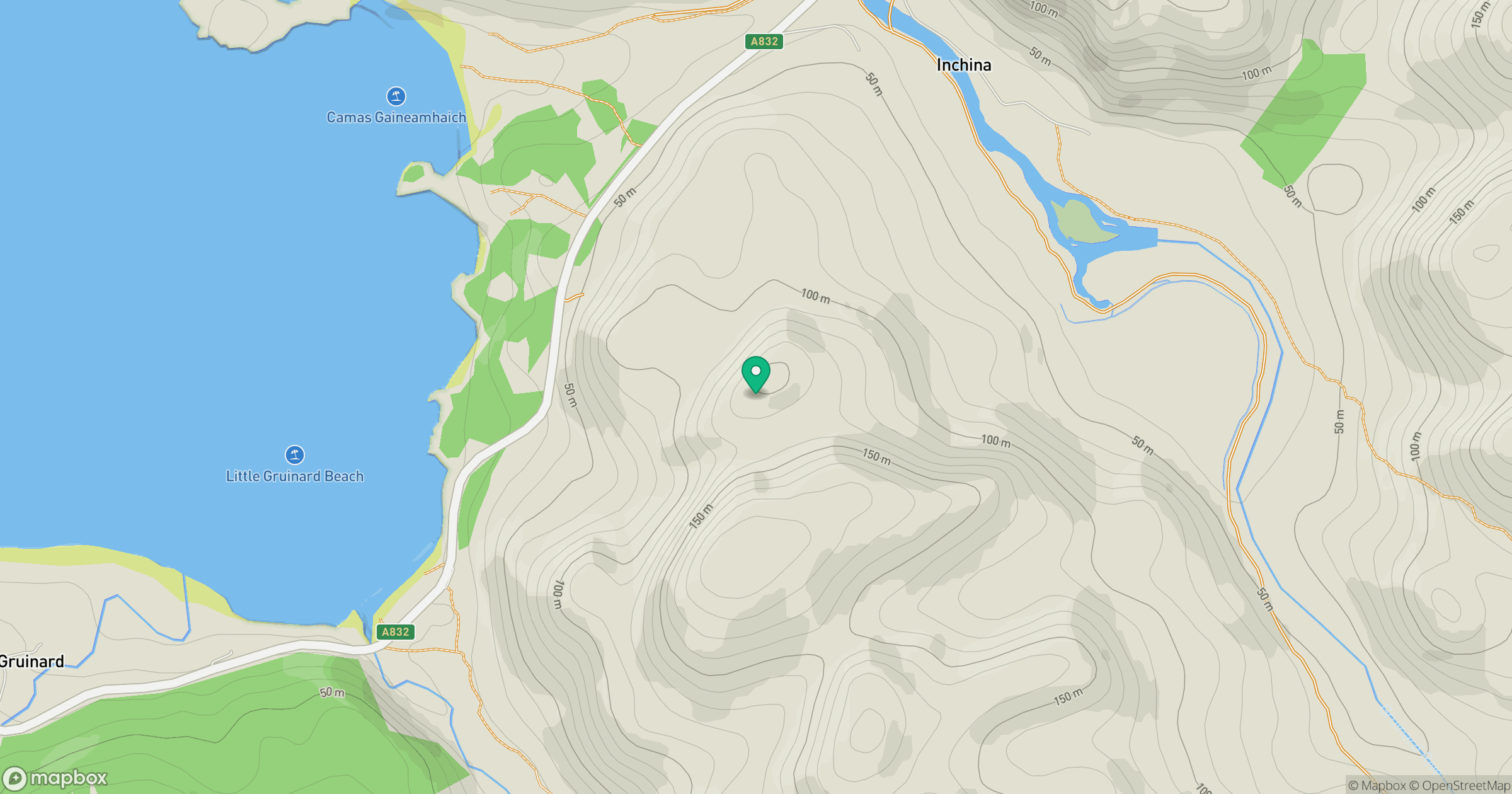
Grid reference: NG959903
View on OpenStreetMapOpens a map in a new tab, centred on the hill.
No comments yet. Be the first.