

Carreglefain
Good walks are even better shared.
Overview
Carreglefain: A Hidden Gem in Snowdonia
Carreglefain, standing at a modest elevation of 481 metres, is a Marilyn that should definitely be on every outdoor enthusiast's radar. Nestled in the stunning Snowdonia National Park, this peak offers a much quieter alternative to some of its more famous neighbours like Snowdon and Cader Idris.
Geology
The mountain's composition primarily consists of volcanic rocks that have shaped the region over millennia. The rugged slate and granite that surround the area provide not just a visual feast but also a fascinating insight into the geological history of Snowdonia. Each rocky outcrop you encounter is a testament to the forces of nature at play.
Access and Parking
Accessing Carreglefain is a breeze, with parking available at the Llyn Berwyn car park. From there, it’s just a short walk to the trailhead where your adventure begins. The area is well-served by public transport from Bala, making it a convenient location for both locals and visitors. Bala itself is a quaint town that boasts charming cafes and shops—a perfect spot to replenish after your hike.
Routes to the Summit
Llyn Berwyn Approach
Starting from the picturesque Llyn Berwyn, this moderate route traverses wild heather and takes hikers on a gentle ascent up the mountain. With an approximate distance of 4.5 km, this route is easily manageable for most and promises beautiful scenery.
Foel Goch Ridge
For those seeking a bit more challenge, try the Foel Goch ridge route. Clocking in at around 6.8 km, this challenging ascent rewards hikers with breathtaking views and a true sense of adventure.
Summit Features
Upon reaching the summit, you’ll be greeted by a classic stone cairn, which is a great spot for a summit selfie. The panoramic views are nothing short of spectacular—Cader Idris looms majestically in the distance, and the lush valleys below are a sight to behold.
Terrain
The terrain around Carreglefain is predominantly grassy but often features rocky outcrops that add variety to your hike. It's a place where every step can reveal something new, all while keeping you on your toes.
Views and Best Seasons
The views from the top can make your jaw drop! Notable landmarks such as Cader Idris can be seen, creating a stunning backdrop for your hiking triumph. The best time to visit is undoubtedly Spring when the flora is blooming, or Autumn, where the landscape bursts into a riot of colours.
Hazards
As with any hike, ensure you're prepared. Be wary of the loosely packed rocky areas that can become slippery when wet, especially near the summit where winds might add a bit of a twist to your day.
Nearby Summits
For the peak baggers, consider combining your walk with visits to nearby summits such as Foel Goch (615 m) and Rhwdd Ddu (661 m) for a full day's adventure in the hills.
Conclusion
In summary, Carreglefain offers the perfect mix of natural beauty, serenity, and a touch of adventure. Don’t let its subtle stature fool you—this mountain holds plenty of surprises for those willing to explore!
Remember, every hike starts with a single step—just make sure it’s in the right direction!
Explore routes near Carreglefain
Public walks starting within 80 km of this hill. Nearby does not mean a route reaches the summit; check its map and access before setting out.
Yr Eifl and the Gyrns guided mountain walk
View route
Beddgelert Forest: Llyn Llywelyn Woodland Circuit
View route
Beddgelert Forest: Derwen Circuit and Llyn Llywelyn
View route
Northern Rhinogydd guided mountain walk
View route
Route planning notes
These notes describe possible approaches, not verified navigable routes or permission to cross land. Check current paths, local access rules and conditions before setting out.
Llyn Berwyn Approach
Starting from the picturesque Llyn Berwyn lake, this route offers a gentle ascent through wild heather before leading to the summit.
Foel Goch Ridge
A slightly more challenging option that weaves along the Foel Goch ridge before tackling the final ascent to Carreglefain.
Make a day of it, together
Find someone to share the walk with, or organise a day out along a route you like.
Photo Gallery
View all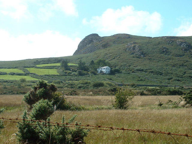 Photo could not load
SH3241 : Carreglefain and Penclogwyn
David Medcalf
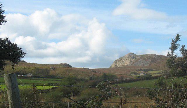 Photo could not load
SH3241 : The moorland of Mynydd Nefyn and the Carreglefain crag on Gwylwyr
Eric Jones
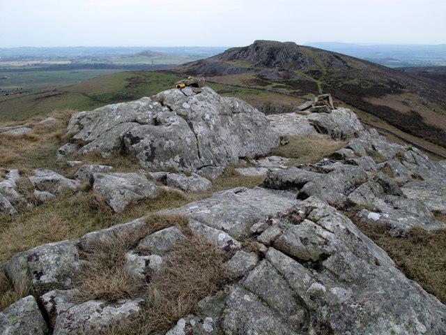 Photo could not load
SH3241 : Gwylwyr Carreglefain
Rude Health
Hill facts and local notes
Classifications
Elevation
261m
855 ft
Prominence
131m
Coordinates
52.9407, -4.4952
SH324410
OS Map
123
Explorer: 253
At the Summit
The summit boasts a classic stone cairn, perfect for that all-important summit selfie. Enjoy a panoramic view that is hard to beat!
Terrain & Geology
Carreglefain is primarily composed of the volcanic rocks typical to the region, giving it a rugged beauty. Its slopes are adorned with slate and are surrounded by stunning granite formations, which provide a glimpse into the geological history of the area.
Views & Scenery
From Carreglefain's summit, you can marvel at the sprawling views of the Snowdonia range, including sights of Cader Idris and the sweeping valleys below.
History & Heritage
Name Origin
The name 'Carreglefain' translates to 'stone of the fae,' hinting at local folklore about fairies inhabiting the rock formations.
Historical Significance
Historically, the surrounding area is rich with ancient ruins and has been a site of various archaeological interests.
Getting There & Facilities
Check current local access restrictions, parking rules and transport timetables before travelling. These notes do not confirm public access to the summit.
Parking
Parking is available at the Llyn Berwyn car park, which is just a short walk from the trailhead.
Public Transport
Regular bus services to nearby towns, such as Bala, operate, but check local schedules as they can vary.
Nearby Facilities
There are limited facilities directly at the access point, but Bala offers several cafes, toilets, and accommodation options for those looking for a bite to eat or a pint after their hike.
Safety Information
Known Hazards
- Loosely packed rocky areas may pose a risk of slipping, especially when wet. Watch your step around the summit area where the winds can also be brisk.
General Safety Tips
- Check weather conditions before setting out
- Carry appropriate clothing and equipment
- Let someone know your planned route
- Take a map, compass, and GPS device
- Carry emergency supplies: food, water, first aid kit, torch
Hills
Some common questions about the hills answered
Are there group walks up Carreglefain?
Many walkers use Walkmates to join or organise walks with others. You can check for group walks around Carreglefain through the maps
Are there other walkers around Carreglefain?
Activity varies by location and time, but Walkmates lets you see whether others have shared walks or shown interest in this area. Find other people through the walking friends search walking friends for Carreglefain search or of course create your own walk for Carreglefain
Can I organise a walk to Carreglefain?
Yes. If there aren’t any walks listed already, you can create a walk and make it available for others to join.
If you're signed up to Walkmates, you can create a walk to Carreglefain.
How do I find a walk up this hill?
There are often multiple ways to walk this hill, depending on experience and route preference. Walkmates helps you explore walks and routes that others have shared.
Can I suggest a new route up Carreglefain?
Yes. You can suggest or create routes to share with others. Walkmates focuses on the social side of walking, so routes are used to help people organise walks and explore areas together, rather than as detailed navigation tools or route libraries.
Other uses really appreciate knowledgeable walkers sharing their routes. Share your favourite route to Carreglefain here
The is an error or something incorrect about this hill. How do I let you know?
We always strive to keep the information on Walkmates as accurate as possible. If you find an error, please let us know through the contact form and we'll aim to correct it as quickly as possible
Community Discussion
Comments
Location
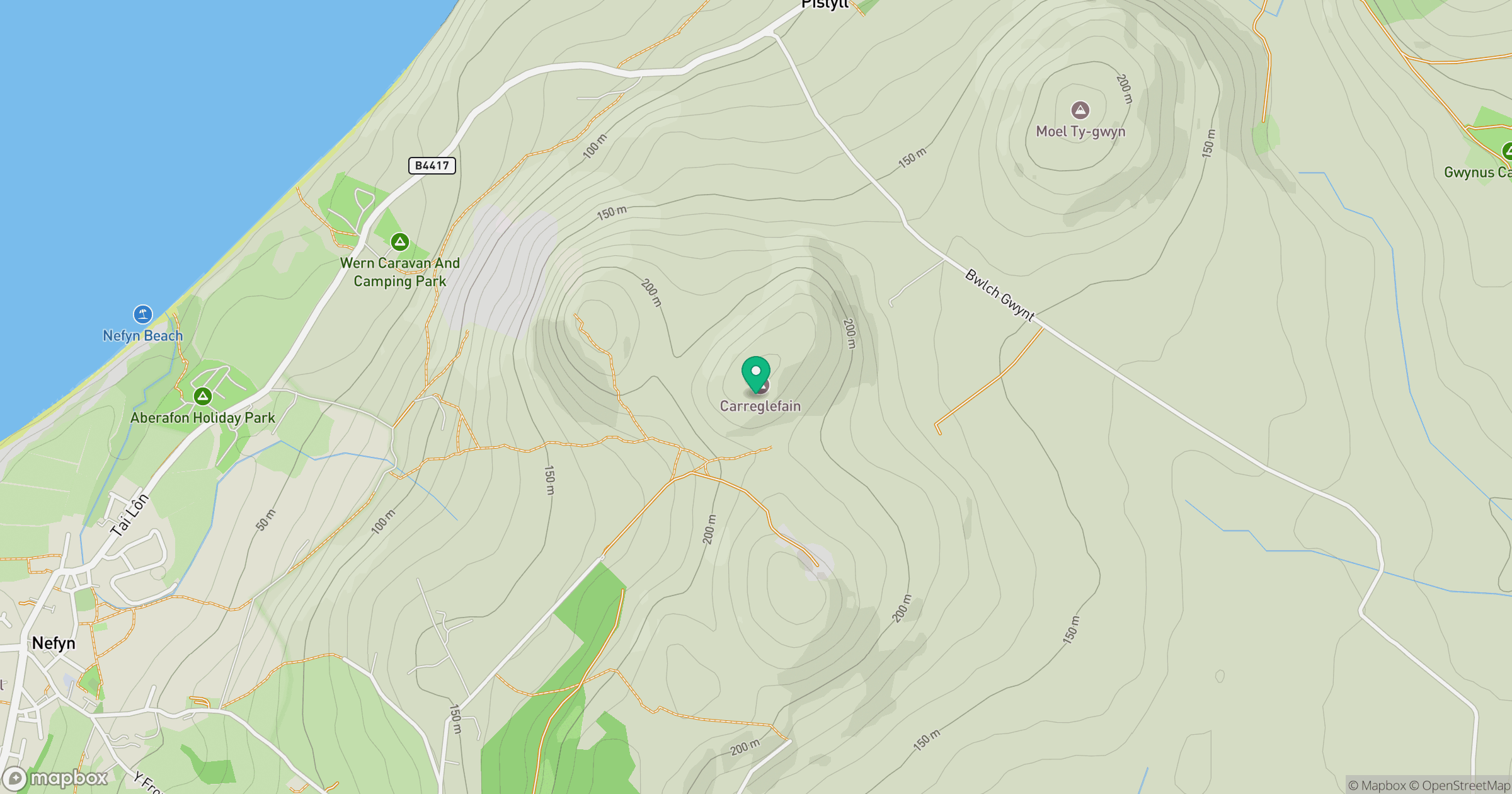
Grid reference: SH324410
View on OpenStreetMapOpens a map in a new tab, centred on the hill.
Hills within 30 km
Straight-line distance, not a walking route or confirmation of access.
No comments yet. Be the first.