

Carn nam Feuaich
Good walks are even better shared.
Overview
Exploring Carn nam Feuaich
Carn nam Feuaich is a splendid Munro standing tall in the Scottish Highlands, where the views are as breathtaking as the climb itself. At 946 meters, the mountain rewards hikers with more than just a good workout – it's a feast for the eyes!
Geological Features
Enjoy the tale of the Earth as you traverse its ancient schists and gneisses, formed over hundreds of millions of years. The rocky terrain might make you feel like you're walking on a piece of history.
Routes to the Summit
Two main routes cater to different levels of ambition; the Strathcarron Route takes about 4 hours over a distance of 9 km, whereas the steeper Allt a' Chaoil Route offers a more challenging experience at 11 km, taking around 5 hours. Choose wisely, and don’t forget your snacks!
Summit Experience
Once you reach the summit, there's a cairn to greet you and stunning vistas of Loch Ness and towering peaks like Ben Wyvis to admire. Perfect for a photo to boast about to friends who are still stuck in the office!
Hazards and Safety
Keep an eye on the weather and have sturdy footwear on hand. Those who are less fond of bogs might find themselves caught in an unexpected squelch or two. Remain vigilant, and stay safe!
Access and Amenities
Park your car near Cannich. If you're relying on public transport, be sure to check the bus schedules before planning your adventure! While facilities around Cannich are limited, a cozy café and local shop are always welcoming.
History and Culture
The name translates to 'hill of the grass' – an apt description of the verdant slopes during warmer months. With its historical significance tied deeply to Highland clans, Carn nam Feuaich isn't just another hill; it's a storyteller of the Highlands.
So, whether you're a seasoned hiker or a weekend warrior, Carn nam Feuaich beckons with its blend of beauty, challenge, and history. Pack up your gear and enjoy your exploration!
Explore routes near Carn nam Feuaich
Public walks starting within 80 km of this hill. Nearby does not mean a route reaches the summit; check its map and access before setting out.
Loch Affric full circuit from River Affric
View route
Glen Affric: Coire Loch Woodland Trail
View route
Fort Augustus to Kytra Lock: Caledonian Canal Towpath
View route
Great Glen Way low route: Fort Augustus to Invermoriston Old Bridge
View route
Route planning notes
These notes describe possible approaches, not verified navigable routes or permission to cross land. Check current paths, local access rules and conditions before setting out.
Strathcarron Route
A moderately challenging ascent starting from the east side, leading through heather-covered slopes and scenic glens before reaching the summit.
Allt a' Chaoil Route
This route approaches from the north and offers stunning views of the surrounding mountains. It's a bit longer but definitely worth it for the vistas.
Make a day of it, together
Find someone to share the walk with, or organise a day out along a route you like.
Photo Gallery
View all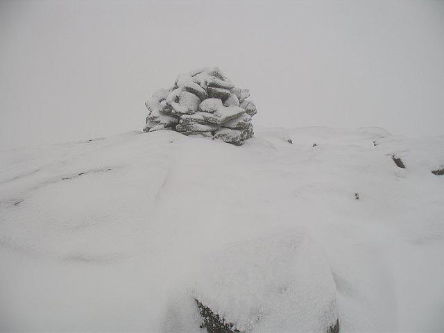 Photo could not load
NH1712 : Summit of Carn nam Feuaich
Richard Webb
Hill facts and local notes
Classifications
Elevation
731m
2,399 ft
Prominence
138m
Coordinates
57.1671, -5.0194
NH175125
OS Map
34
Explorer: 415
At the Summit
The summit boasts a prominent cairn, perfect for a photo op, along with expansive views across the Highlands. If you're lucky, you might spot the mythical Loch Ness Monster taking a dip in the distance.
Terrain & Geology
Carn nam Feuaich is primarily composed of ancient metamorphic rock, including schists and gneisses, which give the mountain its rugged and dramatic profile. This geological formation tells a tale of the Earth's history stretching back hundreds of millions of years, perfect for those with a penchant for rocks and a lot of time on their hands.
Views & Scenery
Panoramic views including Loch Ness, the Great Glen, and the mountainous silhouettes of nearby peaks like Ben Wyvis and the Affric-Cannich mountains.
History & Heritage
Name Origin
The name 'Carn nam Feuaich' translates to 'hill of the grass', which is fitting given its lush greenery during the summer months.
Historical Significance
The area is steeped in history and folklore, often associated with Highland clans and ancient battles, giving it not only a scenic beauty but an intriguing past.
Getting There & Facilities
Check current local access restrictions, parking rules and transport timetables before travelling. These notes do not confirm public access to the summit.
Parking
There is parking available at the end of the B851 road, just before the village of Cannich. Spaces can fill up quickly, so arrive early to secure your spot.
Public Transport
Buses run regularly from Inverness to Cannich, but check schedules beforehand as they can be sparse, especially on weekends.
Nearby Facilities
There are limited facilities in Cannich, but you can find a café and local shops. If you're in dire need of a toilet, the village pub might be an option (just maybe buy a pint while you’re at it).
Safety Information
Known Hazards
- Watch out for sudden weather changes, steep ascents, and limited visibility in poor conditions. Good footwear is a must – no one wants wet socks on a summit!
General Safety Tips
- Check weather conditions before setting out
- Carry appropriate clothing and equipment
- Let someone know your planned route
- Take a map, compass, and GPS device
- Carry emergency supplies: food, water, first aid kit, torch
Hills
Some common questions about the hills answered
Are there group walks up Carn nam Feuaich?
Many walkers use Walkmates to join or organise walks with others. You can check for group walks around Carn nam Feuaich through the maps
Are there other walkers around Carn nam Feuaich?
Activity varies by location and time, but Walkmates lets you see whether others have shared walks or shown interest in this area. Find other people through the walking friends search walking friends for Carn nam Feuaich search or of course create your own walk for Carn nam Feuaich
Can I organise a walk to Carn nam Feuaich?
Yes. If there aren’t any walks listed already, you can create a walk and make it available for others to join.
If you're signed up to Walkmates, you can create a walk to Carn nam Feuaich.
How do I find a walk up this hill?
There are often multiple ways to walk this hill, depending on experience and route preference. Walkmates helps you explore walks and routes that others have shared.
Can I suggest a new route up Carn nam Feuaich?
Yes. You can suggest or create routes to share with others. Walkmates focuses on the social side of walking, so routes are used to help people organise walks and explore areas together, rather than as detailed navigation tools or route libraries.
Other uses really appreciate knowledgeable walkers sharing their routes. Share your favourite route to Carn nam Feuaich here
The is an error or something incorrect about this hill. How do I let you know?
We always strive to keep the information on Walkmates as accurate as possible. If you find an error, please let us know through the contact form and we'll aim to correct it as quickly as possible
Community Discussion
Comments
Location
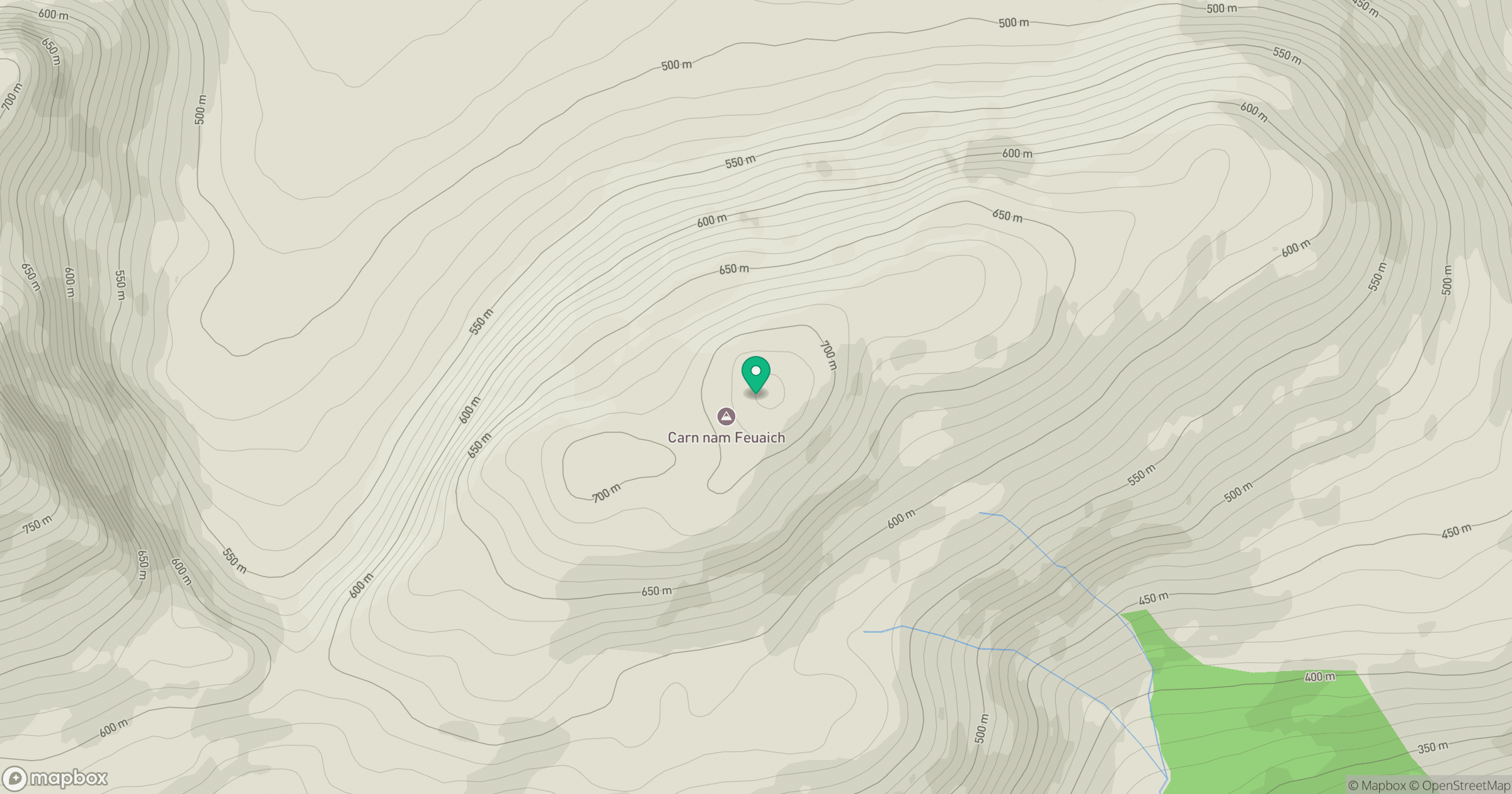
Grid reference: NH175125
View on OpenStreetMapOpens a map in a new tab, centred on the hill.
Hills within 30 km
Straight-line distance, not a walking route or confirmation of access.
Mam Sodhail
1,179m
Carn Eighe
1,183m
Gleouraich
1,035m
Sgurr a' Mhaoraich
1,027m
Sgurr Fhuaran
1,069m
No comments yet. Be the first.