

Carn na Ceardaich
Good walks are even better shared.
Overview
Carn na Ceardaich: A Munro Worth Climbing
Nestled within the breathtaking landscape of the Scottish Highlands, Carn na Ceardaich stands at a respectable 848 meters. Known as a Munro, it offers an adventurous climb that boasts some of the most impressive views in the region. Whether you are a seasoned climber or a casual hiker, this hill beckons with its rustic charm and scenic allure.
Geology
The mountain is primarily composed of granite, a rock that’s as tough as old boots and provides a solid footing for summit-seekers. However, it can turn a bit slippery in wet conditions, so take care to choose your steps wisely. One minute you're confidently striding across rough terrain, and the next you might be channeling your inner Bambi!
Routes
Glen Orchy Route
This scenic path weaves through some stunning landscapes, starting from the Glen Orchy area. It’s about 13.5 km round trip and usually takes about 4.5 hours to complete. The access paths are generally well defined, perfect for those who appreciate a clear route.
Beinn a' Chlaidheimh Route
For a bit of a challenge, why not combine your ascent with a hike from Beinn a' Chlaidheimh? At 15 km and approximately 5.5 hours, it rewards the hardy with panoramic views that make the effort worthwhile.
Summit Features
The summit features a quaint stone cairn that provides the perfect backdrop for your victory selfie. Enjoy the unobstructed views, and take a moment to revel in your achievement.
Terrain Type
The terrain offers a delightful mix of rocky scrambles and grassy slopes, with the occasional boggy patch to keep you on your toes. A solid pair of boots is key to navigating the ups and downs without turning into a mud statue.
Views
Highlights
Reaching the summit opens up views of the formidable Ben Lui and the endless expanse of the West Highlands. On a clear day, you can see for miles, with the landscape stretching out like a patchwork quilt.
Best Seasons
The prime months to visit are from late spring through early autumn when the views are at their best and the weather behaves itself. If you fancy a winter adventure, bundle up, and prepare for a captivating snowy sight.
Hazards
As with many adventures, watch out for the boggy areas, especially after rain. The unpredictable Scottish weather can sometimes take you by surprise, so pack accordingly!
Nearby Summits
Carn na Ceardaich is not alone in its glory. Nearby, you can also tackle Beinn a' Chlaidheimh and the legendary Ben Lui.
Access
Nearest Parking
You’ll find parking at the Glen Orchy trailhead, with easy accessibility from the A85, though do pay attention to parking signs as local regulations apply.
Public Transport
If you're looking to leave the car behind, good old public transport can get you to Tyndrum, the nearest train station, about 10 km away with bus routes also available along the A85.
Nearest Town
Tyndrum is your closest town, offering a welcoming atmosphere with a few shops and friendly faces, perfect for a pre-hike coffee to fuel your adventure.
Facilities
After your climb, Tyndrum has all the necessities like a café and shops for a snack or refreshments before heading home.
History
Name Meaning
‘Carn na Ceardaich’ translates to ‘hill of the craftsmen’—a nod to its historical links with local artisans.
Significance
The mountain holds cultural significance for the locals and has become a cherished playground for outdoor enthusiasts, making it a staple in the Scottish hiking community.
So there you have it! Carn na Ceardaich is waiting, boots on and ready for your footprints. Happy hiking!
Explore routes near Carn na Ceardaich
Public walks starting within 80 km of this hill. Nearby does not mean a route reaches the summit; check its map and access before setting out.
Coire Ardair lochan from Aberarder and back
View route
Great Glen Way low route: Fort Augustus to Invermoriston Old Bridge
View route
Fort Augustus to Kytra Lock: Caledonian Canal Towpath
View route
Glen Banvie Trail with the Bruar viewpoint
View route
Route planning notes
These notes describe possible approaches, not verified navigable routes or permission to cross land. Check current paths, local access rules and conditions before setting out.
Glen Orchy Route
A popular route starting from the Glen Orchy side, taking advantage of well-defined paths that meander through stunning scenery.
Beinn a' Chlaidheimh Route
This alternative route combines a trek from Beinn a' Chlaidheimh, offering a slightly longer route but rewarding with panoramic views.
Make a day of it, together
Find someone to share the walk with, or organise a day out along a route you like.
Photo Gallery
View all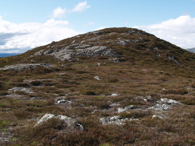 Photo could not load
NN6187 : Summit slopes, Carn na Ceardaich
Chris Eilbeck
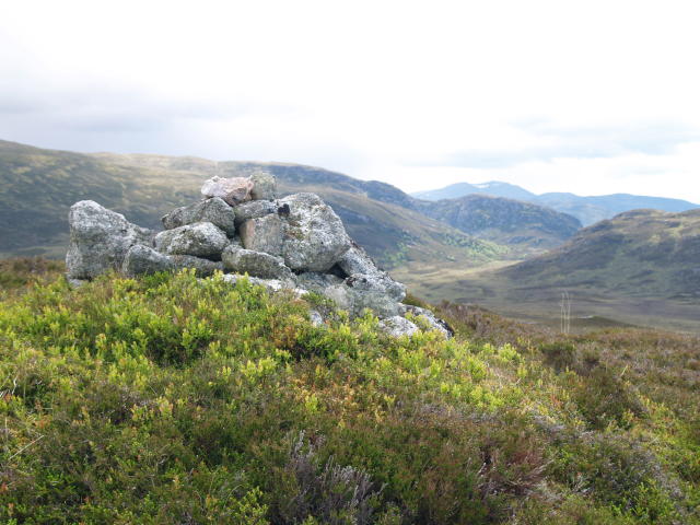 Photo could not load
NN6188 : Summit Cairn, Carn na Ceardaich
Chris Eilbeck
Hill facts and local notes
Classifications
Elevation
571m
1,873 ft
Prominence
113m
Coordinates
56.9626, -4.2734
NN618880
OS Map
42
Explorer: OL50 OL56 393 402
At the Summit
The summit boasts a small stone cairn and offers unobstructed views of the surrounding peaks, making it a favourite for hillwalkers to take a well-deserved break.
Terrain & Geology
Carn na Ceardaich is predominantly formed from granite, which makes it sturdy underfoot but can be a bit slippery when wet. The mountain is part of the Grampian mountain range, known for its impressive geology.
Views & Scenery
From the summit, one can see the likes of Ben Lui and the expansive landscape of the West Highlands stretching into the distance.
History & Heritage
Name Origin
The name 'Carn na Ceardaich' translates loosely as 'hill of the craftsmen' in Gaelic, possibly referencing historical activities in the area.
Historical Significance
This Munro is part of a significant cultural heritage for local communities and has been a focal point for outdoor enthusiasts for decades.
Getting There & Facilities
Check current local access restrictions, parking rules and transport timetables before travelling. These notes do not confirm public access to the summit.
Parking
There is a small parking area at the Glen Orchy trailhead, accessible from the A85. Be mindful of local parking regulations.
Public Transport
The nearest train station is in Tyndrum, which is about 10 km away. Local buses also run along the A85.
Nearby Facilities
For amenities, Tyndrum offers a café, shops, and toilets, allowing for refuelling before or after your hike.
Safety Information
Known Hazards
- Some areas can be treacherously boggy, especially after rain. Beware of sudden weather changes and always be prepared.
General Safety Tips
- Check weather conditions before setting out
- Carry appropriate clothing and equipment
- Let someone know your planned route
- Take a map, compass, and GPS device
- Carry emergency supplies: food, water, first aid kit, torch
Hills
Some common questions about the hills answered
Are there group walks up Carn na Ceardaich?
Many walkers use Walkmates to join or organise walks with others. You can check for group walks around Carn na Ceardaich through the maps
Are there other walkers around Carn na Ceardaich?
Activity varies by location and time, but Walkmates lets you see whether others have shared walks or shown interest in this area. Find other people through the walking friends search walking friends for Carn na Ceardaich search or of course create your own walk for Carn na Ceardaich
Can I organise a walk to Carn na Ceardaich?
Yes. If there aren’t any walks listed already, you can create a walk and make it available for others to join.
If you're signed up to Walkmates, you can create a walk to Carn na Ceardaich.
How do I find a walk up this hill?
There are often multiple ways to walk this hill, depending on experience and route preference. Walkmates helps you explore walks and routes that others have shared.
Can I suggest a new route up Carn na Ceardaich?
Yes. You can suggest or create routes to share with others. Walkmates focuses on the social side of walking, so routes are used to help people organise walks and explore areas together, rather than as detailed navigation tools or route libraries.
Other uses really appreciate knowledgeable walkers sharing their routes. Share your favourite route to Carn na Ceardaich here
The is an error or something incorrect about this hill. How do I let you know?
We always strive to keep the information on Walkmates as accurate as possible. If you find an error, please let us know through the contact form and we'll aim to correct it as quickly as possible
Community Discussion
Comments
Location
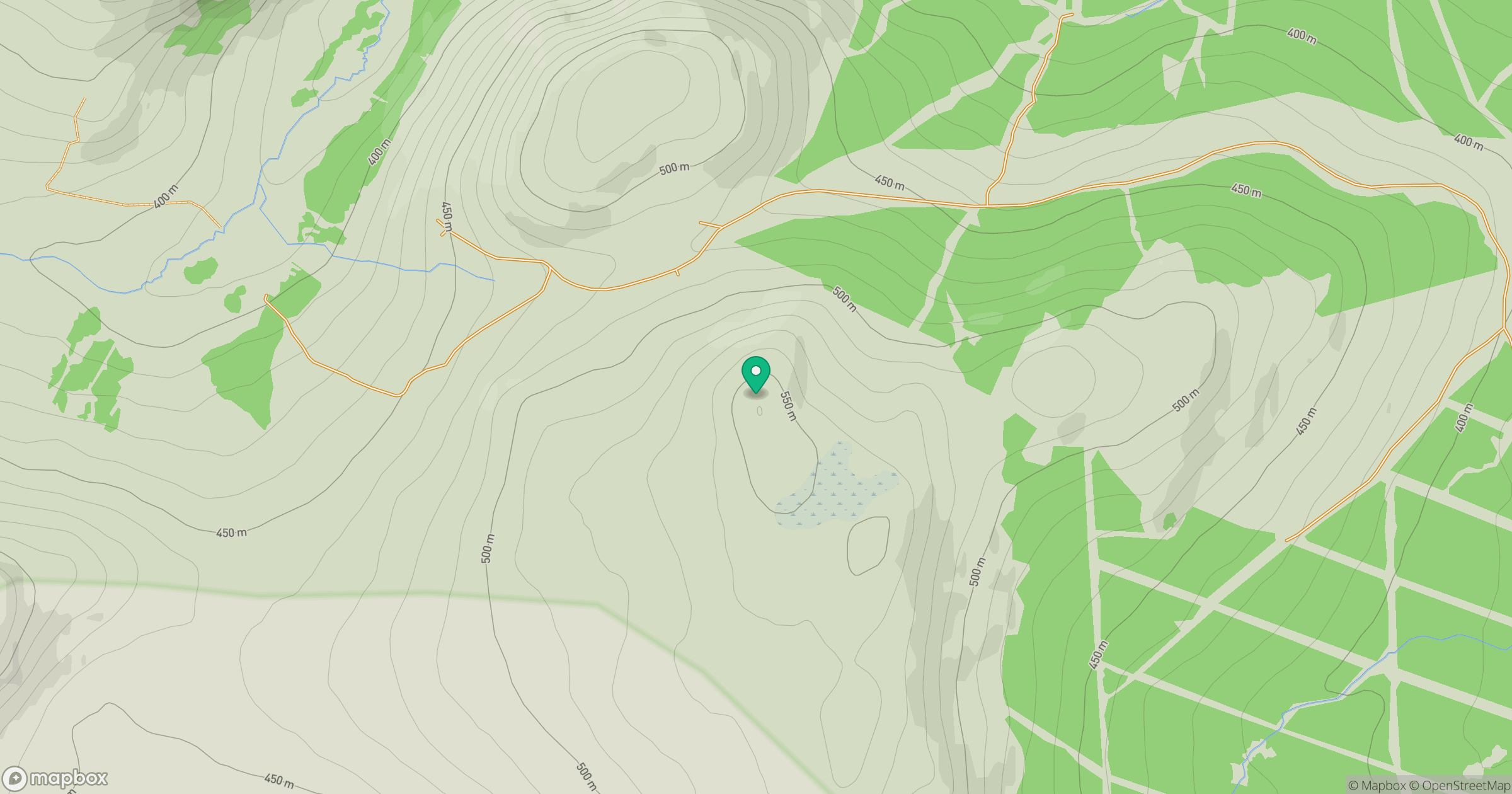
Grid reference: NN618880
View on OpenStreetMapOpens a map in a new tab, centred on the hill.
Hills within 30 km
Straight-line distance, not a walking route or confirmation of access.
Binnein Mor
550m
Ben Alder
1,148m
Beinn Mheadhoin
541m
Creag Meagaidh
1,128m
Creag na Doire Duibhe
571m
No comments yet. Be the first.