

Creag na Doire Duibhe
Good walks are even better shared.
Overview
Creag na Doire Duibhe
Nestled in the heart of the Scottish Highlands, Creag na Doire Duibhe is an enchanting Marilyn that offers a memorable hiking experience for outdoor enthusiasts. Standing at a respectable 726 meters, this peak provides a taste of Scotland’s breathtaking natural beauty.
Geology
The mountain’s geology is comprised mainly of rugged schists and gneisses, remnants of ancient geological formations that tell tales of time long past. The rocky outcrops are not just a feast for the eyes; they are also a window into the Earth's history. If you listen closely, you might hear them whisper secrets of their ancient origins, though that could just be the wind.
Access
To reach Creag na Doire Duibhe, the nearest parking is conveniently located along the A82 road at coordinates NN615905, where you can park 5-6 vehicles comfortably. A bus service runs from Oban and Glasgow to Crianlarich, providing access for those using public transport. Once you’ve parked, it’s a pleasant walk to the trailhead where your journey begins. The closest town is Crianlarich, approximately 16 km away, which offers a small shop and café—ideal for picking up a snack or two. Remember, you may want to fuel up before your outdoor adventure!
Routes
The preferred route to the summit starts at the A82, described as a moderate hike that stretches about 5.5 kilometers. This scenic trek takes you through a stunning glen, filled with flora and fauna. The ascent to the summit is rewarding, showcasing the wild beauty of the Scottish Highlands at every turn. Allow around 2.5 hours for this hike, though you might find yourself stopping frequently to take photographs!
Summit Features
At the top, a prominent rocky outcrop greets you, topped with a small cairn that has become the unofficial marker of summity triumphs. It’s an ideal spot for resting, enjoying a well-deserved snack, and taking in the panoramic views.
Views
From the summit, you will enjoy breathtaking views of Loch Awe, the rugged terrain of the Highlands, and the prominent Ben Cruachan looming majestically to the west. You won’t want to forget your camera, as the landscape changes with the seasons, offering unique vistas throughout the year. Spring and autumn are typically the best times to visit, with clear skies providing optimal viewing conditions.
Hazards
Hikers should be aware of the hazards associated with the Scottish weather, which can change faster than a cat on a hot tin roof. Rain and low visibility can sneak up on you, so always check the forecast before heading out. The terrain may also become slippery when wet, so be sure to wear appropriate footwear and exercise caution, especially in the boggy patches near the base.
Nearby Summits
In addition to Creag na Doire Duibhe, outdoor enthusiasts may wish to explore nearby peaks such as Ben Cruachan (1126 meters) and Meall nan Sammhlach (704 meters). Each offers its own unique charm and hiking opportunities.
Conclusion
Creag na Doire Duibhe is a delightful peak for those looking to immerse themselves in the beauty of the Scottish Highlands. Whether you’re an experienced hiker or a novice, this mountain promises stunning views, rich geology, and the chance to connect with nature. Just remember—no matter how tempted you may feel, the cairn doesn’t need any more stones.
Happy hiking!
Explore routes near Creag na Doire Duibhe
Public walks starting within 80 km of this hill. Nearby does not mean a route reaches the summit; check its map and access before setting out.
Coire Ardair lochan from Aberarder and back
View route
Great Glen Way low route: Fort Augustus to Invermoriston Old Bridge
View route
Fort Augustus to Kytra Lock: Caledonian Canal Towpath
View route
Rothiemurchus: Beaver Trail and Lochan Mor
View route
Route planning notes
These notes describe possible approaches, not verified navigable routes or permission to cross land. Check current paths, local access rules and conditions before setting out.
From the A82
A straightforward route starting from the A82, following a well-trodden path that meanders through a beautiful glen before ascending towards the summit.
Make a day of it, together
Find someone to share the walk with, or organise a day out along a route you like.
Photo Gallery
View all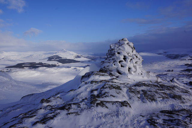 Photo could not load
NN6190 : Creag na Doire Duibhe summit cairn
Terry
Hill facts and local notes
Classifications
Elevation
571m
1,873 ft
Prominence
166m
Coordinates
56.9856, -4.2807
NN615905
OS Map
35
Explorer: OL56 402
At the Summit
The summit features a prominent rocky outcrop with a small cairn, offering a perfect spot for a well-deserved photo op.
Terrain & Geology
Creag na Doire Duibhe predominantly consists of rugged schists and gneisses. The area is shaped by ancient geological processes, providing a fascinating glimpse into the Earth's history.
Views & Scenery
From the summit, you’ll enjoy stunning views of Loch Awe and the surrounding hills, including Ben Cruachan and the wild expanse of the Scottish Highlands.
History & Heritage
Name Origin
Creag na Doire Duibhe translates from Gaelic to 'Rock of the Black Grove', possibly referencing the dark forested areas that once covered the hills.
Historical Significance
The surrounding area is steeped in history, once being a refuge for wildlife and a hunting ground for local clans.
Getting There & Facilities
Check current local access restrictions, parking rules and transport timetables before travelling. These notes do not confirm public access to the summit.
Parking
There is limited parking available along the A82 at NN615905, with space for about 5-6 vehicles.
Public Transport
Buses run regularly from Oban and Glasgow to the nearby villages, with a bit of a walk required to reach the trailhead.
Nearby Facilities
Crianlarich has a small shop and café, perfect for grabbing a snack before or after your hike. Toilets are available at the rail station.
Safety Information
Known Hazards
- Watch for sudden weather changes, especially in winter. The terrain can be slippery when wet, and low visibility is not uncommon.
General Safety Tips
- Check weather conditions before setting out
- Carry appropriate clothing and equipment
- Let someone know your planned route
- Take a map, compass, and GPS device
- Carry emergency supplies: food, water, first aid kit, torch
Hills
Some common questions about the hills answered
Are there group walks up Creag na Doire Duibhe?
Many walkers use Walkmates to join or organise walks with others. You can check for group walks around Creag na Doire Duibhe through the maps
Are there other walkers around Creag na Doire Duibhe?
Activity varies by location and time, but Walkmates lets you see whether others have shared walks or shown interest in this area. Find other people through the walking friends search walking friends for Creag na Doire Duibhe search or of course create your own walk for Creag na Doire Duibhe
Can I organise a walk to Creag na Doire Duibhe?
Yes. If there aren’t any walks listed already, you can create a walk and make it available for others to join.
If you're signed up to Walkmates, you can create a walk to Creag na Doire Duibhe.
How do I find a walk up this hill?
There are often multiple ways to walk this hill, depending on experience and route preference. Walkmates helps you explore walks and routes that others have shared.
Can I suggest a new route up Creag na Doire Duibhe?
Yes. You can suggest or create routes to share with others. Walkmates focuses on the social side of walking, so routes are used to help people organise walks and explore areas together, rather than as detailed navigation tools or route libraries.
Other uses really appreciate knowledgeable walkers sharing their routes. Share your favourite route to Creag na Doire Duibhe here
The is an error or something incorrect about this hill. How do I let you know?
We always strive to keep the information on Walkmates as accurate as possible. If you find an error, please let us know through the contact form and we'll aim to correct it as quickly as possible
Community Discussion
Comments
Location
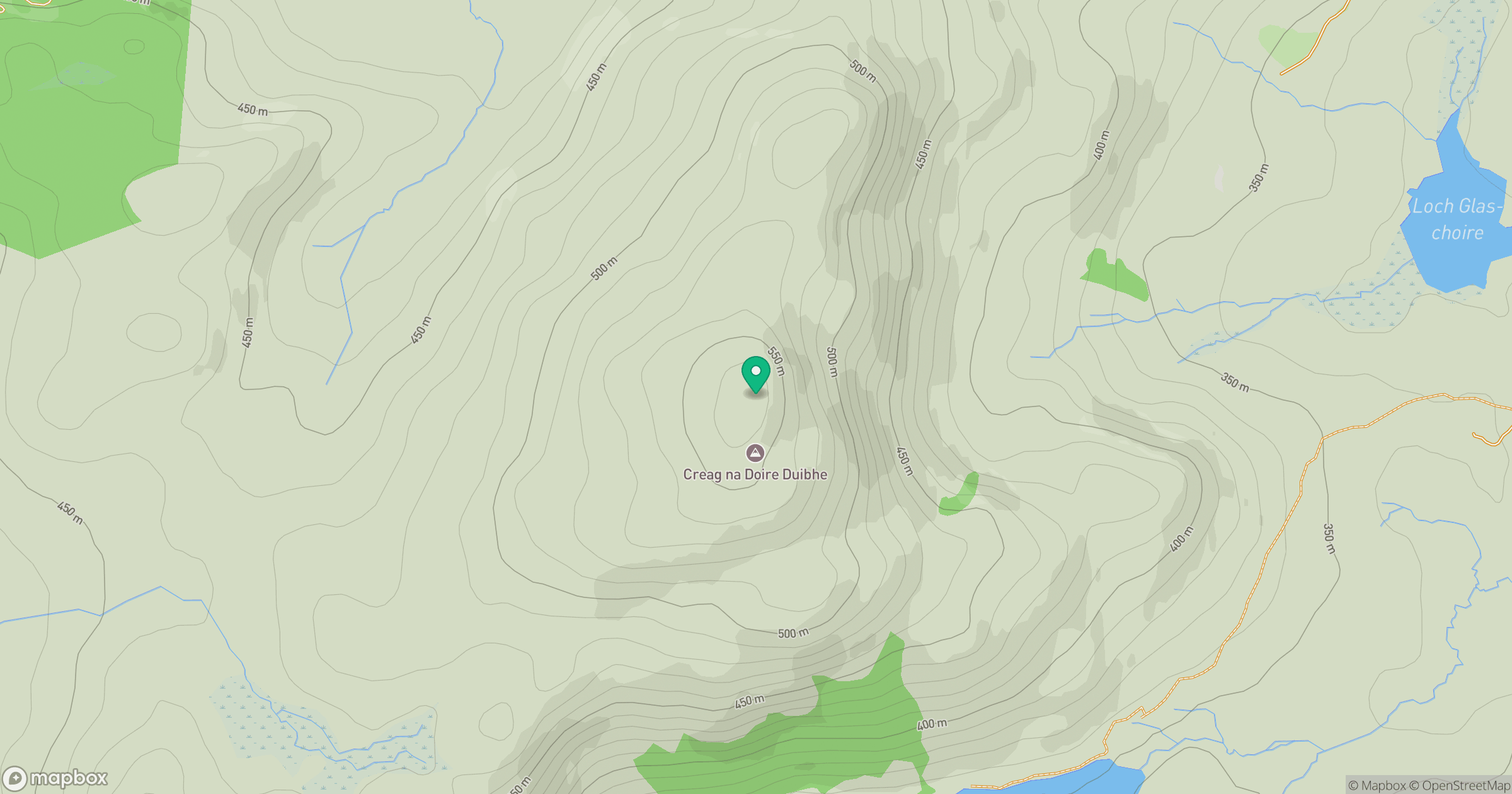
Grid reference: NN615905
View on OpenStreetMapOpens a map in a new tab, centred on the hill.
Hills within 30 km
Straight-line distance, not a walking route or confirmation of access.
No comments yet. Be the first.