

Marg na Craige
Good walks are even better shared.
Overview
Marg na Craige
Overview
Marg na Craige, standing proud at 765 meters, is a Marilyn nestled in the beautiful Scottish Highlands, close to coordinates NN620973. This gem offers not just a hike, but a ticket to some of the most stunning vistas in Scotland.
Geology
The mountain is primarily composed of volcanic rock, remnants of ancient geological processes that shaped the highlands into the rugged terrain seen today. The rocks beneath your feet are a history lesson waiting to be explored!
Route Information
The most popular route to the summit is the Glen Lochay Route, an 8.5 km trek that takes approximately 4 hours. While it’s a moderate hike, don’t underestimate the brisk Scottish weather and prepare for all seasons!
Summit Features
The summit is marked by a cairn and a trig point, perfect for photo opportunities. Remember, a good selfie demands a majestic mountain behind you, not just a pile of stones!
Terrain
Expect rocky paths with grassy patches, along with a few boggy bits to keep it interesting. A sturdy pair of hiking boots will serve you well here, lest you wish to resemble a mud monster!
Views
The summit rewards its conquerors with breathtaking views of Loch Tay, Ben Lawers, and the Crianlarich hills. Spring and summer are the best seasons to soak in these sights, but beware of sunburn—Scotland may surprise you!
Hazards
While the climb is generally safe, be mindful of changing weather conditions. It’s not uncommon for the weather to shift from sun to cloud faster than you can say ‘Scotland’. Plus, slick rocks and muddy paths may test your agility.
Nearby Summits
Don’t stop at Marg na Craige! Nearby peaks like Ben Lawers and Meall a' Bhuiridh await to be explored, each offering their own unique charm and stunning views.
Access and Facilities
You’ll find parking at Glen Lochay car park, but arrive early to snag a spot. Killin is the closest town, where you can find cafes and essential amenities. Don’t forget to refuel with a scone!
History
Marg na Craige’s name means 'The Summit of the Crag' in Gaelic—a fitting title for its towering rocky presence. The mountain stands witness to local legends, adding a sprinkle of intrigue to your hiking story.
So gear up and hit the trail—it’s time to make some memories on Marg na Craige!
Explore routes near Marg na Craige
Public walks starting within 80 km of this hill. Nearby does not mean a route reaches the summit; check its map and access before setting out.
Coire Ardair lochan from Aberarder and back
View route
Great Glen Way low route: Fort Augustus to Invermoriston Old Bridge
View route
Fort Augustus to Kytra Lock: Caledonian Canal Towpath
View route
Rothiemurchus: Beaver Trail and Lochan Mor
View route
Route planning notes
These notes describe possible approaches, not verified navigable routes or permission to cross land. Check current paths, local access rules and conditions before setting out.
Glen Lochay Route
A popular route starting from the Glen Lochay parking area, offering a gradual ascent with stunning views.
Make a day of it, together
Find someone to share the walk with, or organise a day out along a route you like.
Photo Gallery
View all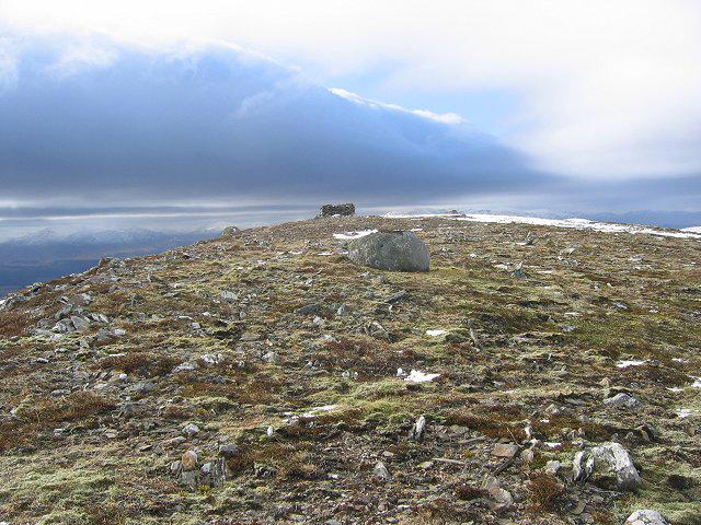 Photo could not load
NN6297 : Mullach Sron na h-Uamhaidh.
Richard Webb
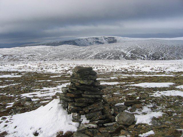 Photo could not load
NN6297 : West from Mullach Sron na h-Uamhaidh.
Richard Webb
Hill facts and local notes
Classifications
Elevation
834m
2,735 ft
Prominence
149m
Coordinates
57.0463, -4.2752
NN620973
OS Map
35
Explorer: OL56 402
At the Summit
The summit is marked by a prominent cairn and offers a trig point, perfect for the classic summit selfie. Just remember, no one likes a selfie with a scowling mountain in the background!
Terrain & Geology
Primarily composed of volcanic rock, Marg na Craige showcases the classic rugged geology of the Scottish Highlands. The rock formations tell tales of ancient volcanic activity that shaped this dramatic landscape.
Views & Scenery
From the summit, you can feast your eyes on the stunning expanse of the highlands including Loch Tay and the surrounding peaks like Ben Lawers and the Crianlarich hills.
History & Heritage
Name Origin
The name 'Marg na Craige' translates to 'The Summit of the Crag' in Gaelic, which perfectly describes the rocky nature of this mountain.
Historical Significance
The area has a rich history and is often referenced in local folklore, with legends of ancient warriors and mythical creatures. A step back in time while you stroll!
Getting There & Facilities
Check current local access restrictions, parking rules and transport timetables before travelling. These notes do not confirm public access to the summit.
Parking
The nearest parking is at the Glen Lochay car park, with space for several vehicles. It can fill up quickly, so get there early if you're keen on a good spot.
Public Transport
The nearest bus service is from Killin, though services can be infrequent. Consider hitching a ride with a fellow adventurer or see if you can catch a taxi!
Nearby Facilities
There are limited facilities at the nearest town of Killin. A delightful café offering good coffee, and a public toilet nearby.
Safety Information
Known Hazards
- Be wary of rapidly changing weather conditions, which can transform a sunny hike into a blustery adventure in minutes. Also, slippery rocks in wet conditions.
General Safety Tips
- Check weather conditions before setting out
- Carry appropriate clothing and equipment
- Let someone know your planned route
- Take a map, compass, and GPS device
- Carry emergency supplies: food, water, first aid kit, torch
Hills
Some common questions about the hills answered
Are there group walks up Marg na Craige?
Many walkers use Walkmates to join or organise walks with others. You can check for group walks around Marg na Craige through the maps
Are there other walkers around Marg na Craige?
Activity varies by location and time, but Walkmates lets you see whether others have shared walks or shown interest in this area. Find other people through the walking friends search walking friends for Marg na Craige search or of course create your own walk for Marg na Craige
Can I organise a walk to Marg na Craige?
Yes. If there aren’t any walks listed already, you can create a walk and make it available for others to join.
If you're signed up to Walkmates, you can create a walk to Marg na Craige.
How do I find a walk up this hill?
There are often multiple ways to walk this hill, depending on experience and route preference. Walkmates helps you explore walks and routes that others have shared.
Can I suggest a new route up Marg na Craige?
Yes. You can suggest or create routes to share with others. Walkmates focuses on the social side of walking, so routes are used to help people organise walks and explore areas together, rather than as detailed navigation tools or route libraries.
Other uses really appreciate knowledgeable walkers sharing their routes. Share your favourite route to Marg na Craige here
The is an error or something incorrect about this hill. How do I let you know?
We always strive to keep the information on Walkmates as accurate as possible. If you find an error, please let us know through the contact form and we'll aim to correct it as quickly as possible
Community Discussion
Comments
Location
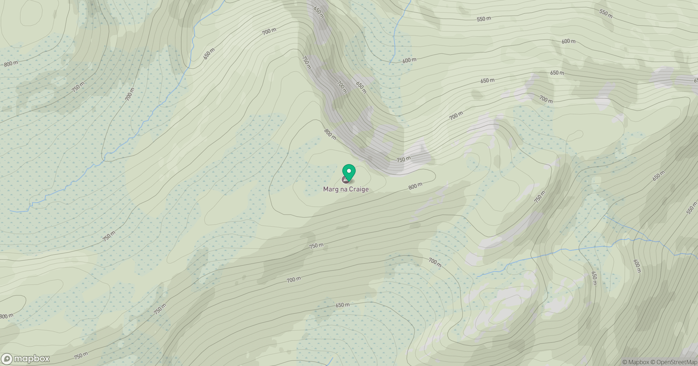
Grid reference: NN620973
View on OpenStreetMapOpens a map in a new tab, centred on the hill.
Hills within 30 km
Straight-line distance, not a walking route or confirmation of access.
No comments yet. Be the first.