
Carn Mor
Good walks are even better shared.
Overview
Hiking Carn Mor
Introduction
Nestled in the Scottish Highlands, Carn Mor is a Marilyn that attracts hikers from all over seeking stunning views and a solid workout. Towering at 813 meters, this mountain offers a worthy challenge for seasoned trekkers and newbies alike.
Geology
Carn Mor's geological composition is dominated by granite, known for its durability. The mountain's shape has been sculpted by the forces of nature, particularly glaciers during the last Ice Age. Pay attention to the interesting rock formations on your way up!
Routes
Starting from Tomatin, you can embark on a moderately challenging route that weaves through forests before tackling the rocky slopes of Carn Mor. Expect a total distance of about 14 km, which should take approximately 5 hours if you take reasonable breaks to catch your breath and enjoy the sights.
Summit Features
Atop Carn Mor, you'll be greeted by a prominent stone cairn, a testament to the many adventurers who’ve shared this view. Don’t forget to stop by the trig point next door for that perfect photo!
Terrain Type
Expect a mixed bag: rocky paths, grassy knolls, and boggy patches. It’s a classic Highland experience, requiring sturdy boots and possibly a spirit of adventure if you misjudge the paths!
Views
Once at the summit, the panorama stretches beautifully, revealing parts of Cawdor Glen and even the mighty Monadhliath Mountains. The best seasons for views are definitely late spring and early autumn, when you can embrace vibrant colours and clear skies.
Hazards
While hiking is a joy, remember that weather in the Highlands is notorious for being unpredictable. Rain can turn a solid path into a slippery slide, so heed the warning: if the clouds roll in, don't ignore them!
Nearby Summits
If you're feeling particularly ambitious, consider an extension to nearby peaks such as Carn na Caim or Sgòr Gaoith.
Access
Tomatin is your best bet for parking and access. The small car park here is free, but do make sure not to block any access roads. There's also public transport from Inverness, making it a convenient spot for day hikers.
Facilities
While this isn’t the most bustling village, Tomatin has a bit to offer. You can grab supplies at a local shop or enjoy a meal at the pub — a perfect place to recount your adventures!
Conclusion
In summary, Carn Mor is not just another mountain; it’s an experience waiting to be had. Whether you're in it for the exercise, the vistas, or the chance to indulge in some local lore, this Highland wonder is ready to welcome you with open arms.
Happy Hiking!
Explore routes near Carn Mor
Public walks starting within 80 km of this hill. Nearby does not mean a route reaches the summit; check its map and access before setting out.
Great Glen Way low route: Fort Augustus to Invermoriston Old Bridge
View route
Fort Augustus to Kytra Lock: Caledonian Canal Towpath
View route
Glen Affric: Coire Loch Woodland Trail
View route
Loch Affric full circuit from River Affric
View route
Route planning notes
These notes describe possible approaches, not verified navigable routes or permission to cross land. Check current paths, local access rules and conditions before setting out.
Inverness to Carn Mor
This route begins in the small village of Tomatin, leading you through lush forests before ascending the rugged slopes of Carn Mor. The path may be wet in places, so wear sensible shoes.
Make a day of it, together
Find someone to share the walk with, or organise a day out along a route you like.
Hill facts and local notes
Classifications
Elevation
509m
1,670 ft
Prominence
101m
Coordinates
57.2372, -4.6282
NH414193
OS Map
34
Explorer: 416S
At the Summit
The summit is capped with a large stone cairn, paying homage to the many hikers who have ventured to the top. A trig point is also located nearby, used by surveyors and enthusiasts alike.
Terrain & Geology
Carn Mor is primarily composed of granite, a resilient material that stands the test of time. The mountain's rugged terrain is punctuated by glacial features that tell a story of ancient ice age activity.
Views & Scenery
From the summit, hikers can enjoy sweeping views of the surrounding Cawdor and Strathnairn Glen, with the iconic peaks of the Monadhliath Mountains in the distance.
History & Heritage
Name Origin
The name 'Carn Mor' translates to 'Big Cairn' in Gaelic, a fitting tribute to its monumental stature.
Historical Significance
Carn Mor has long been a waypoint for local shepherds and a popular hiking destination, appreciated for both its natural beauty and cultural significance.
Getting There & Facilities
Check current local access restrictions, parking rules and transport timetables before travelling. These notes do not confirm public access to the summit.
Parking
There is a small car park at Tomatin, which is around a 10-minute drive from the A9. Additional roadside parking may be available but be cautious not to block access.
Public Transport
Tomatin is accessible by bus from Inverness. Check local schedules for the best routes. It's a short walk from the bus stop to the trailhead.
Nearby Facilities
While Tomatin has limited facilities, there is a local shop and a friendly pub where you can grab a bite before or after your hike. Toilets are available in the village.
Safety Information
Known Hazards
- Beware of sudden weather changes that can dramatically reduce visibility. The terrain may become slippery when wet, so take care on your descent.
General Safety Tips
- Check weather conditions before setting out
- Carry appropriate clothing and equipment
- Let someone know your planned route
- Take a map, compass, and GPS device
- Carry emergency supplies: food, water, first aid kit, torch
Hills
Some common questions about the hills answered
Are there group walks up Carn Mor?
Many walkers use Walkmates to join or organise walks with others. You can check for group walks around Carn Mor through the maps
Are there other walkers around Carn Mor?
Activity varies by location and time, but Walkmates lets you see whether others have shared walks or shown interest in this area. Find other people through the walking friends search walking friends for Carn Mor search or of course create your own walk for Carn Mor
Can I organise a walk to Carn Mor?
Yes. If there aren’t any walks listed already, you can create a walk and make it available for others to join.
If you're signed up to Walkmates, you can create a walk to Carn Mor.
How do I find a walk up this hill?
There are often multiple ways to walk this hill, depending on experience and route preference. Walkmates helps you explore walks and routes that others have shared.
Can I suggest a new route up Carn Mor?
Yes. You can suggest or create routes to share with others. Walkmates focuses on the social side of walking, so routes are used to help people organise walks and explore areas together, rather than as detailed navigation tools or route libraries.
Other uses really appreciate knowledgeable walkers sharing their routes. Share your favourite route to Carn Mor here
The is an error or something incorrect about this hill. How do I let you know?
We always strive to keep the information on Walkmates as accurate as possible. If you find an error, please let us know through the contact form and we'll aim to correct it as quickly as possible
Community Discussion
Comments
Location
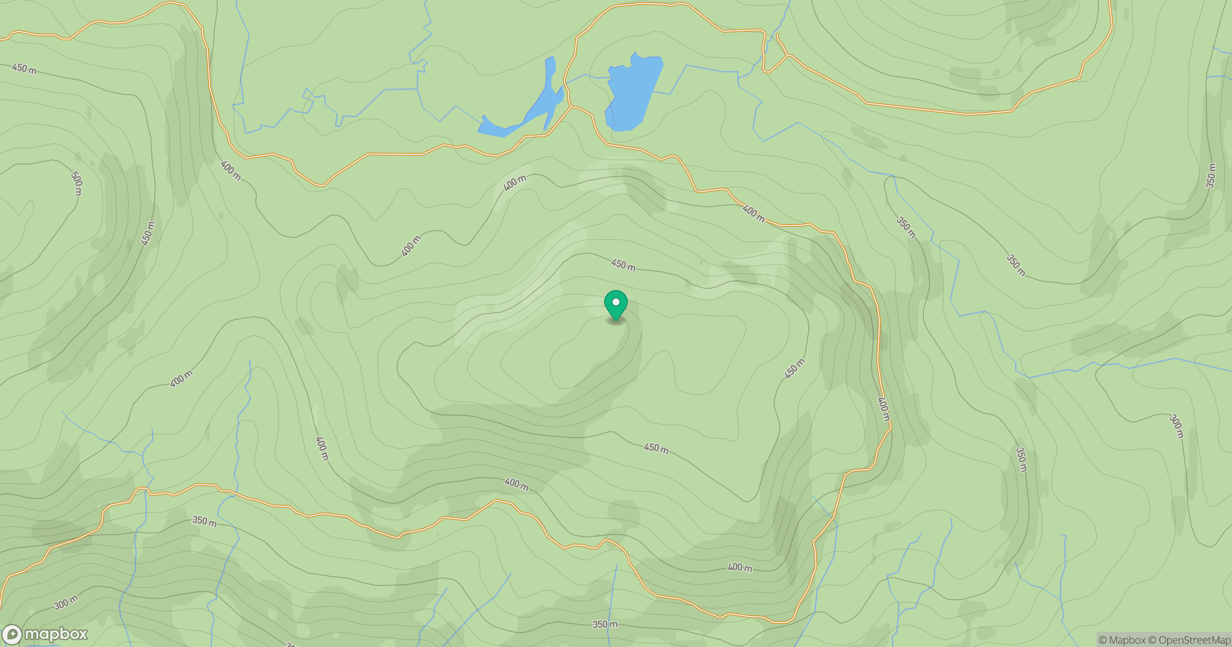
Grid reference: NH414193
View on OpenStreetMapOpens a map in a new tab, centred on the hill.
Hills within 30 km
Straight-line distance, not a walking route or confirmation of access.
Beinn Mheadhoin
541m
Sgurr a' Choire Ghlais
1,084m
Carn Eighe
1,183m
Mam Sodhail
1,179m
Creag nan Eun
418m
No comments yet. Be the first.