

Carn Menyn
Good walks are even better shared.
SN1432 : Carn Menyn from Carn Ingli
Dylan Moore Photo source
Overview
Overview
Carn Menyn is a charming Marilyn located in the heart of the Preseli Hills, Pembrokeshire, rising to an impressive 476 meters. With its unique volcanic geology, this mountain offers both history and striking views, making it a must-visit for outdoor enthusiasts.
Routes
One of the most popular paths is the Foel Cwmcerwyn Route. It's a delightful 8-kilometer circular hike and typically takes around three hours to complete. The route is moderately challenging and leads you over gentle hills, providing ample opportunities for taking in the stunning landscape.
Summit Features
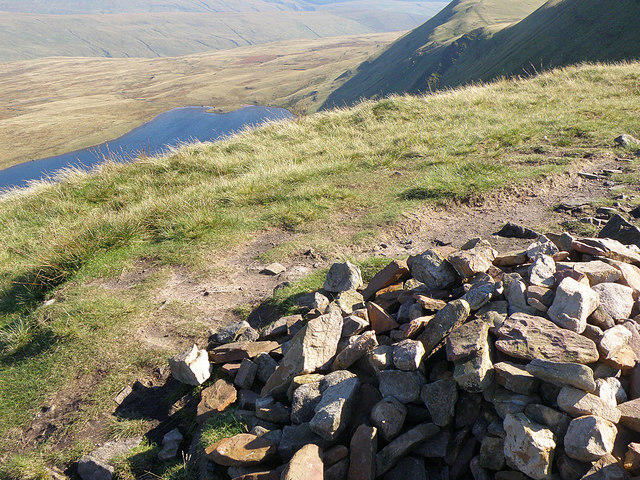
At the summit, you'll find an eye-catching cairn that serves as both a navigation point and a perfect spot to take a breather. The parapet of stones creates a sheltered area to enjoy your packed lunch while contemplating the wondrous views.
Terrain
The terrain around Carn Menyn is primarily grassy with rocky outcrops, a spectacular landscape interspersed with patches of bog, particularly after rain. Some parts may pose a challenge, so a good pair of hiking boots is always advisable.
Views
On a clear day, the views from Carn Menyn are absolutely breathtaking! You can gaze at the Pembrokeshire coastline, the rolling hills of the Preseli range, and, on a particularly fine day, you may even spot the distant peaks of Snowdonia. The best times to visit for stunning vistas are in spring or early summer when wildflowers adorn the meadows.
Hazards
It’s essential to keep in mind that weather in this area can change quicker than you can say 'chilly breeze'. Adequate gear is a must, and be wary of the uneven paths, especially after wet conditions.
Access
For those driving, there's a small car park at the end of a farm lane near Gwaun-Cae-Gurwen, making it quite accessible. If you're relying on public transport, you can catch a bus to Crymych, but be prepared to walk a bit or arrange for a taxi to the trailhead.
Facilities
While nearby villages offer some basic amenities, don’t expect the glitz of urban cafes! There is a delightful café in Crymych for a hot drink or snack, and public toilets can be found at certain points.
History
The name Carn Menyn has an interesting etymology, with 'Carn' meaning 'heap of stones' and 'Menyn' relating to 'butter', possibly inspired by the yellowish stones in the area. This mountain is not just about the thrills of the climb; its archaeological significance adds a layer of mystery, often linked to ancient rituals and monuments.
Conclusion
Whether you’re a seasoned hiker or just looking for a peaceful escape in nature, Carn Menyn offers a blend of adventure, history, and stunning natural beauty. Don't forget your camera—and an extra sandwich or two!
Happy hiking!
Explore routes near Carn Menyn
Walks starting near this hill. Open a route to check its map, distance and full itinerary.
Pembrokeshire Coast Path: Newport Parrog to Fishguard via Dinas Head
View route
Abergwili to Nantgaredig: Tywi Valley Path out and back
View route
Neyland to Johnston: Brunel and Westfield Railway Trail
View route
Stackpole Estate: Bosherston Lily Ponds and Lodge Park Woodland Circuit
View route
Route planning notes
These notes describe possible approaches. Check a route's map and access information when planning your walk.
Foel Cwmcerwyn Route
A lovely circular route beginning at the nearby Foel Cwmcerwyn, leading you over rolling hills and providing stunning views of the surrounding countryside.
Make a day of it, together
Find someone to share the walk with, or organise a day out along a route you like.
Photo Gallery
View all Photo could not load
SN1432 : Carn Menyn from Carn Ingli
Dylan Moore
 Photo could not load
SN1432 : Dringo tuag at Garn Menyn / Ascending towards Carn Menyn
Alan Richards
 Photo could not load
SN1432 : Carn Menyn
Gareth James
 Photo could not load
SN1432 : Carn Menyn
Gareth James
 Photo could not load
SN1432 : A panorama of Carn Menyn
Andrew Sprott
 Photo could not load
SN1432 : Logan stone at Carn Menyn?
Natasha Ceridwen de Chroustchoff
 Photo could not load
SN1432 : Carn Menyn from Eglwyswrw
Dylan Moore
 Photo could not load
SN1432 : Looking Towards Carn Meini
Deborah Tilley
 Photo could not load
SN1432 : Towards Carn Menyn
Gareth James

SN1432 : Spotted dolerite
Natasha Ceridwen de Chroustchoff
Hill facts and local notes
Classifications
Elevation
365m
1,197 ft
Prominence
47m
Coordinates
51.9598, -4.7028
SN143324
OS Map
145
Explorer: OL35E
At the Summit
The summit features a prominent cairn, which makes it a notable point for navigation. There is also a parapet of stones surrounding the area, perfect for shelter to enjoy a packed lunch while soaking in the views.
Terrain & Geology
Carn Menyn is primarily composed of volcanic rock, specifically rhyolite. This geological history adds to its rugged beauty and provides unique formations that attract geologists and hikers alike. The area is known for its ancient stones, often linked to the fascinating Neolithic past of Wales.
Views & Scenery
From the summit, hikers can enjoy breathtaking views of the Pembrokeshire coastline, the rolling hills of the Preseli range, and on clear days, even as far as the distant mountains of Snowdonia.
History & Heritage
Name Origin
The name Carn Menyn comes from Welsh, where 'Carn' means 'heap of stones' and 'Menyn' translates to 'butter', possibly due to the yellowish scree of the hill.
Historical Significance
Carn Menyn is steeped in archaeological significance, often associated with ancient rituals and stone circles, which adds a mystical context for those exploring its landscapes.
Getting There & Facilities
Parking
There is a small car park at the end of a farm lane near the village of Gwaun-Cae-Gurwen, providing a great starting point for your hike.
Public Transport
The nearest public transport options are limited. However, the closest bus stop is in the village of Crymych, approximately 6 miles away, after which a taxi or a long walk will be needed to reach the trailhead.
Nearby Facilities
Facilities are quite basic in the nearby villages. For a warm cup of coffee or a bite to eat, the nearest café can be found in Crymych, while public toilets are available at certain locations.
Safety Information
Known Hazards
- Weather conditions can change rapidly; it is advisable to check forecasts and come prepared with appropriate gear. The terrain can be uneven, and certain paths may become treacherous during wet weather.
General Safety Tips
- Check weather conditions before setting out
- Carry appropriate clothing and equipment
- Let someone know your planned route
- Take a map, compass, and GPS device
- Carry emergency supplies: food, water, first aid kit, torch
Hills
Some common questions about the hills answered
Are there group walks up Carn Menyn?
Many walkers use Walkmates to join or organise walks with others. You can check for group walks around Carn Menyn through the maps
Are there other walkers around Carn Menyn?
Activity varies by location and time, but Walkmates lets you see whether others have shared walks or shown interest in this area. Find other people through the walking friends search walking friends for Carn Menyn search or of course create your own walk for Carn Menyn
Can I organise a walk to Carn Menyn?
Yes. If there aren’t any walks listed already, you can create a walk and make it available for others to join.
If you're signed up to Walkmates, you can create a walk to Carn Menyn.
How do I find a walk up this hill?
There are often multiple ways to walk this hill, depending on experience and route preference. Walkmates helps you explore walks and routes that others have shared.
Can I suggest a new route up Carn Menyn?
Yes. You can suggest or create routes to share with others. Walkmates focuses on the social side of walking, so routes are used to help people organise walks and explore areas together, rather than as detailed navigation tools or route libraries.
Other uses really appreciate knowledgeable walkers sharing their routes. Share your favourite route to Carn Menyn here
The is an error or something incorrect about this hill. How do I let you know?
We always strive to keep the information on Walkmates as accurate as possible. If you find an error, please let us know through the contact form and we'll aim to correct it as quickly as possible
Community Discussion
Comments
Location
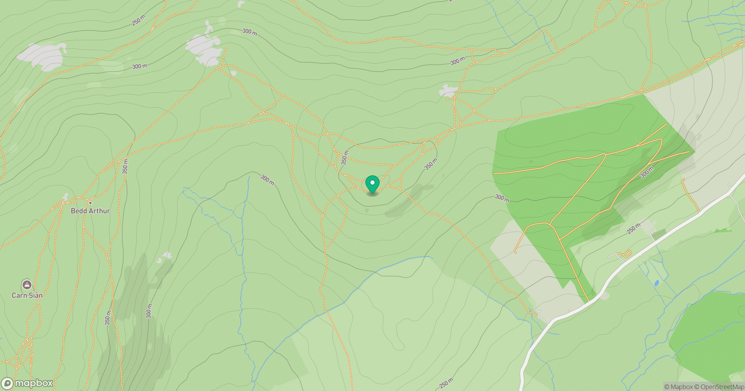
Grid reference: SN143324
View on OpenStreetMapOpens a map in a new tab, centred on the hill.
No comments yet. Be the first.