
Geal-charn
Good walks are even better shared.
Overview
Geal-charn: A Scottish Munro Worth Climbing
Nestled in the heart of the Scottish Highlands, Geal-charn stands tall at an impressive 1045 meters. This Munro, with its rugged beauty and remarkable vistas, entices hikers from near and far. Whether you are a seasoned mountaineer or a casual walker, Geal-charn has something to offer for everyone.
Geology
Geal-charn is composed primarily of granite and schist, a testament to the geological forces that shaped the Highlands. The varied terrain, marked by ancient glacial activity, features smooth ridges and rocky spectacles that provide not just a sense of adventure but also a perfect natural gym for calves and quads! When you’re clambering over rocks, just think of it as your very own leg day.
Routes
From the Lairig Leacach
This route remains one of the most popular trails to the summit, starting at Lairig Leacach pass. You’ll follow a well-trodden path that meanders through stunning landscapes.
- Distance: 10.5 km
- Time: Approximately 4.5 hours
- Difficulty: Moderate
From Roughburn
For those seeking a quieter trek, consider starting from Roughburn. This trail offers a serene atmosphere, relatively less foot traffic, and the chance to soak in the natural surroundings.
- Distance: 9.0 km
- Time: Approximately 4.0 hours
- Difficulty: Moderate
Summit Features
Upon reaching the summit, you’ll encounter a grand cairn that stands as a tribute to those who have ventured to the top. Make sure to capture your adventure on camera—after all, what’s the point of climbing a mountain if you don’t have proof?
Terrain Type
The terrain ranges from rocky outcrops to patches of grass and boggy areas. Wear sturdy footwear to tackle the occasionally deceptive ground.
Views
From the summit, you can feast your eyes on panoramic views of the Monadhliath Mountains and the lush Spey Valley. On clear days, the sight of Ben Nevis in the distance is particularly rewarding.
- Best Seasons: The late spring to early autumn period boasts the best weather for climbing, with summer being ideal for visibility, while autumn’s tapestry of colours can make for a lovely backdrop.
Hazards
Tread carefully, as the weather can shift rapidly, particularly in autumn. Always be cautious of loose rocks, especially on steeper sections. A good head for heights will help too—no one wants to take an unexpected slide!
Nearby Summits
Be sure to check out:
- A' Chailleach (1068 m)
- Carn na Saobhaidhe (975 m)
Access
The nearest parking is a small area at Lairig Leacach, with ample space to leave your vehicle. Just remember not to park in a way that blocks access for others! Public transport options are limited, but you can reach Newtonmore by bus and catch a taxi from there.
Facilities
The charm of Geal-charn is in its wilderness, but do not fret! Newtonmore, just a stone's throw away, has cafes and shops offering well-deserved refreshments after your hike.
History
The name 'Geal-charn' translates to 'White Cairn', and its historical significance is interwoven with tales from the Highland clans. It's said that every stone in the cairn holds a story—though, much like your average pub tale, the truth may be stretched!
With its stunning views, engaging routes, and rich history, a trip to Geal-charn is one for the books. So lace up your boots, pack your lunch, and set out for an adventure that you won’t soon forget!
Happy hiking!
Explore routes near Geal-charn
Walks starting near this hill. Open a route to check its map, distance and full itinerary.
Ben Nevis via Mountain Path
View route
Banavie to Glen Loy Aqueduct: Neptune’s Staircase Canal Towpath
View route
Fort Augustus to Kytra Lock: Caledonian Canal Towpath
View route
Kenmore: Drummond Hill Black Rock Trail above Loch Tay
View route
Route planning notes
These notes describe possible approaches. Check a route's map and access information when planning your walk.
From the Lairig Leacach
A popular route that starts from the Lairig Leacach pass and follows a well-defined path up to the summit.
From Roughburn
A lesser-known but scenic route starting from Roughburn, offering a more serene experience
Make a day of it, together
Find someone to share the walk with, or organise a day out along a route you like.
Hill facts and local notes
Classifications
Elevation
1,132m
3,714 ft
Prominence
410m
Coordinates
56.8378, -4.5097
NN469746
OS Map
42
Explorer: OL50 393
At the Summit
At the summit, hikers will find a distinctive cairn marking the peak, along with expansive views of the surrounding hills and valleys. Don't forget to snap a selfie with the pile of stones - it's practically customary!
Terrain & Geology
Geal-charn is characterized by rugged granite and schist formations, typical of the Scottish Highlands. The mountain's slopes are shaped by ancient glacial activity, leaving a mix of smooth ridges and rocky outcrops, ideal for those seeking a solid footing while enjoying the views.
Views & Scenery
Clear views of the surrounding Monadhliath Mountains and the Spey Valley, as well as distant peaks like Ben Nevis on a good day.
History & Heritage
Name Origin
The name 'Geal-charn' translates to 'White Cairn' in Scots Gaelic, likely referring to the mountain's distinctive summit cairn.
Historical Significance
Geal-charn is not only a popular walking destination but also holds historical significance, featuring in local folklore and tales of the Highland clans.
Getting There & Facilities
Parking
There is a parking area at the start of the Lairig Leacach route, where there's enough space for several cars. Always park considerately!
Public Transport
The nearest public transport options are buses to Laggan, followed by a short taxi ride to the trailhead.
Nearby Facilities
While facilities are sparse on the mountain, the village of Newtonmore offers cafes, shops, and public toilets.
Safety Information
Known Hazards
- Sudden weather changes, especially in the autumn. Also, watch for loose rocks when ascending and descending.
General Safety Tips
- Check weather conditions before setting out
- Carry appropriate clothing and equipment
- Let someone know your planned route
- Take a map, compass, and GPS device
- Carry emergency supplies: food, water, first aid kit, torch
Hills
Some common questions about the hills answered
Are there group walks up Geal-charn?
Many walkers use Walkmates to join or organise walks with others. You can check for group walks around Geal-charn through the maps
Are there other walkers around Geal-charn?
Activity varies by location and time, but Walkmates lets you see whether others have shared walks or shown interest in this area. Find other people through the walking friends search walking friends for Geal-charn search or of course create your own walk for Geal-charn
Can I organise a walk to Geal-charn?
Yes. If there aren’t any walks listed already, you can create a walk and make it available for others to join.
If you're signed up to Walkmates, you can create a walk to Geal-charn.
How do I find a walk up this hill?
There are often multiple ways to walk this hill, depending on experience and route preference. Walkmates helps you explore walks and routes that others have shared.
Can I suggest a new route up Geal-charn?
Yes. You can suggest or create routes to share with others. Walkmates focuses on the social side of walking, so routes are used to help people organise walks and explore areas together, rather than as detailed navigation tools or route libraries.
Other uses really appreciate knowledgeable walkers sharing their routes. Share your favourite route to Geal-charn here
The is an error or something incorrect about this hill. How do I let you know?
We always strive to keep the information on Walkmates as accurate as possible. If you find an error, please let us know through the contact form and we'll aim to correct it as quickly as possible
Community Discussion
Comments
Location
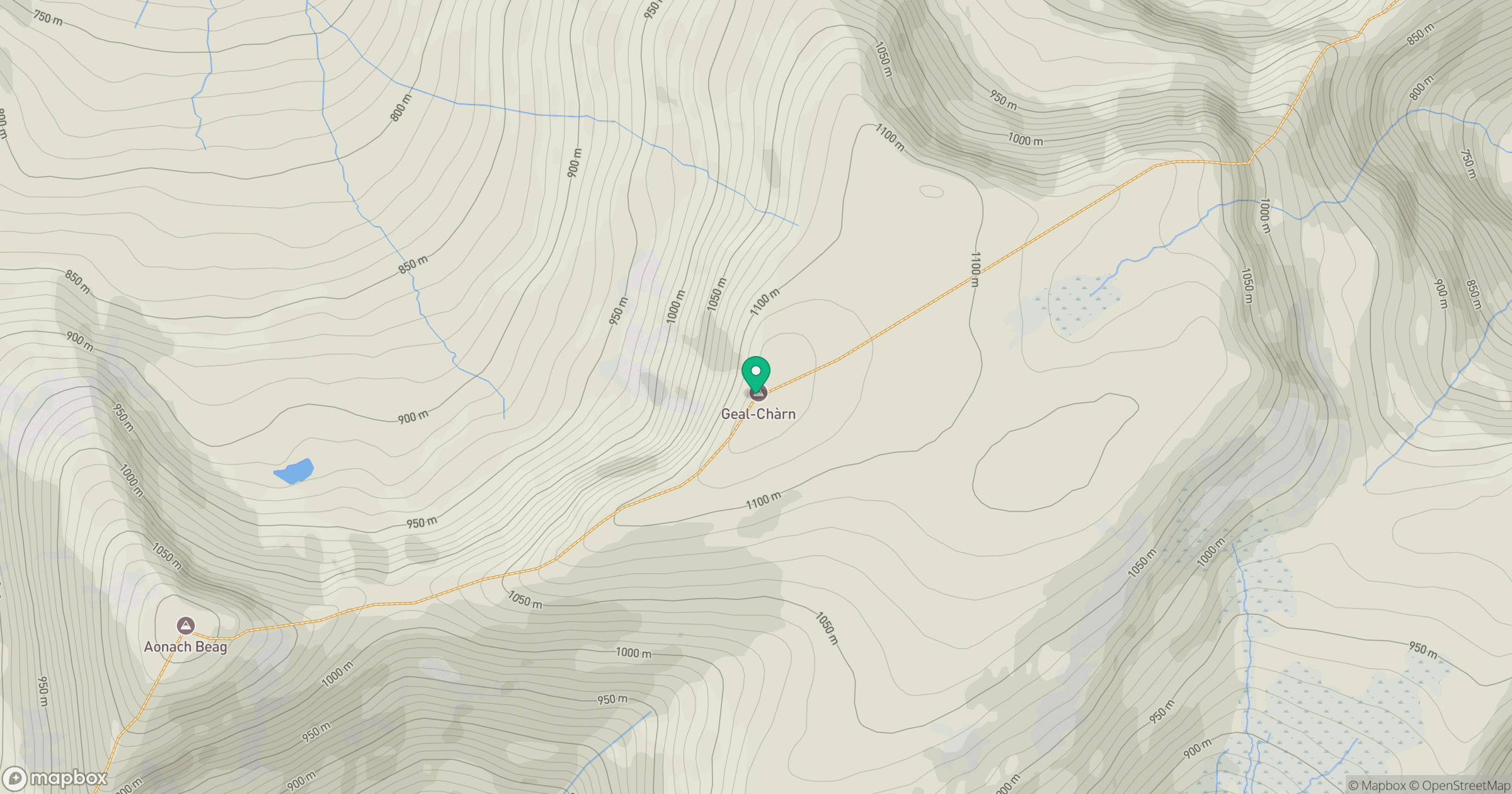
Grid reference: NN469746
View on OpenStreetMapOpens a map in a new tab, centred on the hill.
Nearby Hills
Ben Alder
1,148m
Creag Meagaidh
1,128m
Beinn Mheadhoin
541m
Stob Ban
977m
Stob Choire Claurigh
1,177m
No comments yet. Be the first.