

Carn Mor Dearg
Good walks are even better shared.
NN1772 : On the Carn Mor Dearg ridge
Peter S Photo source
Overview
Carn Mor Dearg
Carn Mor Dearg is a Munro in Lochaber, northeast of Ben Nevis. Its current surveyed elevation is 1,221.1 metres, rounded to 1,221 metres for a whole-metre display. The older 1,220-metre figure remains in some guidebooks and websites. A cairn marks the summit, which looks across Coire Leis towards the North Face of Ben Nevis. The Mamores lie to the south and the Aonachs to the east.
Routes and planning
The established North Face car park circuit climbs Carn Mor Dearg, crosses the CMD Arête to Ben Nevis and returns by the upper Mountain Track and the Allt a' Mhuilinn approach. Walkhighlands gives approximately 17.5 km, 1,506 metres of ascent and 10–11 hours for its specific itinerary. This is a strenuous outing with exposed scrambling, not a casual mountain walk. Its rough return includes a burn crossing that can be impassable in spate; the alternative bridge detour changes the distance and time.
Carn Mor Dearg can also be climbed without continuing over the arête. Use a mapped out-and-back approach from the North Face car park via the northern summit ridge, returning by the same route. Do not confuse this with a direct ascent from near the CIC Hut: that option crosses very steep, loose, broken ground. The exact mapped line for the summit-only option has not been verified.
Combining the mountain with the Aonachs is a specialist undertaking. The suggested Aonach Mor circular, Lairig Leacach approach and two-day traverse below are not verified complete itineraries. Plan the actual connections, descent, finish and any overnight stop before considering them; the narrow exposed arête should not be presented as a recommended campsite.
Local mountain guides have highlighted erosion on the lower Carn Mor Dearg approach. Check current route and responsible-access advice rather than widening eroded peat paths.
Landscape and geology
The peak consists of pink-to-grey granite from the Ben Nevis Inner Granite intrusion, which formed when magma cooled below the surface. Subsequent erosion and glaciation exposed and shaped the mountain. Its granite contrasts with the darker volcanic cliffs across the corrie on Ben Nevis.
The Scottish Mountaineering Club gives the Gaelic name's meaning as “Big red hill”.
Safety and conditions
The CMD Arête has steep drops, loose blocks and exposed scrambling. It requires appropriate experience, sure-footedness and a head for heights. Strong winds, wet rock and poor visibility can make the crossing much more serious. Reaching Ben Nevis still leaves a long descent requiring careful navigation.
Snow and ice can turn the arête into a winter mountaineering route. Appropriate winter skills and equipment, including an ice axe and crampons, may be needed. Do not assume spring or autumn offers gentle conditions. Check mountain weather and, when snow is present, the relevant avalanche information. Carry a map and compass and know how to use them, suitable clothing, food, water, a torch and emergency equipment. Choose a route and turnaround time suited to the whole group.
Access and facilities
The North Face car park is reached from the A82 at Torlundy, outside Fort William. Parking is charged; check Forestry and Land Scotland for current charges and access notices. Its published postcode refers to the road turn-off, not the summit or exact car park entrance.
Buses between Fort William and Nevis Range or Spean Bridge can stop at Torlundy on request. There is no bus to the car park itself: allow for the additional approach and check the current timetable and last return. Forestry and Land Scotland lists the nearest public toilets at Fort William or Nevis Range. Carry everything needed for the mountain day.
Nearby summits include Ben Nevis, conventionally rounded to 1,345 metres, and Aonach Mor, whose surveyed height is 1,220.4 metres. Their proximity does not make connecting routes straightforward.
Sources
- Database of British and Irish Hills: current downloads — version 18.6, Carn Mor Dearg record 282
- Alan Dawson: The 1033 High Hills of Britain, survey method and height table
- Walkhighlands: the North Face car park CMD Arête circuit
- Walkhighlands: Carn Mor Dearg and alternative approaches
- Forestry and Land Scotland: North Face visitor information
- British Geological Survey and Scottish Natural Heritage: Ben Nevis and Glencoe geology
- Scottish Mountaineering Club: hill lists and name meanings
- UKHillwalking: winter CMD Arête conditions
- Abacus Mountain Guides: lower-approach erosion advice
Reviewed 15 October 2026. These are planning summaries, not turn-by-turn navigation.
Explore routes near Carn Mor Dearg
Walks starting near this hill. Open a route to check its map, distance and full itinerary.
Ben Nevis via Mountain Path
View route
Banavie to Glen Loy Aqueduct: Neptune’s Staircase Canal Towpath
View route
Coire Ardair lochan from Aberarder and back
View route
Fort Augustus to Kytra Lock: Caledonian Canal Towpath
View route
Route planning notes
These notes describe possible approaches. Check a route's map and access information when planning your walk.
Carn Mor Dearg and Ben Nevis via the CMD Arête (North Face circuit)
From the North Face car park, climb Carn Mor Dearg via its northern ridge, cross the CMD Arête to Ben Nevis, then return via the upper Mountain Track, Lochan Meall an t-Suidhe and Allt a' Mhuilinn. Walkhighlands gives approximately 17.5 km, 1,506 m ascent and 10–11 hours. A burn on the rough return can be impassable in spate; a bridge detour adds distance. Requires fitness, navigation and exposed scrambling skills. Snow and ice require winter mountaineering skills.
Carn Mor Dearg from the North Face car park (out and back)
A summit-only option from the North Face car park, using the Allt a' Mhuilinn approach and northern summit ridge, with a return by the same route. It avoids continuing across the CMD Arête but still involves a substantial ascent and steep, rough mountain terrain. Do not mistake the very steep, loose direct slope above the CIC Hut for a straightforward path. Select a complete mapped line before setting out; the precise itinerary has not been verified.
Carn Mor Dearg and Aonach Mor (unverified circuit)
Combining Carn Mor Dearg with the Aonachs is possible for experienced mountaineers, but this card does not establish a complete circular route. The precise Nevis Range start, connection between summits and return are unverified. The terrain between these mountains must not be treated as a straightforward continuous ridge walk. Use a specialist mapped itinerary and appropriate skills rather than navigating from this summary.
Carn Mor Dearg via Lairig Leacach (unverified proposal)
The Spean Bridge–Lairig Leacach approach has not been verified as a complete route to Carn Mor Dearg. Its onward connection, descent and finish are not established. Do not rely on this card for navigation or treat it as a recommended day walk.
Ben Nevis and Carn Mor Dearg two-day traverse (unverified proposal)
A two-day plan needs an explicit start, finish, descent and safe, lawful overnight location. These have not been verified for this proposal. The CMD Arête is a narrow exposed scrambling ridge and should not be presented as a recommended campsite. This card is not a complete itinerary; use a complete specialist mapped itinerary with appropriate mountain experience and responsible-access guidance.
Make a day of it, together
Find someone to share the walk with, or organise a day out along a route you like.
Photo Gallery
View all Photo could not load
NN1772 : On the Carn Mor Dearg ridge
Peter S
 Photo could not load
NN1772 : Carn Mor Dearg Arete
William Starkey
 Photo could not load
NN1772 : Carn Mor Dearg, Ben Nevis behind, from Aonach Mor
John Dyason
 Photo could not load
NN1772 : Carn Mor Dearg
Walter Baxter
 Photo could not load
NN1772 : Carn Mor Dearg
Walter Baxter
 Photo could not load
NN1772 : Snow patches on the side of Carn Mor Dearg
Peter S
 Photo could not load
NN1772 : Carn Mòr Dearg
Russel Wills
 Photo could not load
NN1772 : Stony slope descending from summit area of Carn Mòr Dearg
Trevor Littlewood
 Photo could not load
NN1772 : On the Carn Mor Dearg ridge
Peter S

NN1772 : Carn Mor Dearg summit ridge
Peter S
Hill facts and local notes
Classifications
Elevation
1,221m
4,006 ft
Prominence
164m
Coordinates
56.8053, -4.9866
NN177721
OS Map
41
Explorer: 392
At the Summit
A cairn marks the rocky summit. Steep ground falls away close by; the outlook includes the North Face of Ben Nevis across Coire Leis.
Terrain & Geology
Carn Mor Dearg exposes the Ben Nevis Inner Granite, a pink-to-grey intrusive rock formed as magma cooled beneath the surface. Later erosion and glaciation shaped the peak and its ridges.
Views & Scenery
The North Face of Ben Nevis lies to the southwest across Coire Leis, with the Mamores to the south and the Aonachs to the east. Views depend on visibility.
Best Seasons
Clear weather can bring extensive mountain views in any season. Spring and autumn can still have severe weather, snow or ice; choose conditions rather than assuming a season is benign.
History & Heritage
Name Origin
The Scottish Mountaineering Club gives the Scottish Gaelic name Carn Mor Dearg as “Big red hill”.
Getting There & Facilities
Parking
North Face car park near Torlundy, reached from the signed A82 turn-off outside Fort William. Parking is charged. Check Forestry and Land Scotland for current charges and access notices; PH33 6SW refers to the Torlundy turn-off.
Public Transport
Buses between Fort William and Nevis Range or Spean Bridge can stop at Torlundy on request. There is no bus to the North Face car park itself, so allow for the extra approach. Check current Traveline Scotland timetables and the last return.
Nearby Facilities
The North Face site has parking, picnic and viewpoint facilities. Forestry and Land Scotland lists the nearest public toilets at Fort William or Nevis Range. Carry food, water and equipment for the mountain day.
Safety Information
Known Hazards
- The CMD Arête involves exposed scrambling, steep drops and loose blocks; a slip can have serious consequences. Strong wind, wet rock and poor visibility increase the difficulty.
- Direct slopes above the CIC Hut are very steep, loose and broken. The usual northern ridge approach is still a strenuous mountain ascent.
- The full Ben Nevis circuit requires careful summit navigation and a long descent. Its pathless return includes a burn crossing that can be impassable in spate; plan the alternative bridge detour.
Seasonal Hazards
Snow and ice can turn the CMD Arête into a winter mountaineering route requiring winter skills, ice axe and crampons. Snow can persist beyond winter. Check mountain forecasts and relevant avalanche information; do not assume spring or autumn conditions are forgiving.
General Safety Tips
- Check weather conditions before setting out
- Carry appropriate clothing and equipment
- Let someone know your planned route
- Take a map, compass, and GPS device
- Carry emergency supplies: food, water, first aid kit, torch
Hills
Some common questions about the hills answered
Are there group walks up Carn Mor Dearg?
Many walkers use Walkmates to join or organise walks with others. You can check for group walks around Carn Mor Dearg through the maps
Are there other walkers around Carn Mor Dearg?
Activity varies by location and time, but Walkmates lets you see whether others have shared walks or shown interest in this area. Find other people through the walking friends search walking friends for Carn Mor Dearg search or of course create your own walk for Carn Mor Dearg
Can I organise a walk to Carn Mor Dearg?
Yes. If there aren’t any walks listed already, you can create a walk and make it available for others to join.
If you're signed up to Walkmates, you can create a walk to Carn Mor Dearg.
How do I find a walk up this hill?
There are often multiple ways to walk this hill, depending on experience and route preference. Walkmates helps you explore walks and routes that others have shared.
Can I suggest a new route up Carn Mor Dearg?
Yes. You can suggest or create routes to share with others. Walkmates focuses on the social side of walking, so routes are used to help people organise walks and explore areas together, rather than as detailed navigation tools or route libraries.
Other uses really appreciate knowledgeable walkers sharing their routes. Share your favourite route to Carn Mor Dearg here
The is an error or something incorrect about this hill. How do I let you know?
We always strive to keep the information on Walkmates as accurate as possible. If you find an error, please let us know through the contact form and we'll aim to correct it as quickly as possible
Community Discussion
Comments
Location
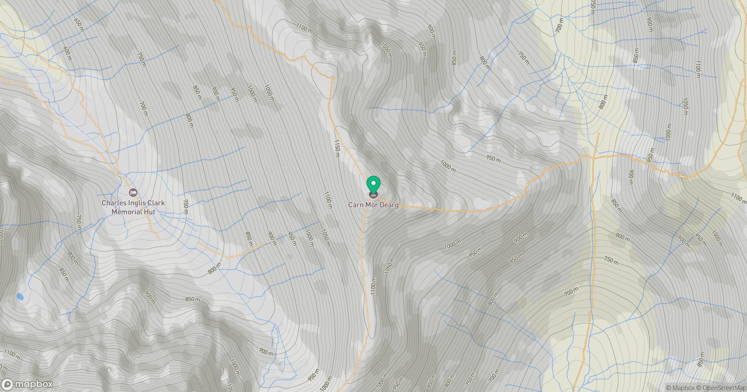
Grid reference: NN177721
View on OpenStreetMapOpens a map in a new tab, centred on the hill.

No comments yet. Be the first.