

Caerketton Hill
Good walks are even better shared.
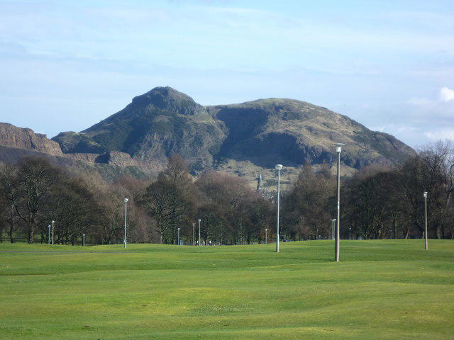
NT2366 : Caerketton Craigs
Jim Barton Photo source
Overview
Overview of Caerketton Hill
Caerketton Hill, standing proudly at 431 metres, is a Marilyn located in the Southern Uplands of Scotland. Just a stone's throw from the bustling city of Edinburgh, this hill offers a perfect escape into nature without straying too far from urban comforts.
Geology
The geology of Caerketton is fascinating, primarily composed of basalt—an ancient volcanic rock that has created a stunning landscape over millions of years. As you hike, take a moment to admire these rocky formations; you may start to wonder if the giant that created them still roams the hills!
Routes
One of the most popular routes is the Pentland Hills Circular Route, a 5 km loop that rewards you with breathtaking views of the surrounding countryside and the city of Edinburgh. This moderate hike can be comfortably completed in about 2 hours, making it perfect for a sunny afternoon.
Summit Features
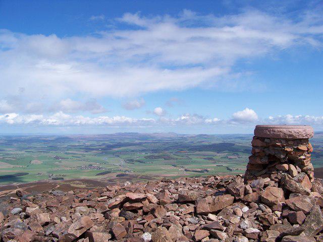
At the summit, the prominent trig point is a highlight; not only does it mark your achievement, but it also provides a fantastic backdrop for photos. One cannot help but feel a sense of accomplishment as you look down on the world from this lofty perch.
Terrain
The terrain is mainly grassy with occasional rocky patches, ensuring you're constantly entertained by nature's lovely obstacles. Remember to wear sturdy shoes, as some of these lovely rocks may have you tripping over your own two feet!
Views
From the summit, the panoramic views will steal your breath away. On a clear day, you can see the majestic Edinburgh Castle rise against the skyline, along with the sparkling Firth of Forth and the rolling hills of the Pentlands stretching into the distance. For vowing leaders and aspiring photographers alike, spring and early autumn present the best seasons for clear views and mild weather.
Hazards
As delightful as hiking is, one must remember to keep an eye on the weather. The Scottish climate is known for its sudden shifts, so pack a jacket just in case it decides to rain on your parade. The uneven terrain also requires a steady foot, so stay alert to avoid any unintended tumbles.
Nearby Summits
For those looking to extend their adventure, nearby summits like West Kip and East Kip offer additional hiking opportunities and magnificent views, ensuring your outing is nothing short of spectacular.
Access
For those driving, you can find parking at Flotterstone car park, which is well signposted and fills up quickly on weekends, so be sure to come early. For public transport enthusiasts, Lothian Bus routes 37 and 101 provide convenient access. The charming village of Balerno is just a stone's throw away and offers local amenities post-hike.
Facilities
After your trek, a visit to the Flotterstone Inn is in order; they serve delightful food and drinks, and there are toilets available for your convenience.
History
The name Caerketton translates to 'fort of the pile of stones', giving insight into its historical relevance. This hill has been part of local folklore and culture for centuries, making any visit a journey through time.
So pack your boots, grab your gear, and set off to experience the beauty of Caerketton Hill. It’s an adventure worth the walk!
Explore routes near Caerketton Hill
Walks starting near this hill. Open a route to check its map, distance and full itinerary.
Artists’ walk in Craigmillar Castle Park (group meeting)
View route
To Absent Friends: Holyrood Park walk
View route
Dalkeith Country Park: Estate and North Woods Green Trail
View route
East Calder: Almondell, Mandela Bridge and River Almond Circuit
View route
Route planning notes
These notes describe possible approaches. Check a route's map and access information when planning your walk.
Pentland Hills Circular Route
A popular loop offering stunning views over Edinburgh and beyond, perfect for a leisurely afternoon stroll.
Make a day of it, together
Find someone to share the walk with, or organise a day out along a route you like.
Photo Gallery
View all Photo could not load
NT2366 : Caerketton Craigs
Jim Barton
 Photo could not load
NT2366 : Caerketton Hill
Richard Webb
 Photo could not load
NT2366 : Caerketton Hill
Graeme Yuill
 Photo could not load
NT2366 : Caerketton from Swanston Burn
Adam Ward
 Photo could not load
NT2366 : Caerketton Hill above a sea of cloud
Callum Black
 Photo could not load
NT2366 : Cairn on Caerketton Hill
Alan O'Dowd
 Photo could not load
NT2366 : The northern crags of Caerketton Hill
Keith Burns
 Photo could not load
NT2366 : Ridge to Caerketton summit
Jim Barton
 Photo could not load
NT2366 : Caerketton
Anne Burgess

NT2366 : Slope below Caerketton Craigs
Alan O'Dowd
Hill facts and local notes
Classifications
Elevation
478m
1,568 ft
Prominence
65m
Coordinates
55.8827, -3.2236
NT235661
OS Map
66
Explorer: 344 350
At the Summit
The summit features a distinctive trig point, which is not only excellent for navigation but also for taking that obligatory summit selfie.
Terrain & Geology
The hill primarily consists of volcanic rock formed during the Carboniferous period, showcasing beautiful basalt formations that might make you feel like you're walking through a giant's backyard.
Views & Scenery
From the summit, you can see iconic landmarks including Edinburgh Castle, the Firth of Forth, and a stunning expanse of the Pentland Hills.
History & Heritage
Name Origin
The name 'Caerketton' is believed to derive from the Gaelic 'Caer Ceitinn', which translates to 'fort of the pile of stones', hinting at its historical significance.
Historical Significance
Historically, Caerketton Hill has been a site of interest since ancient times, and the surrounding area is steeped in tales and folklore from the early inhabitants.
Getting There & Facilities
Parking
There is limited parking available at the Flotterstone car park, which is well signposted; do arrive early to nab a spot, especially on sunny weekends.
Public Transport
The area is serviced by the Lothian Buses; routes 37 and 101 will take you partway to the starting points of various hikes.
Nearby Facilities
Facilities around include the Flotterstone Inn which offers refreshments and toilets, perfect for a post-hike pint or a warm cuppa.
Safety Information
Known Hazards
- Be cautious of sudden weather changes, as the Scottish climate can be unpredictably capricious, and uneven ground can lead to missteps.
General Safety Tips
- Check weather conditions before setting out
- Carry appropriate clothing and equipment
- Let someone know your planned route
- Take a map, compass, and GPS device
- Carry emergency supplies: food, water, first aid kit, torch
Hills
Some common questions about the hills answered
Are there group walks up Caerketton Hill?
Many walkers use Walkmates to join or organise walks with others. You can check for group walks around Caerketton Hill through the maps
Are there other walkers around Caerketton Hill?
Activity varies by location and time, but Walkmates lets you see whether others have shared walks or shown interest in this area. Find other people through the walking friends search walking friends for Caerketton Hill search or of course create your own walk for Caerketton Hill
Can I organise a walk to Caerketton Hill?
Yes. If there aren’t any walks listed already, you can create a walk and make it available for others to join.
If you're signed up to Walkmates, you can create a walk to Caerketton Hill.
How do I find a walk up this hill?
There are often multiple ways to walk this hill, depending on experience and route preference. Walkmates helps you explore walks and routes that others have shared.
Can I suggest a new route up Caerketton Hill?
Yes. You can suggest or create routes to share with others. Walkmates focuses on the social side of walking, so routes are used to help people organise walks and explore areas together, rather than as detailed navigation tools or route libraries.
Other uses really appreciate knowledgeable walkers sharing their routes. Share your favourite route to Caerketton Hill here
The is an error or something incorrect about this hill. How do I let you know?
We always strive to keep the information on Walkmates as accurate as possible. If you find an error, please let us know through the contact form and we'll aim to correct it as quickly as possible
Community Discussion
Comments
Location
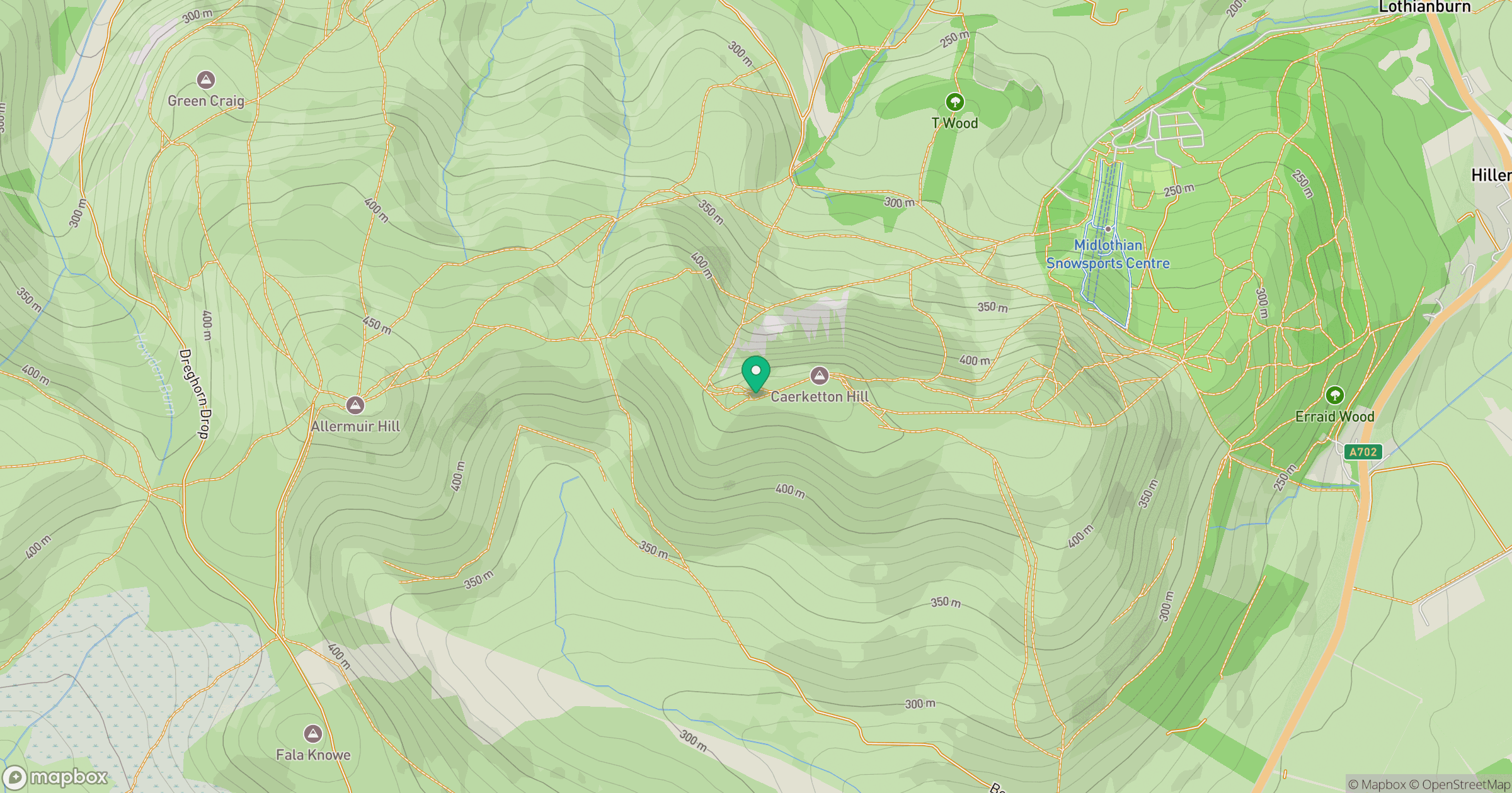
Grid reference: NT235661
View on OpenStreetMapOpens a map in a new tab, centred on the hill.
No comments yet. Be the first.