

Cadair Bronwen
Good walks are even better shared.
SJ0734 : Miaren Gor. Rubus Chamaemorus. Cloudberry
Eric Jones Photo source
Overview
Cadair Bronwen
Cadair Bronwen, standing proudly at 785 meters, is not just another peak in the Berwyn Mountains; it's a marvellous concoction of history, whimsy, and geological intrigue. This Marilyn beckons to hikers with its stunning views and a variety of routes suitable for different skill levels.
Geology
Cadair Bronwen exhibits fascinating volcanic geology, with
tuffs and andesites carved by time. It’s like nature's own canvas showcasing ancient volcanic activity. If you ever wanted to get up close with the earth's molten history, you’re in for a treat!
Routes
The North Ridge Route is a popular choice for those starting from Llandrillo. At a moderate distance of 10 km, it pushes you to elevate your heart rate while treating you to beautiful landscapes along the way.
For the more adventurous, the South East Approach gives a real workout, climbing steeply from the valley near Cynwyd. Bring your A-game and maybe a snack or two for motivation!
Summit Features
Reaching the summit entails a rewarding sight: a trig point and stone cairn standing guard, offering fantastic photo opportunities. Plenty of people have celebrated their ascent with a little picnic—just mind not to let the seagulls steal your sandwich!
Terrain
The terrain presents a bit of everything: rocky outcrops, windswept grass, and some boggy sections that ensure you're not just strolling through a walk in the park. It can be a right old challenge, particularly in wet conditions!
Views
From the top, the sight of the Berwyn range sprawls before you, a verdant carpet of life, with sweeping valleys and, on clear days, a peek at Snowdonia’s majestic beauty in the distance. As for seasons, late spring and autumn will have you spotting vibrant wildflowers or fiery foliage, making your views even sweeter.
Hazards
Keep your wits about you: weather can change on a dime here. Slippery rocks after rain can make for an interesting adventure—just remember to think twice before attempting your best rock-climbing moves!
Nearby Summits
Don’t leave just yet; consider conquering Cadair Berwyn and Moel Sych, both of which are just a stone's throw away and easily accessible from Cadair Bronwen.
Access
To access this beautiful peak, park at Llandrillo (SJ 079 346). It’s a cozy little spot where you can leave your car. Public transport is available to Llandrillo, but it might be more of a scavenger hunt to find it, so check ahead! The nearest town, Bala, is a treasure trove of amenities and just about 15 km away.
Facilities
Make sure to swing by Llandrillo for basic facilities, including a shop and a pub, or take a longer trek to Bala for more significant amenities. Toilets can also be found there, which is always a plus!
History
The name 'Cadair Bronwen' is steeped in meaning and lore. Specifically, it hints at a connection to Welsh history, translating to 'Cairn of Bronwen'. Legends abound here, making each climb not just a physical journey but a step into the rich tapestry of Welsh heritage.
So, lace up those boots and take to the hills; Cadair Bronwen awaits to share its beauty and tales with you!
Explore routes near Cadair Bronwen
Walks starting near this hill. Open a route to check its map, distance and full itinerary.
Llangollen to Horseshoe Falls: Canal Towpath from Market Street
View route
World’s End and back
View route
Arenig Fach guided mountain walk
View route
Aran Benllyn and Aran Fawddwy from LLanuwchllyn
View route
Route planning notes
These notes describe possible approaches. Check a route's map and access information when planning your walk.
North Ridge Route
A scenic route starting from the village of Llandrillo leading to the north ridge of Cadair Bronwen.
South East Approach
This is a more challenging route starting from the valley near the village of Cynwyd, gaining elevation quickly.
Make a day of it, together
Find someone to share the walk with, or organise a day out along a route you like.
Photo Gallery
View all Photo could not load
SJ0734 : Miaren Gor. Rubus Chamaemorus. Cloudberry
Eric Jones
 Photo could not load
SJ0734 : Glissading off Cadair Bronwen
Richard Law
 Photo could not load
SJ0734 : View north east from Cadair Bronwen summit
Espresso Addict
 Photo could not load
SJ0734 : Cadair Bronwen summit cairn
Espresso Addict
 Photo could not load
SJ0734 : View to Cadair Bronwen from Cadair Berwyn
Jeremy Bolwell
 Photo could not load
SJ0734 : South along the Berwyn Ridge from Cadair Bronwen
Richard Law
 Photo could not load
SJ0734 : Walkers by cairn on summit of Cadair Bronwen
Roger Davies
 Photo could not load
SJ0734 : The top of Cadair Bronwen
Bill Boaden
 Photo could not load
SJ0734 : Stone cairn on Cadair Bronwen
Jeremy Bolwell

SJ0734 : Bwrdd Arthur
Eric Jones
Hill facts and local notes
Classifications
Elevation
783m
2,570 ft
Prominence
73m
Coordinates
52.9015, -3.3729
SJ077346
OS Map
125
Explorer: 255
At the Summit
The summit features a prominent trig point and a stone cairn, making it a perfect spot for a celebratory snack after the ascent.
Terrain & Geology
Cadair Bronwen is primarily composed of volcanic rock, specifically tuffs and andesites formed during the late Ordovician to early Silurian period. The mountain's rugged characteristics stem from ancient volcanic activity, providing a fascinating glimpse into the Earth’s geological past.
Views & Scenery
From the summit, enjoy panoramic views of the Berwyn range, the lush valleys below, and on clear days, you might even catch a glimpse of Snowdonia in the distance.
History & Heritage
Name Origin
The name 'Cadair Bronwen' translates to 'Cairn of Bronwen,' with 'Cadair' meaning 'chair' or 'cairn' in Welsh, referring to its prominent summit.
Historical Significance
Cadair Bronwen holds both historical and cultural significance, referenced in various Welsh legends and tales of valor.
Getting There & Facilities
Parking
There is a small car park at Llandrillo (SJ 079 346) suitable for about 5-6 cars. Please park considerately.
Public Transport
The nearest bus service to Llandrillo operates through the county's public transport options, but services may be limited. Verify local timetables for accurate information.
Nearby Facilities
Llandrillo offers some basic facilities, including a shop and a pub. For more extensive services, head to Bala, which has cafes, restaurants, and public toilets.
Safety Information
Known Hazards
- Beware of sudden weather changes typical of the Welsh mountains. Also, the rocky terrain may become slippery, especially after rainfall.
General Safety Tips
- Check weather conditions before setting out
- Carry appropriate clothing and equipment
- Let someone know your planned route
- Take a map, compass, and GPS device
- Carry emergency supplies: food, water, first aid kit, torch
Hills
Some common questions about the hills answered
Are there group walks up Cadair Bronwen?
Many walkers use Walkmates to join or organise walks with others. You can check for group walks around Cadair Bronwen through the maps
Are there other walkers around Cadair Bronwen?
Activity varies by location and time, but Walkmates lets you see whether others have shared walks or shown interest in this area. Find other people through the walking friends search walking friends for Cadair Bronwen search or of course create your own walk for Cadair Bronwen
Can I organise a walk to Cadair Bronwen?
Yes. If there aren’t any walks listed already, you can create a walk and make it available for others to join.
If you're signed up to Walkmates, you can create a walk to Cadair Bronwen.
How do I find a walk up this hill?
There are often multiple ways to walk this hill, depending on experience and route preference. Walkmates helps you explore walks and routes that others have shared.
Can I suggest a new route up Cadair Bronwen?
Yes. You can suggest or create routes to share with others. Walkmates focuses on the social side of walking, so routes are used to help people organise walks and explore areas together, rather than as detailed navigation tools or route libraries.
Other uses really appreciate knowledgeable walkers sharing their routes. Share your favourite route to Cadair Bronwen here
The is an error or something incorrect about this hill. How do I let you know?
We always strive to keep the information on Walkmates as accurate as possible. If you find an error, please let us know through the contact form and we'll aim to correct it as quickly as possible
Community Discussion
Comments
Location
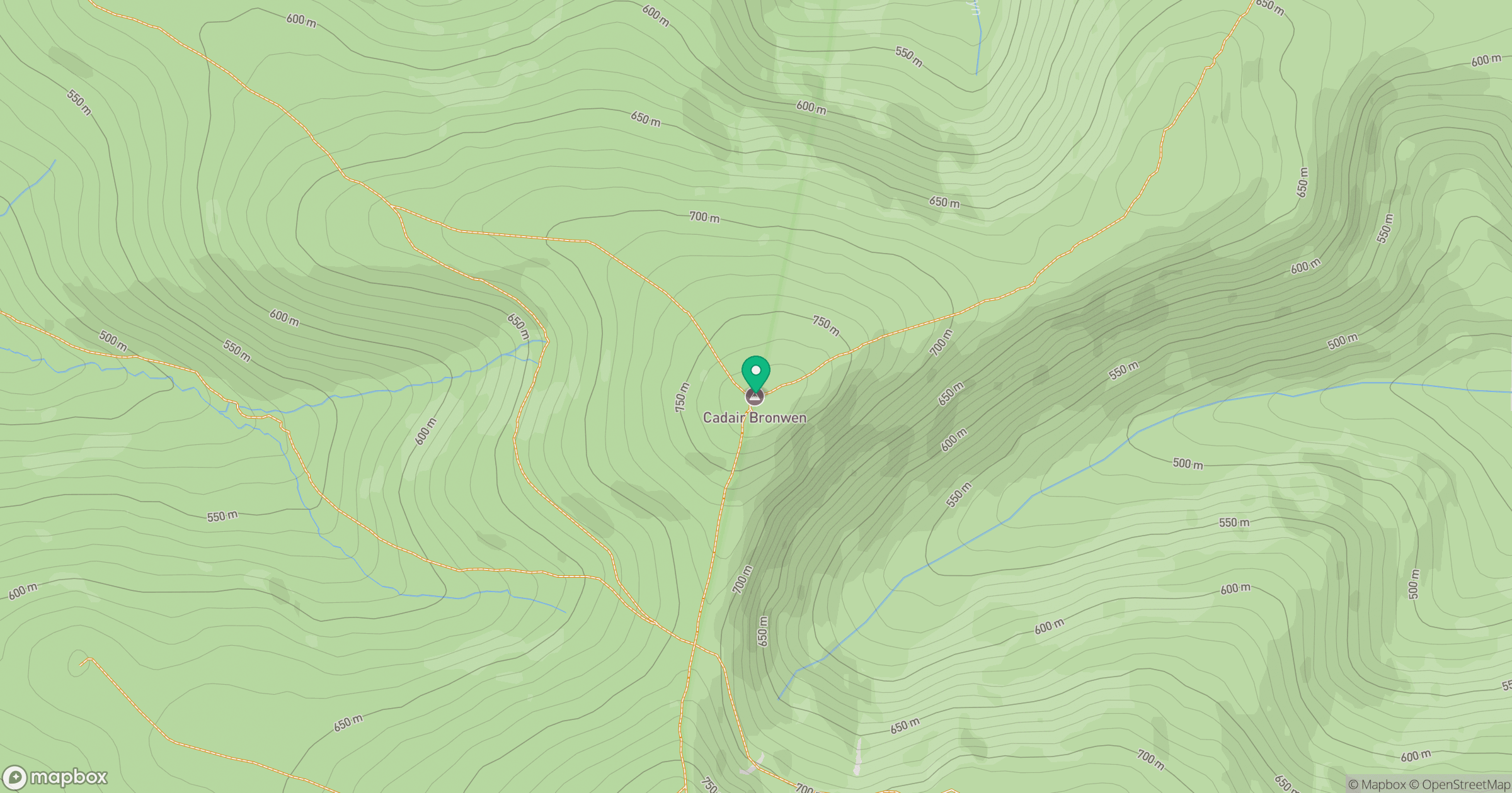
Grid reference: SJ077346
View on OpenStreetMapOpens a map in a new tab, centred on the hill.
No comments yet. Be the first.