

Burrow Mump
Good walks are even better shared.
ST3530 : Burrow Mump Church
Ashley Dace Photo source
Overview
Burrow Mump
Nestled in the picturesque Somerset Levels, Burrow Mump is a splendid hill that rises just 15 meters above sea level. The Mump may not be the highest peak in the region, but it offers an exquisite outing for those wishing to enjoy the breathtaking views of the plains below.
Geology
Burrow Mump is largely formed from sedimentary rocks and is surrounded by fertile alluvial deposits, making it a botanical treasure trove. This scenery accentuates a vibrant ecosystem teeming with wildflowers and is a fine example of nature's artistry in topography.
Routes
The Burrow Mump Circuit is the most popular route, spanning just 2.5 km and easily tackled in around half an hour. Suitable for families and those looking for a gentle stroll, it presents a relaxing way to take in the lovely scenery.
Summit Features
The summit is crowned by the impressive remains of St. Michael's Church tower. Standing as a lone guardian of the past, this structure is a wonderful spot for a few photos and a moment of reflection.
Terrain
The terrain is predominantly grassy, with well-maintained paths making for a pleasant walking experience. Just be mindful of the occasional muddy spot, as it may challenge your footwear fashion sense!
Views
From the summit, you'll enjoy panoramic views that stretch to the Mendip Hills and the iconic Glastonbury Tor. Best seasons for this spectacle are spring and autumn, ensuring clear skies and vibrant flora.
Hazards
The main hazards are muddy spots, especially after a rain shower. A little caution will go a long way—no one wants to end up with soggy socks!
Nearby Summits
Don’t miss the chance to visit the majestic Glastonbury Tor, which offers a unique comparison of height and history.
Access
Access is a breeze with a small layby on the A361 allowing easy parking. If public transport is your cup of tea, there are bus services from Bridgwater that lead you close to Burrowbridge, although you'll need to stretch those legs a bit!
Facilities
After your hike, the lovely village of Burrowbridge has a selection of cafés and a perfectly nice pub to reward yourself with a well-deserved drink.
History
The name 'Burrow' harks back to Anglo-Saxon roots, relating to fortified hills. Historically, it's a place of intrigue, often linked with Arthurian legends, making it a cherished landmark in the area.
In short, Burrow Mump is a delightful little hill that proves that good things come in small packages. So, lace up your walking boots and discover the charm for yourself!
Explore routes near Burrow Mump
Walks starting near this hill. Open a route to check its map, distance and full itinerary.
Maunsel Lock to Charlton Bridge: Durston and Cogload canal return
View route
Maunsel Lock to Fordgate: Somerset Space Walk Towpath Return
View route
Ham Wall: Avalon Hide and Walton Heath wetland circuit, Somerset
View route
Taunton Walk with Men Walking & Talking
View route
Route planning notes
These notes describe possible approaches. Check a route's map and access information when planning your walk.
Burrow Mump Circuit
A gentle loop around Burrow Mump, perfect for families and casual walkers.
Make a day of it, together
Find someone to share the walk with, or organise a day out along a route you like.
Photo Gallery
View all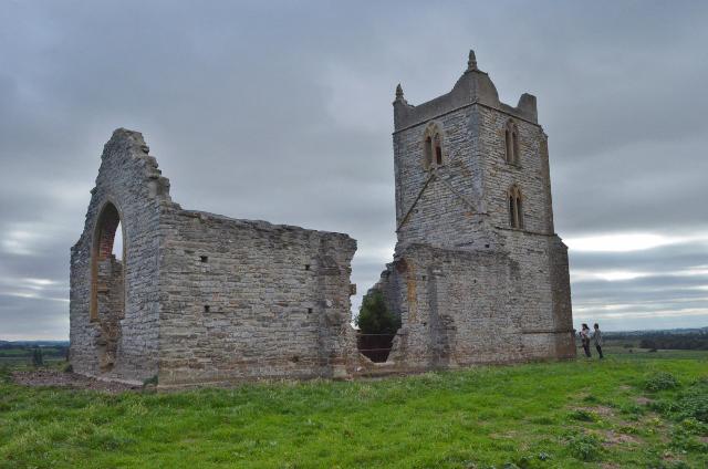 Photo could not load
ST3530 : Burrow Mump Church
Ashley Dace
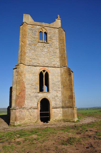 Photo could not load
ST3530 : Burrowbridge : Burrow Mump
Lewis Clarke
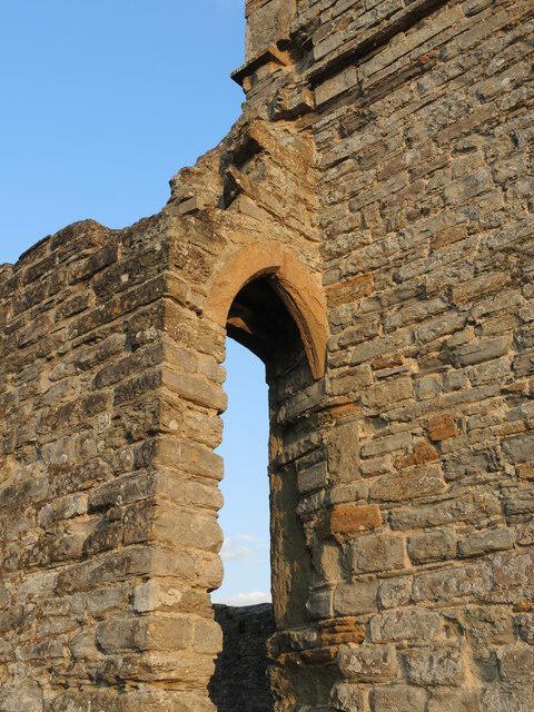 Photo could not load
ST3530 : Airy St Michael's
Neil Owen
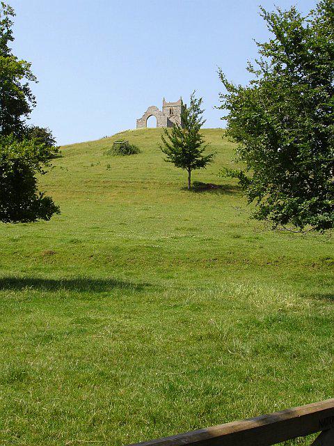 Photo could not load
ST3530 : Burrow Mump (hill hill)
Penny Mayes
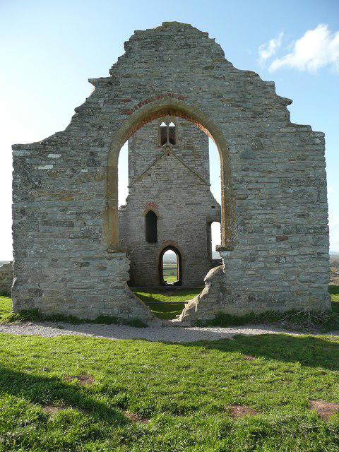 Photo could not load
ST3530 : St Michael's Chapel from the east, Burrowbridge
Humphrey Bolton
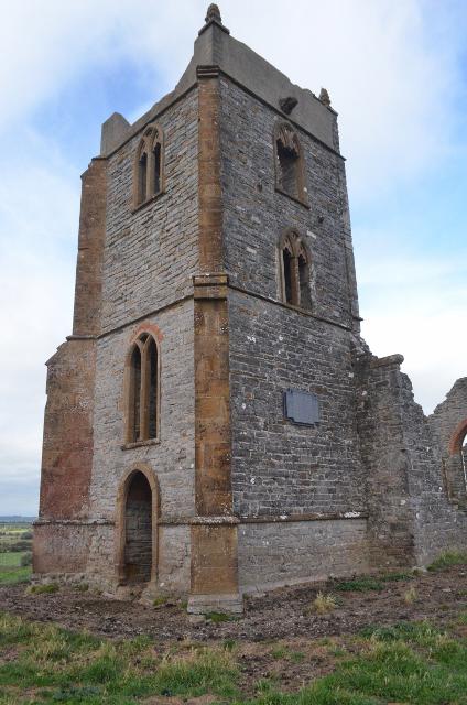 Photo could not load
ST3530 : Burrow Mump Church
Ashley Dace
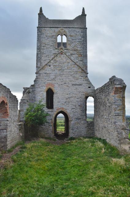 Photo could not load
ST3530 : Burrow Mump Church
Ashley Dace
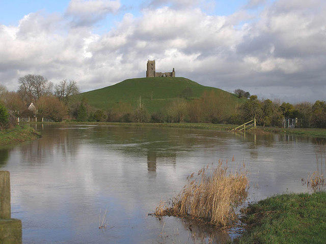 Photo could not load
ST3530 : Burrow Mump from the Tone - Parrett junction
Martin Southwood
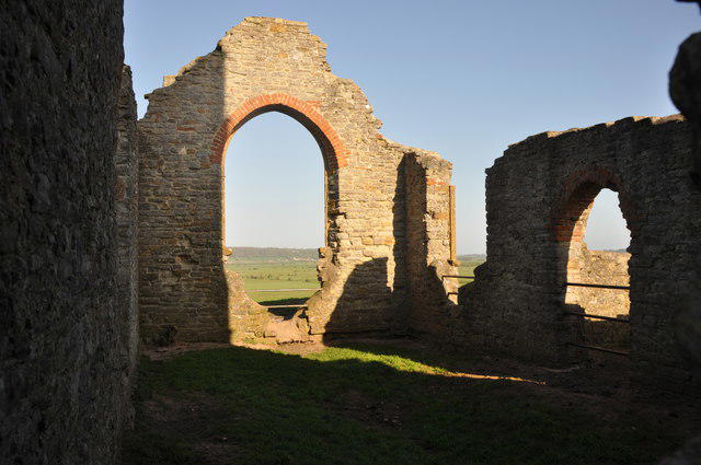 Photo could not load
ST3530 : Burrowbridge : Burrow Mump
Lewis Clarke
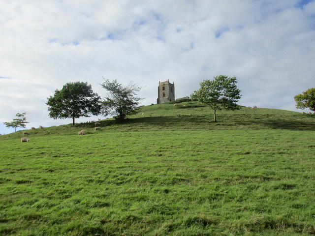
ST3530 : Burrow Mump
Jonathan Thacker
Hill facts and local notes
Classifications
Elevation
33m
108 ft
Prominence
29m
Coordinates
51.0704, -2.9160
ST359305
OS Map
182
Explorer: 140
At the Summit
At the summit, you will find a lovely old church tower, which is a relic of the days when the Mump echoed with the sounds of the community.
Terrain & Geology
Predominantly composed of sedimentary rocks, the area surrounding Burrow Mump features rich alluvial deposits forming the fertile plains and slowly eroding soils, a true testament to nature's ways.
Views & Scenery
On a clear day, one can gaze upon the vast Somerset Levels, the distant Mendip Hills, and even spot Glastonbury Tor standing proud.
History & Heritage
Name Origin
The name 'Burrow' is believed to originate from the Old English word 'burh', meaning hill or fortified place.
Historical Significance
It holds historical importance due to its strategic location and is often associated with legendary tales of King Arthur and Avalon.
Getting There & Facilities
Parking
There is a small layby on the A361 close to the base of Burrow Mump, suitable for several cars.
Public Transport
The nearest bus service operates from Bridgwater, with connections to Glastonbury. It's a bit of a walk from the bus stop!
Nearby Facilities
The nearby village of Burrowbridge offers a few cafes and a pub, perfect for a post-hike brew and slice of cake.
Safety Information
Known Hazards
- Occasional muddy patches after rainfall; watch your step to avoid unfashionable footwear!
General Safety Tips
- Check weather conditions before setting out
- Carry appropriate clothing and equipment
- Let someone know your planned route
- Take a map, compass, and GPS device
- Carry emergency supplies: food, water, first aid kit, torch
Hills
Some common questions about the hills answered
Are there group walks up Burrow Mump?
Many walkers use Walkmates to join or organise walks with others. You can check for group walks around Burrow Mump through the maps
Are there other walkers around Burrow Mump?
Activity varies by location and time, but Walkmates lets you see whether others have shared walks or shown interest in this area. Find other people through the walking friends search walking friends for Burrow Mump search or of course create your own walk for Burrow Mump
Can I organise a walk to Burrow Mump?
Yes. If there aren’t any walks listed already, you can create a walk and make it available for others to join.
If you're signed up to Walkmates, you can create a walk to Burrow Mump.
How do I find a walk up this hill?
There are often multiple ways to walk this hill, depending on experience and route preference. Walkmates helps you explore walks and routes that others have shared.
Can I suggest a new route up Burrow Mump?
Yes. You can suggest or create routes to share with others. Walkmates focuses on the social side of walking, so routes are used to help people organise walks and explore areas together, rather than as detailed navigation tools or route libraries.
Other uses really appreciate knowledgeable walkers sharing their routes. Share your favourite route to Burrow Mump here
The is an error or something incorrect about this hill. How do I let you know?
We always strive to keep the information on Walkmates as accurate as possible. If you find an error, please let us know through the contact form and we'll aim to correct it as quickly as possible
Community Discussion
Comments
Location
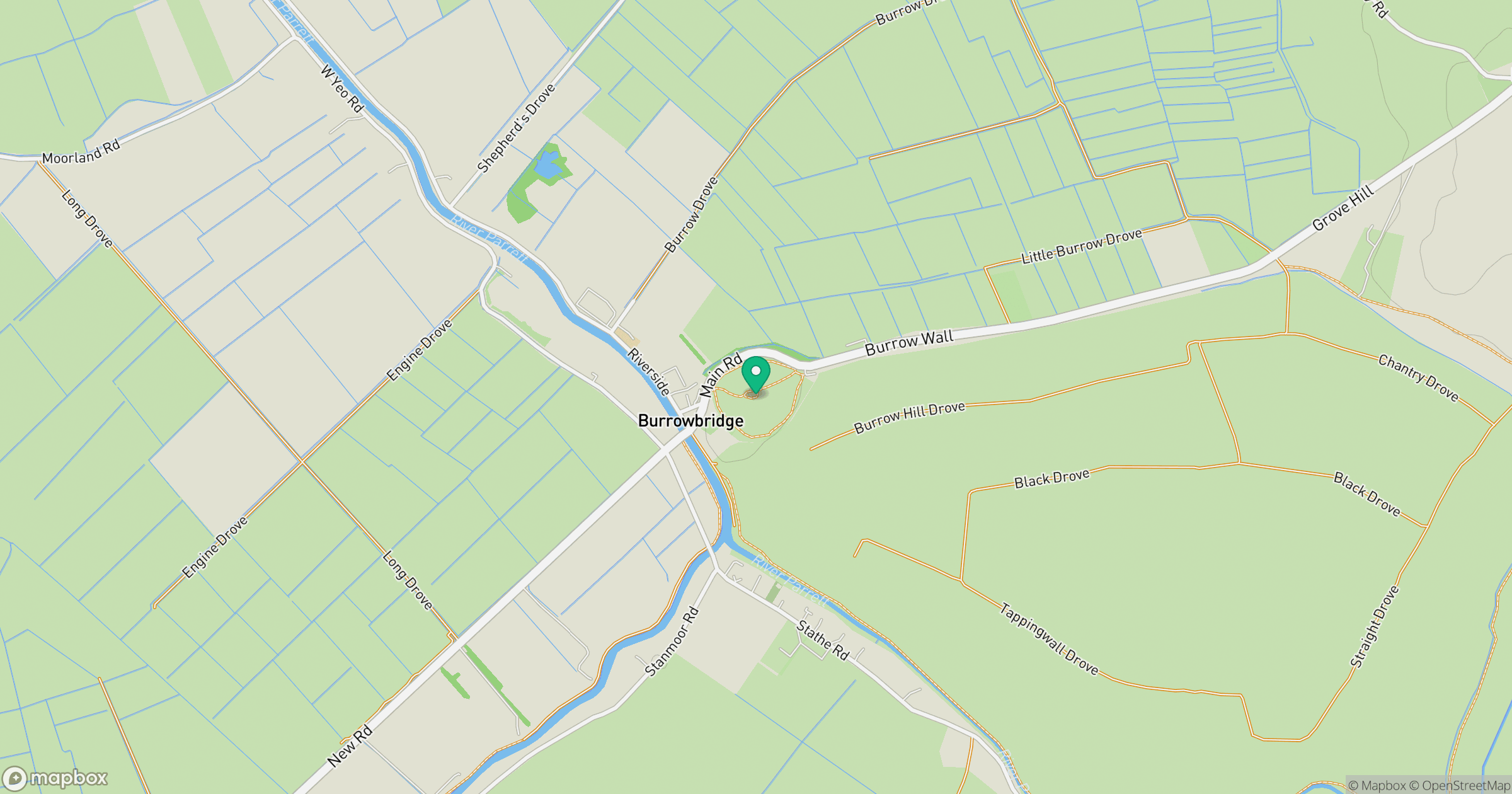
Grid reference: ST359305
View on OpenStreetMapOpens a map in a new tab, centred on the hill.


No comments yet. Be the first.