

Bromley Muir
Good walks are even better shared.
Overview
Bromley Muir
Nestled in the beautiful Scottish Borders, Bromley Muir stands at an elevation of 328 meters, making it a delightful day out for hikers of various skill levels. This Marilyn is not just a peak; it’s a viewpoint that offers a unique perspective on the surrounding landscapes.
Geology
Bromley Muir is primarily formed from Old Red Sandstone, showcasing sedimentary formations that hold the remnants of ancient river beds and marine life. It's like walking across a geological history book!
Routes
A popular choice for hikers is the Bromley Muir Circular Walk. This moderate route starts from Stow, winding through heather-clad hills and providing plenty of picturesque views. At about 8 kilometers, it takes roughly 3 hours to complete, perfect for a day in the fresh Scottish air.
Summit Features
At the summit, you’ll find a delightful cairn. It’s a perfect place to take a break, snap a photo, or simply enjoy the serenity at the top. Just watch out for any cheeky sheep that might want to join your selfie!
Terrain Type
Expect a mix of grassy slopes and rocky outcrops. The paths can be a bit boggy after rain, so a good pair of waterproof boots is highly recommended. Nothing says 'adventure' quite like leaping over a puddle!
Views
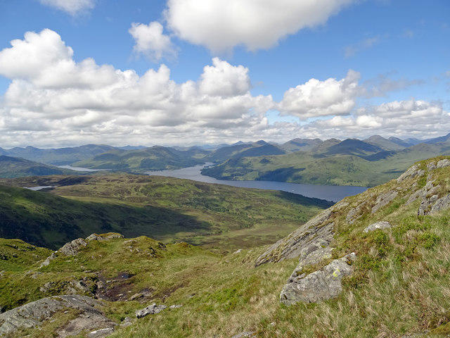
From the top, the sweeping vistas include the scenic hills of the Borders and, on a clear day, the distant Pentland Hills can be spotted. The best seasons to enjoy these views are during spring and autumn when the landscape is awash with colourful flowers and foliage.
Hazards
While hiking, be mindful of slippery paths, particularly during or after wet weather. The occasional bog may also try to catch you off-guard, so keep your eyes peeled and your boots high!
Nearby Summits
If your legs still have some spring left in them, consider visiting nearby peaks like Hawick Hill (405 meters) and the Moorfoot Hills (614 meters) for further exploration.
Access
The nearest parking is conveniently located in Stow, where a small car park awaits your vehicle, and public transport options are available via bus routes from Edinburgh.
Facilities
Once you complete your hike, treat yourself at the local shop or café in Stow – nothing quite like a warm drink after a brisk walk!
History
The name Bromley means 'broom' or 'gorse clearance', hinting at its picturesque flowering shrubs. The area is steeped in local legend and folklore, adding to its allure as a hiking destination.
Enjoy your adventure at Bromley Muir!
Explore routes near Bromley Muir
Public walks starting within 80 km of this hill. Nearby does not mean a route reaches the summit; check its map and access before setting out.
Greenock Cut: the full circuit from Cornalees
View route
Ben Lomond in the trossachs
View route
West Highland Way: Milngavie to Drymen
View route
West Bay walk and talk
View route
Route planning notes
These notes describe possible approaches, not verified navigable routes or permission to cross land. Check current paths, local access rules and conditions before setting out.
Bromley Muir Circular Walk
A circular route starting from the nearby village of Stow, providing lovely views as well as an enjoyable hike through heather-covered hills.
Make a day of it, together
Find someone to share the walk with, or organise a day out along a route you like.
Photo Gallery
View all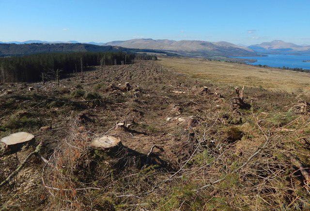 Photo could not load
NS3680 : Cleared north-eastern margin of woods
Lairich Rig
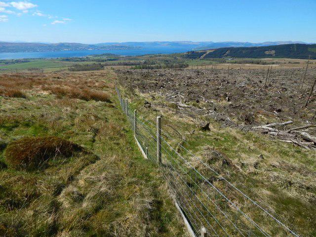 Photo could not load
NS3680 : Moorland fence
Lairich Rig
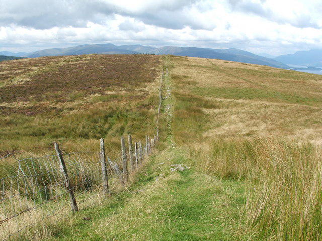 Photo could not load
NS3680 : Dry stone wall disappearing under the grass
Lairich Rig
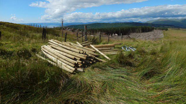 Photo could not load
NS3680 : Preparations for fence-building
Lairich Rig
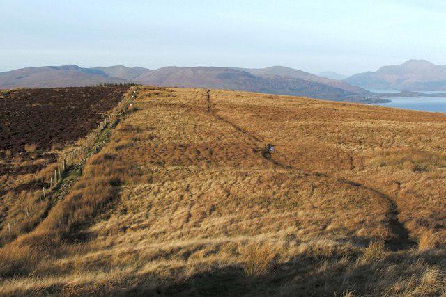 Photo could not load
NS3680 : Footpath on Bromley Muir
Lairich Rig
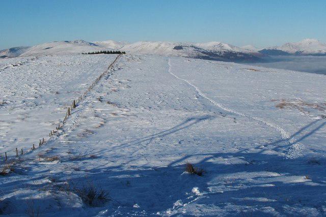 Photo could not load
NS3680 : Footpath on Bromley Muir
Lairich Rig
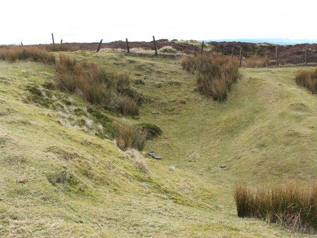 Photo could not load
NS3680 : Large pit
Lairich Rig
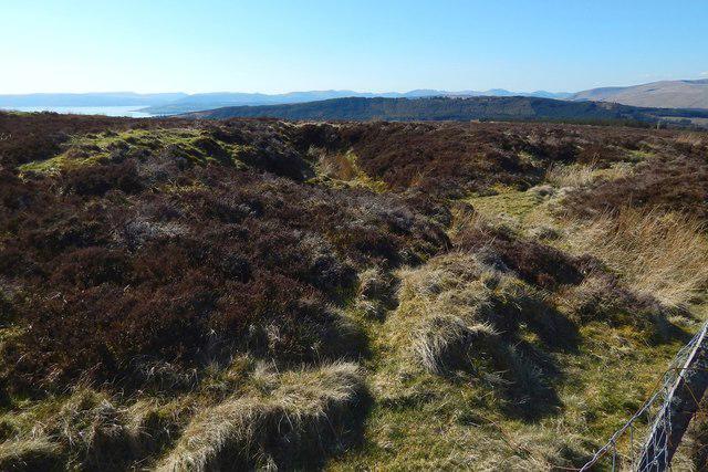 Photo could not load
NS3680 : Pit beside fence
Lairich Rig
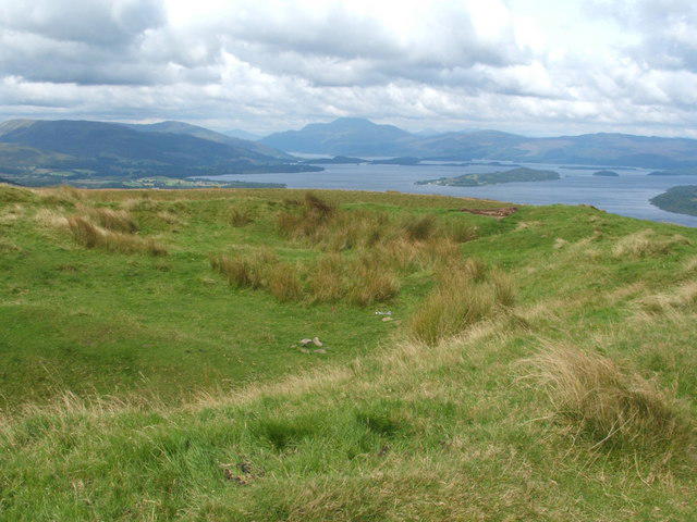 Photo could not load
NS3680 : The lip of a large pit
Lairich Rig
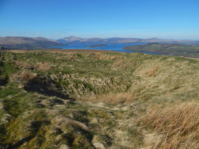
NS3680 : Large pit
Lairich Rig
Hill facts and local notes
Classifications
Elevation
304m
998 ft
Prominence
105m
Coordinates
55.9916, -4.6187
NS367807
OS Map
63
Explorer: OL38 347
At the Summit
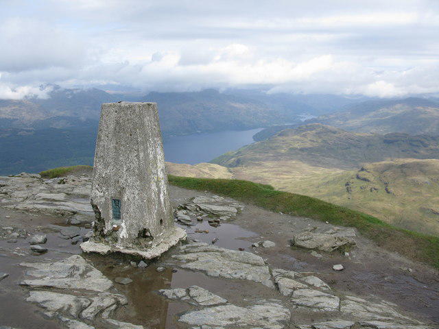
The summit features a small cairn that offers a moment to pause and reflect or a perfect backdrop for that quintessential summit selfie.
Terrain & Geology
Bromley Muir is primarily composed of Old Red Sandstone, with interesting sedimentary rock formations that tell a story of ancient river systems and marine environments.
Views & Scenery
From the summit, one can see the picturesque hills of the Borders, along with glimpses of the distant Pentland Hills.
History & Heritage
Name Origin
The name 'Bromley' may derive from the Old English 'Brom' meaning broom or gorse, and 'leah', indicating a clearing.
Historical Significance
Historically, the area has been linked to many local legends and folklore, adding an extra layer of charm to your hike.
Getting There & Facilities
Check current local access restrictions, parking rules and transport timetables before travelling. These notes do not confirm public access to the summit.
Parking
The nearest parking is at Stow, where there is a small car park near the village hall.
Public Transport
Stow is accessible by bus from Edinburgh, making it a convenient starting point for hikers.
Nearby Facilities
Stow has a small local shop and a café, perfect for a pre- or post-hike coffee and snack.
Safety Information
Known Hazards
- Occasional boggy ground; be cautious after heavy rain, as paths can become slippery and muddy.
General Safety Tips
- Check weather conditions before setting out
- Carry appropriate clothing and equipment
- Let someone know your planned route
- Take a map, compass, and GPS device
- Carry emergency supplies: food, water, first aid kit, torch
Hills
Some common questions about the hills answered
Are there group walks up Bromley Muir?
Many walkers use Walkmates to join or organise walks with others. You can check for group walks around Bromley Muir through the maps
Are there other walkers around Bromley Muir?
Activity varies by location and time, but Walkmates lets you see whether others have shared walks or shown interest in this area. Find other people through the walking friends search walking friends for Bromley Muir search or of course create your own walk for Bromley Muir
Can I organise a walk to Bromley Muir?
Yes. If there aren’t any walks listed already, you can create a walk and make it available for others to join.
If you're signed up to Walkmates, you can create a walk to Bromley Muir.
How do I find a walk up this hill?
There are often multiple ways to walk this hill, depending on experience and route preference. Walkmates helps you explore walks and routes that others have shared.
Can I suggest a new route up Bromley Muir?
Yes. You can suggest or create routes to share with others. Walkmates focuses on the social side of walking, so routes are used to help people organise walks and explore areas together, rather than as detailed navigation tools or route libraries.
Other uses really appreciate knowledgeable walkers sharing their routes. Share your favourite route to Bromley Muir here
The is an error or something incorrect about this hill. How do I let you know?
We always strive to keep the information on Walkmates as accurate as possible. If you find an error, please let us know through the contact form and we'll aim to correct it as quickly as possible
Community Discussion
Comments
Location
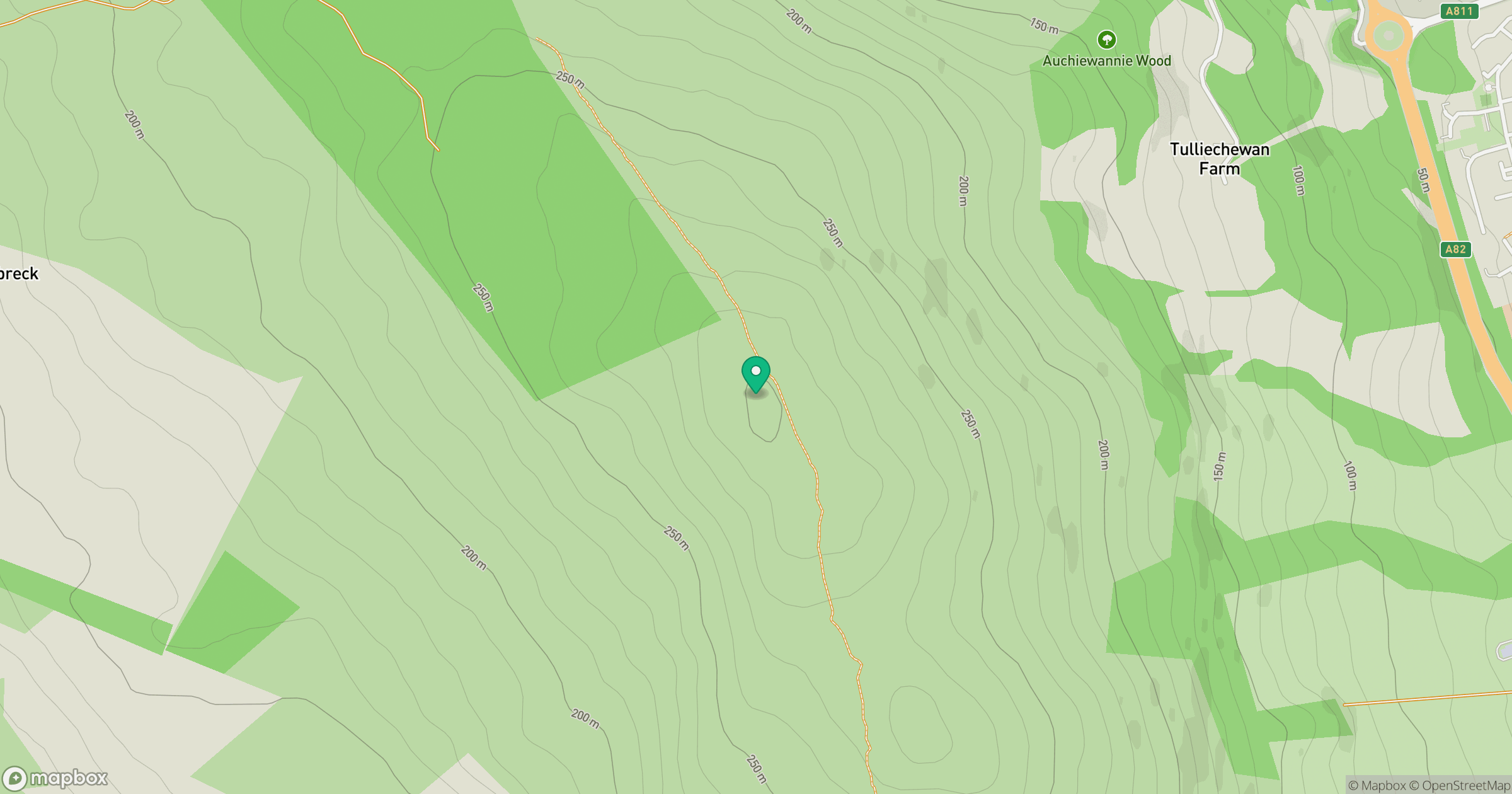
Grid reference: NS367807
View on OpenStreetMapOpens a map in a new tab, centred on the hill.
Hills within 30 km
Straight-line distance, not a walking route or confirmation of access.

No comments yet. Be the first.