

Balcnock
Good walks are even better shared.
Overview
Balcnock: A Hidden Gem in the Southern Uplands
Balcnock, standing at an altitude of 600 meters, is a delightful Marilyn nestled within the Southern Uplands of Scotland. Even though it doesn’t rival the heights of the Munros, its charm is undeniable, with its picturesque surroundings inviting hikers from far and wide.
Geology
The mountain is primarily made up of ancient volcanic rocks, showcasing fascinating geological features. The eroded landscape tells tales of time gone by, and if you're a geology enthusiast, you might find the rock formations to be more intriguing than a good mystery novel!
Hiking Routes
The popular 'Balcnock Circular' route begins at the quaint village of Dalmellington and stretches approximately 8 kilometers. Expect to grace a variety of terrains, from grassy slopes to rocky outcrops, providing a moderate challenge for your legs.
Terrain
The terrain is a lovely mix; you’ll encounter lush grassy hillsides and a few rocky sections that may have you wishing for a bit more grip on your boots. Watch out for the boggy bits! They tend to hide in plain sight, just waiting to surprise unsuspecting hikers.
Summit Features
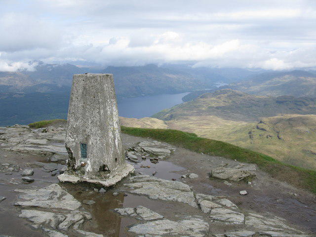
At the top, stand proud beside a sizable stone cairn. Don’t forget to capture the moment—you’ll want proof that you made it to the top!
Stunning Views
The sweeping views from Balcnock are simply breathtaking, especially on a clear day when the Galloway Hills come into full view. For the best experience, try hiking during the spring or autumn when the colours transform the landscape into a canvas of vibrant hues.
Hazards
As with any mountain, be prepared for the unpredictable Scottish weather. A sunny beginning can quickly turn into a wet ordeal. Pack wisely!
Access
Accessing Balcnock is fairly straightforward, with lay-by parking available close to the trailhead in Dalmellington. If you prefer public transport, bus services from nearby towns will have you dropped off at the village, ready to start your adventure!
Facilities
Dalmellington offers a few quaint facilities, including a café perfect for a pre-hike treat, where you can invigorate yourself with a good cup of tea or coffee.
A Touch of History
The name Balcnock comes from Gaelic, with its meaning reflecting the rounded shape of the hill. This area, steeped in scenic beauty, has significant historical value, having been a meeting point for wildlife and adventurers alike over the ages.
In conclusion, whether you’re a seasoned hiker or just looking for a peaceful getaway, Balcnock provides a charming experience in the heart of the Southern Uplands. Lace up your boots and hit the slopes—adventure awaits!
Explore routes near Balcnock
Public walks starting within 80 km of this hill. Nearby does not mean a route reaches the summit; check its map and access before setting out.
Ben Lomond in the trossachs
View route
The Cobbler from Succoth Carpark
View route
Beinn Ime from Succoth
View route
Glen Kin group walk
View route
Route planning notes
These notes describe possible approaches, not verified navigable routes or permission to cross land. Check current paths, local access rules and conditions before setting out.
Balcnock Circular
A delightful circular route starting from the village of Dalmellington, weaving through lush woodlands and open moorland before making the ascent to the summit of Balcnock.
Make a day of it, together
Find someone to share the walk with, or organise a day out along a route you like.
Photo Gallery
View all Photo could not load
NS3091 : Old gateway, Balcnock
Richard Webb
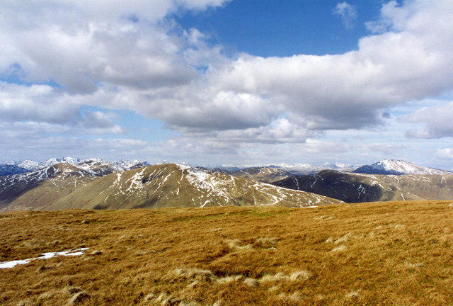 Photo could not load
NS3091 : Beinn Eich
wfmillar
 Photo could not load
NS3091 : Balcnock north summit
Richard Webb
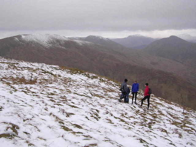 Photo could not load
NS3091 : On Luss Hill with no name
Chris Upson
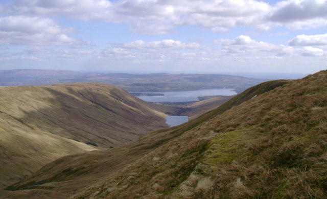 Photo could not load
NS3091 : Glen Finlas
Mark Nightingale
Hill facts and local notes
Classifications
Elevation
693m
2,274 ft
Prominence
116m
Coordinates
56.0854, -4.7288
NS303914
OS Map
56
Explorer: OL38 347
At the Summit
The summit boasts a substantial stone cairn, as well as expansive views across the Southern Uplands. Don't forget to take a selfie with the cairn; it demands attention!
Terrain & Geology
The geomorphology of Balcnock is primarily composed of volcanic rock formations, which contribute to its rugged terrain. You'll find a mixture of igneous rocks that have created a fascinating landscape through millennia of erosion.
Views & Scenery
From the summit, you can enjoy breathtaking panoramic views of the surrounding hills, including the Galloway Hills and the distant peaks of Ayrshire.
History & Heritage
Name Origin
The name 'Balcnock' is derived from the Gaelic terms which loosely translate to 'the rounded hill', well-suited for its charmingly unassuming shape.
Historical Significance
Historically, the area around Balcnock has been a gathering point for local wildlife and hikers alike, known for its natural beauty and tranquillity.
Getting There & Facilities
Check current local access restrictions, parking rules and transport timetables before travelling. These notes do not confirm public access to the summit.
Parking
There is lay-by parking available near the start of the Balcnock Circular route in Dalmellington. Limited spaces, so arrive early to nab your spot!
Public Transport
Regular bus services connect Dalmellington with larger towns like Ayr and Cumnock. Consult local timetables to ensure smooth connections.
Nearby Facilities
The village of Dalmellington offers some basic facilities, including a small cafe and public toilets. Perfect for a pre-hike cuppa or a post-hike cake!
Safety Information
Known Hazards
- Beware of sudden weather changes typical of the region. Ensure you have appropriate clothing and gear; a sunny start can end in a downpour faster than you can say 'where did my waterproofs go?'
General Safety Tips
- Check weather conditions before setting out
- Carry appropriate clothing and equipment
- Let someone know your planned route
- Take a map, compass, and GPS device
- Carry emergency supplies: food, water, first aid kit, torch
Hills
Some common questions about the hills answered
Are there group walks up Balcnock?
Many walkers use Walkmates to join or organise walks with others. You can check for group walks around Balcnock through the maps
Are there other walkers around Balcnock?
Activity varies by location and time, but Walkmates lets you see whether others have shared walks or shown interest in this area. Find other people through the walking friends search walking friends for Balcnock search or of course create your own walk for Balcnock
Can I organise a walk to Balcnock?
Yes. If there aren’t any walks listed already, you can create a walk and make it available for others to join.
If you're signed up to Walkmates, you can create a walk to Balcnock.
How do I find a walk up this hill?
There are often multiple ways to walk this hill, depending on experience and route preference. Walkmates helps you explore walks and routes that others have shared.
Can I suggest a new route up Balcnock?
Yes. You can suggest or create routes to share with others. Walkmates focuses on the social side of walking, so routes are used to help people organise walks and explore areas together, rather than as detailed navigation tools or route libraries.
Other uses really appreciate knowledgeable walkers sharing their routes. Share your favourite route to Balcnock here
The is an error or something incorrect about this hill. How do I let you know?
We always strive to keep the information on Walkmates as accurate as possible. If you find an error, please let us know through the contact form and we'll aim to correct it as quickly as possible
Community Discussion
Comments
Location
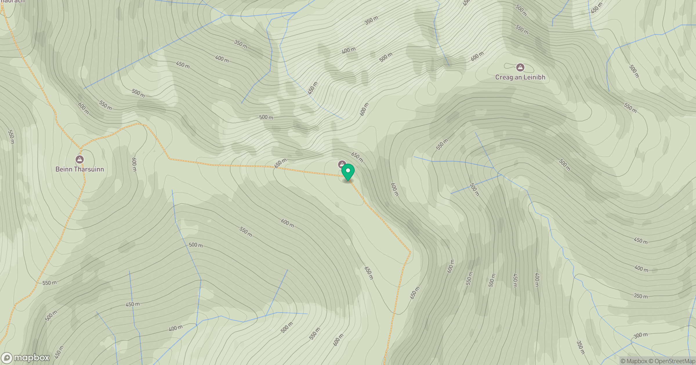
Grid reference: NS303914
View on OpenStreetMapOpens a map in a new tab, centred on the hill.
Hills within 30 km
Straight-line distance, not a walking route or confirmation of access.

No comments yet. Be the first.