
Brechfa Forest
Good walks are even better shared.
Overview
Brechfa Forest
Brechfa Forest, nestled in the picturesque hills of Carmarthenshire, Wales, offers a veritable treasure trove of natural beauty just waiting to be explored. With its miles of trails woven through ancient woodlands, this forest is perfect for a day out, whether you’re walking, cycling, or birdwatching.
Geology
The geology of Brechfa is quite intriguing, comprising a blend of sedimentary rocks, primarily mudstone and sandstone. This hilly terrain has been crafted by the gentle hand of glaciers over thousands of years, resulting in the inviting landscape we see today. So, if you fancy yourself a bit of a geology buff, take a moment to ponder the history beneath your feet—it's older than your Granny's recipes!
Routes
Brechfa Forest features a variety of routes catering to different skill levels. The Brechfa Trail is a popular circular route of around 8.0 km, which takes approximately 2.5 hours to complete at a comfortable pace. This moderate hike meanders through the heart of the forest, offering a delightful mix of shaded paths and wide, open views.
For those looking for something a little gentler, try the Gwenffrwd-Dinas RSPB Nature Reserve Loop. At 5.5 km, this easy route gives you a chance to soak up the sights and sounds of the local wildlife, all while strolling through the stunning scenery—perfect for spotting the occasional curious squirrel!
Summit Features
While Brechfa Forest lacks a designated summit, several viewpoints pepper the trails, each providing opportunities for a well-deserved picnic break or a cheeky selfie. Bring your own sarnies and claim your spot—it’s like a stage, set for glorious outdoor theatricals!
Terrain Type
Expect a medley of mixed forest trails, blending gravel and dirt paths. The terrain is predominantly flat with gentle slopes, making it accessible for families and your beloved four-legged friends.
Views
On clear days, the views are simply unmissable; you might even catch a glimpse of the soaring Brecon Beacons to the north and the rolling hills of Carmarthenshire extending before you. The best seasons for these vistas are spring and autumn, when nature rolls out its vibrant palette—just right for an Instagram post or two!
Hazards
Like every good adventure, there are some hazards to keep in mind. Uneven terrain, potential tree roots, and rainy weather can lead to slippery paths that require a watchful eye. And let’s not forget to keep an eye out for wildlife! Remember, they live here too.
Access
Getting to Brechfa Forest is straightforward. The nearest parking area is located in Brechfa village, near the church. Despite its remote charm, you can catch a bus from towns like Carmarthen or Llandeilo, though services may be a bit sparse. A good reason to bring a packed lunch and enjoy the tranquillity, if you ask us!
Facilities
Post-hike, rejoice in the handy facilities on offer. Public toilets are available at the main car park, and a couple of local cafes serve delicious snacks to refuel you after a day of exploration.
History
The name Brechfa translates to 'the place of the hill' in Welsh, a fitting title for this rugged landscape rich with ancient woodlands. Historically, the forest holds a cultural significance, not just for its beauty, but as an ecological haven that continues to thrive.
So, don your hiking boots and take a stroll through Brechfa Forest—the adventure awaits! Just remember, no matter how far you wander, always have a buddy and tell someone your plans. Happy hiking!
Explore routes near Brechfa Forest
Walks starting near this hill. Open a route to check its map, distance and full itinerary.
Abergwili to Nantgaredig: Tywi Valley Path out and back
View route
Dolaucothi Estate: Cothi Valley and Red Waymarked Circuit
View route
Ammanford Walk with Men Walking & Talking
View route
Llanelli North Dock to Machynys Point and Wetland Centre
View route
Route planning notes
These notes describe possible approaches. Check a route's map and access information when planning your walk.
Brechfa Trail
A circular route through the heart of Brechfa Forest, offering a blend of shaded paths and open views.
Gwenffrwd-Dinas RSPB Nature Reserve Loop
A scenic loop that showcases the rich wildlife of the area while winding through stunning forest landscapes.
Make a day of it, together
Find someone to share the walk with, or organise a day out along a route you like.
Hill facts and local notes
Classifications
Elevation
261m
856 ft
Prominence
60m
Coordinates
51.9342, -4.2358
SN463285
OS Map
146
Explorer: 185 186
At the Summit
While Brechfa Forest itself does not have a summit per se, it features numerous viewpoints and clearings for picnics, complete with benches (the forest's unsung heroes!).
Terrain & Geology
The area features a mix of sedimentary rocks, mainly mudstone and sandstone, shaped into rolling hills and valleys through millennia of glacial activity.
Views & Scenery
On a clear day, you might even catch a glimpse of the Brecon Beacons to the north, and the rolling hills of Carmarthenshire stretching out before you.
History & Heritage
Name Origin
The name 'Brechfa' comes from Welsh, translating roughly to 'the place of the hill', a nod to its ancient landscape.
Historical Significance
Brechfa Forest has historical significance in the region, once a site of ancient woodlands and notable for its biodiversity.
Getting There & Facilities
Parking
Brechfa village offers a designated parking area with easy access to forest trails. Look for the signposted car park near the church.
Public Transport
Limited bus services run to Brechfa from nearby towns such as Carmarthen and Llandeilo.
Nearby Facilities
Public toilets can be found at the main car park, and there are a couple of local cafes in Brechfa for refreshments after your hike.
Safety Information
Known Hazards
- Uneven terrain, potential tree roots, and wet conditions can lead to slippery paths, so tread carefully. Keep your eyes peeled for wildlife too!
General Safety Tips
- Check weather conditions before setting out
- Carry appropriate clothing and equipment
- Let someone know your planned route
- Take a map, compass, and GPS device
- Carry emergency supplies: food, water, first aid kit, torch
Hills
Some common questions about the hills answered
Are there group walks up Brechfa Forest?
Many walkers use Walkmates to join or organise walks with others. You can check for group walks around Brechfa Forest through the maps
Are there other walkers around Brechfa Forest?
Activity varies by location and time, but Walkmates lets you see whether others have shared walks or shown interest in this area. Find other people through the walking friends search walking friends for Brechfa Forest search or of course create your own walk for Brechfa Forest
Can I organise a walk to Brechfa Forest?
Yes. If there aren’t any walks listed already, you can create a walk and make it available for others to join.
If you're signed up to Walkmates, you can create a walk to Brechfa Forest.
How do I find a walk up this hill?
There are often multiple ways to walk this hill, depending on experience and route preference. Walkmates helps you explore walks and routes that others have shared.
Can I suggest a new route up Brechfa Forest?
Yes. You can suggest or create routes to share with others. Walkmates focuses on the social side of walking, so routes are used to help people organise walks and explore areas together, rather than as detailed navigation tools or route libraries.
Other uses really appreciate knowledgeable walkers sharing their routes. Share your favourite route to Brechfa Forest here
The is an error or something incorrect about this hill. How do I let you know?
We always strive to keep the information on Walkmates as accurate as possible. If you find an error, please let us know through the contact form and we'll aim to correct it as quickly as possible
Community Discussion
Comments
Location
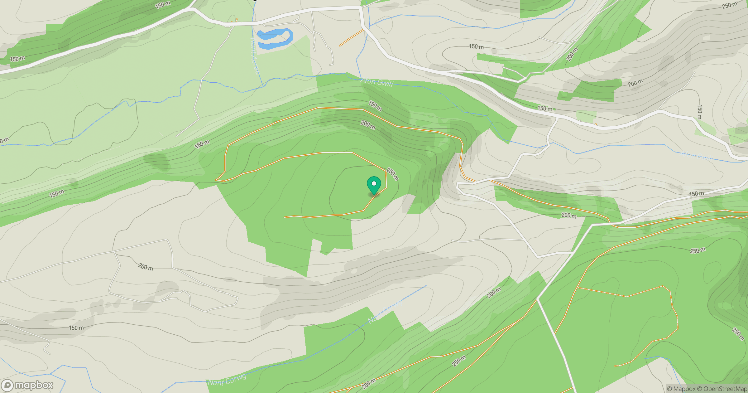
Grid reference: SN463285
View on OpenStreetMapOpens a map in a new tab, centred on the hill.
Nearby Hills
Rhossili Down - The Beacon
193m

Fan Brycheiniog - Twr y Fan Foel
802m
Fan Gyhirych
726m
Pen y Fan
142m
Pumlumon Fawr [Plynlimon]
753m
No comments yet. Be the first.