

Booth Hill
Good walks are even better shared.
SK0568 : Pond beneath Booth Farm
Dave Dunford Photo source
Overview
Booth Hill: A Gem in the Yorkshire Dales
Geology
Booth Hill's limestone is a geological marvel, contributing to the rugged beauty of the Yorkshire Dales. The formation displays typical karst features, such as sinkholes and caves. When hiking, keep an eye out for unique rock formations that make you feel like you're on another planet (or at least another part of Yorkshire).
Routes
Two primary hiking routes will lead you up to Booth Hill. The Booth Hill Circular offers a pleasant trek of 6.5 km and is ideal for families looking to bask in nature's beauty. If you’re feeling sprightly and fancy a bit of a challenge, the Direct Ascent from Kettlewell is your ticket. This 3.5 km climb will get the heart pumping!
Summit Features
At the top, you'll find a rather unassuming cairn marking the summit, which somehow manages to look both proud and humble at the same time. From here, you can feast your eyes on sweeping views that could give even a postcard a run for its money!
Terrain
The terrain is mostly grassy with some rocky patches, particularly near the summit. Wet weather can make it a bit slippy, so bring your good hiking boots and perhaps a walking stick, unless you fancy a game of 'catch the slip'!
Views
The views from Booth Hill are nothing short of spectacular. You can spot notable landmarks like Pen-y-ghent, making it a great photo-op. Best seasons for views include spring and crisp autumn days. Only the brave will venture in winter—hold onto your hats!
Hazards
As with most outdoor pursuits, pay attention to the weather and trail conditions. Slippery stones can make for surprising moments during your hike. Your body might play a game of 'surprise twist,' so stay alert!
Access
Kettlewell is your go-to starting point for this adventure, accessible by car and by bus from Grassington. The local car park is your friendly field of asphalt where you can stash your vehicle while you stretch your legs.
Nearby Facilities
After the hike or before, indulge in a delightful tea or coffee at one of Kettlewell's quaint cafes. No one will judge if you order the biggest slice of cake on the menu!
Conclusion
In summary, Booth Hill is a delightful escape into the Yorkshire Dales, catering to walkers of varying experience levels. Just remember, 'a hill isn’t a mountain'... unless you’re trying to climb it with a dodgy knee!
Explore routes near Booth Hill
Walks starting near this hill. Open a route to check its map, distance and full itinerary.
Three Villages and Five Wells
View route
Three Villages and Five Wells
View route
Three Villages and Five Wells
View route
Three Shires guided hike
View route
Route planning notes
These notes describe possible approaches. Check a route's map and access information when planning your walk.
Booth Hill Circular
A lovely circular route starting from the village of Kettlewell, providing stunning scenery and manageable terrain.
Direct Ascent from Kettlewell
A direct ascent route that offers a more challenging hike straight to the summit from Kettlewell.
Make a day of it, together
Find someone to share the walk with, or organise a day out along a route you like.
Photo Gallery
View all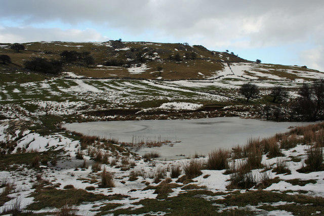 Photo could not load
SK0568 : Pond beneath Booth Farm
Dave Dunford
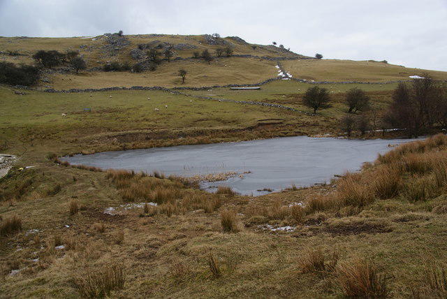 Photo could not load
SK0568 : Frozen pond near Booth Farm
Bill Boaden
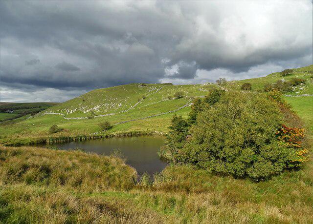 Photo could not load
SK0568 : Upland pond near Booth Farm
Neil Theasby
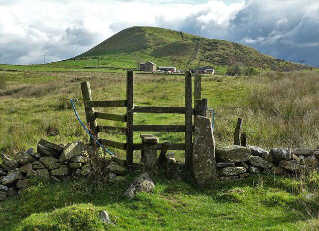 Photo could not load
SK0568 : Heading to Booth Farm and Hollins Hill
Neil Theasby
Hill facts and local notes
Classifications
Elevation
408m
1,338 ft
Prominence
29m
Coordinates
53.2100, -1.9194
SK054681
OS Map
119
Explorer: OL24W
At the Summit
The summit features a modest cairn and stunning panoramic views, with a picturesque view of the surrounding valleys.
Terrain & Geology
Booth Hill is primarily composed of limestone, prevalent in the Yorkshire Dales, which is rich in karst features. Expect to see interesting rock formations and perhaps a few limestone pavements along the way.
Views & Scenery
From Booth Hill's summit, behold the magnificent panorama of the Yorkshire Dales, including the impressive Littondale and the distinctive outline of Pen-y-ghent in the distance.
History & Heritage
Name Origin
The name 'Booth' is derived from Old English, meaning a temporary shelter, while 'Hill' is rather self-explanatory.
Historical Significance
Historically, Booth Hill has always been a loved spot for local walkers and has ties to the picturesque landscape paintings popular in the 19th century.
Getting There & Facilities
Parking
There is a small car park in Kettlewell, which serves as an ideal starting point for your adventure up Booth Hill.
Public Transport
The nearest bus service to Kettlewell operates from Grassington; check local timetables for updates.
Nearby Facilities
In Kettlewell, you will find a couple of cosy cafes where you can enjoy a cuppa and a slice of cake before or after your hike.
Safety Information
Known Hazards
- Watch out for slippery rocks in wet conditions and sudden changes in weather, as they can put a spanner in the works of an otherwise lovely hike.
General Safety Tips
- Check weather conditions before setting out
- Carry appropriate clothing and equipment
- Let someone know your planned route
- Take a map, compass, and GPS device
- Carry emergency supplies: food, water, first aid kit, torch
Hills
Some common questions about the hills answered
Are there group walks up Booth Hill?
Many walkers use Walkmates to join or organise walks with others. You can check for group walks around Booth Hill through the maps
Are there other walkers around Booth Hill?
Activity varies by location and time, but Walkmates lets you see whether others have shared walks or shown interest in this area. Find other people through the walking friends search walking friends for Booth Hill search or of course create your own walk for Booth Hill
Can I organise a walk to Booth Hill?
Yes. If there aren’t any walks listed already, you can create a walk and make it available for others to join.
If you're signed up to Walkmates, you can create a walk to Booth Hill.
How do I find a walk up this hill?
There are often multiple ways to walk this hill, depending on experience and route preference. Walkmates helps you explore walks and routes that others have shared.
Can I suggest a new route up Booth Hill?
Yes. You can suggest or create routes to share with others. Walkmates focuses on the social side of walking, so routes are used to help people organise walks and explore areas together, rather than as detailed navigation tools or route libraries.
Other uses really appreciate knowledgeable walkers sharing their routes. Share your favourite route to Booth Hill here
The is an error or something incorrect about this hill. How do I let you know?
We always strive to keep the information on Walkmates as accurate as possible. If you find an error, please let us know through the contact form and we'll aim to correct it as quickly as possible
Community Discussion
Comments
Location
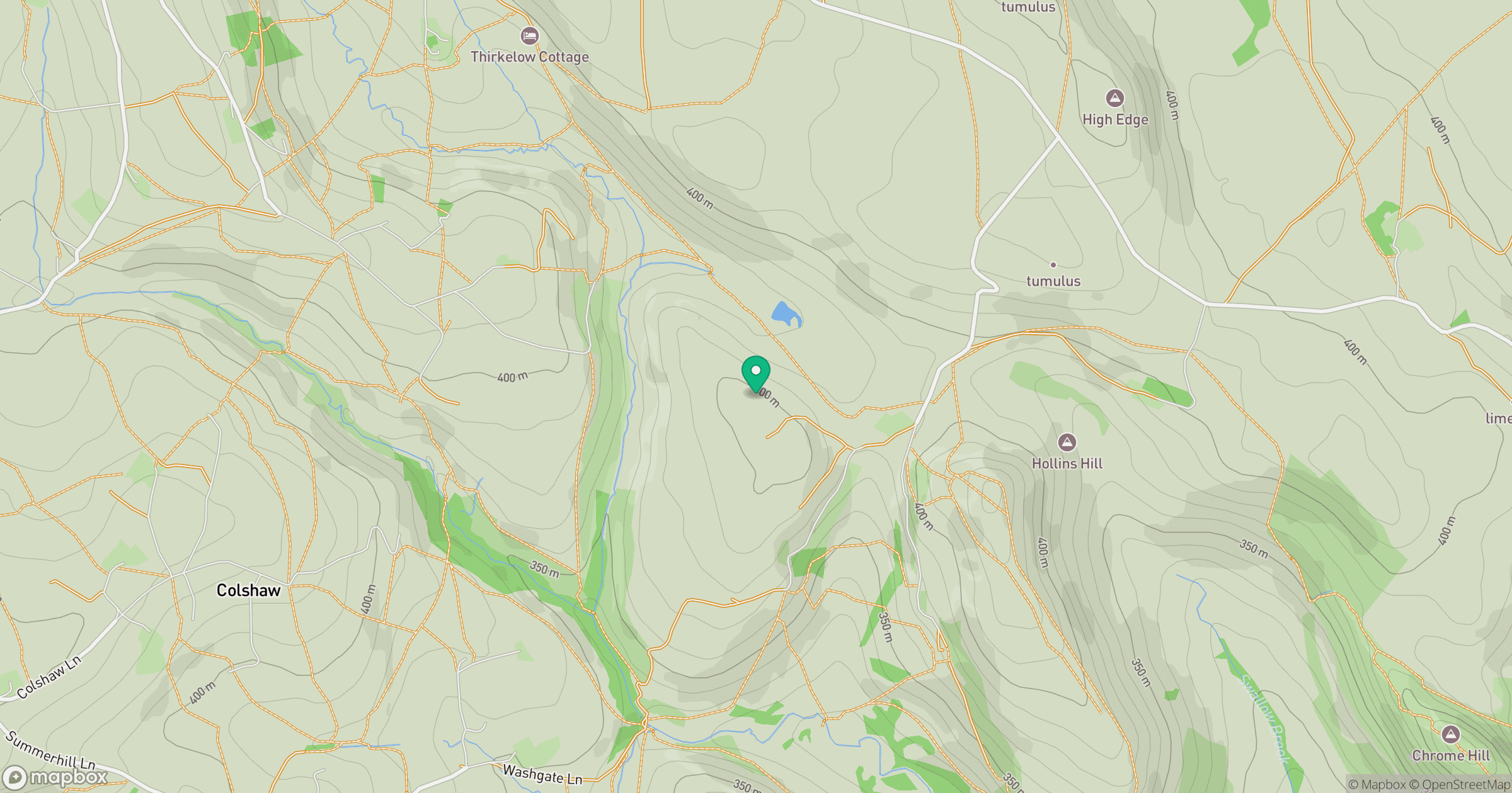
Grid reference: SK054681
View on OpenStreetMapOpens a map in a new tab, centred on the hill.
Nearby Hills
The Roaches
505m

Kinder Scout
636m
Rombalds Moor [Ilkley Moor]
402m
Winter Hill
456m

Pendle Hill
557m
No comments yet. Be the first.