

Traprain Law
Good walks are even better shared.
Overview
Traprain Law is a 221 m hill in East Lothian, southwest of East Linton. Its rocky dome, prehistoric settlement remains and open views make it a distinctive local landmark. Exmoor ponies graze its grassland.
Traprain Law
Traprain Law is a 221 m hill in East Lothian, southwest of East Linton. Its catalogue classification is Hu,2, and the recorded summit feature is a shelter 10 m north of the trig point.
Geology
The hill consists of phonolite in a shallow igneous intrusion generally interpreted as a laccolith. It is associated with Carboniferous volcanism; the precise emplacement age is uncertain. Later erosion, including glacial erosion, shaped the hill.
Heritage and name
Bronze Age ritual and burial use preceded a substantial defended settlement. Occupation and the hill's role changed over time; its later inhabitants maintained links with Rome. The Traprain Treasure, found in 1919, contains more than 23 kg of late Roman hacksilver. Leave the archaeological remains undisturbed.
Traprain is probably Brittonic. Scholarly interpretations of the early form Trepren differ, so no single translation is certain. Dunpelder is an older name for the hill.
Walking
The researched summit-and-base circuit and the shorter western return both finish at the same north-side car park. Follow their full route descriptions. Avoid the path east of the summit above the quarry. The longer base path can be wet and rough, and its last section uses a road. Carry a map and allow for weather and ground conditions.
Access and facilities
The car park is beside the minor road on the north side of the hill. Park considerately and follow current signs. There are no facilities on site. East Linton has shops and places to eat. No bus serves the hill directly; buses to East Linton still leave an onward walk. The official village-to-hill approach is one-way and should not be treated as a complete return itinerary.
Grazing and views
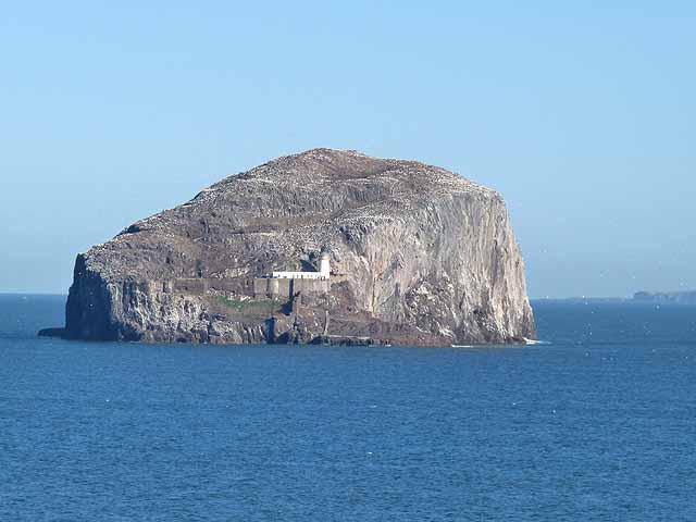
Exmoor ponies graze here throughout the year to help maintain the grassland. Keep your distance, control dogs and leave gates as found. Views include the Tyne estuary, Bass Rock, Craigleith and other Forth islands when visibility permits.
Nearby hills
North Berwick Law is a separate 187 m summit to the north.
Explore routes near Traprain Law
Walks starting near this hill. Open a route to check its map, distance and full itinerary.
Cottyburn to Haddington: East Lothian Railway Walk return
View route
Cockburnspath to Dunglass Dean and Old Bridge
View route
Dalkeith Country Park: Estate and North Woods Green Trail
View route
Lauder Burn Mill and Chester Hill Circuit
View route
Route planning notes
These notes describe possible approaches. Check a route's map and access information when planning your walk.
Traprain Law summit and base circuit
From the north-side car park at NT582749, head west and take the left fork uphill through the ramparts. From the summit descend southwest, avoiding the eastern quarry path. At the foot turn left above a ruin, pass through a pedestrian gate and follow the wall around the hill, keeping the crags on your left. Ignore the stile. At the metal farm gate use the pedestrian gate on its left, descend through trees and turn left along the road to the same car park. Walkhighlands gives 3.2 km, 145 m ascent and 1–1.5 hours for this complete circuit.
Traprain Law short western return
From NT582749 car park, head west, then fork left uphill through the ramparts to the summit. Descend southwest, avoiding the eastern quarry path. At the foot turn right, rejoin the outward path and return to the same car park. This is the shorter option described by Walkhighlands; separate distance and timing are not published.
Make a day of it, together
Find someone to share the walk with, or organise a day out along a route you like.
Photo Gallery
View all Photo could not load
NT5874 : Pond on Traprain Law
kim traynor
 Photo could not load
NT5874 : Breaking the ice for a drink
Keith Burns
 Photo could not load
NT5874 : Traprain Law viewed from Barnes Castle in the Garleton Hillss
kim traynor
 Photo could not load
NT5874 : Traprain Law
M J Richardson
 Photo could not load
NT5874 : Trig Point on Traprain Law
Colin Park
 Photo could not load
NT5874 : The summit of Traprain Law
Oliver Dixon
 Photo could not load
NT5874 : Summit cairn on Traprain Law
kim traynor
 Photo could not load
NT5874 : Traprain Law
Lisa Jarvis
 Photo could not load
NT5874 : Triangulation pillar, Traprain Law
Adrian Taylor

NT5874 : Traprain Law Triangulation Point
Calum McRoberts
Hill facts and local notes
Classifications
Elevation
221m
725 ft
Prominence
133m
Coordinates
55.9632, -2.6717
NT581746
OS Map
67
Explorer: 351E
At the Summit
The recorded summit feature is a shelter 10 m north of the trig point. Ancient ramparts and settlement remains occupy the hilltop.
Terrain & Geology
Traprain Law is formed from phonolite, a rare igneous rock, in a shallow intrusion generally interpreted as a laccolith. It is associated with Carboniferous volcanism in East Lothian; its precise emplacement age is uncertain. Erosion, including glacial erosion, exposed and shaped the rocky hill.
Views & Scenery
Views extend over East Lothian towards the Tyne estuary, Bass Rock, Craigleith and the Forth islands, depending on visibility.
History & Heritage
Name Origin
Traprain is probably Brittonic. Bethany Fox records Trepren in 1335 and competing derivations from tref plus pren or bryn; a single translation is uncertain. The older hill name Dunpelder is also recorded.
Historical Significance
The hill was used for Bronze Age ritual and burial before becoming a substantial defended settlement in the later Bronze Age. Its use changed through the Iron Age; later inhabitants had close connections with Rome. Excavations in 1919 uncovered the Traprain Treasure, more than 23 kg of late Roman hacksilver. Preserve the earthworks and stone remains.
Getting There & Facilities
Parking
Use the dedicated car park beside the minor road on the north side of Traprain Law, at NT582749. This is below the hill, not at the summit grid reference. Park without blocking gates or the road and check signs for any current restrictions or charges.
Public Transport
No bus serves the hill directly. Visit East Lothian lists buses to East Linton from Haddington and Dunbar, but reaching the Law requires a separate walk. Its published approach is 6 km one way. Check current timetables and allow for the return journey.
Nearby Facilities
East Lothian Council lists no facilities on site. East Linton has shops and places to eat; plan food, water and toilet stops before reaching the hill.
Safety Information
Known Hazards
- Avoid the path east of the summit above the quarry; use the southwest descent.
- Take care on steep grass, exposed rock and muddy paths, and watch for traffic on the final road section.
- Exmoor ponies graze here year-round. Give them space, prevent dogs approaching them and use a lead if needed for control.
- Do not disturb the archaeological remains; leave stones and earthworks as they are.
General Safety Tips
- Check weather conditions before setting out
- Carry appropriate clothing and equipment
- Let someone know your planned route
- Take a map, compass, and GPS device
- Carry emergency supplies: food, water, first aid kit, torch
Hills
Some common questions about the hills answered
Are there group walks up Traprain Law?
Many walkers use Walkmates to join or organise walks with others. You can check for group walks around Traprain Law through the maps
Are there other walkers around Traprain Law?
Activity varies by location and time, but Walkmates lets you see whether others have shared walks or shown interest in this area. Find other people through the walking friends search walking friends for Traprain Law search or of course create your own walk for Traprain Law
Can I organise a walk to Traprain Law?
Yes. If there aren’t any walks listed already, you can create a walk and make it available for others to join.
If you're signed up to Walkmates, you can create a walk to Traprain Law.
How do I find a walk up this hill?
There are often multiple ways to walk this hill, depending on experience and route preference. Walkmates helps you explore walks and routes that others have shared.
Can I suggest a new route up Traprain Law?
Yes. You can suggest or create routes to share with others. Walkmates focuses on the social side of walking, so routes are used to help people organise walks and explore areas together, rather than as detailed navigation tools or route libraries.
Other uses really appreciate knowledgeable walkers sharing their routes. Share your favourite route to Traprain Law here
The is an error or something incorrect about this hill. How do I let you know?
We always strive to keep the information on Walkmates as accurate as possible. If you find an error, please let us know through the contact form and we'll aim to correct it as quickly as possible
Community Discussion
Comments
Location
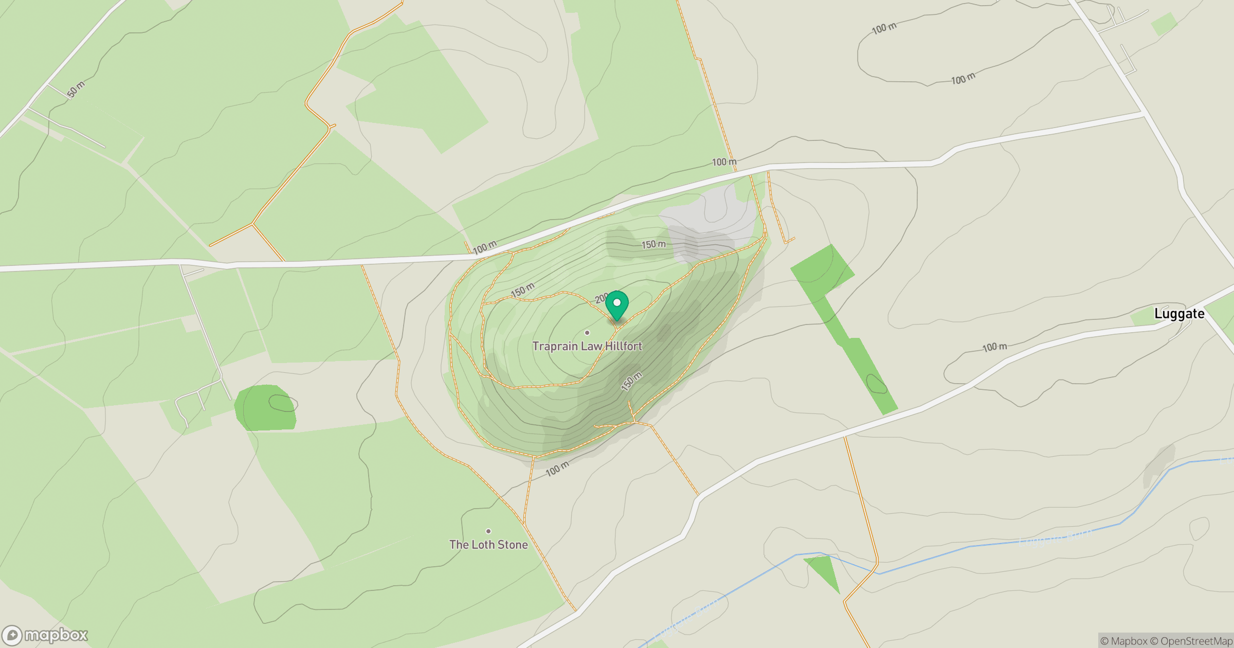
Grid reference: NT581746
View on OpenStreetMapOpens a map in a new tab, centred on the hill.
No comments yet. Be the first.