

Scaw'd Fell
Good walks are even better shared.
NT1502 : Near Garrogill
Bob Cowan Photo source
Explore routes near Scaw'd Fell
Walks starting near this hill. Open a route to check its map, distance and full itinerary.
Moffat Gallow Hill Woodland and Viewpoint Circuit
View route
Forest of Ae Water of Ae Riverside Trail
View route
Hoddom Castle and River Annan Woodland Circuit
View route
Cademuir Forest Pilots Trail
View route
Route planning notes
These notes describe possible approaches. Check a route's map and access information when planning your walk.
Scaw'd Fell Circular Walk from Braithwaite
This circular walk begins in the picturesque village of Braithwaite. The route takes you through beautiful woodlands, up onto rocky paths, and eventually to the summit of Scaw'd Fell.
Direct Ascent from Thornthwaite
A more direct ascent begins from the village of Thornthwaite, following a well-defined path. This route is shorter but quite steep, rewarding those determined hikers with unmissable views at the top.
Make a day of it, together
Find someone to share the walk with, or organise a day out along a route you like.
Photo Gallery
View all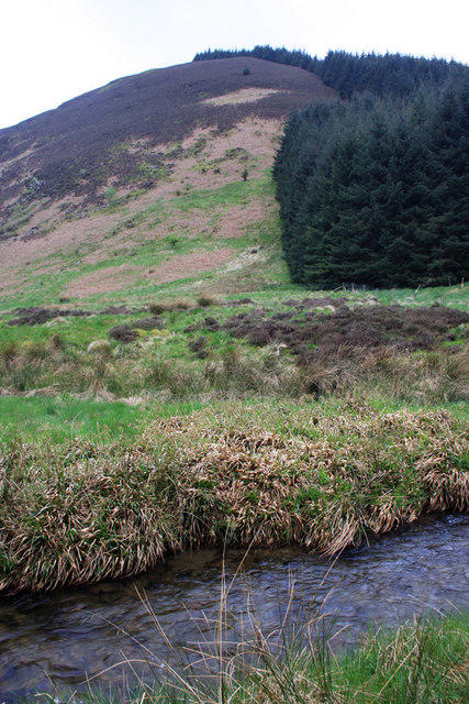 Photo could not load
NT1502 : Near Garrogill
Bob Cowan
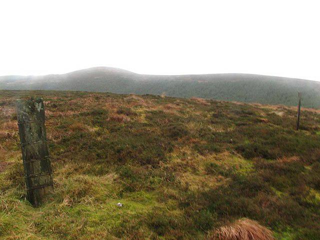 Photo could not load
NT1402 : Scaw'd Fell
Callum Black
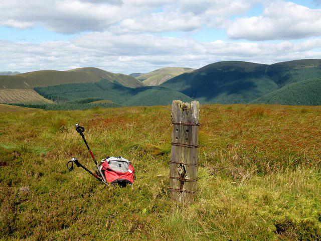 Photo could not load
NT1402 : Scaw'd Fell
Rude Health
Hill facts and local notes
Classifications
Elevation
550m
1,803 ft
Prominence
158m
Coordinates
55.3120, -3.3417
NT149028
OS Map
78
Explorer: 322N
At the Summit
The summit is marked by a modest cairn and offers a trig point for those keen to grab a photo. The flat summit provides a perfect spot for a picnic or a place to contemplate life's big questions, like why you have two left feet.
Terrain & Geology
Scaw'd Fell primarily consists of sedimentary rock, specifically skiddaw slate, a product of ancient ocean floor deposits that have been uplifted into the rolling landscapes we see today. The area showcases classic glacial features, reflecting its long geological history.
Views & Scenery
From the summit, one can gaze upon the imposing Helvellyn range to the southeast, Grisedale Pike, and the sprawling vistas of Bassenthwaite Lake below.
History & Heritage
Name Origin
The name 'Scaw'd' derives from the Old Norse 'skald', meaning 'barren', possibly referencing the terrain or the former grazing lands.
Historical Significance
Scaw'd Fell has local significance for outdoor enthusiasts, representing a place of adventure and exploration for generations. The fell attracts walkers year-round, fostering a connection between people and the breath-taking landscape.
Getting There & Facilities
Parking
The nearest parking is available at Braithwaite, with several car parks located in the village. Make sure to check for payment requirements to avoid any unexpected fines.
Public Transport
The nearest railway station is in Penrith, approximately 12 miles away. From there, local bus services operate to Braithwaite, making it accessible for day-trippers.
Nearby Facilities
While on the mountain, facilities are non-existent, so be sure to pack plenty of snacks! However, the village of Braithwaite is home to charming cafes, pubs, and toilets to cater to your pre- and post-adventure needs.
Safety Information
Known Hazards
- Changing weather conditions can lead to sudden fog or rain. Steep sections may be slippery, especially after wet weather, so cautious footwork is advised.
General Safety Tips
- Check weather conditions before setting out
- Carry appropriate clothing and equipment
- Let someone know your planned route
- Take a map, compass, and GPS device
- Carry emergency supplies: food, water, first aid kit, torch
Hills
Some common questions about the hills answered
Are there group walks up Scaw'd Fell?
Many walkers use Walkmates to join or organise walks with others. You can check for group walks around Scaw'd Fell through the maps
Are there other walkers around Scaw'd Fell?
Activity varies by location and time, but Walkmates lets you see whether others have shared walks or shown interest in this area. Find other people through the walking friends search walking friends for Scaw'd Fell search or of course create your own walk for Scaw'd Fell
Can I organise a walk to Scaw'd Fell?
Yes. If there aren’t any walks listed already, you can create a walk and make it available for others to join.
If you're signed up to Walkmates, you can create a walk to Scaw'd Fell.
How do I find a walk up this hill?
There are often multiple ways to walk this hill, depending on experience and route preference. Walkmates helps you explore walks and routes that others have shared.
Can I suggest a new route up Scaw'd Fell?
Yes. You can suggest or create routes to share with others. Walkmates focuses on the social side of walking, so routes are used to help people organise walks and explore areas together, rather than as detailed navigation tools or route libraries.
Other uses really appreciate knowledgeable walkers sharing their routes. Share your favourite route to Scaw'd Fell here
The is an error or something incorrect about this hill. How do I let you know?
We always strive to keep the information on Walkmates as accurate as possible. If you find an error, please let us know through the contact form and we'll aim to correct it as quickly as possible
Community Discussion
Comments
Location
View the hill's mapped position and surrounding paths.
Grid reference: NT149028
View on OpenStreetMapOpens a map in a new tab, centred on the hill.


No comments yet. Be the first.