
Black Knowe
Good walks are even better shared.
Overview
Exploring Black Knowe
Overview
Black Knowe, standing at an elevation of 346 meters, is nestled in the picturesque Southern Uplands of Scotland. Renowned as a Marilyn, this summit offers breathtaking views and a chance to escape into nature.
Geology
The geology of Black Knowe is dominated by Old Red Sandstone, which gives the mountainside its unique character. As you hike, take note of the reddish tones that glow warmly in the sunlight—perfect for that Instagram shot at sunrise!
Hiking Routes
One of the most popular routes is the Glen Afton Approach, a moderate trail that winds through scenic countryside. Expect to spend around three hours covering approximately 7.5 km, making it a great day out for families or less experienced hikers.
Summit Features
Reaching the summit is a rewarding experience. You’ll find a rocky outcrop and a well-constructed view-cairn, perfect for resting your weary legs while enjoying the panoramic vistas. Don’t forget the snacks! A summit picnic is essential, and remember: selfies are mandatory!
Terrain
The terrain here is predominantly grassy, with some rocky patches that provide variety. Be cautious as some areas can be boggy, especially after rainfall, so sturdy footwear is advisable.
Scenic Views
Once at the top, the views are truly stunning. The Afton Water valley sprawls beneath, and if you’re lucky, the distant Galloway Hills will appear like a painting at your feet. For the best views, try to hike in late spring or early autumn when the clarity rivals that of a polished window.
Hazards
While hiking, watch for sudden weather changes; Scotland is notorious for its quick shifts. The terrain can also become slippery after rain, so tread carefully!
Nearby Summits
For the more adventurous, nearby peaks such as Benguaire Hill (462 meters) and Blackcraig Hill (466 meters) are well worth exploring.
Access and Facilities
Parking is available at a modest site at the end of the Glen Afton road. You won't be camping out; it accommodates about ten cars, so get there early! If you're relying on public transport, several bus services run from nearby towns, but expect to trek about 3 miles from the closest bus stop.
In New Cumnock, a short drive away, you’ll find cafes and toilets to refuel after your adventure. And remember to hydrate!
History
The name Black Knowe has Gaelic roots, literally translating to 'black hillock.' The area bears historical significance with ancient cultivation terraces still visible today. It’s a walk not just on the hills, but through the history of the land.
So lace up those hiking boots and get ready for an adventure that combines stunning nature, a dash of history, and the occasional chuckle. After all, life isn’t merely about the destination; it’s also about the stories we collect along the way!
Explore routes near Black Knowe
Public walks starting within 80 km of this hill. Nearby does not mean a route reaches the summit; check its map and access before setting out.
Moffat Gallow Hill Woodland and Viewpoint Circuit
View route
Cademuir Forest Pilots Trail
View route
Hawick: Wilton Lodge Park and River Teviot Circular
View route
Peebles to Neidpath Castle: Tweed Riverside Walk
View route
Route planning notes
These notes describe possible approaches, not verified navigable routes or permission to cross land. Check current paths, local access rules and conditions before setting out.
Glen Afton Approach
A scenic route that starts from the Glen Afton valley, ideal for leisurely walkers and those looking to enjoy the natural beauty.
Make a day of it, together
Find someone to share the walk with, or organise a day out along a route you like.
Hill facts and local notes
Classifications
Elevation
549m
1,801 ft
Prominence
126m
Coordinates
55.3859, -3.2237
NT225109
OS Map
79
Explorer: 330
At the Summit
The summit features a small rocky outcrop and an impressive view-cairn constructed by well-meaning locals, offering a perfect spot for a picnic selfie.
Terrain & Geology
The mountain is primarily composed of Old Red Sandstone, lending the area a rich reddish hue, especially visible during sunrise and sunset.
Views & Scenery
From the summit, you can gaze out over the Afton Water valley and, on a clear day, you might spot the iconic peaks of the Galloway Hills in the distance.
History & Heritage
Name Origin
The name 'Black Knowe' stems from Scots Gaelic, meaning ‘black hillock,’ likely referring to its darker, heath-covered summit.
Historical Significance
Historically, the area was significant for its ancient cultivation terraces, remnants of which can still be spotted on the lower slopes.
Getting There & Facilities
Check current local access restrictions, parking rules and transport timetables before travelling. These notes do not confirm public access to the summit.
Parking
There's a small car park located at the end of the Glen Afton road, accommodating up to 10 vehicles.
Public Transport
Bus services run from nearby towns, with the closest stop about 3 miles from the starting point.
Nearby Facilities
There are no facilities on the mountain, but New Cumnock offers cafes and toilets for pre- or post-hike refreshments.
Safety Information
Known Hazards
- Beware of sudden changes in weather; the terrain can also be slippery after rain.
General Safety Tips
- Check weather conditions before setting out
- Carry appropriate clothing and equipment
- Let someone know your planned route
- Take a map, compass, and GPS device
- Carry emergency supplies: food, water, first aid kit, torch
Hills
Some common questions about the hills answered
Are there group walks up Black Knowe?
Many walkers use Walkmates to join or organise walks with others. You can check for group walks around Black Knowe through the maps
Are there other walkers around Black Knowe?
Activity varies by location and time, but Walkmates lets you see whether others have shared walks or shown interest in this area. Find other people through the walking friends search walking friends for Black Knowe search or of course create your own walk for Black Knowe
Can I organise a walk to Black Knowe?
Yes. If there aren’t any walks listed already, you can create a walk and make it available for others to join.
If you're signed up to Walkmates, you can create a walk to Black Knowe.
How do I find a walk up this hill?
There are often multiple ways to walk this hill, depending on experience and route preference. Walkmates helps you explore walks and routes that others have shared.
Can I suggest a new route up Black Knowe?
Yes. You can suggest or create routes to share with others. Walkmates focuses on the social side of walking, so routes are used to help people organise walks and explore areas together, rather than as detailed navigation tools or route libraries.
Other uses really appreciate knowledgeable walkers sharing their routes. Share your favourite route to Black Knowe here
The is an error or something incorrect about this hill. How do I let you know?
We always strive to keep the information on Walkmates as accurate as possible. If you find an error, please let us know through the contact form and we'll aim to correct it as quickly as possible
Community Discussion
Comments
Location
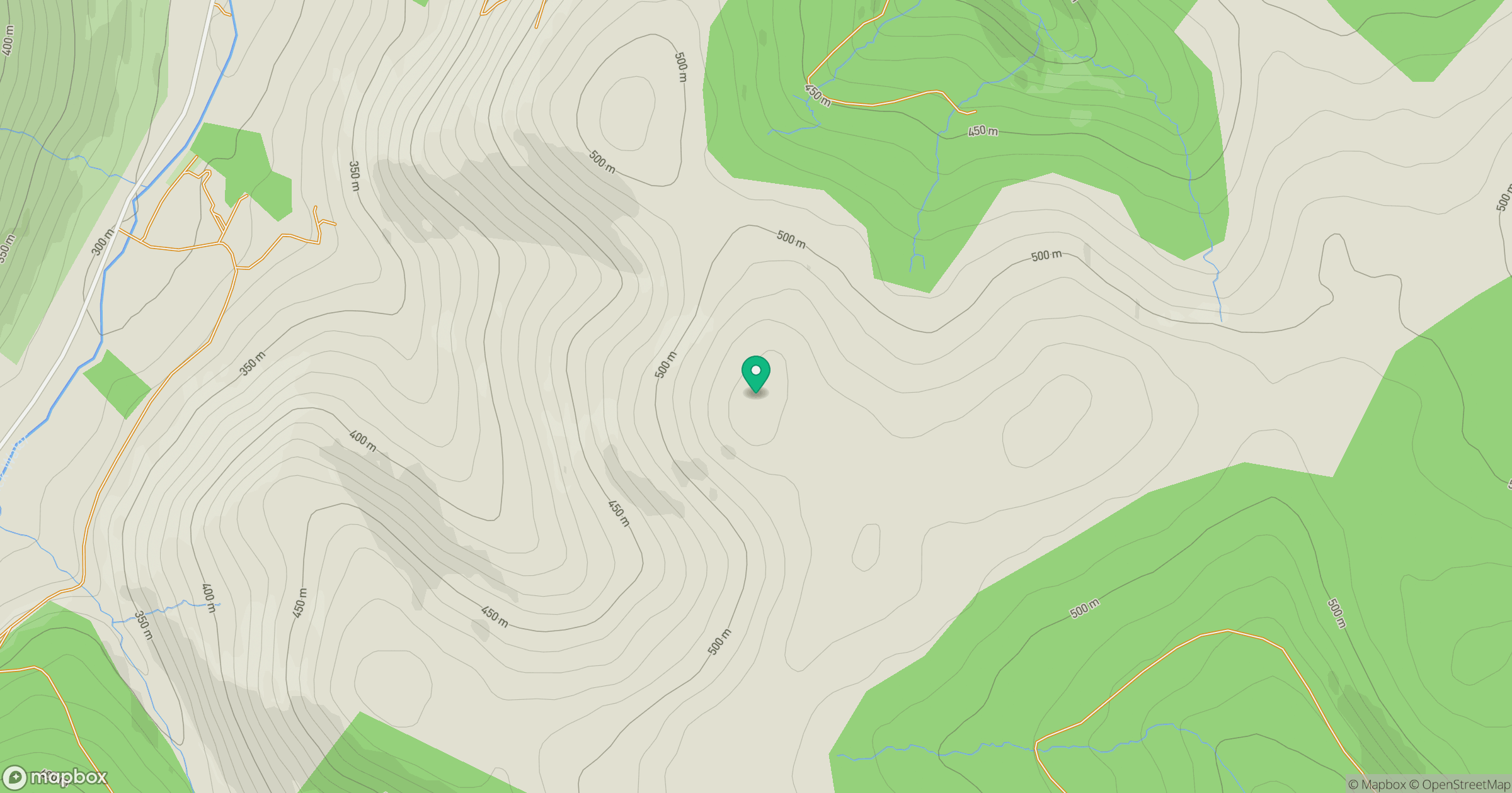
Grid reference: NT225109
View on OpenStreetMapOpens a map in a new tab, centred on the hill.
Hills within 30 km
Straight-line distance, not a walking route or confirmation of access.
No comments yet. Be the first.