

Ben Venue East Top
Good walks are even better shared.
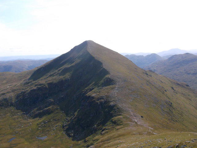
NN4706 : Between the Tops
Adam Ward Photo source
Overview
Ben Venue East Top
Ben Venue East Top is a remarkable peak nestled in the heart of the Scottish Highlands, providing a perfect getaway for outdoor enthusiasts.
Geology
The geological formation of Ben Venue East Top is primarily Granitic, giving it a rugged charm and a fascinating look into the Earth's history. Geologists love to dissect these ancient rocks, though many claim they provide the perfect backdrop for a good 'cuppa'.
Access & Parking
For those planning to visit, the Loch Achray car park is your best bet. It’s like the welcome mat to your adventure! Just remember, it can get a tad crowded during the summer months, so plan to arrive early or risk parking at the end of the road—where you may find it a little harder to stretch your legs after the drive.
Routes
The Ben Venue Circular route is highly popular! Spanning approximately 9.5 kilometres and taking around 4.5 hours to complete, it presents a moderate challenge and is well-marked. Grab your boots, grab your mates, and maybe a majestic haggis or two—just kidding on the last part!
Summit Features
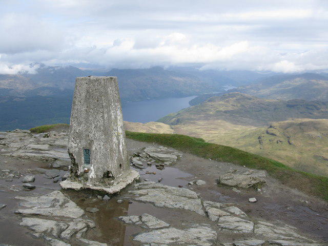
Reaching the East Top is typically rewarded with a stone cairn that many have claimed enhances the view exponentially. Besides being a perfect spot for a quick selfie, it’s ideal for enjoying your well-earned snacks whilst basking in the Highland beauty.
Terrain
Expect a mix of rocky pathways interspersed with some grassy plots. The initial ascent may have you puffing a bit, but trust us, the views from the top are worth every breath!
Views
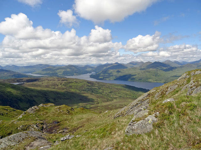
The breathtaking vista from the East Top features Loch Katrine and the Trossachs National Park, offering a kaleidoscope of colours depending on the season. Spring and autumn are your best bets for those picture-perfect moments, but don't fault winter for a bit of snow-induced romance!
Hazards
Like every good Scottish walk, be prepared for some pitfalls—loose rocks, sudden weather shifts, and yes, spirited sheep. They don't take kindly to interlopers, so keep your snacks close!
Nearby Summits
While you’re in the area, consider venturing to nearby peaks such as Ben Venue (727 meters) and Ben A'an (454 meters), both offering their own unique charm and beautiful vistas.
History
The Anglo-Saxon origins of the name give a nod to its mystical past, with tales of battles echoing through the glens. Whether you're a history buff or just out for a walk, you can’t help but feel the weight of the past in this stunning landscape.
Conclusion
Ben Venue East Top is more than just a hike; it’s a celebration of the great Scottish outdoors, enhanced by a sprinkle of history and marvellous flora and fauna. Just don’t forget your camera—and, of course, an ample supply of snacks!
Happy hiking!
Explore routes near Ben Venue East Top
Walks starting near this hill. Open a route to check its map, distance and full itinerary.
Loch Katrine: Brenachoile Point Shore Walk from Trossachs Pier
View route
Loch Ard Forest: Sculpture Trail and Little Loch Ard
View route
Aberfoyle woodland wellbeing walk
View route
Loch Lubnaig: West Shore Railway Path from Ben Ledi Car Park
View route
Route planning notes
These notes describe possible approaches. Check a route's map and access information when planning your walk.
Ben Venue Circular
This popular circular route provides an excellent day out, showcasing the beauty of the surrounding lochs and mountains. Starting from the car park at Loch Achray, it leads you along a well-defined path.
Make a day of it, together
Find someone to share the walk with, or organise a day out along a route you like.
Photo Gallery
View all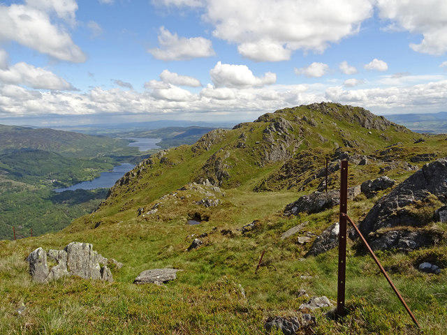 Photo could not load
NN4706 : Between the Tops
Adam Ward
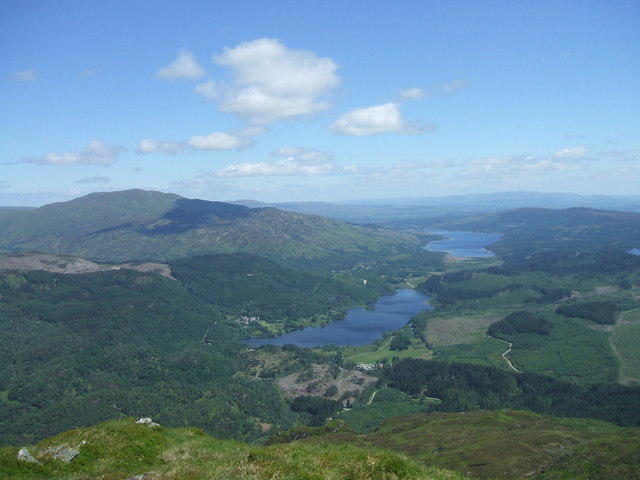 Photo could not load
NN4706 : From Ben Venue
Iain Russell
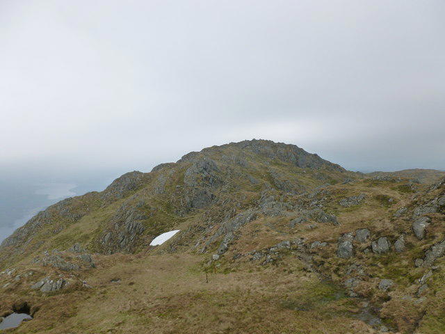 Photo could not load
NN4706 : East top, Ben Venue
Alan O'Dowd
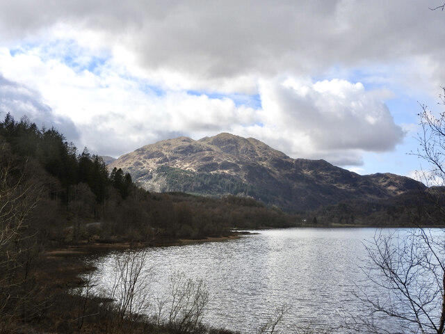 Photo could not load
NN4706 : Ben Venue across Loch Achray
Mags49
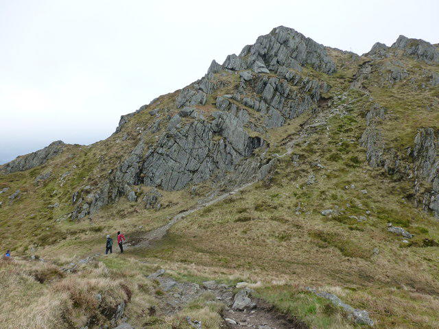 Photo could not load
NN4706 : Path up to the east top of Ben Venue
Alan O'Dowd
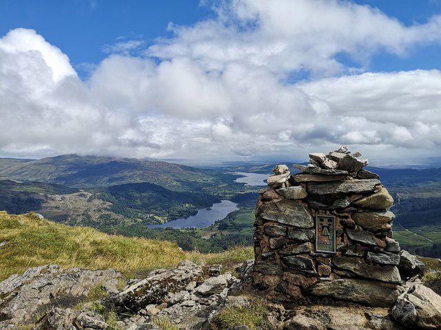 Photo could not load
NN4706 : Southeast summit of Ben Venue
Robyn Haggard
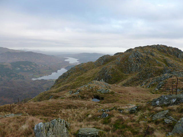 Photo could not load
NN4706 : Ben Venue ('mountain of the stirks')
Alan O'Dowd
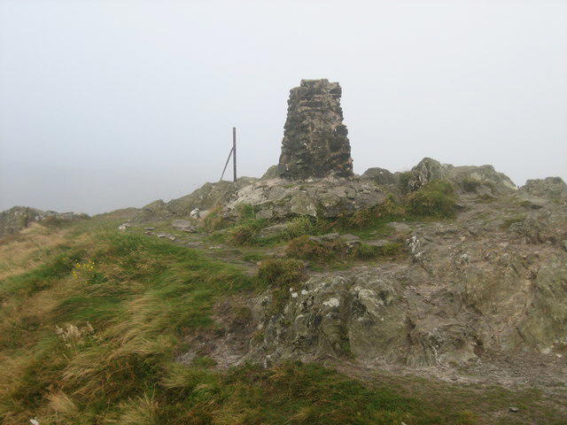 Photo could not load
NN4706 : Summit of Ben Venue
Dannie Calder
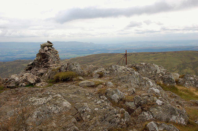 Photo could not load
NN4706 : Southeast summit of Ben Venue
Jim Barton
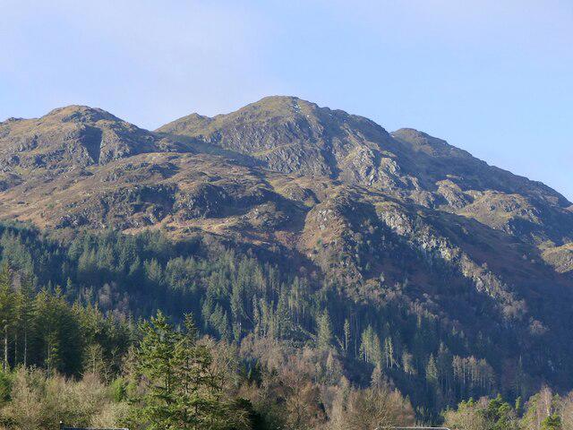
NN4706 : Ben Venue
Richard Webb
Hill facts and local notes
Classifications
Elevation
727m
2,385 ft
Prominence
32m
Coordinates
56.2233, -4.4576
NN477061
OS Map
57
Explorer: OL46S 365S
At the Summit
At the summit, hikers are greeted by a substantial stone cairn which, some say, has the power to make your sandwich taste better. There is also a stunning view that will make you question decisively if you really ever want to come down.
Terrain & Geology
Primarily composed of granitic rocks, with intriguing formations that have weathered over millennia to create stunning landscapes. The bedrock presents a fascinating study for both amateur and professional geologists looking to explore ancient geological processes.
Views & Scenery
Spectacular views of Loch Katrine, the surrounding hills, and a crystal-clear sight of the Trossachs National Park across the water. On a clear day, you might even spot as far as the distant peaks of the Southern Highlands.
History & Heritage
Name Origin
The name 'Ben Venue' likely derives from the Gaelic 'Beinn Naomh', meaning 'Holy Mountain', suggesting localized tales and significance over the ages.
Historical Significance
The area holds historical significance, having been a pivotal spot during various battles and disputes in Scotland's tumultuous history, including the Jacobite uprisings.
Getting There & Facilities
Parking
The nearest parking is available at the Loch Achray car park (NN502059), which offers ample space but can fill up quickly during peak seasons.
Public Transport
Limited public transport options are available, with the closest bus service operating from Aberfoyle. Check local schedules prior to your journey.
Nearby Facilities
There are no facilities on the mountain itself, but Aberfoyle has numerous cafes, shops, and public toilets available for hikers. Be sure to stock up on snacks to fuel your adventure!
Safety Information
Known Hazards
- Loose rocks on narrow paths, sudden changes in weather, and the occasional enthusiastic sheep willing to challenge your hiking prowess.
General Safety Tips
- Check weather conditions before setting out
- Carry appropriate clothing and equipment
- Let someone know your planned route
- Take a map, compass, and GPS device
- Carry emergency supplies: food, water, first aid kit, torch
Hills
Some common questions about the hills answered
Are there group walks up Ben Venue East Top?
Many walkers use Walkmates to join or organise walks with others. You can check for group walks around Ben Venue East Top through the maps
Are there other walkers around Ben Venue East Top?
Activity varies by location and time, but Walkmates lets you see whether others have shared walks or shown interest in this area. Find other people through the walking friends search walking friends for Ben Venue East Top search or of course create your own walk for Ben Venue East Top
Can I organise a walk to Ben Venue East Top?
Yes. If there aren’t any walks listed already, you can create a walk and make it available for others to join.
If you're signed up to Walkmates, you can create a walk to Ben Venue East Top.
How do I find a walk up this hill?
There are often multiple ways to walk this hill, depending on experience and route preference. Walkmates helps you explore walks and routes that others have shared.
Can I suggest a new route up Ben Venue East Top?
Yes. You can suggest or create routes to share with others. Walkmates focuses on the social side of walking, so routes are used to help people organise walks and explore areas together, rather than as detailed navigation tools or route libraries.
Other uses really appreciate knowledgeable walkers sharing their routes. Share your favourite route to Ben Venue East Top here
The is an error or something incorrect about this hill. How do I let you know?
We always strive to keep the information on Walkmates as accurate as possible. If you find an error, please let us know through the contact form and we'll aim to correct it as quickly as possible
Community Discussion
Comments
Location
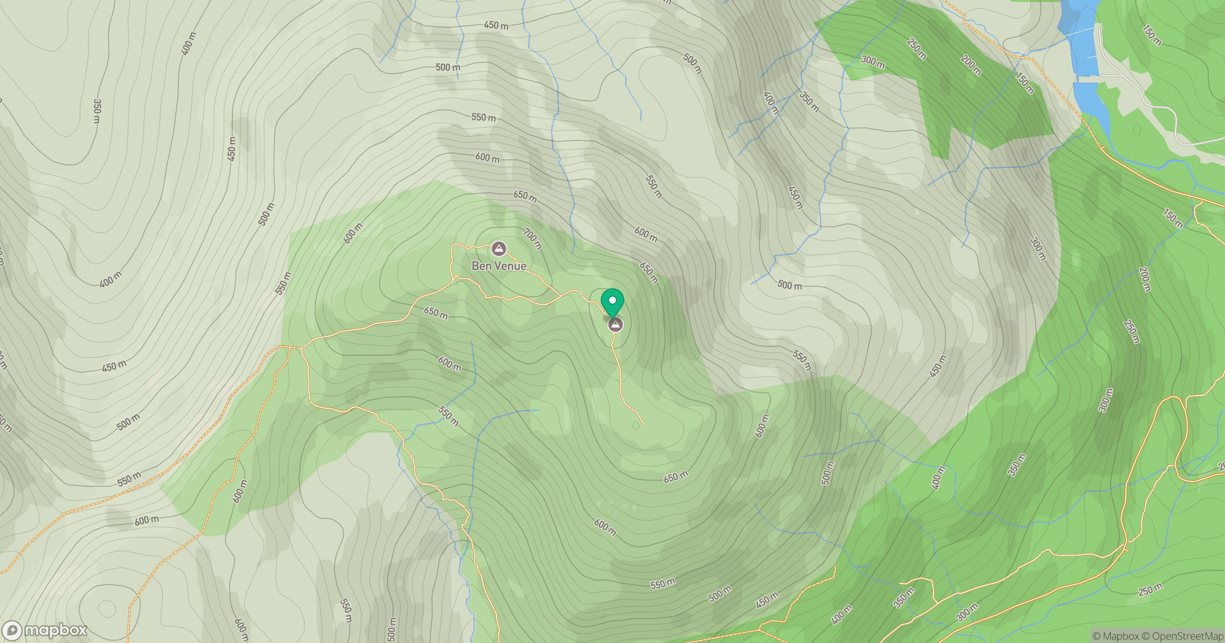
Grid reference: NN477061
View on OpenStreetMapOpens a map in a new tab, centred on the hill.
No comments yet. Be the first.