

Beinn nan Dubh-lochan
Good walks are even better shared.
Overview
Beinn nan Dubh-lochan
Nestled in the heart of the Scottish Highlands, Beinn nan Dubh-lochan stands proudly at an elevation of 720 meters. With a classification as a Munro and a prominence of 137 meters, it offers a rewarding challenge to hikers looking to stretch their legs in a setting rich with natural beauty.
Geology
The geological composition of Beinn nan Dubh-lochan is primarily schist and quartzite, contributing to the rugged character of its slopes. The rocks here are like an open book, showcasing the ancient geological history of the region. As you hike, take a moment to appreciate the remnants of the tumultuous processes that formed these mountains—who knew rock could tell such tall tales?
Routes
The recommended route to the summit is via The Glen Affric Approach, which totals approximately 13 km and typically takes around 5.5 hours to complete. This moderately challenging trek leads you through delightful ancient woodlands along the picturesque Loch Affric, eventually bringing you to the more strenuous ascent as you near the summit. Remember, a hike is nothing without a good story to tell—make sure to capture some photos along the way!
Summit Features
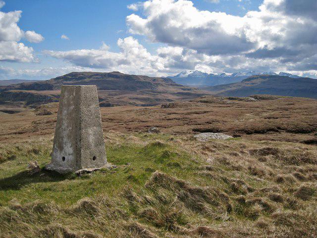
Upon reaching the summit, hikers are greeted with a prominent cairn that seems to beckon you for a snack break. It’s the perfect spot to pause, reflect on your efforts, and admire the breathtaking views that stretch before you.
Terrain Type
The terrain varies from rocky outcrops that require careful navigation to grassy slopes that provide a softer footing. Just a heads up: if you stray from the path in the lower regions, you might find yourself tiptoeing through some boggy patches—consider it a natural foot spa!
Views
The views from atop Beinn nan Dubh-lochan are nothing short of spectacular. On a clear day, the striking Affric hills and the serene Loch Affric are laid out before you, a reminder of why we all love to roam these wild landscapes. Best seasons for these stunning vistas are undoubtedly spring and summer when the lands are adorned in vibrant greens.
Hazards
Keep in mind that the weather in the Highlands can be as fickle as a cat in a room full of rocking chairs. Conditions can change quickly, so pack layers and be prepared for anything. Additionally, loose rocks can be slippery, particularly after a rain; it’s all part of the adventure, right?
Nearby Summits
If you're feeling ambitious, consider tackling nearby mountains such as Mullach Fraoch-Choire at 849 meters and Beinn Fhada at 834 meters for a full day out among some of the best Scotland has to offer.
Access
Parking is conveniently available at the end of the main road by Loch Affric, where limited spaces are available. For those relying on public transport, check the local bus service that runs from Drumnadrochit to Glen Affric—double-check those schedules! The nearest town is Drumnadrochit, located approximately 20 km away, which has creature comforts to recharge after your exploits.
Facilities
While there are no facilities directly at the foot of Beinn nan Dubh-lochan, typical facilities such as cafés, shops, and toilets can be found in nearby towns.
History
Etymologically, the name itself—Beinn nan Dubh-lochan—means 'mountain of the dark lochans', speaking to the many small water bodies that dot the terrain. This mountain is not just a hike; it is a place steeped in the cultural heritage of the Highland communities, who have historically relied on these lands for sustenance and recreation.
So there you have it! Beinn nan Dubh-lochan awaits you with open hillsides and a promise of adventure. Happy hiking!
Explore routes near Beinn nan Dubh-lochan
Public walks starting within 80 km of this hill. Nearby does not mean a route reaches the summit; check its map and access before setting out.
Dun Mhulan Broch Quick Walk
View route
Berneray Community Hall to the beautiful beach
View route
Fairy Lochs Liberator Wreckage Circuit
View route
Beinn Eighe Lancaster Wreckage at Coire Mhic Fhearchair
View route
Route planning notes
These notes describe possible approaches, not verified navigable routes or permission to cross land. Check current paths, local access rules and conditions before setting out.
The Glen Affric Approach
This route features stunning vistas alongside Loch Affric and leads you through beautiful ancient woodlands before the ascent begins in earnest.
Make a day of it, together
Find someone to share the walk with, or organise a day out along a route you like.
Photo Gallery
View all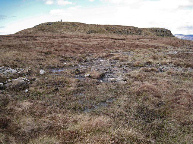 Photo could not load
NG3132 : Beinn nan Dubh-lochan
Richard Dorrell
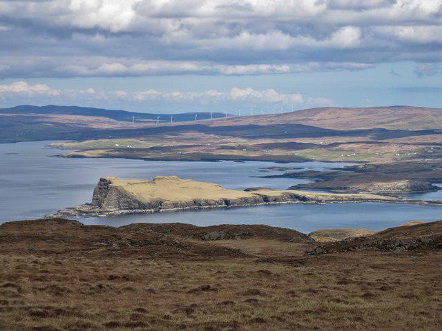 Photo could not load
NG3132 : Looking north from Beinn nan Dubh-lochan
Richard Dorrell
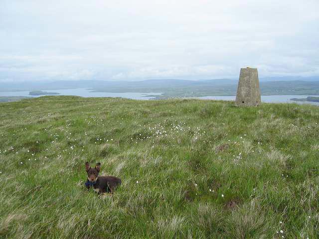 Photo could not load
NG3132 : Summit of Beinn nan Dubh-Lochan
John Allan
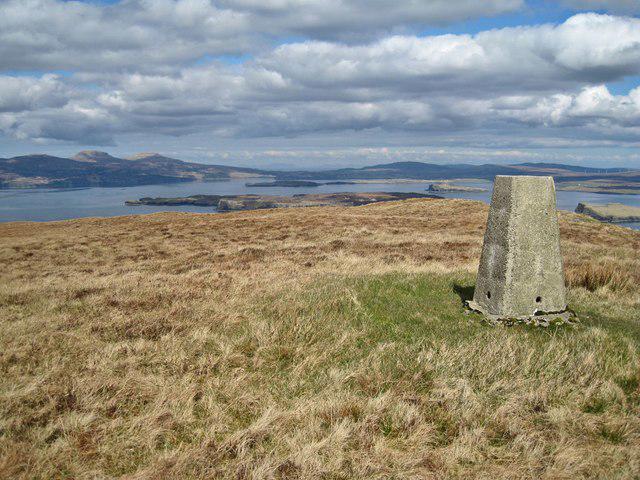 Photo could not load
NG3132 : Summit of Beinn nan Dubh-lochan - NNW view
Richard Dorrell
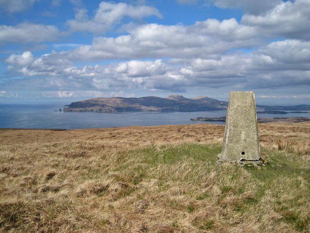 Photo could not load
NG3132 : Summit of Beinn nan Dubh-lochan - NW view
Richard Dorrell
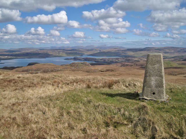 Photo could not load
NG3132 : Summit of Beinn nan Dubh-lochan - NE view
Richard Dorrell
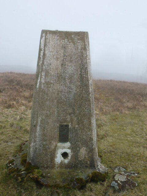 Photo could not load
NG3132 : Beinn Nan Dubh Trig Point Flush Bracket S9711
thejackrustles
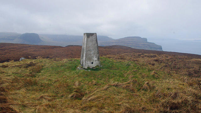 Photo could not load
NG3132 : Trig point, Beinn nan Dubh-lochan
Ian Taylor
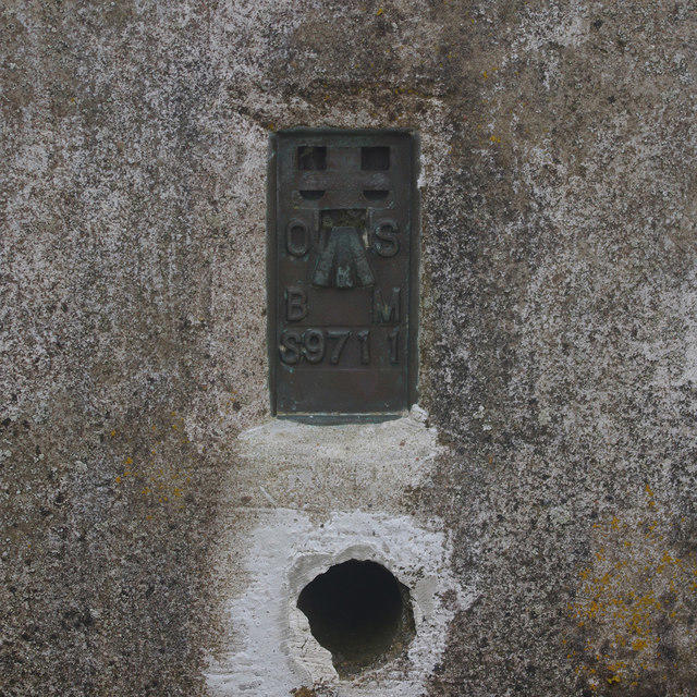 Photo could not load
NG3132 : Flush bracket S9711
Ian Taylor
NG3132 : Summit of Beinn nan Dubh-lochan - SE view
Richard Dorrell
Hill facts and local notes
Classifications
Elevation
253m
830 ft
Prominence
129m
Coordinates
57.3026, -6.4636
NG312323
OS Map
32
Explorer: 410
At the Summit
The summit boasts a prominent cairn, which offers a comforting invitation for a celebratory snack whilst soaking in the views.
Terrain & Geology
Beinn nan Dubh-lochan is primarily composed of schist and quartzite, providing a rugged landscape that tells tales of ancient tectonic activity. These rocks are a testament to the geological forces that shaped the Highlands.
Views & Scenery
From the summit, one can see the striking outlines of the Affric hills, Loch Affric below, and the spectacular views stretching into the heart of the Highlands.
History & Heritage
Name Origin
The name Beinn nan Dubh-lochan translates as 'mountain of the dark lochans', possibly referencing the numerous small, dark waters found on and around the hill.
Historical Significance
This mountain holds cultural significance to the local communities who have historically used the surrounding lands for grazing and recreation.
Getting There & Facilities
Check current local access restrictions, parking rules and transport timetables before travelling. These notes do not confirm public access to the summit.
Parking
Parking is available at the end of the main road near Loch Affric, where a small parking area can accommodate a few vehicles.
Public Transport
The nearest bus service operates from Drumnadrochit to the Glen Affric area, but check the local timetable for frequency.
Nearby Facilities
There are no facilities directly at the mountain but local villages and towns have cafés, shops, and toilets.
Safety Information
Known Hazards
- Be wary of the shifting weather; conditions can change rapidly. Additionally, watch out for loose rocks, particularly in steep areas.
General Safety Tips
- Check weather conditions before setting out
- Carry appropriate clothing and equipment
- Let someone know your planned route
- Take a map, compass, and GPS device
- Carry emergency supplies: food, water, first aid kit, torch
Hills
Some common questions about the hills answered
Are there group walks up Beinn nan Dubh-lochan?
Many walkers use Walkmates to join or organise walks with others. You can check for group walks around Beinn nan Dubh-lochan through the maps
Are there other walkers around Beinn nan Dubh-lochan?
Activity varies by location and time, but Walkmates lets you see whether others have shared walks or shown interest in this area. Find other people through the walking friends search walking friends for Beinn nan Dubh-lochan search or of course create your own walk for Beinn nan Dubh-lochan
Can I organise a walk to Beinn nan Dubh-lochan?
Yes. If there aren’t any walks listed already, you can create a walk and make it available for others to join.
If you're signed up to Walkmates, you can create a walk to Beinn nan Dubh-lochan.
How do I find a walk up this hill?
There are often multiple ways to walk this hill, depending on experience and route preference. Walkmates helps you explore walks and routes that others have shared.
Can I suggest a new route up Beinn nan Dubh-lochan?
Yes. You can suggest or create routes to share with others. Walkmates focuses on the social side of walking, so routes are used to help people organise walks and explore areas together, rather than as detailed navigation tools or route libraries.
Other uses really appreciate knowledgeable walkers sharing their routes. Share your favourite route to Beinn nan Dubh-lochan here
The is an error or something incorrect about this hill. How do I let you know?
We always strive to keep the information on Walkmates as accurate as possible. If you find an error, please let us know through the contact form and we'll aim to correct it as quickly as possible
Community Discussion
Comments
Location
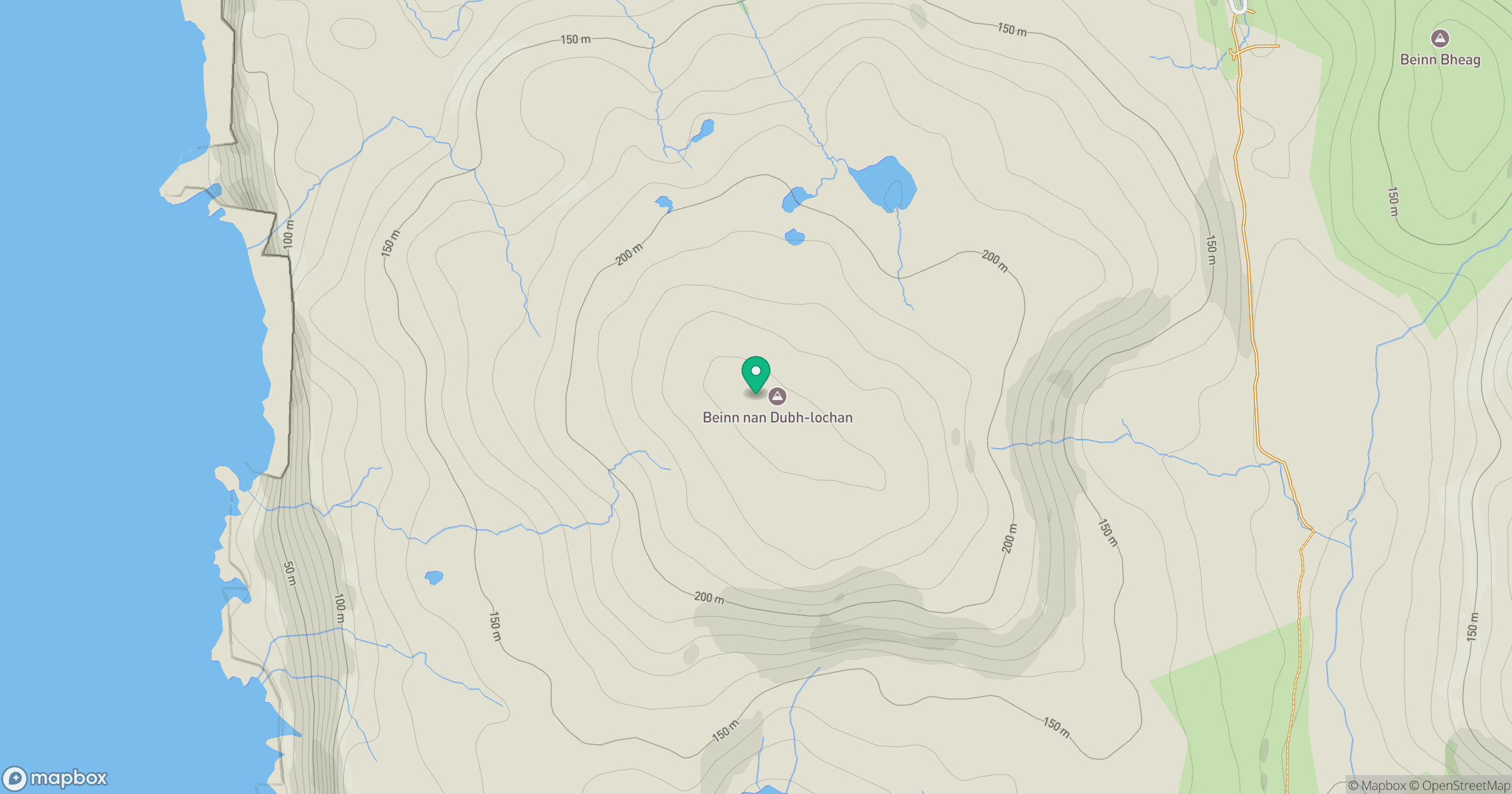
Grid reference: NG312323
View on OpenStreetMapOpens a map in a new tab, centred on the hill.
Hills within 30 km
Straight-line distance, not a walking route or confirmation of access.
Sgurr na Banachdich [Sgurr na Banachdaich]
966m
Sgurr a' Ghreadaidh
972m
Sgurr Dearg - Inaccessible Pinnacle
986m
Sgurr Alasdair
992m
Bruach na Frithe
959m
No comments yet. Be the first.