

Beinn nan Cabag
Good walks are even better shared.
Overview
Beinn nan Cabag: A Hiker's Delight
Beinn nan Cabag is a gem nestled in the heart of the Scottish Highlands, with an elevation of 630 meters that packs a punch relative to its size. This Graham-class hill may not be the tallest in the region, but its splendid views and unique geological features make it a must-visit for any hiking enthusiast.
Geology
The geology here reflects the rugged nature of the Highlands, predominantly showcasing granite with sections of schist. This means that whether you’re slipping into your hiking boots or your walking shoes, you're guaranteed a bit of a scrambly adventure! Glacial features grace the landscape, leaving behind a dramatic arrangement of rolling hills and deep valleys.
Routes
There are a couple of fabulous routes to choose from:
- East Ridge Route: This route is the classic ascent, where walkers will enjoy a steady incline and fabulous scenery, perfect for those looking to take in the views as they climb.
- West Side Approach: For those seeking a bit of isolation and a touch of adventure, the west side offers a challenging path that’s less frequented by other hikers.
Summit Features
The summit displays a charming rocky cairn. Standing at the top is akin to sitting on the throne of the Highlands, with views that would make even the most seasoned hiker shed a tear of joy (bring tissues).
Terrain Type
Expect a mix: rocky during the ascent with patches of delightful grass and heather, but be alert for boggy spots that may snatch boots unexpectedly!
Views
At the summit, you'll be rewarded with an impressive panorama of the Cairngorms soaring in the east and the tranquil Glen Affric to the north. The best seasons for experiencing these views are spring and autumn when nature puts on its best show.
Hazards
Always keep a close eye on the weather. The conditions can change faster than you can say 'Scottish rain', leading to suddenly reduced visibility. Loose rocks are present—take care to avoid making any accidental rock slides.
Access
To get to Beinn nan Cabag, park at the small-but-mighty car park at the head of Glen Affric. Public transport is available from Inverness to Cannich, though you may need to rely on taxis for the final stretch.
Facilities
While Cannich has some local amenities, including a shop and cozy cafes, it is best to come prepared. The Highlands are not renowned for their 24-hour diners!
History
The mountain's name harks back to local folklore, meaning 'Mountain of the Bags', which connects to the tales of past inhabitants. It’s a testament to the rich cultural fabric of the region that's well worth exploring.
In summary, Beinn nan Cabag may not be the heavyweight of the Highlands, but it certainly knows how to deliver on views, adventure, and history. So lace up your boots, pack some sandwiches, and perhaps a cheeky flask of whisky (responsibly, of course) for a day of hiking you won't soon forget!
Explore routes near Beinn nan Cabag
Public walks starting within 80 km of this hill. Nearby does not mean a route reaches the summit; check its map and access before setting out.
Inverness: River Ness and Caledonian Canal circuit
View route
Glen Affric: Coire Loch Woodland Trail
View route
Loch Migdale from Torroy: Spinningdale pinewood and loch shore walk
View route
Beinn Eighe Lancaster Wreckage at Coire Mhic Fhearchair
View route
Route planning notes
These notes describe possible approaches, not verified navigable routes or permission to cross land. Check current paths, local access rules and conditions before setting out.
East Ridge Route
A delightful ascent via the eastern ridge, offering a gradual incline with stunning views as you climb.
West Side Approach
A less travelled path that provides a more adventurous option for the intrepid explorer.
Make a day of it, together
Find someone to share the walk with, or organise a day out along a route you like.
Photo Gallery
View all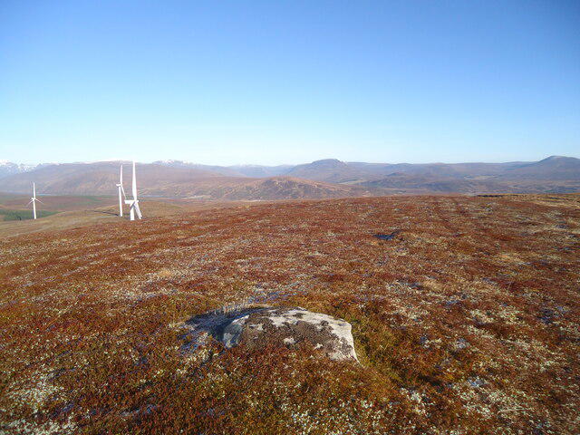 Photo could not load
NH3566 : Northern slopes of Beinn nan Cabag
Michael Earnshaw
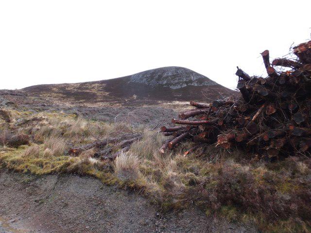 Photo could not load
NH3566 : Beinn nan Cabag from Corriemoillie Forest
Alpin Stewart
Hill facts and local notes
Classifications
Elevation
474m
1,555 ft
Prominence
138m
Coordinates
57.6618, -4.7615
NH353668
OS Map
20
Explorer: 437S
At the Summit
The summit features a distinctive cairn, a perfect spot for photography, along with panoramic views of the surrounding peaks.
Terrain & Geology
Beinn nan Cabag is predominantly formed from granite with patches of schist, typical of the rugged Scottish Highlands. The area showcases classic glacial features such as U-shaped valleys and craggy hilltops.
Views & Scenery
From the summit, you can see the rugged peaks of the Cairngorms to the east and the expansive Glen Affric to the north.
History & Heritage
Name Origin
Beinn nan Cabag translates to 'Mountain of the Bags', which is said to refer to the local folklore of the area's past inhabitants who carried their belongings on their backs.
Historical Significance
The region has been a crucial part of local history, connected to the Gaelic culture and historically significant land usage.
Getting There & Facilities
Check current local access restrictions, parking rules and transport timetables before travelling. These notes do not confirm public access to the summit.
Parking
There is a small car park at the start of the Glen Affric road (NH 309 254), suitable for about 10 cars.
Public Transport
The nearest bus service operates from Inverness to Cannich, from where it's a short taxi ride to the starting point.
Nearby Facilities
Cannich has a small shop and a couple of cafes, but facilities are limited and it is advised to carry your own supplies.
Safety Information
Known Hazards
- Watch out for loose rocks and sudden weather changes. Mist can envelop the area swiftly, leading to confusion in navigation.
General Safety Tips
- Check weather conditions before setting out
- Carry appropriate clothing and equipment
- Let someone know your planned route
- Take a map, compass, and GPS device
- Carry emergency supplies: food, water, first aid kit, torch
Hills
Some common questions about the hills answered
Are there group walks up Beinn nan Cabag?
Many walkers use Walkmates to join or organise walks with others. You can check for group walks around Beinn nan Cabag through the maps
Are there other walkers around Beinn nan Cabag?
Activity varies by location and time, but Walkmates lets you see whether others have shared walks or shown interest in this area. Find other people through the walking friends search walking friends for Beinn nan Cabag search or of course create your own walk for Beinn nan Cabag
Can I organise a walk to Beinn nan Cabag?
Yes. If there aren’t any walks listed already, you can create a walk and make it available for others to join.
If you're signed up to Walkmates, you can create a walk to Beinn nan Cabag.
How do I find a walk up this hill?
There are often multiple ways to walk this hill, depending on experience and route preference. Walkmates helps you explore walks and routes that others have shared.
Can I suggest a new route up Beinn nan Cabag?
Yes. You can suggest or create routes to share with others. Walkmates focuses on the social side of walking, so routes are used to help people organise walks and explore areas together, rather than as detailed navigation tools or route libraries.
Other uses really appreciate knowledgeable walkers sharing their routes. Share your favourite route to Beinn nan Cabag here
The is an error or something incorrect about this hill. How do I let you know?
We always strive to keep the information on Walkmates as accurate as possible. If you find an error, please let us know through the contact form and we'll aim to correct it as quickly as possible
Community Discussion
Comments
Location
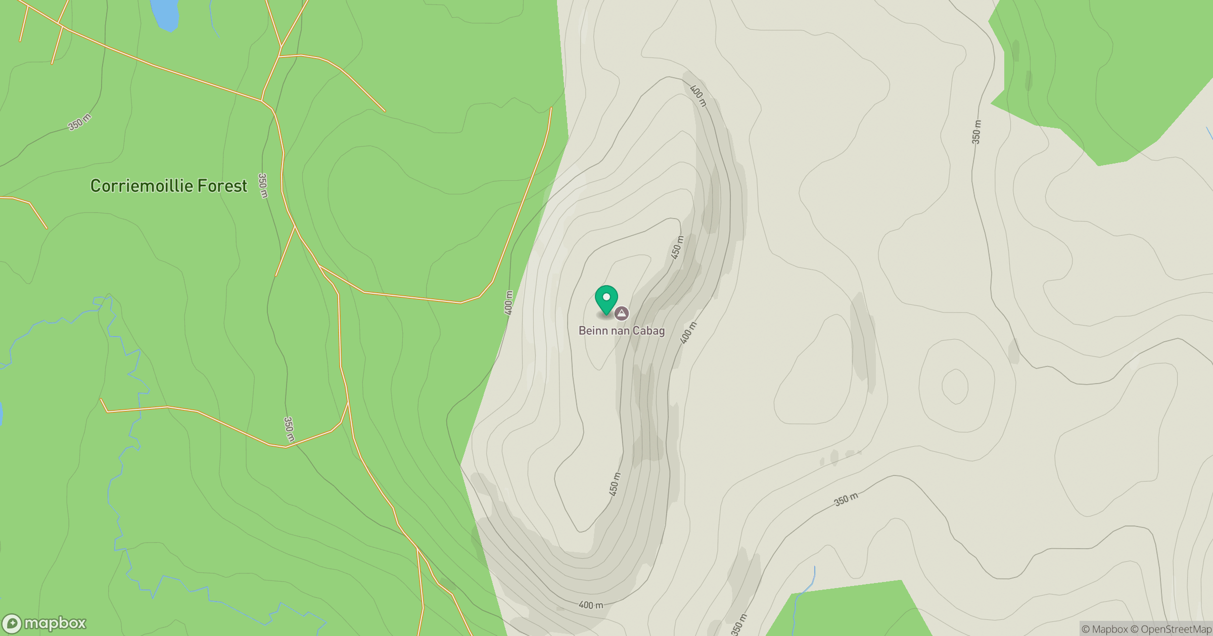
Grid reference: NH353668
View on OpenStreetMapOpens a map in a new tab, centred on the hill.
Hills within 30 km
Straight-line distance, not a walking route or confirmation of access.
Cul Mor
393m
Seana Bhraigh
926m
Sgurr a' Choire Ghlais
1,084m
Beinn a' Bhric
442m
Carn na Dubh Choille
480m
No comments yet. Be the first.