

Meall a' Ghrianain
Good walks are even better shared.
Overview
Meall a' Ghrianain: A Highland Gem
Meall a' Ghrianain, standing at an impressive 878 meters, truly deserves its title as a Munro. This striking mountain is nestled in the heart of the Scottish Highlands and offers a delightful mix of challenge and breathtaking views.
Geology
The mountain's bedrock is ancient gneiss, giving it a rugged and timeless feel. For geology enthusiasts, Meall a' Ghrianain provides a peek into Scotland's geological past, with its intriguing formations and features telling stories that date back millions of years.
Routes
North Ridge Route
Starting from the A9 layby near the River Calder, the North Ridge Route presents a moderate hike for those looking to stretch their legs. The trail winds up gently, rewarding you with magnificent vistas at every turn. Expect rocky outcrops and some heather to accompany you on your ascent.
Summit Features
Upon reaching the summit, you'll be greeted by a large stone cairn meticulously assembled by previous adventurers. This is a great spot for a celebratory snack (perhaps a 'Scottish shortbread' moment?). The views from the top are nothing short of spectacular.
Terrain Type
The terrain varies beautifully, featuring a pleasant mix of grassy slopes with rocky patches. However, watch your step; the damp parts can leave your shoes singing a soggy tune if you're not careful.
Views
From the summit, gaze upon a sweeping panorama that includes the Monadhliath range, Loch Ness, and the Great Glen. On a clear day, don’t forget to bring your binoculars—you might spot those elusive highland mists or a wandering deer!
Hazards
As with many adventures in the Highlands, be prepared for sudden weather changes. Slippery paths pose a little risk, especially those rocky bits after a good Scots' drizzle.
Nearby Summits
Feel like extending your hike? The nearby Carn a' Mhaim, standing at 825 meters, beckons hikers looking for more elevation.
Access
Nearest Parking: Located at a layby on the A9, there is enough room for several cars.
Public Transport: Public transport is at a premium, but with a bus to Inverness followed by local connections, you won't be left in the lurch.
Nearest Town: Inverness, the Highland capital, is about 25 km away.
Facilities
Facilities are limited at the trailhead, but the nearest town, Inverness, is full of cafes and shops to fuel up before or after your hike.
History
Name Meaning
'Meall a' Ghrianain' translates to 'Hill of the Sun'—an apt name for a mountain where the sun often breaks through the clouds just when you need it most.
Significance
This Munro is not just a peak; it’s a part of Scotland's outdoor tradition, drawing countless hikers eager to experience the beauty of the Highlands.
In conclusion, Meall a' Ghrianain isn’t just a mountain; it’s an experience waiting to unfold. So lace up those hiking boots, and don’t forget your camera—you’ll want to catch those views (and the inevitable photo of you pretending to lift the cairn)!
Explore routes near Meall a' Ghrianain
Public walks starting within 80 km of this hill. Nearby does not mean a route reaches the summit; check its map and access before setting out.
Loch Migdale from Torroy: Spinningdale pinewood and loch shore walk
View route
Inverness: River Ness and Caledonian Canal circuit
View route
Beinn Eighe Lancaster Wreckage at Coire Mhic Fhearchair
View route
Ben Klibreck
View route
Route planning notes
These notes describe possible approaches, not verified navigable routes or permission to cross land. Check current paths, local access rules and conditions before setting out.
North Ridge Route
Starting from the A9 layby near the River Calder, this route offers a gradual ascent with stunning views of the surrounding hills.
Make a day of it, together
Find someone to share the walk with, or organise a day out along a route you like.
Photo Gallery
View all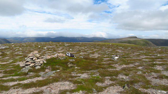 Photo could not load
NH3677 : Summit of Meall a' Ghrianain - view towards Beinn a' Chaisteil
Colin Park
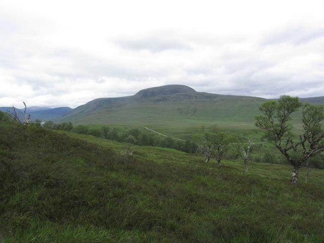 Photo could not load
NH3677 : View to Meall a' Ghrianain from above Strathvaich Lodge
Colin Park
Hill facts and local notes
Classifications
Elevation
772m
2,533 ft
Prominence
127m
Coordinates
57.7582, -4.7487
NH365775
OS Map
20
Explorer: 437N
At the Summit
The summit features a large stone cairn, often decked with offerings from hikers who've made it to the top. On a clear day, you might even catch sight of the distant Cairngorms.
Terrain & Geology
The mountain is primarily composed of ancient gneiss rock, typical of the Scottish Highlands. This makes it a fascinating area for geological studies, showcasing the region's complex geological history.
Views & Scenery
From the summit, you can see the expansive Monadhliath range, Loch Ness to the south, and stretches of the Great Glen. It's a panorama that makes your heart sing (or at least hum a catchy tune).
History & Heritage
Name Origin
The name 'Meall a' Ghrianain' translates to 'Hill of the Sun', possibly referring to the hill's sunny aspects or its prominent position in the landscape.
Historical Significance
This mountain has been a popular destination for hikers and mountaineers for many years, contributing to the rich tapestry of outdoor culture in Scotland.
Getting There & Facilities
Check current local access restrictions, parking rules and transport timetables before travelling. These notes do not confirm public access to the summit.
Parking
There is parking available at a designated layby on the A9, which is just a short walk to the start of the trail.
Public Transport
Public transport options are relatively limited, but you can catch a bus to Inverness and take a connecting bus to near the starting point.
Nearby Facilities
Facilities are limited near the trailhead, but in Inverness, you will find cafes, restaurants, and public toilets.
Safety Information
Known Hazards
- Be cautious of sudden weather changes typical of the Highlands. Paths can become slippery after rain, especially on rocky sections.
General Safety Tips
- Check weather conditions before setting out
- Carry appropriate clothing and equipment
- Let someone know your planned route
- Take a map, compass, and GPS device
- Carry emergency supplies: food, water, first aid kit, torch
Hills
Some common questions about the hills answered
Are there group walks up Meall a' Ghrianain?
Many walkers use Walkmates to join or organise walks with others. You can check for group walks around Meall a' Ghrianain through the maps
Are there other walkers around Meall a' Ghrianain?
Activity varies by location and time, but Walkmates lets you see whether others have shared walks or shown interest in this area. Find other people through the walking friends search walking friends for Meall a' Ghrianain search or of course create your own walk for Meall a' Ghrianain
Can I organise a walk to Meall a' Ghrianain?
Yes. If there aren’t any walks listed already, you can create a walk and make it available for others to join.
If you're signed up to Walkmates, you can create a walk to Meall a' Ghrianain.
How do I find a walk up this hill?
There are often multiple ways to walk this hill, depending on experience and route preference. Walkmates helps you explore walks and routes that others have shared.
Can I suggest a new route up Meall a' Ghrianain?
Yes. You can suggest or create routes to share with others. Walkmates focuses on the social side of walking, so routes are used to help people organise walks and explore areas together, rather than as detailed navigation tools or route libraries.
Other uses really appreciate knowledgeable walkers sharing their routes. Share your favourite route to Meall a' Ghrianain here
The is an error or something incorrect about this hill. How do I let you know?
We always strive to keep the information on Walkmates as accurate as possible. If you find an error, please let us know through the contact form and we'll aim to correct it as quickly as possible
Community Discussion
Comments
Location
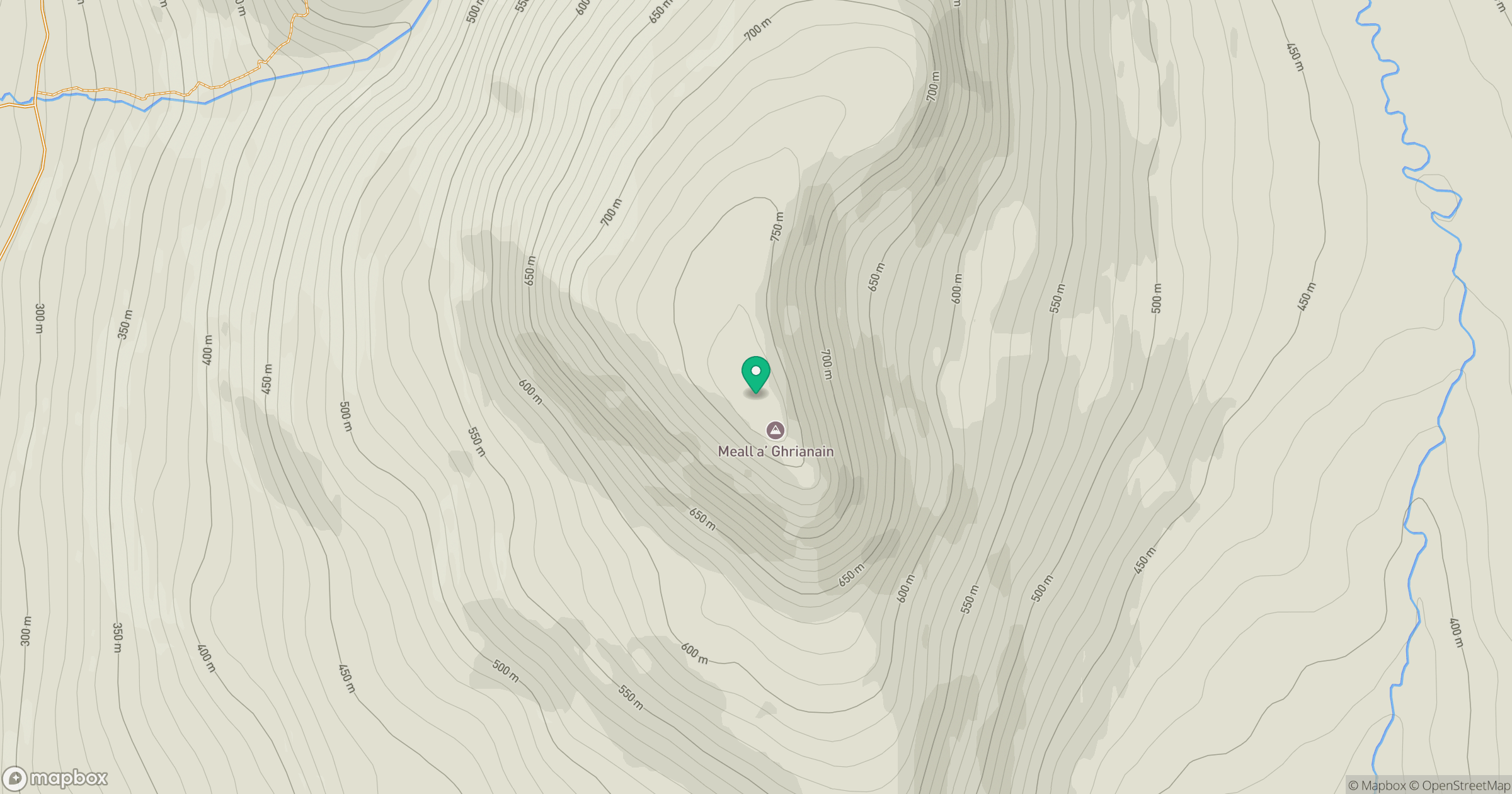
Grid reference: NH365775
View on OpenStreetMapOpens a map in a new tab, centred on the hill.
Hills within 30 km
Straight-line distance, not a walking route or confirmation of access.
Seana Bhraigh
926m
Cul Mor
393m
Beinn a' Chaisteil
787m
Meall a' Chaorainn
632m
Meall a' Chuaille
629m
No comments yet. Be the first.