
Carn na Cre
Good walks are even better shared.
Overview
Introduction
Nestled in the breathtaking Scottish Highlands, Carn na Cre is a hidden gem that caters to both novice and seasoned hikers. At an elevation of 509 meters, this Marilyn offers a satisfying climb without the toil of more challenging Munros.
Geology
Carn na Cre is primarily composed of granitic rock, typical of the Scottish Highlands. The rocky outcrops provide fascinating geological features that tell tales of ancient times, showcasing the region's rugged beauty.
Route Details
For those looking to tackle this hill, the most popular route is from Beinn na Dòire. This 6.5 km trek usually takes about 3 hours and falls under the moderate category in terms of difficulty. The path may be somewhat muddy at times, but it’s worth every step for the views that await at the summit.
Summit Features
The summit is marked by a modest cairn, perfect for a celebratory selfie. As you stand atop Carn na Cre, you could almost feel like you’re on top of the world – or at least the Highlands!
Terrain
Expect rocky outcrops and grassy expanses, making the ascent feel comfortable on the whole. Just watch out for the occasional squelchy patch if the weather has been unkind.
Views
The views you’ll encounter are nothing short of spectacular. From the summit, you can admire the picturesque Glen Affric and nearby peaks, with the best seasons being spring and early summer when the landscape is vibrant with colour.
Safety Hazards
While the ascent is manageable, take note of muddy patches and loose rocks. Remember, the only thing you should be leaving behind is your footprints!
Access and Amenities
The nearest parking is a small layby at NH308592, just a stone's throw from the start of your adventure. Remember that public transport is limited, so plan accordingly. The closest town is Drumnadrochit, where you can refuel with some (well-earned) scones and coffee post-hike.
Conclusion
With its remarkable views, rich geology, and moderate hike, Carn na Cre is an ideal outing for those looking to immerse themselves in the splendid Highland scenery. So strap on those boots, pack a sandwich, and head for the hills. Who knows what delightful sights await?
Happy hiking!
Explore routes near Carn na Cre
Public walks starting within 80 km of this hill. Nearby does not mean a route reaches the summit; check its map and access before setting out.
Glen Affric: Coire Loch Woodland Trail
View route
Beinn Eighe Lancaster Wreckage at Coire Mhic Fhearchair
View route
Loch Affric full circuit from River Affric
View route
Inverness: River Ness and Caledonian Canal circuit
View route
Route planning notes
These notes describe possible approaches, not verified navigable routes or permission to cross land. Check current paths, local access rules and conditions before setting out.
Beinn na Dòire to Carn na Cre
A scenic route that includes several ascents and offers stunning views of the surrounding countryside.
Make a day of it, together
Find someone to share the walk with, or organise a day out along a route you like.
Hill facts and local notes
Classifications
Elevation
463m
1,519 ft
Prominence
118m
Coordinates
57.5897, -4.8348
NH306590
OS Map
26
Explorer: 436S
At the Summit
A modest cairn marks the summit, providing a perfect backdrop for that obligatory summit selfie.
Terrain & Geology
Carn na Cre is primarily composed of granitic rock, typical of the Scottish Highlands, with exposed bedrock offering insights into the region's geological history.
Views & Scenery
From the summit, hikers can enjoy panoramic views of the nearby hills and valleys, including the picturesque Glen Affric.
History & Heritage
Name Origin
The name 'Carn na Cre' translates from Gaelic as 'Hill of the Cattle', hinting at its pastoral past.
Historical Significance
'Carn' refers to a mound or heap, indicating the historic significance of the site as a place of gathering.
Getting There & Facilities
Check current local access restrictions, parking rules and transport timetables before travelling. These notes do not confirm public access to the summit.
Parking
There is a small layby at NH308592, suitable for a few cars.
Public Transport
Limited public transport options are available; check local services for the nearest bus stops.
Nearby Facilities
Drumnadrochit offers cafes, shops, and public toilets for hikers before or after their trek.
Safety Information
Known Hazards
- Muddy patches may be encountered, especially in wet weather. Be cautious of loose rocks along the ascent.
General Safety Tips
- Check weather conditions before setting out
- Carry appropriate clothing and equipment
- Let someone know your planned route
- Take a map, compass, and GPS device
- Carry emergency supplies: food, water, first aid kit, torch
Hills
Some common questions about the hills answered
Are there group walks up Carn na Cre?
Many walkers use Walkmates to join or organise walks with others. You can check for group walks around Carn na Cre through the maps
Are there other walkers around Carn na Cre?
Activity varies by location and time, but Walkmates lets you see whether others have shared walks or shown interest in this area. Find other people through the walking friends search walking friends for Carn na Cre search or of course create your own walk for Carn na Cre
Can I organise a walk to Carn na Cre?
Yes. If there aren’t any walks listed already, you can create a walk and make it available for others to join.
If you're signed up to Walkmates, you can create a walk to Carn na Cre.
How do I find a walk up this hill?
There are often multiple ways to walk this hill, depending on experience and route preference. Walkmates helps you explore walks and routes that others have shared.
Can I suggest a new route up Carn na Cre?
Yes. You can suggest or create routes to share with others. Walkmates focuses on the social side of walking, so routes are used to help people organise walks and explore areas together, rather than as detailed navigation tools or route libraries.
Other uses really appreciate knowledgeable walkers sharing their routes. Share your favourite route to Carn na Cre here
The is an error or something incorrect about this hill. How do I let you know?
We always strive to keep the information on Walkmates as accurate as possible. If you find an error, please let us know through the contact form and we'll aim to correct it as quickly as possible
Community Discussion
Comments
Location
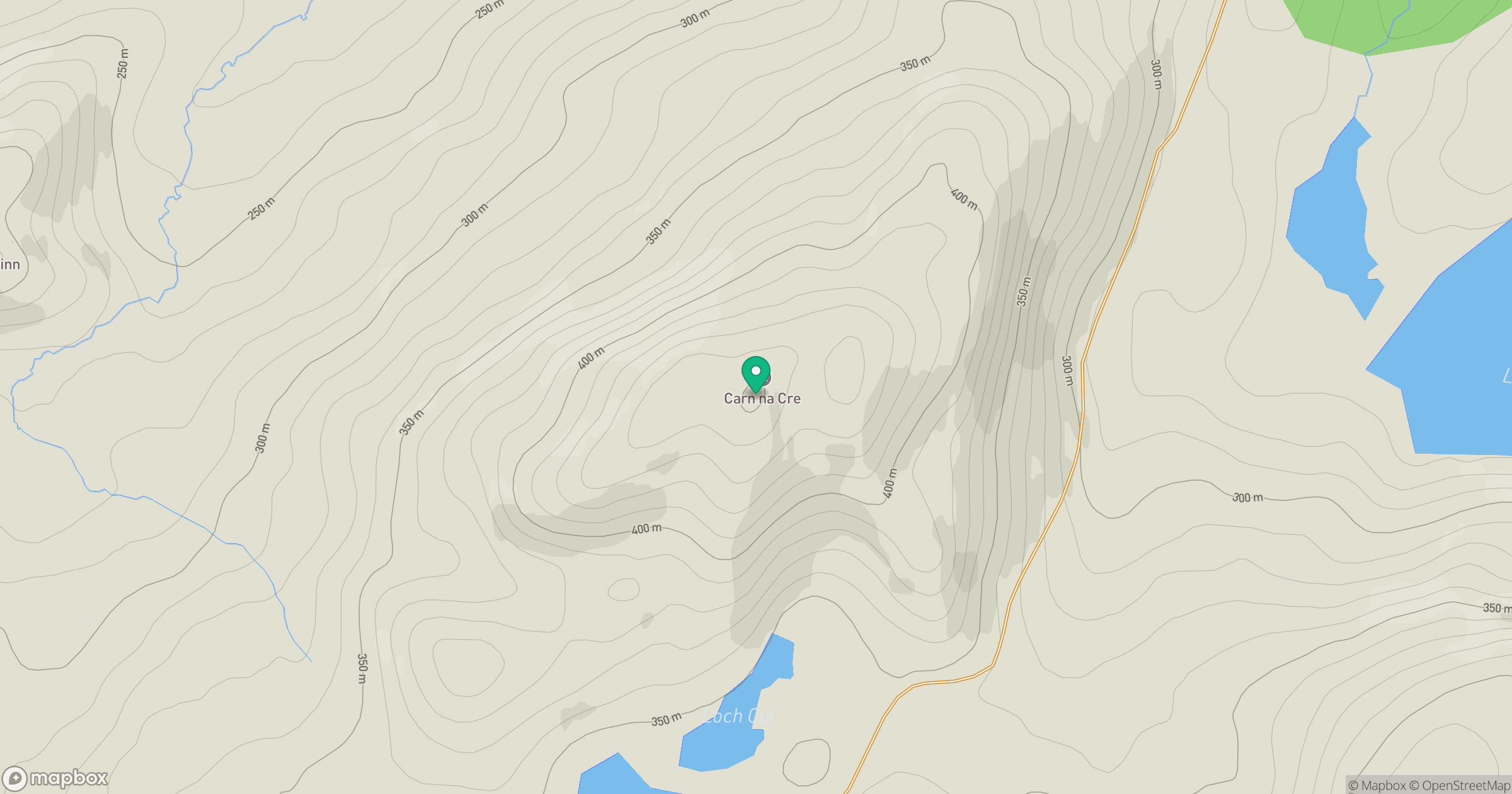
Grid reference: NH306590
View on OpenStreetMapOpens a map in a new tab, centred on the hill.
Hills within 30 km
Straight-line distance, not a walking route or confirmation of access.
Sgurr a' Choire Ghlais
1,084m
Cul Mor
393m
Seana Bhraigh
926m
Mullach Coire Mhic Fhearchair
1,015m
Meallan a' Mhuthaidh Mor
513m
No comments yet. Be the first.