

Beinn Mheadhoin
Good walks are even better shared.
NM7951 : Beinn Mheadhoin seen from Meall na Fìdhle
Richard Webb Photo source
Overview
Beinn Mheadhoin: A Hiker's Paradise
Nestled in the heart of the Scottish Highlands, Beinn Mheadhoin stands tall at 1182 meters. Like a sentinel, it watches over the majestic landscape, offering adventurers both challenges and rewards.
Geology
This Munro is primarily composed of granite—a rock as fierce and unyielding as the Scottish weather itself! It showcases a myriad of geological formations that tell a story of ancient volcanic activity and glacial sculpting. Rock enthusiasts might just feel as if they've stumbled upon a natural history book laid out across the hills.
Routes to the Summit
The most popular route starts from the A939. It's a challenging 14-kilometre round trip, weaving through heather and rocky paths. Don’t forget to stop and catch your breath — you’ll be rewarded with views that could make you weep with joy (or exhaustion)!
Summit Features
The summit is marked by a striking cairn that beckons hikers for a photo op. After all, a summit without a selfie is just a hill, right? From here, you can gaze upon the Cairngorms and the iconic Loch Avon—nature's artwork at its finest.
Terrain
Prepare for a delightful blend of rugged outcrops and squishy terrain. A word to the wise: waterproof boots are your best friends on this trek, unless you enjoy muddy surprises!
Views
The panoramic views from Beinn Mheadhoin can compete with any postcard. Spring and late summer are the prime times to soak in these vistas, especially with the heather blooming in shades of purple. If you fancy an early start, mornings often gift you with crisp air and stunning sky colours.
Hazards
Don't let the beauty fool you! Weather can change in the blink of an eye, bringing fog and sudden downpours. Keep your wits about you, and make sure you're adequately prepared. After all, safety doesn’t take a day off!
Access and Facilities
The nearest parking spots are scattered along the A939—just watch for the local signs to avoid a slap on the wrist by parking wardens. The fine folks in Aviemore, about 17 km away, have cafes, toilets, and everything else a hiker needs before tackling this great adventure.
Conclusion
In summary, Beinn Mheadhoin offers a harmonious blend of challenge and beauty, perfect for both seasoned hikers and newcomers alike. So pack those boots, grab a friend (or two), and hit the trail! You won’t regret it.
Happy hiking!
Explore routes near Beinn Mheadhoin
Walks starting near this hill. Open a route to check its map, distance and full itinerary.
Ben Nevis via Mountain Path
View route
Banavie to Glen Loy Aqueduct: Neptune’s Staircase Canal Towpath
View route
Crinan Canal: Bellanoch and Dunardry towpath return
View route
Beinn Ime from Succoth
View route
Route planning notes
These notes describe possible approaches. Check a route's map and access information when planning your walk.
Classic Approach from Glen Affric
This popular route starts from the car park at the end of Glen Affric road and follows a well-marked trail through the picturesque glen. The path initially leads through forested areas before opening up onto the moorland. Ascend via the southern ridge to reach the summit of Beinn Mheadhoin. The views from the top are spectacular, encompassing the surrounding Munros and Loch Affric.
Circular Route via Gleann nam Fiadh
This circular route offers variety and stunning scenery. Starting at the Glen Affric car park, head northwest through Gleann nam Fiadh, following the river before ascending the western flank of Beinn Mheadhoin. After reaching the summit, descend via the southern ridge and rejoin the main path in Glen Affric for the return leg.
Short Route from Loch Beinn a' Mheadhoin
Ideal for those looking for a shorter outing, this route begins at the small parking area near the eastern end of Loch Beinn a' Mheadhoin. Follow the path along the lochside before turning northwards to ascend the steep southern slopes of Beinn Mheadhoin. This direct route is a shorter but more strenuous option.
Alternative Route via Coire Leachavie
This less-travelled route begins at the Glen Affric car park and heads southwest into Coire Leachavie. Ascend through the coire, which offers a more rugged and remote feel. The final climb to the summit involves some steep sections, but you'll likely have the mountain to yourself.
Extended Ridge Walk from Mullach Fraoch-choire
For experienced hikers, this extended route links Beinn Mheadhoin with the nearby ridge of Mullach Fraoch-choire. Starting from the Glen Affric car park, ascend Mullach Fraoch-choire first and then traverse the ridge to Beinn Mheadhoin. The route is long and requires good navigation skills, but the ridgeline views are well worth the effort.
Make a day of it, together
Find someone to share the walk with, or organise a day out along a route you like.
Photo Gallery
View all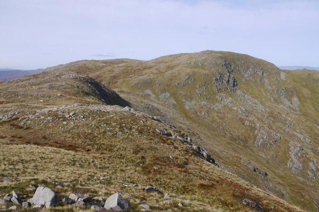 Photo could not load
NM7951 : Beinn Mheadhoin seen from Meall na Fìdhle
Richard Webb
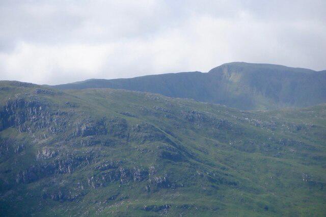 Photo could not load
NM8051 : Beinn Mheadhoin
Richard Webb
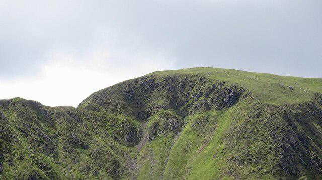 Photo could not load
NM8051 : Tricky step, East ridge, Beinn Mheadhoin
Richard Webb
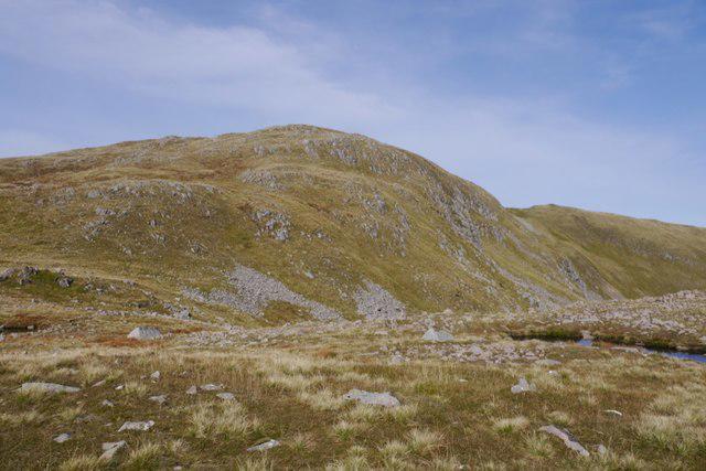 Photo could not load
NM7951 : Beinn Mheadhoin, Kingairloch
Richard Webb
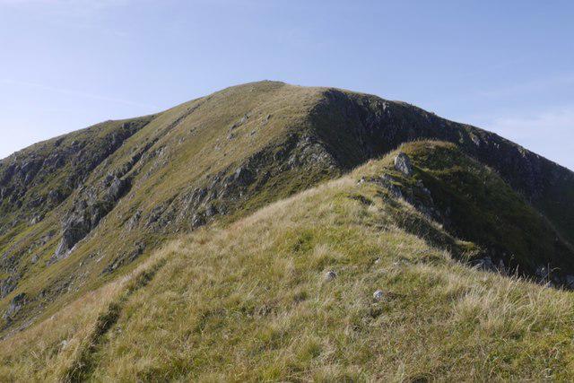 Photo could not load
NM8051 : Steep step in the east ridge of Beinn Mheadhoin
Richard Webb
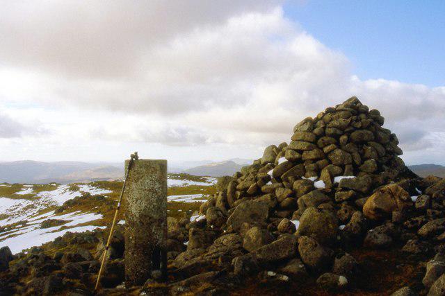 Photo could not load
NM7951 : Summit of Beinn Mheadhoin
Alan Reid
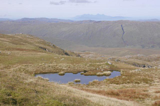 Photo could not load
NM7951 : Near the summit of Beinn Mheadhoin
Richard Webb
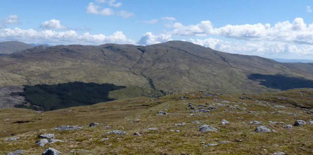 Photo could not load
NM7951 : Beinn Mheadhoin from Beinn Chlaonleud
Phillip Williams
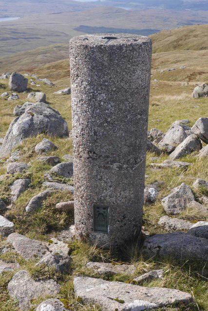 Photo could not load
NM7951 : Beinn Mheadhoin triangulation pillar
Richard Webb
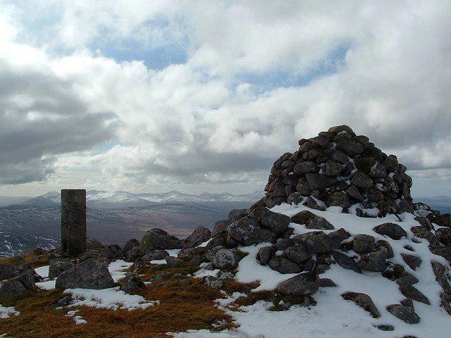
NM7951 : Beinn Mheadhoin
Raibeart MacAoidh
Hill facts and local notes
Classifications
Elevation
739m
2,425 ft
Prominence
568m
Coordinates
56.6031, -5.5874
NM799514
OS Map
49
Explorer: 383E
At the Summit
The summit features a prominent cairn, constructed with local boulders, which serves as a perfect spot for a well-earned lunch break. There's also a stunning view over the Cairngorms and the endless heather-clad hills.
Terrain & Geology
Beinn Mheadhoin is primarily composed of granite, a tough and resilient rock that has been shaped by glacial action over thousands of years. The surrounding areas showcase a rich tapestry of geology from ancient volcanic activity to sedimentary deposits, offering a visual feast for geology buffs.
Views & Scenery
From the summit, you'll be treated to breathtaking views of the surrounding Cairngorms, Loch Avon, and in the distance, the impressive Ben Nevis when the weather allows. It's a panorama worth every puff of effort.
History & Heritage
Name Origin
The name 'Beinn Mheadhoin' translates to 'the mountain of the middle', reflecting its prominent position in the surrounding landscape.
Historical Significance
Beinn Mheadhoin is a popular destination for walkers and climbers, steeped in local folklore and known for its rugged beauty.
Getting There & Facilities
Parking
Parking is available along the A939 road at designated pull-in spots. However, be mindful of local signage about parking regulations.
Public Transport
Public transport options are limited, with the nearest bus services operating between Aviemore and other towns. Check timetables ahead of your trip, as services can be sporadic.
Nearby Facilities
Aviemore offers a range of facilities including cafes, restaurants, and public toilets. It's advisable to refresh and equip yourself before heading to the hills.
Safety Information
Known Hazards
- Potential for sudden weather changes, poor visibility in fog, and rugged terrain can create risks, especially for less experienced walkers. Make sure to come prepared and equipped!
General Safety Tips
- Check weather conditions before setting out
- Carry appropriate clothing and equipment
- Let someone know your planned route
- Take a map, compass, and GPS device
- Carry emergency supplies: food, water, first aid kit, torch
Hills
Some common questions about the hills answered
Are there group walks up Beinn Mheadhoin?
Many walkers use Walkmates to join or organise walks with others. You can check for group walks around Beinn Mheadhoin through the maps
Are there other walkers around Beinn Mheadhoin?
Activity varies by location and time, but Walkmates lets you see whether others have shared walks or shown interest in this area. Find other people through the walking friends search walking friends for Beinn Mheadhoin search or of course create your own walk for Beinn Mheadhoin
Can I organise a walk to Beinn Mheadhoin?
Yes. If there aren’t any walks listed already, you can create a walk and make it available for others to join.
If you're signed up to Walkmates, you can create a walk to Beinn Mheadhoin.
How do I find a walk up this hill?
There are often multiple ways to walk this hill, depending on experience and route preference. Walkmates helps you explore walks and routes that others have shared.
Can I suggest a new route up Beinn Mheadhoin?
Yes. You can suggest or create routes to share with others. Walkmates focuses on the social side of walking, so routes are used to help people organise walks and explore areas together, rather than as detailed navigation tools or route libraries.
Other uses really appreciate knowledgeable walkers sharing their routes. Share your favourite route to Beinn Mheadhoin here
The is an error or something incorrect about this hill. How do I let you know?
We always strive to keep the information on Walkmates as accurate as possible. If you find an error, please let us know through the contact form and we'll aim to correct it as quickly as possible
Community Discussion
Comments
Location
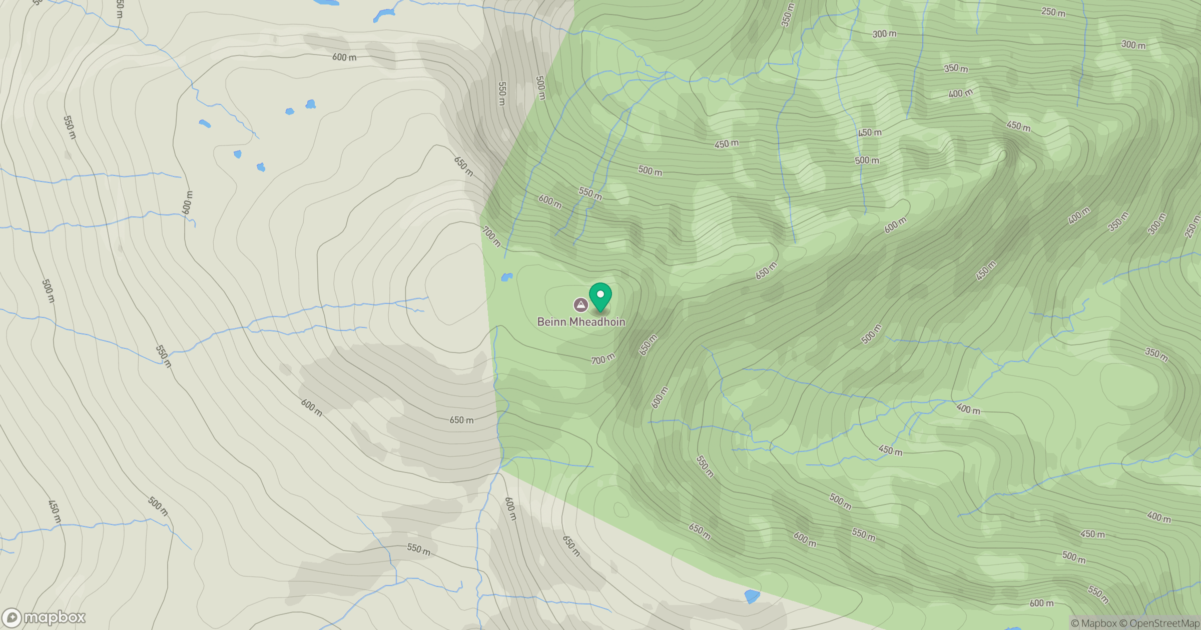
Grid reference: NM799514
View on OpenStreetMapOpens a map in a new tab, centred on the hill.
No comments yet. Be the first.