

Beinn a' Chumhainn
Good walks are even better shared.
Overview
Beinn a' Chumhainn
Introduction
Beinn a' Chumhainn, standing tall at 704 meters, is a charming Marilyn located in the Scottish Highlands. This peak may not make it to the ‘big boys’ league of Munros, but it surely packs a punch for those willing to lace up their hiking boots.
Geology
Made up primarily of schist and quartzite, Beinn a' Chumhainn showcases the classic ruggedness of the Highlands. The rocks, dating back to the Dalradian Supergroup, give a fascinating glimpse into the geological history of the region. If geology gets you excited, you’ll love the different textures and colours found in the stone as you hike!
Routes
One of the most common routes to the summit is from the A82 road. It's a manageable 5.5 km trek that can be comfortably done in around 3.5 hours. Just be sure not to stop too long at the tempting photo opportunities along the way, or you might find you've turned a short outing into a full-day adventure!
Summit Features
Upon reaching the summit, hikers are welcomed by a sturdy cairn and some delightful rocky outcrops. This is the ideal spot to dig into your packed lunch while soaking in the panoramic views. Don't forget to snap a few selfies—after all, your friends need proof that you really did venture beyond the sofa!
Terrain
Expect a mixed bag of terrain: grassy slopes that rise to reveal rocky surfaces and some delightful scrambling as you near the top. Sturdy footwear is recommended to conquer the uneven ground.
Views
From the summit, the sights are simply breathtaking. Loch Awe sprawls beautifully beneath you, and the distance reveals other majestic peaks of the Southern Highlands, including Beinn a' Mhanaich and Ben Cruachan. The best time to appreciate these views? Spring and early autumn, when the colours pop and the air is crisp.
Hazards
As with any Scottish mountain, the weather can change on a dime, so always check conditions before heading out. Loose rocks on the upper sections can lead to slips if you're not careful. A firm footing and a good pair of boots will help keep you upright!
Access
The nearest parking is a layby on the A82, but spots can be limited, especially on sunny weekends. Dalmally is the nearest town, offering basic amenities, whereas a quick trip to Oban will provide you with more options to refuel post-hike.
Facilities
While Dalmally sports a shop and a café, do ensure to check operating hours because it can get quiet. For a bigger meal, Oban is a fantastic choice with its array of eateries and services.
History
The name Beinn a' Chumhainn hints at its rich agricultural past—'Mountain of the Cattle' certainly evokes images of pastoral life that can still be seen today. The mountain is also woven into local folklore and is part of the ecological tapestry of the Highlands, providing habitat for various wildlife.
Conclusion
Whether you're a seasoned hiker or a fresh-faced adventurer, Beinn a' Chumhainn offers a delightful day out. So pack your goodies, grab your friends, and enjoy the great Scottish outdoors. Just don’t forget to leave the ‘cattle’ behind!
Explore routes near Beinn a' Chumhainn
Public walks starting within 80 km of this hill. Nearby does not mean a route reaches the summit; check its map and access before setting out.
Coire Ardair lochan from Aberarder and back
View route
Ben Nevis via Mountain Path
View route
Banavie to Glen Loy Aqueduct: Neptune’s Staircase Canal Towpath
View route
Fort Augustus to Kytra Lock: Caledonian Canal Towpath
View route
Route planning notes
These notes describe possible approaches, not verified navigable routes or permission to cross land. Check current paths, local access rules and conditions before setting out.
From the A82 Road
A straightforward ascent starting from the A82, providing a direct route to the summit with limited navigation challenges.
Make a day of it, together
Find someone to share the walk with, or organise a day out along a route you like.
Photo Gallery
View all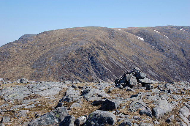 Photo could not load
NN4671 : Summit cairn, Beinn a' Chumhainn
Jim Barton
Hill facts and local notes
Classifications
Elevation
902m
2,959 ft
Prominence
145m
Coordinates
56.8053, -4.5195
NN462710
OS Map
42
Explorer: OL50 385E 393
At the Summit
The summit features a prominent cairn and a rocky outcrop, providing a perfect spot for a well-earned break and some stunning photographs.
Terrain & Geology
Beinn a' Chumhainn is primarily composed of schist and quartzite, which form the rugged cliffs and scree slopes characteristic of the area. The rocks date back to the Dalradian Supergroup.
Views & Scenery
Spectacular views over Loch Awe, the surrounding mountains, and the distant peaks of the Southern Highlands.
History & Heritage
Name Origin
The name Beinn a' Chumhainn translates roughly to 'Mountain of the Cattle', hinting at its pastoral heritage.
Historical Significance
The mountain has long been a part of local folklore, and its rugged terrain provides habitats for various wildlife, making it significant ecologically as well.
Getting There & Facilities
Check current local access restrictions, parking rules and transport timetables before travelling. These notes do not confirm public access to the summit.
Parking
There is a layby on the A82 (NN443742) suitable for a few vehicles, but it can fill up quickly during peak times.
Public Transport
Buses run regularly from Oban and Glasgow to the nearby village of Dalmally, but a car is recommended for closer access.
Nearby Facilities
Dalmally has a few basic facilities including a shop and a café, but for a full-service experience, Oban is the nearest larger town.
Safety Information
Known Hazards
- Check the weather before heading out; sudden changes can occur. Loose rocks on steeper sections pose a risk of slips.
General Safety Tips
- Check weather conditions before setting out
- Carry appropriate clothing and equipment
- Let someone know your planned route
- Take a map, compass, and GPS device
- Carry emergency supplies: food, water, first aid kit, torch
Hills
Some common questions about the hills answered
Are there group walks up Beinn a' Chumhainn?
Many walkers use Walkmates to join or organise walks with others. You can check for group walks around Beinn a' Chumhainn through the maps
Are there other walkers around Beinn a' Chumhainn?
Activity varies by location and time, but Walkmates lets you see whether others have shared walks or shown interest in this area. Find other people through the walking friends search walking friends for Beinn a' Chumhainn search or of course create your own walk for Beinn a' Chumhainn
Can I organise a walk to Beinn a' Chumhainn?
Yes. If there aren’t any walks listed already, you can create a walk and make it available for others to join.
If you're signed up to Walkmates, you can create a walk to Beinn a' Chumhainn.
How do I find a walk up this hill?
There are often multiple ways to walk this hill, depending on experience and route preference. Walkmates helps you explore walks and routes that others have shared.
Can I suggest a new route up Beinn a' Chumhainn?
Yes. You can suggest or create routes to share with others. Walkmates focuses on the social side of walking, so routes are used to help people organise walks and explore areas together, rather than as detailed navigation tools or route libraries.
Other uses really appreciate knowledgeable walkers sharing their routes. Share your favourite route to Beinn a' Chumhainn here
The is an error or something incorrect about this hill. How do I let you know?
We always strive to keep the information on Walkmates as accurate as possible. If you find an error, please let us know through the contact form and we'll aim to correct it as quickly as possible
Community Discussion
Comments
Location
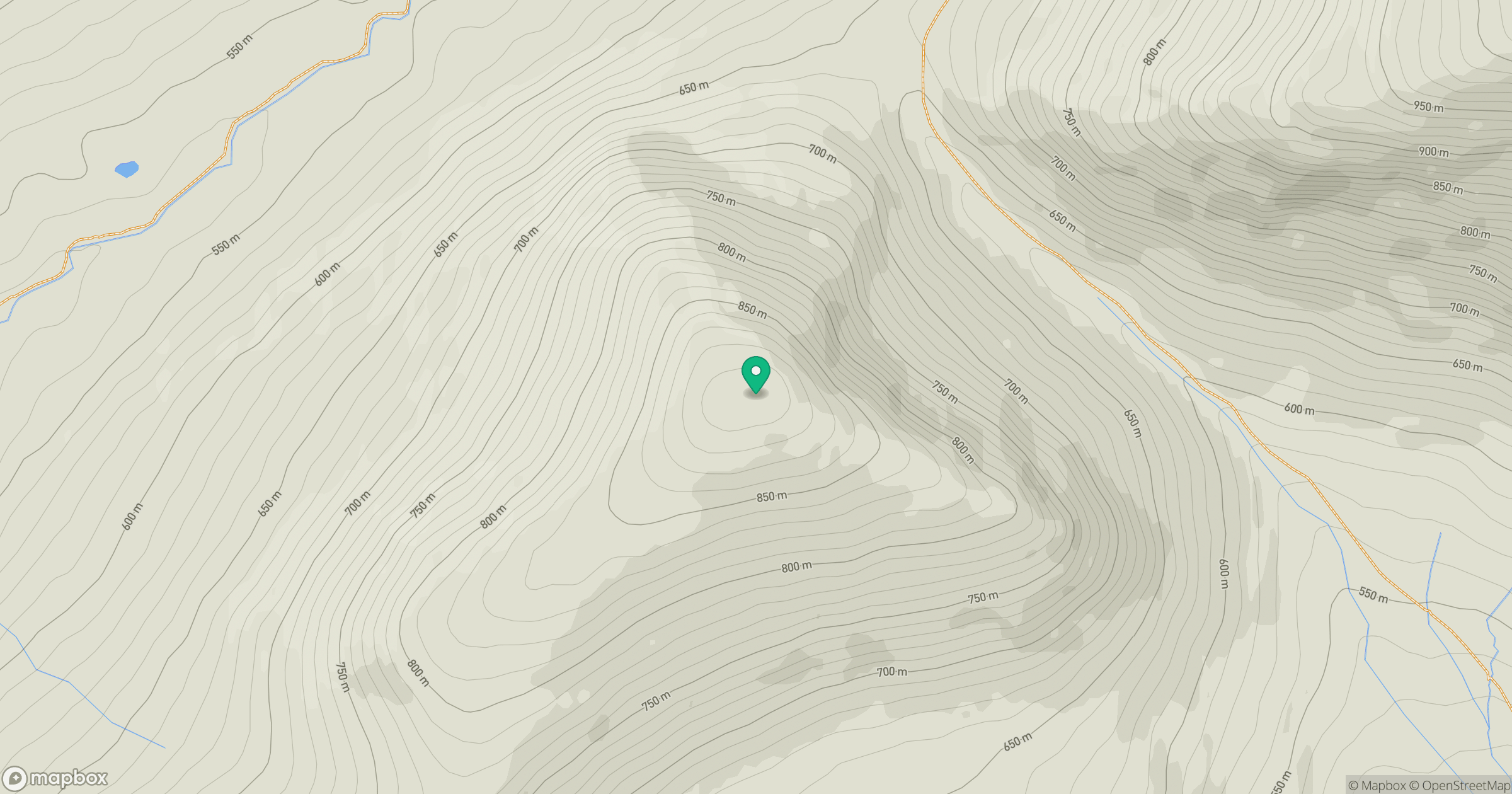
Grid reference: NN462710
View on OpenStreetMapOpens a map in a new tab, centred on the hill.
Hills within 30 km
Straight-line distance, not a walking route or confirmation of access.
Ben Alder
1,148m
Creag Meagaidh
1,128m
Stob Ban
977m
Stob Choire Claurigh
1,177m
Buachaille Etive Mor - Stob Dearg
1,021m
No comments yet. Be the first.