

An Gearanach
Good walks are even better shared.
NN1867 : Upper Glen Nevis, Scottish Highlands
Andrew Tryon Photo source
Overview
An Gearanach: A Hiker’s Delight
Overview
Nestled in the heart of the Scottish Highlands, An Gearanach rises to a proud 982 meters, standing as a sentinel over the breathtaking landscapes below. This Munro, known as 'the snowy one', offers hikers both stunning vistas and a fair bit of adventure.
Routes to the Summit
There are several routes to reach the summit of An Gearanach, each offering unique views and challenges. The most popular, the North Face Route, begins at the car park in Glen Nevis and promises a challenge worthy of any seasoned walker. For those seeking a different perspective, the West Ridge Route offers a moderately strenuous climb combined with delightful scrambling, perfect for adding a few thrills to your hike.
Summit Features
Upon reaching the top, you'll be greeted by a sturdy cairn marking the summit. The views are utterly spectacular, with the sweeping landscapes of the Mamores and the distant reach of Loch Leven stretching in every direction. Bring your camera—this is a view worthy of envy!
Terrain and Conditions
Expect a mix of rocky and grassy terrain, with some sections of loose scree. While the hike is rewarding, be ready for a workout! The Highlands are known for their fickle weather, so pack layers and prepare for anything!
Hazards and Safety
Mind the loose rocks as you navigate the paths, and keep an eye on changing weather conditions. Safety first—don't forget to take the time to enjoy that awe-inspiring view (but not too long, it’s a long way down!).
Access and Facilities
Most visitors access An Gearanach via Glen Nevis. The parking gets pretty packed, so consider starting early to secure your spot. Fort William, just a short drive away, provides all the amenities you may need, plus a variety of good eateries where you can treat yourself post-hike.
Conclusion
In conclusion, An Gearanach is not only a Munro but a passport to some of the most stunning landscapes in Scotland. Whether you're a seasoned hiker or a newcomer to the trails, you’ll find this mountain both striking and rewarding. Just remember to tread carefully, take loads of photos, and maybe keep a snack handy to fuel your adventure!
Happy Hiking!
Explore routes near An Gearanach
Walks starting near this hill. Open a route to check its map, distance and full itinerary.
Ben Nevis via Mountain Path
View route
Banavie to Glen Loy Aqueduct: Neptune’s Staircase Canal Towpath
View route
Fort Augustus to Kytra Lock: Caledonian Canal Towpath
View route
Killin: Falls of Dochart, Finlarig and Moirlanich Longhouse
View route
Route planning notes
These notes describe possible approaches. Check a route's map and access information when planning your walk.
Ring of Steall Circuit
This classic route begins at the car park near the Lower Falls in Glen Nevis. Follow the path along the Water of Nevis towards Steall Meadows and the famous wire bridge. From here, ascend steeply to reach the summit of An Gearanach, the first Munro of the day. Continue along the airy ridge to Stob Coire a' Chairn and Am Bodach, completing the circuit over Sgurr a' Mhaim before descending back to Glen Nevis.
An Gearanach via Steall Meadows
This out-and-back route starts at the Glen Nevis car park and follows the scenic path to Steall Meadows, crossing the wire bridge for an adventurous touch. From there, ascend directly to An Gearanach, enjoying stunning views of Glen Nevis and the surrounding peaks. Retrace your steps for the return journey.
An Gearanach and Stob Coire a' Chairn Traverse
Begin at the Glen Nevis car park and hike into Steall Meadows. After crossing the wire bridge, ascend An Gearanach as the first Munro of the route. Continue along the ridge to Stob Coire a' Chairn before descending via the path leading back to Glen Nevis, making this a slightly shorter alternative to the full Ring of Steall.
An Gearanach and Na Gruagaichean Loop
This circular route starts from Kinlochleven and heads up through Coire na Ba. Ascend An Gearanach first, then follow the ridge southwards to Na Gruagaichean. Descend via Coire na Ba for a quieter but rewarding day in the Mamores.
An Gearanach Short Ascent
For those seeking a shorter day, start at Glen Nevis and focus solely on summiting An Gearanach. Follow the path to Steall Meadows, cross the wire bridge, and make a direct ascent. This route avoids the ridge traverses, making it more manageable while still offering superb views.
Make a day of it, together
Find someone to share the walk with, or organise a day out along a route you like.
Photo Gallery
View all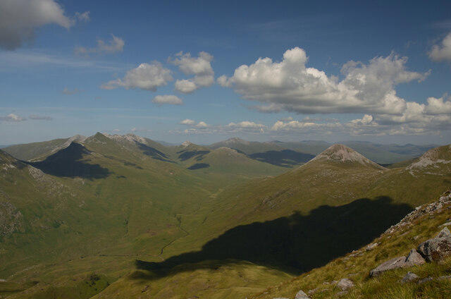 Photo could not load
NN1867 : Upper Glen Nevis, Scottish Highlands
Andrew Tryon
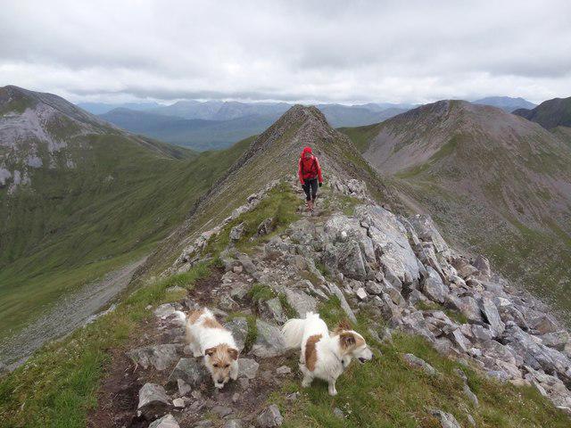 Photo could not load
NN1866 : Summit Arrival
Adam Ward
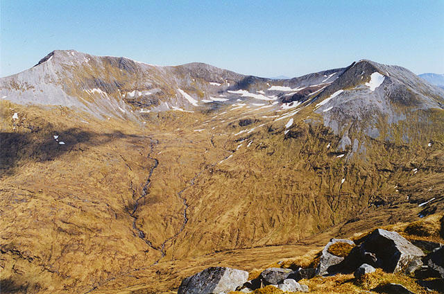 Photo could not load
NN1867 : View south east from An Gearanach
Nigel Brown
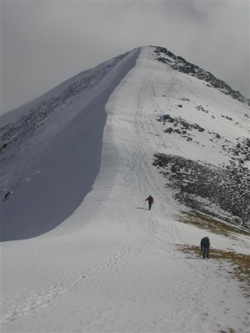 Photo could not load
NN1867 : An Gearanach
Ben Gamble
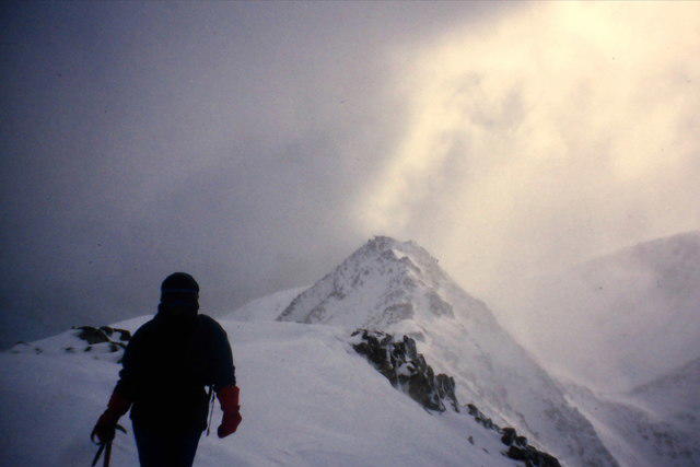 Photo could not load
NN1866 : An Garbhanach from An Gearanach
Richard Law
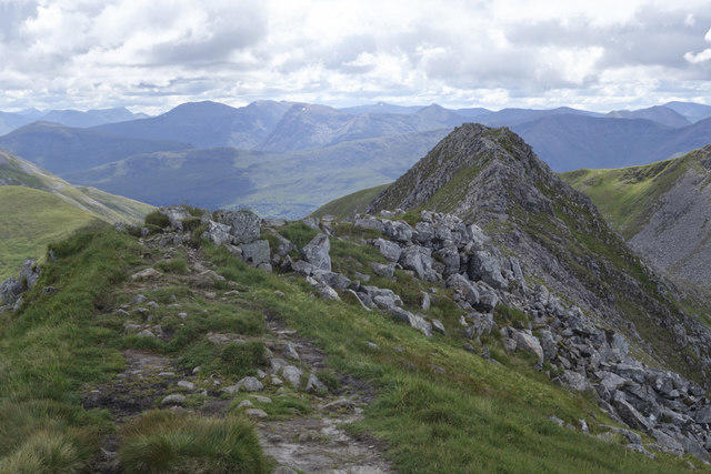 Photo could not load
NN1866 : Along the ridge to An Garbhanach from An Gearanach
Doug Lee
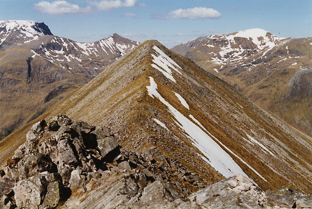 Photo could not load
NN1866 : The summit of An Gearanach
Nigel Brown
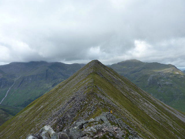 Photo could not load
NN1866 : An Gearanach summit
Ian Stewart
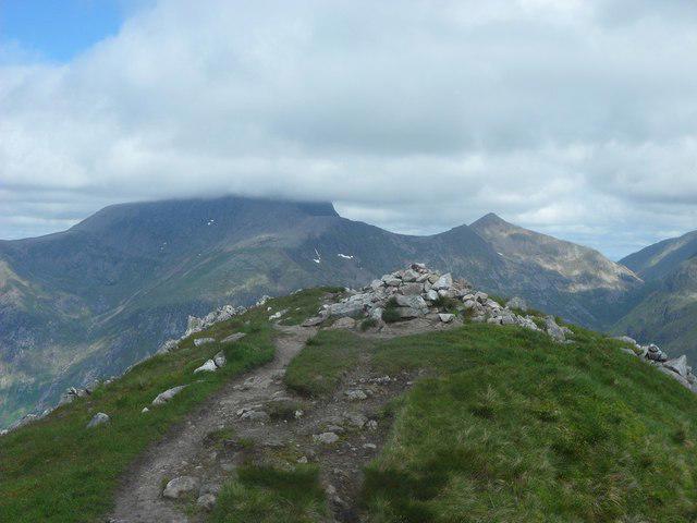 Photo could not load
NN1866 : An Gearnach summit, looking north
Stephen Sweeney
Hill facts and local notes
Classifications
Elevation
982m
3,220 ft
Prominence
152m
Coordinates
56.7592, -4.9662
NN187669
OS Map
41
Explorer: 392
At the Summit
The summit boasts a majestic cairn and breathtaking panoramic views that could make even the most hardened urbanite shed a tear.
Terrain & Geology
The mountain is primarily composed of metamorphic rock, specifically schist, which contributes to its rugged terrain. Its rocky outcrops and crags boast a mix of quartzite, adding to the drama of the landscape.
Views & Scenery
From the summit, you can enjoy spectacular views of the surrounding Mamores and the Nevis Range, with the distant glimmer of Loch Leven on a clear day.
History & Heritage
Name Origin
The name An Gearanach translates from Gaelic as 'the snowy one', possibly referring to its snow-capped peaks in winter.
Historical Significance
An Gearanach is part of the historic Mamores Range, which has long been a favourite among climbers and hikers, celebrated for its natural beauty and ruggedness.
Getting There & Facilities
Parking
The nearest parking is available at the end of Glen Nevis, where a car park accommodates hikers. Arrive early, as it can fill up quickly, especially in summer.
Public Transport
Buses from Fort William provide easy access to Glen Nevis. Remember to check the schedule for return times!
Nearby Facilities
Nearby facilities include public toilets at the Glen Nevis Visitor Centre and various cafés in Fort William to refuel after your hike.
Safety Information
Known Hazards
- Be mindful of loose rocks, particularly on the ascent and descent. Weather can change rapidly in the Highlands, so ensure you're prepared for wind and rain at any time!
General Safety Tips
- Check weather conditions before setting out
- Carry appropriate clothing and equipment
- Let someone know your planned route
- Take a map, compass, and GPS device
- Carry emergency supplies: food, water, first aid kit, torch
Hills
Some common questions about the hills answered
Are there group walks up An Gearanach?
Many walkers use Walkmates to join or organise walks with others. You can check for group walks around An Gearanach through the maps
Are there other walkers around An Gearanach?
Activity varies by location and time, but Walkmates lets you see whether others have shared walks or shown interest in this area. Find other people through the walking friends search walking friends for An Gearanach search or of course create your own walk for An Gearanach
Can I organise a walk to An Gearanach?
Yes. If there aren’t any walks listed already, you can create a walk and make it available for others to join.
If you're signed up to Walkmates, you can create a walk to An Gearanach.
How do I find a walk up this hill?
There are often multiple ways to walk this hill, depending on experience and route preference. Walkmates helps you explore walks and routes that others have shared.
Can I suggest a new route up An Gearanach?
Yes. You can suggest or create routes to share with others. Walkmates focuses on the social side of walking, so routes are used to help people organise walks and explore areas together, rather than as detailed navigation tools or route libraries.
Other uses really appreciate knowledgeable walkers sharing their routes. Share your favourite route to An Gearanach here
The is an error or something incorrect about this hill. How do I let you know?
We always strive to keep the information on Walkmates as accurate as possible. If you find an error, please let us know through the contact form and we'll aim to correct it as quickly as possible
Community Discussion
Comments
Location
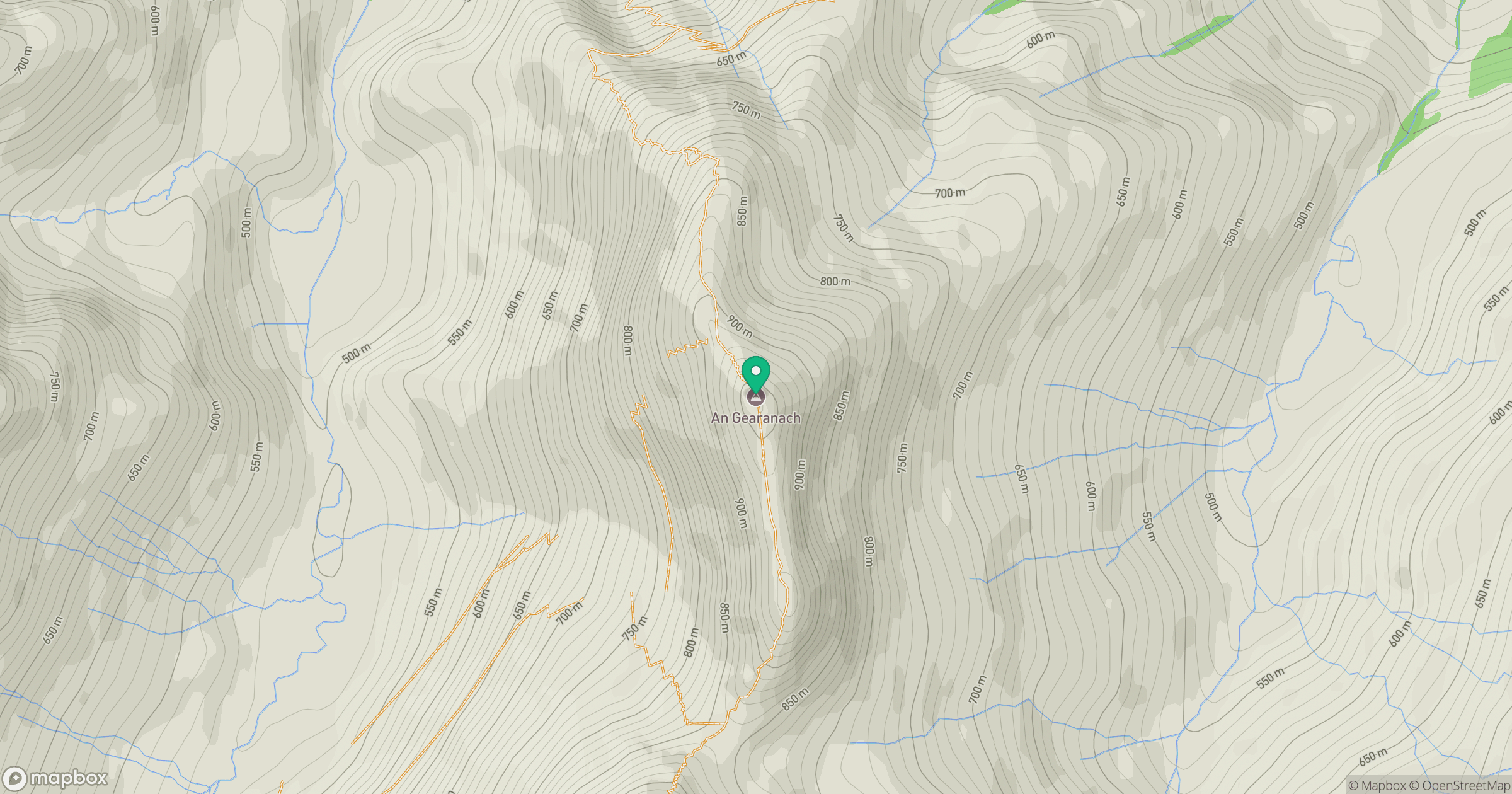
Grid reference: NN187669
View on OpenStreetMapOpens a map in a new tab, centred on the hill.
![Ben Nevis [Beinn Nibheis]](https://cdn.walkmates.com/gallery-images/44e34d25abc849e78f7b99a97863fffb.jpg)
No comments yet. Be the first.