

Beinn a' Chrulaiste
Good walks are even better shared.
NN2456 : Glen Etive and Buachaille Etive Mor viewed from Beinn a' Chrùlaiste
Alan O'Dowd Photo source
Overview
Beinn a' Chrulaiste is an 857 m Corbett north of the A82 at the eastern entrance to Glen Coe, overlooking Buachaille Etive Mor and Rannoch Moor. The western hillwalk and Pink Rib scramble are distinct routes; both need navigation on rough, partly pathless ground.
Overview
Beinn a' Chrulaiste is an 857 m Corbett at the eastern entrance to Glen Coe, north of the A82. It overlooks Buachaille Etive Mor and Rannoch Moor. Glencoe Folk Museum translates its Gaelic name as 'rocky hill'.
Summit and geology
The highest recorded feature is an embedded rock 5 m south of the trig point in a wind shelter. A nearby cairn is another summit-area landmark. Geological Survey work describes a complex exposed margin of the Moor of Rannoch igneous pluton here.
Routes
The complete route descriptions distinguish the Altnafeadh western ascent with Kingshouse circuit from the Pink Rib scrambling circuit. The western ascent can also be retraced, but no separate distance or duration has been assigned to that variant. Do not mix figures between routes. Published time ranges appear in each description instead of a fabricated single-number estimate.
Terrain and preparation
Expect rough heather, intermittent paths and boggy sections. Broad upper ground needs navigation; the eastern slopes become steep. Follow the described eastern descent towards Allt a' Bhalaich rather than a direct line at the hotel. Pink Rib is a Grade 1 scramble with route-finding and loose-rock considerations. Check mountain weather and carry navigation and emergency equipment. Winter conditions require appropriate equipment and skills.
Access and facilities
Altnafeadh and Kingshouse are different access points. Use the stated parking location for the chosen route and take care at the A82. Kingshouse Hotel has ANPR parking charges and restrictions; its older appearance in a route guide is not permission for unrestricted parking. Food and drink are available at the hotel and Way Inn; check current details. Verify the A82 bus timetable and return service before travelling.
Seasonal land management
NatureScot's Central Highlands table, updated 18 March 2026, lists Blackcorries stalking from mid-September to 20 October, excluding Sundays. Consult current local information; the published period is not a blanket closure.
Nearby hills
The nearby Black Mount summit is Meall a' Bhuiridh, DoBIH 233 (1107.9 m), not the same-name Ardgour hill. The summit opposite is Stob Dearg, DoBIH 196 (1021.4 m), on Buachaille Etive Mor; the massif contains more than one summit.
Explore routes near Beinn a' Chrulaiste
Walks starting near this hill. Open a route to check its map, distance and full itinerary.
Ben Nevis via Mountain Path
View route
Banavie to Glen Loy Aqueduct: Neptune’s Staircase Canal Towpath
View route
Killin: Falls of Dochart, Finlarig and Moirlanich Longhouse
View route
Beinn Ime from Succoth
View route
Route planning notes
These notes describe possible approaches. Check a route's map and access information when planning your walk.
Beinn a' Chrulaiste from Altnafeadh via Kingshouse
Walkhighlands' full circuit: 11 km, 652 m ascent, 4–5 hours. Start at Altnafeadh layby (NN221563). Take the West Highland Way east towards Kingshouse for about 400 m, leave at the gate and climb beside the fence to the west ridge. Pass Stob Beinn a' Chrulaiste, a boggy dip and broad slopes to the summit. For the circuit, descend the eastern ridge, turning northeast towards Allt a' Bhalaich as the ground steepens; follow the boggy route down to the track by Kingshouse. Turn right, continue along the minor road, then take the West Highland Way west along the old military road back to Altnafeadh. Retracing the western ascent is an alternative return, but these circuit figures do not describe that shorter option. Paths are intermittent and navigation is needed.
Beinn a' Chrulaiste via the Pink Rib
UKHillwalking's Pink Rib circuit: 7.70 km and 646 m ascent; published time 2–3 hours, labelled Walking. Start from rough A82 parking at NN237553. Identify the rib before leaving the road, cross carefully and cross the West Highland Way, then climb rough heather beside the small stream to the pink rock rib. Scramble the easiest Grade 1 line; watch for loose rock above the waterfall. Continue northeast over the upper slopes to the summit. Descend southeast on the eastern spur, then turn left/east into Coire a' Bhalach instead of heading straight down the steep slopes towards the hotel. Follow the boggy Allt a' Bhalaich route south to Kingshouse, the minor road west, and the West Highland Way back to the ascent approach; retrace the roadside approach to the start, crossing the A82 carefully. Allow for route-finding and scrambling pace. This is a separate scramble, not the western hillwalk. Hotel parking has separate charges and restrictions.
Make a day of it, together
Find someone to share the walk with, or organise a day out along a route you like.
Photo Gallery
View all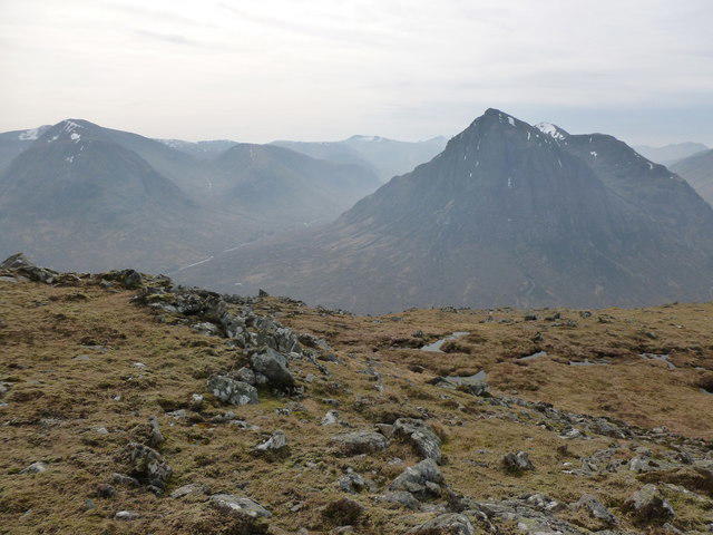 Photo could not load
NN2456 : Glen Etive and Buachaille Etive Mor viewed from Beinn a' Chrùlaiste
Alan O'Dowd
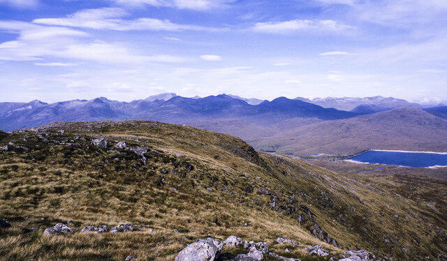 Photo could not load
NN2456 : Ridge extending north from summit area of Beinn a' Chrùlaiste
Trevor Littlewood
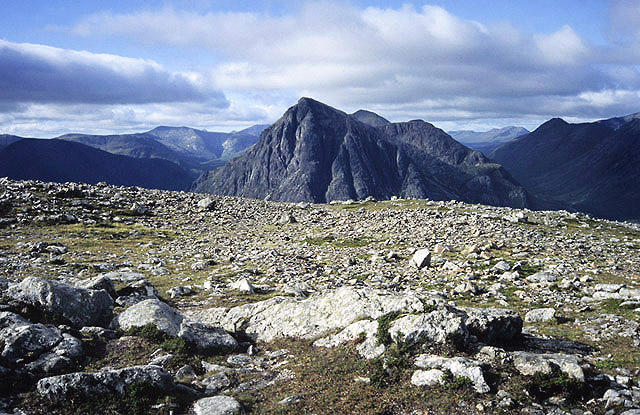 Photo could not load
NN2456 : On Beinn á Chrulaiste
Walter Baxter
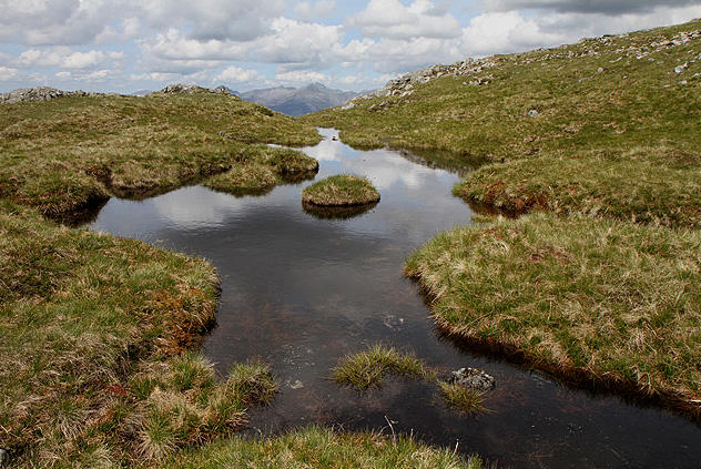 Photo could not load
NN2456 : A pool on Beinn a’ Chrulaiste
Walter Baxter
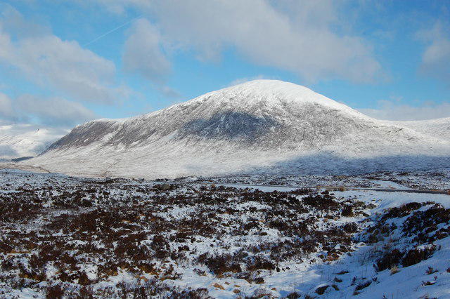 Photo could not load
NN2456 : Beinn a' Chrulaiste
Alex Mcnaughton
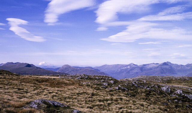 Photo could not load
NN2456 : Rock exposures at summit area of Beinn a' Chrùlaiste
Trevor Littlewood
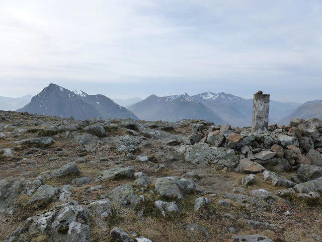 Photo could not load
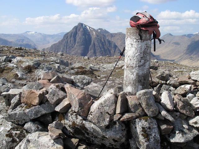
NN2456 : Triangulation pillar on the summit of Beinn a' Chrùlaiste
Alan O'Dowd
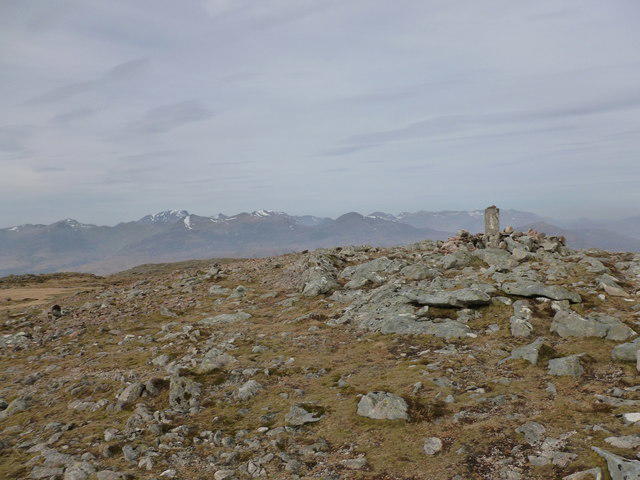 Photo could not load
NN2456 : Triangulation pillar on the summit of Beinn a' Chrùlaiste
Alan O'Dowd
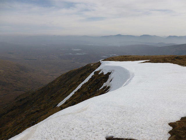 Photo could not load
NN2456 : Snow cornice on the lip of Coire Bhalach, Beinn a' Chrùlaiste
Alan O'Dowd
NN2456 : Beinn a' Chrulaiste
Rude Health
Hill facts and local notes
Classifications
Elevation
857m
2,812 ft
Prominence
464m
Coordinates
56.6689, -4.8635
NN246566
OS Map
41
Explorer: 384
At the Summit
The summit area has a trig point, stone shelter and nearby cairn. The recorded highest feature is an embedded rock 5 m south of the trig point, within the wind shelter.
Terrain & Geology
The Geological Survey memoir places Beinn a' Chrulaiste at a complex, exposed margin of the Moor of Rannoch igneous pluton. The pluton includes quartz-diorite and granite-related rocks.
Views & Scenery
Views across the A82 to Buachaille Etive Mor, along Glen Coe and over Rannoch Moor.
History & Heritage
Name Origin
Beinn a' Chrulaiste is commonly translated from Gaelic as 'rocky hill', as given by Glencoe Folk Museum.
Getting There & Facilities
Parking
The western route starts at the Altnafeadh layby on the A82 (NN221563); the route guide also describes rough parking opposite. Park considerately and follow current signs. The Pink Rib route has a different rough A82 start at NN237553. Kingshouse Hotel uses ANPR parking with charges for non-residents and resident-only overnight use; check its current terms before leaving a vehicle.
Public Transport
Route guides identify buses along the A82 between Glasgow and Fort William, with Kingshouse used for the eastern approach. Check the operator's current timetable, exact stop and return service before travel; no departure times or frequencies are verified here.
Nearby Facilities
Kingshouse Hotel's Way Inn and bars provide food and drink near the eastern end of the circuit; check current opening details. Carry supplies for the hill. Facilities at Glencoe Visitor Centre are separate from the Altnafeadh route start.
Safety Information
Known Hazards
- Intermittent paths, heather and bog can make progress slow; the broad upper slopes need careful navigation in poor visibility.
- The eastern descent steepens and becomes rough. Follow the described line towards Allt a' Bhalaich; avoid a direct descent towards Kingshouse across steep ground.
- Pink Rib requires finding the correct line and Grade 1 scrambling; loose rock occurs above the waterfall.
- A82 approaches and crossings need care. Check mountain weather and carry suitable clothing, navigation and emergency equipment.
Seasonal Hazards
Snow and ice require winter equipment and the skills to use it; summer route times and scrambling grades do not describe winter conditions. NatureScot's Area 6 table, updated 18 March 2026, lists Blackcorries stalking from mid-September to 20 October, excluding Sundays. This is general guidance, not a closure notice; check current local notices and follow reasonable requests to avoid active stalking.
General Safety Tips
- Check weather conditions before setting out
- Carry appropriate clothing and equipment
- Let someone know your planned route
- Take a map, compass, and GPS device
- Carry emergency supplies: food, water, first aid kit, torch
Hills
Some common questions about the hills answered
Are there group walks up Beinn a' Chrulaiste?
Many walkers use Walkmates to join or organise walks with others. You can check for group walks around Beinn a' Chrulaiste through the maps
Are there other walkers around Beinn a' Chrulaiste?
Activity varies by location and time, but Walkmates lets you see whether others have shared walks or shown interest in this area. Find other people through the walking friends search walking friends for Beinn a' Chrulaiste search or of course create your own walk for Beinn a' Chrulaiste
Can I organise a walk to Beinn a' Chrulaiste?
Yes. If there aren’t any walks listed already, you can create a walk and make it available for others to join.
If you're signed up to Walkmates, you can create a walk to Beinn a' Chrulaiste.
How do I find a walk up this hill?
There are often multiple ways to walk this hill, depending on experience and route preference. Walkmates helps you explore walks and routes that others have shared.
Can I suggest a new route up Beinn a' Chrulaiste?
Yes. You can suggest or create routes to share with others. Walkmates focuses on the social side of walking, so routes are used to help people organise walks and explore areas together, rather than as detailed navigation tools or route libraries.
Other uses really appreciate knowledgeable walkers sharing their routes. Share your favourite route to Beinn a' Chrulaiste here
The is an error or something incorrect about this hill. How do I let you know?
We always strive to keep the information on Walkmates as accurate as possible. If you find an error, please let us know through the contact form and we'll aim to correct it as quickly as possible
Community Discussion
Comments
Location
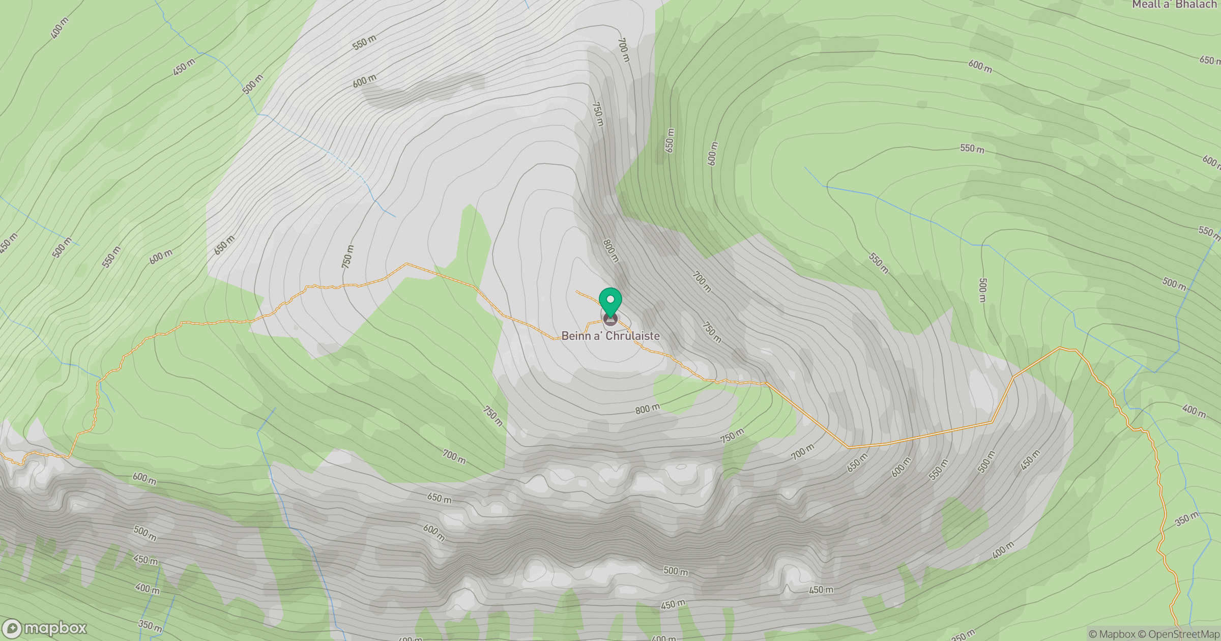
Grid reference: NN246566
View on OpenStreetMapOpens a map in a new tab, centred on the hill.
Nearby Hills
Buachaille Etive Mor - Stob Dearg
1,021m
Creise
1,100m
Buachaille Etive Beag - Stob Coire Raineach
924m
Buachaille Etive Mor - Stob na Broige
953m
Stob Ghabhar
1,089m
No comments yet. Be the first.