

Beinn a' Bhuiridh
Good walks are even better shared.
NN0928 : Late afternoon view down Loch Awe from Beinn a' Bhuiridh
Alan O'Dowd Photo source
Overview
Beinn a' Bhuiridh
Nestled in the heart of the Scottish Highlands, Beinn a' Bhuiridh stands proudly at an elevation of 945 meters, making it a quintessential Munro for outdoor enthusiasts. With its rugged terrain and stunning views, it offers a delightful challenge for hikers seeking adventure amidst Scotland's natural beauty.
Geology
The mountain primarily features metamorphic rocks, particularly schists and gneisses. This gives Beinn a' Bhuiridh its striking and aesthetically pleasing rocky formations. The geological history of the area dates back hundreds of millions of years, and the erosion of these resilient rocks has shaped the scenic landscape we see today.
Routes
The most popular route to the summit is the Glencoe Route, which begins at the Glencoe ski centre. This route spans approximately 9.5 km and typically takes about 4.5 hours to complete. Its moderate difficulty level makes it accessible to many hikers, while still providing breathtaking views along the way. It's a well-trodden path, but don’t forget to watch your step – those pesky rocks can be slippery!
Summit Features
Once at the summit, hikers are greeted by a prominent stone cairn, standing as a tribute to the many adventurers who have made the journey. This high point rewards your efforts with sweeping views across the Scottish landscape. From here, you can spot neighbouring peaks like the majestic Buachaille Etive Mor, which looks like something straight out of a postcard.
Terrain
The terrain on Beinn a' Bhuiridh varies from rocky outcrops to expansive grassy areas, with some parts being boggy, especially after a good rain. Make sure to wear sturdy footwear – your ankles will thank you later!
Views
The summit provides some of the most spectacular views in the region. You'll be able to see the sprawling Rannoch Moor and the rugged hills surrounding Glencoe. Spring and autumn are favoured times for summit views due to clearer conditions, although summer brings its own advantages with vibrant wildflowers.
Hazards
Just a word of caution: the Highlands are known for unpredictable weather. Be prepared for mist and rain, and don’t underestimate those rocky sections, especially in wet conditions. A wise hiker is a safe hiker!
Nearby Summits
If you're feeling adventurous, consider tackling nearby peaks such as Buachaille Etive Mor and Meall a' Bhuiridh, each offering unique vistas and challenges.
Access
Getting to Beinn a' Bhuiridh is straightforward. Park at the Glencoe ski centre, where there's plenty of parking space available. Buses run from towns like Fort William and Glasgow, making this gem accessible without a car. The nearest town, Ballachulish, boasts some lovely cafes and amenities to prepare for your hike.
Facilities
Before setting off, be sure to use the toilets at the ski centre, and perhaps grab a coffee for that extra energy boost! The local cafes in Ballachulish provide hearty meals and delightful pastries, perfect for fuelling your outdoor exploits.
History
The name Beinn a' Bhuiridh, meaning 'Mountain of the Brow,' reflects its appearance and offers a glimpse into the rich tapestry of Scottish culture and history. The mountain also carries significance in local lore and has inspired countless poets and writers throughout the ages.
Enjoy your hike, respect nature, and always leave no trace behind. Happy trails!
Explore routes near Beinn a' Bhuiridh
Walks starting near this hill. Open a route to check its map, distance and full itinerary.
Beinn Ime from Succoth
View route
The Cobbler from Succoth Carpark
View route
Ben Lomond in the trossachs
View route
Ben Nevis via Mountain Path
View route
Route planning notes
These notes describe possible approaches. Check a route's map and access information when planning your walk.
Glencoe Route
A popular approach that starts from the Glencoe ski centre and offers well-defined paths with stunning views of the surrounding landscape.
Make a day of it, together
Find someone to share the walk with, or organise a day out along a route you like.
Photo Gallery
View all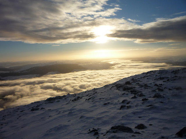 Photo could not load
NN0928 : Late afternoon view down Loch Awe from Beinn a' Bhuiridh
Alan O'Dowd
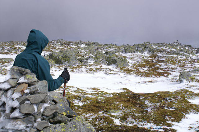 Photo could not load
NN0928 : Beinn a Bhuiridh
Peter Standing
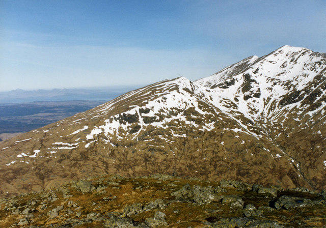 Photo could not load
NN0928 : View from summit of Beinn a Bhuirdh
wfmillar
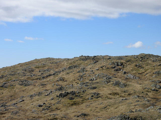 Photo could not load
NN0928 : Beinn a' Bhuiridh from the east
Scott Cormie
Hill facts and local notes
Classifications
Elevation
898m
2,948 ft
Prominence
172m
Coordinates
56.4091, -5.0903
NN094283
OS Map
50
Explorer: 360N 377W
At the Summit
The summit features a prominent cairn and stunning panoramic views extending over the Scottish glens and peaks.
Terrain & Geology
The mountain is primarily composed of metamorphic rocks, specifically schists and gneisses, which give it a rugged appearance befitting its Highland stature.
Views & Scenery
Distant views of the neighboring peaks such as Buachaille Etive Mor and the rugged landscape of Rannoch Moor.
History & Heritage
Name Origin
Beinn a' Bhuiridh translates to 'Mountain of the Brow,' a nod to its distinctive peaked profile.
Historical Significance
The mountain has historic significance as it played a role in the past movements of clans, and its rugged terrain has been a source of inspiration for poets and writers throughout history.
Getting There & Facilities
Parking
The nearest parking is at the Glencoe ski centre, which is well-signposted; it offers ample space for vehicles.
Public Transport
Regular bus services operate from nearby towns, such as Fort William and Glasgow, with stops at Glencoe.
Nearby Facilities
There are toilets available at the Glencoe ski centre and various cafes in Ballachulish offering hot meals and refreshments.
Safety Information
Known Hazards
- Be prepared for rapidly changing weather conditions; fog and rain can reduce visibility significantly. Slippery loose rocks and mud can present a challenge, especially in wet conditions.
General Safety Tips
- Check weather conditions before setting out
- Carry appropriate clothing and equipment
- Let someone know your planned route
- Take a map, compass, and GPS device
- Carry emergency supplies: food, water, first aid kit, torch
Hills
Some common questions about the hills answered
Are there group walks up Beinn a' Bhuiridh?
Many walkers use Walkmates to join or organise walks with others. You can check for group walks around Beinn a' Bhuiridh through the maps
Are there other walkers around Beinn a' Bhuiridh?
Activity varies by location and time, but Walkmates lets you see whether others have shared walks or shown interest in this area. Find other people through the walking friends search walking friends for Beinn a' Bhuiridh search or of course create your own walk for Beinn a' Bhuiridh
Can I organise a walk to Beinn a' Bhuiridh?
Yes. If there aren’t any walks listed already, you can create a walk and make it available for others to join.
If you're signed up to Walkmates, you can create a walk to Beinn a' Bhuiridh.
How do I find a walk up this hill?
There are often multiple ways to walk this hill, depending on experience and route preference. Walkmates helps you explore walks and routes that others have shared.
Can I suggest a new route up Beinn a' Bhuiridh?
Yes. You can suggest or create routes to share with others. Walkmates focuses on the social side of walking, so routes are used to help people organise walks and explore areas together, rather than as detailed navigation tools or route libraries.
Other uses really appreciate knowledgeable walkers sharing their routes. Share your favourite route to Beinn a' Bhuiridh here
The is an error or something incorrect about this hill. How do I let you know?
We always strive to keep the information on Walkmates as accurate as possible. If you find an error, please let us know through the contact form and we'll aim to correct it as quickly as possible
Community Discussion
Comments
Location
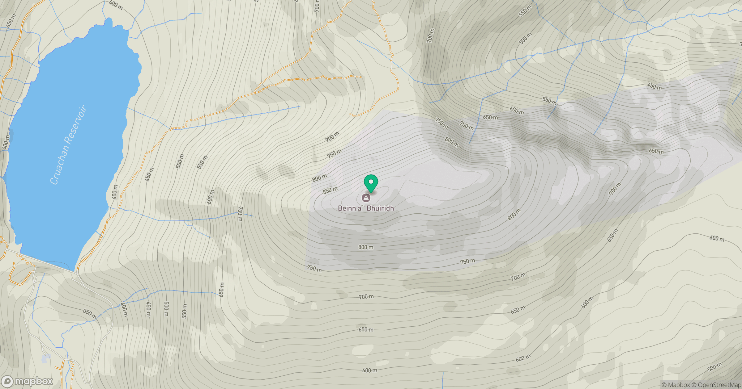
Grid reference: NN094283
View on OpenStreetMapOpens a map in a new tab, centred on the hill.
No comments yet. Be the first.