
Beacon Hill
Good walks are even better shared.
Overview
Beacon Hill
Nestled in the stunning Worcestershire Hills, Beacon Hill stands at an elevation of 234 metres (768 feet) and serves as a Marilyn - a hill with a prominence of over 150 metres. Despite its modest stature, this hill rewards dedicated walkers with breathtaking views and a rich tapestry of geological history.
Geology
Beacon Hill's rocky foundation is formed mainly from Jurassic limestone. This robust rock type creates impressive features that entice both geologists and casual hikers alike. The erosion that has shaped Beacon Hill has crafted steep slopes and crags that not only provide drama to the landscape but also create a varied ecosystem.
Routes
There are several ways to conquer Beacon Hill, with a few popular routes available for all levels of hikers:
Circular Route from Wichenford
This moderate 8.5 km circular walk begins in the charming village of Wichenford, meandering through woods and open fields. It's ideal for families and those looking for a leisurely outing. Expect to spend about 2.5 hours enjoying the views and fresh air.
Beacon Hill Direct Ascent
If you’re feeling a bit cheeky, try the direct ascent route. This more challenging option covers 3.2 km and will get your heart racing. It's steep in parts with some pesky brambles to navigate, but you’ll feel accomplished in just 1.5 hours.
Summit Features
The summit boasts a little stone cairn and a trig point, markers left by those who ventured before you. Here, you can inhale the views of the Malverns and beyond.
Views
Notable landmarks visible from the summit include the beautiful Malvern Hills to the south and the winding Severn Valley to the north. Visit during spring or autumn for the best views, and don’t forget to snap a picture or two!
Hazards
While Beacon Hill is not treacherous, you should keep an eye on the terrain. It can be uneven, and wildlife might pop up unannounced. Be mindful of your sandwiches—some local critters may have a penchant for picnic food!
Access
Access to this delightful hill is hassle-free. The nearest parking area can be found in Wichenford, with a small lot that accommodates around 10 vehicles. If you aren’t driving, there are bus services to Wichenford from Worcester, but check the times beforehand, as even transportation can have a mind of its own!
Facilities
Essential facilities are absent on the hill itself, but the nearby village of Wichenford has a lovely café perfect for refuelling after your escapade. They also have public toilets available for visitors.
History
The name 'Beacon Hill' hints at its historical significance as a site for signaling and communication, with origins stretching back through time. The area is also connected to ancient earthworks and holds cultural significance in the landscape.
In summary, whether you're hiking for fitness, the love of nature, or simply to indulge in a lovely slice of cake afterward, Beacon Hill provides an excellent opportunity for a memorable outdoor adventure!
Happy hiking, and remember: the best views come after the hardest climbs!
Explore routes near Beacon Hill
Walks starting near this hill. Open a route to check its map, distance and full itinerary.
Sampford Peverell to Whipcott Bridge: Grand Western Canal return
View route
Maunsel Lock to Fordgate: Somerset Space Walk Towpath Return
View route
Maunsel Lock to Charlton Bridge: Durston and Cogload canal return
View route
Langdon Hill Circular
View route
Route planning notes
These notes describe possible approaches. Check a route's map and access information when planning your walk.
Circular Route from Wichenford
A delightful circular walk starting from the quaint village of Wichenford, this route features a mix of woodland paths and open fields, providing a taste of Worcestershire's beautiful countryside.
Beacon Hill Direct Ascent
For those seeking a more direct challenge, this route will take you straight to the summit, navigating through murky trails lined with brambles and mystery.
Make a day of it, together
Find someone to share the walk with, or organise a day out along a route you like.
Hill facts and local notes
Classifications
Elevation
272m
892 ft
Prominence
33m
Coordinates
50.8718, -3.0879
ST235086
OS Map
192 193
Explorer: 116
At the Summit
At the top, you'll find a small stone cairn and a trig point that offers a panoramic view, almost as if you’re catching a glimpse of the entire county's secrets.
Terrain & Geology
Beacon Hill is primarily composed of Jurassic limestone, a rock that has endured the ravages of time, much like your well-worn hiking boots. The landforms are shaped by natural erosional processes that create distinct features, including crags and steep slopes.
Views & Scenery
From the summit, look out for the Malvern Hills to the south and the Severn Valley to the north, where you can almost hear the ghosts of ancient Romans discussing road construction.
History & Heritage
Name Origin
'Beacon' refers to a fire or signal, believed to have been used on the hilltop to warn of impending trouble, while 'Hill' is quite self-explanatory.
Historical Significance
Historically, this area has been important for communication and has connections to ancient earthworks and hill forts.
Getting There & Facilities
Parking
There is a small car park located at the base in Wichenford with space for about 10 vehicles. Arrive early to avoid a spot of bother!
Public Transport
Bus services operate from Worcester to Wichenford, but check the local schedules as they can be as fickle as the British weather.
Nearby Facilities
There are no facilities directly on the hill, but Wichenford provides a charming local café for tea and cake, as well as public toilets. Perfect pre- or post-walk indulgence!
Safety Information
Known Hazards
- Uneven terrain and occasional wildlife. Watch your step and perhaps pack away those sandwiches before the local critters claim them!
General Safety Tips
- Check weather conditions before setting out
- Carry appropriate clothing and equipment
- Let someone know your planned route
- Take a map, compass, and GPS device
- Carry emergency supplies: food, water, first aid kit, torch
Hills
Some common questions about the hills answered
Are there group walks up Beacon Hill?
Many walkers use Walkmates to join or organise walks with others. You can check for group walks around Beacon Hill through the maps
Are there other walkers around Beacon Hill?
Activity varies by location and time, but Walkmates lets you see whether others have shared walks or shown interest in this area. Find other people through the walking friends search walking friends for Beacon Hill search or of course create your own walk for Beacon Hill
Can I organise a walk to Beacon Hill?
Yes. If there aren’t any walks listed already, you can create a walk and make it available for others to join.
If you're signed up to Walkmates, you can create a walk to Beacon Hill.
How do I find a walk up this hill?
There are often multiple ways to walk this hill, depending on experience and route preference. Walkmates helps you explore walks and routes that others have shared.
Can I suggest a new route up Beacon Hill?
Yes. You can suggest or create routes to share with others. Walkmates focuses on the social side of walking, so routes are used to help people organise walks and explore areas together, rather than as detailed navigation tools or route libraries.
Other uses really appreciate knowledgeable walkers sharing their routes. Share your favourite route to Beacon Hill here
The is an error or something incorrect about this hill. How do I let you know?
We always strive to keep the information on Walkmates as accurate as possible. If you find an error, please let us know through the contact form and we'll aim to correct it as quickly as possible
Community Discussion
Comments
Location
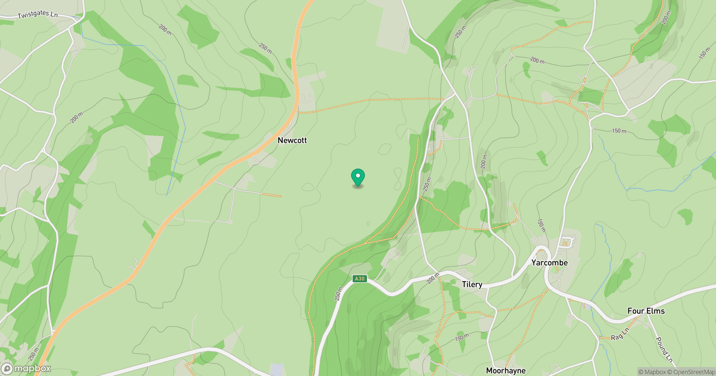
Grid reference: ST235086
View on OpenStreetMapOpens a map in a new tab, centred on the hill.



No comments yet. Be the first.