

Bannau Sir Gaer - Picws Du
Good walks are even better shared.
SN8121 : Llyn y Fan Fach from Picws Du
Gareth James Photo source
Overview
Picws Du is a 749.1 m summit above Llyn y Fan Fach in the Black Mountain, western Bannau Brycheiniog. Its cairn-topped ridge overlooks a glacial lake and steep sandstone cliffs. Summit circuits involve exposed escarpments and sustained climbing; the lakeside track is a separate, lower-level outing.
Bannau Sir Gaer – Picws Du
Picws Du rises to 749.1 m above Llyn y Fan Fach in the Black Mountain, in the western part of Bannau Brycheiniog National Park. A cairn marks its summit. The grassy ridge gives way abruptly to the cliffs above the lake, which are the defining feature of this walk.
Choose a summit route
The northern circuit starts at Llyn y Fan Fach car park near Llanddeusant. Walking Britain’s route 3559 follows Afon Sychlwch to the col east of Picws Du, crosses the summit, then returns along the western escarpment and down to the lake. Its published figures are 8.6 km, 485 m of ascent and 4 hours.
A different circuit begins at the small roadside parking area at SN853218, east of Llyn y Fan Fawr. Walking Britain’s route 3563 climbs through Bwlch Giedd, includes Fan Brycheiniog and an out-and-back visit to Picws Du via Fan Foel, then descends north of Fan Foel to return beside the lake. It is 11.5 km with 606 m of ascent; the published time is 5 hours 10 minutes. Allow more time for stops and difficult conditions.
The track to Llyn y Fan Fach offers a shorter lakeside outing without climbing Picws Du. A lake walk, the western ridge circuit and the longer two-lake routes have different distances and demands.
Ridge, weather and navigation
Expect steep path sections, loose stones near the escarpment, open grass and wet ground. Keep well back from the cliffs, particularly in wind or mist, and keep dogs close around the edges and sheep. Carry a map and compass and know how to use them; the remote terrain and branching paths demand care when cloud hides the landmarks.
Snow or ice can obscure paths and make steep ground much more serious. Cornices may overhang the escarpment: stay well away from the snow edge. Winter conditions require appropriate skills and equipment, and short daylight needs extra planning.
Access and facilities
Approach the northern car park through Llanddeusant on narrow lanes, with an uneven final approach. Parking space is limited; follow current signs and keep access clear. The car park has an information panel. Bring supplies for the walk; Llandovery has shops and cafés. Plan rail and onward transport separately, checking current connections through Traveline Cymru.
Landscape and neighbouring tops
The rocks around the lake and cliffs belong to the Devonian Old Red Sandstone, including the Brownstones and Plateau Beds formations. Ice shaped the deep hollow now occupied by Llyn y Fan Fach.
Waun Lefrith is the lower top to the west. Fan Foel and Fan Brycheiniog lie to the east, beyond an intervening descent and climb. Fan Brycheiniog’s highest point, Twr y Fan Foel, is distinct from its nearby trig-point top.
Bannau Sir Gaer means “Carmarthenshire peaks”. Welsh folklore associates the lake below with the Lady of the Lake and the Physicians of Myddfai.
Explore routes near Bannau Sir Gaer - Picws Du
Walks starting near this hill. Open a route to check its map, distance and full itinerary.
Usk Reservoir: Glasfynydd Forest and Dam Circuit
View route
Aircraft Crash Site - Wellington Bomber and Vampire Jet (Black Mountain range)
View route
Pen y Fan via Corn Du from Storey Arms
View route
Ammanford Walk with Men Walking & Talking
View route
Route planning notes
These notes describe possible approaches. Check a route's map and access information when planning your walk.
Picws Du and Llyn y Fan Fach from Llanddeusant
Circular from Llyn y Fan Fach car park (SN798238), via Afon Sychlwch and the col east of Picws Du. Cross the summit and western escarpment, descend to the lake and return by the access track. Walking Britain route 3559: 485 m ascent.
Fan Brycheiniog and Picws Du from the east
From roadside parking at SN853218, cross the Tawe to Llyn y Fan Fawr and ascend Bwlch Giedd. Visit Fan Brycheiniog and Picws Du via Fan Foel; return to Fan Foel, descend north and follow the lakeside path back. Walking Britain route 3563: 606 m ascent; 5 h 10 min.
Make a day of it, together
Find someone to share the walk with, or organise a day out along a route you like.
Photo Gallery
View all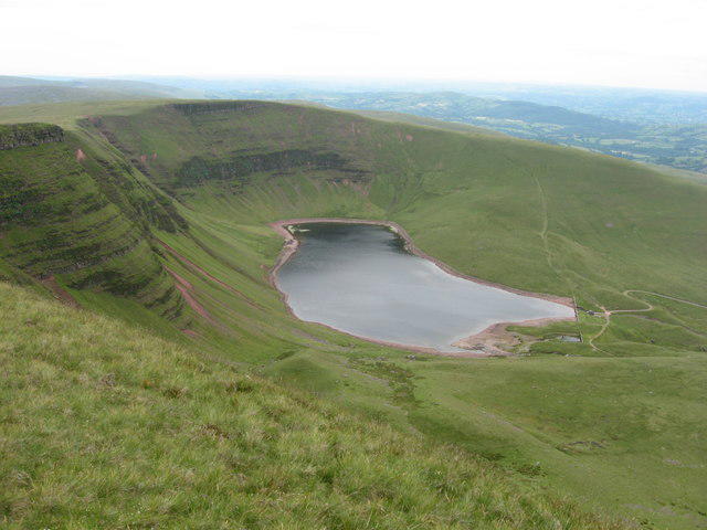 Photo could not load
SN8121 : Llyn y Fan Fach from Picws Du
Gareth James
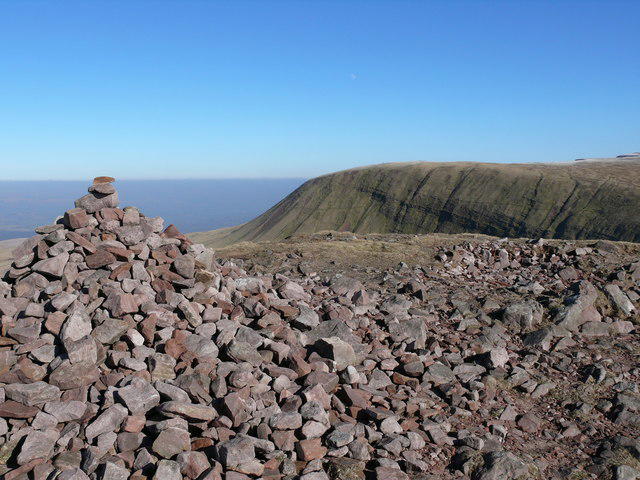 Photo could not load
SN8121 : Picws Du
Ian Medcalf
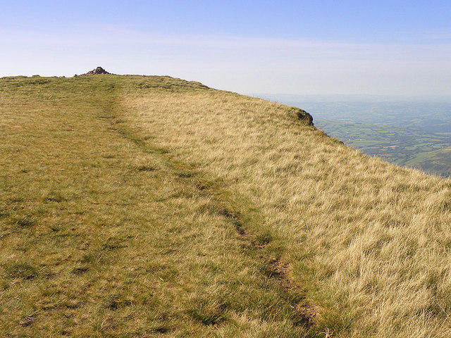 Photo could not load
SN8121 : Picws Du
Stuart Wilding
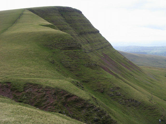 Photo could not load
SN8121 : Picws Du
Shaun Ferguson
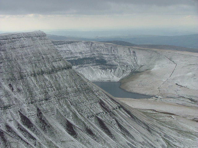 Photo could not load
SN8121 : Banau Sir Gaer with Llyn y Fan Fach beyond
John Dyason
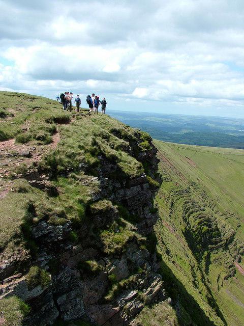 Photo could not load
SN8121 : Picws Du
Aaron Jones
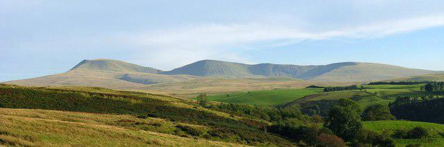 Photo could not load
SN8121 : Bannau Sir Gaer seen from the north
Nigel Davies
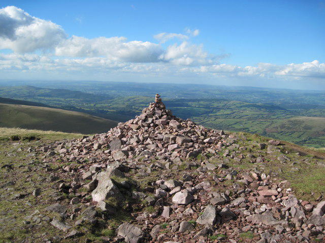 Photo could not load
SN8121 : Cairn on Picws Du
John Light
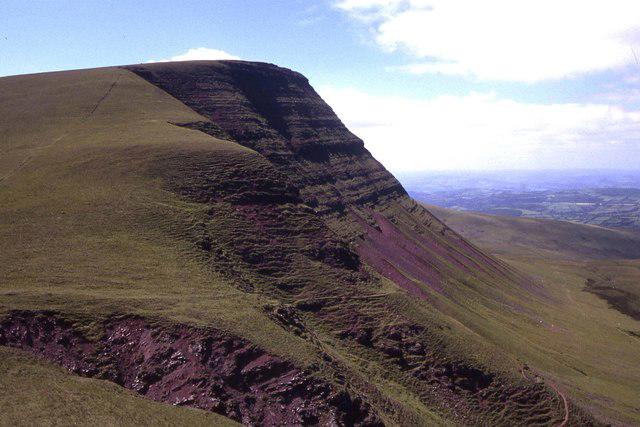 Photo could not load
SN8121 : Looking west to Picws Du
Colin Park
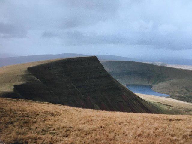
SN8121 : Bannau Sir Gaer / Picws Du 2760' / 749m
John H Darch
Hill facts and local notes
Classifications
Elevation
749m
2,458 ft
Prominence
93m
Coordinates
51.8826, -3.7278
SN811218
OS Map
160
Explorer: OL12W
At the Summit
A cairn marks the open summit at SN811218, above the northern escarpment overlooking Llyn y Fan Fach.
Terrain & Geology
The cliffs and lake basin expose Devonian Old Red Sandstone, including the Brownstones and Plateau Beds formations. Glacial erosion shaped the cirque containing Llyn y Fan Fach; glacial deposits and moraine also occur around the lake.
Views & Scenery
The chief view is down to Llyn y Fan Fach and along the curved escarpment towards Waun Lefrith. Fan Foel and Fan Brycheiniog rise to the east; clear weather opens wider views across the Black Mountain and the Carmarthenshire countryside.
History & Heritage
Name Origin
Bannau Sir Gaer means “Carmarthenshire peaks”, as translated by Fforest Fawr UNESCO Global Geopark.
Historical Significance
Welsh folklore links Llyn y Fan Fach, below the mountain, with the Lady of the Lake and the Physicians of Myddfai. The mountain and lake form part of this well-known local legend.
Getting There & Facilities
Parking
Llyn y Fan Fach car park east of Llanddeusant, at the northern end of the lake access track (Walking Britain route start SN798238). Approach on narrow lanes with an uneven final section. Spaces are limited: follow current parking signs, check any charges and keep passing places and access clear. The eastern route uses separate roadside parking at SN853218.
Public Transport
Plan rail connections via Llangadog or Llandovery, then arrange onward transport to the chosen start. Check current times and return connections with Traveline Cymru. Do not assume a bus serves Llyn y Fan Fach car park; the old published postbus reference is not a current timetable.
Nearby Facilities
An information panel is provided at Llyn y Fan Fach car park. Bring food, water and mountain equipment for the ridge. Llandovery has shops and cafés for supplies before or after the walk.
Safety Information
Known Hazards
- Steep cliffs border the northern escarpment. Keep back from loose edges, especially in gusts or poor visibility.
- Steep paths, loose stones and wet ground require careful footing; stream crossings can become harder after heavy rain.
- Remote mountain terrain and branching paths need competent navigation in low cloud. Carry a map, compass and reliable backup.
- Sheep graze the mountain. Keep dogs close and under control, particularly beside cliffs.
Seasonal Hazards
Snow and ice can hide paths and make the steep escarpment hazardous. Cornices may overhang the edge; keep well back from them. Winter conditions require appropriate navigation skills and equipment. Allow for short daylight, and expect wetter ground and higher streams after prolonged rain or thaw.
General Safety Tips
- Check weather conditions before setting out
- Carry appropriate clothing and equipment
- Let someone know your planned route
- Take a map, compass, and GPS device
- Carry emergency supplies: food, water, first aid kit, torch
Hills
Some common questions about the hills answered
Are there group walks up Bannau Sir Gaer - Picws Du?
Many walkers use Walkmates to join or organise walks with others. You can check for group walks around Bannau Sir Gaer - Picws Du through the maps
Are there other walkers around Bannau Sir Gaer - Picws Du?
Activity varies by location and time, but Walkmates lets you see whether others have shared walks or shown interest in this area. Find other people through the walking friends search walking friends for Bannau Sir Gaer - Picws Du search or of course create your own walk for Bannau Sir Gaer - Picws Du
Can I organise a walk to Bannau Sir Gaer - Picws Du?
Yes. If there aren’t any walks listed already, you can create a walk and make it available for others to join.
If you're signed up to Walkmates, you can create a walk to Bannau Sir Gaer - Picws Du.
How do I find a walk up this hill?
There are often multiple ways to walk this hill, depending on experience and route preference. Walkmates helps you explore walks and routes that others have shared.
Can I suggest a new route up Bannau Sir Gaer - Picws Du?
Yes. You can suggest or create routes to share with others. Walkmates focuses on the social side of walking, so routes are used to help people organise walks and explore areas together, rather than as detailed navigation tools or route libraries.
Other uses really appreciate knowledgeable walkers sharing their routes. Share your favourite route to Bannau Sir Gaer - Picws Du here
The is an error or something incorrect about this hill. How do I let you know?
We always strive to keep the information on Walkmates as accurate as possible. If you find an error, please let us know through the contact form and we'll aim to correct it as quickly as possible
Community Discussion
Comments
Location
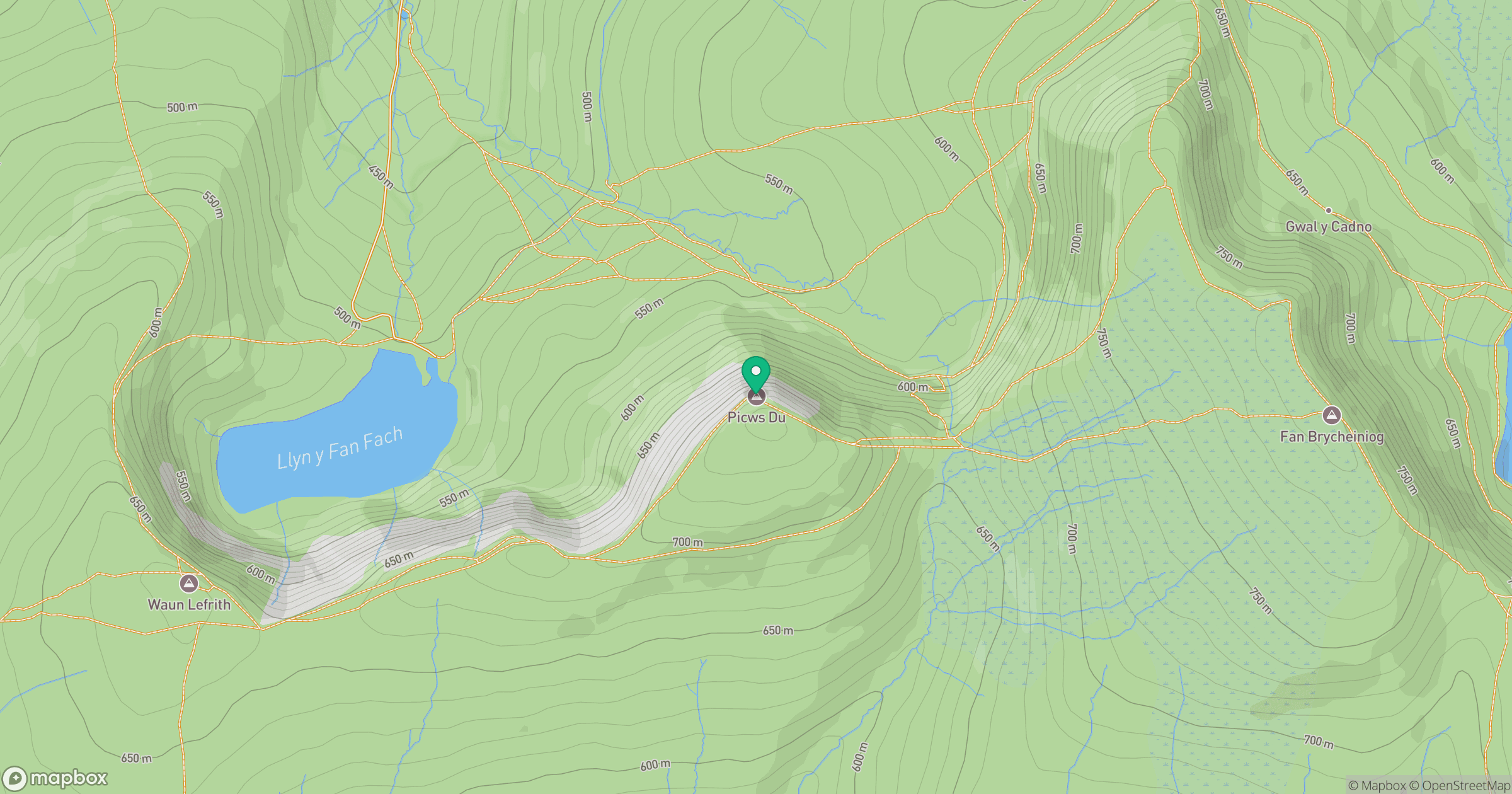
Grid reference: SN811218
View on OpenStreetMapOpens a map in a new tab, centred on the hill.


No comments yet. Be the first.