

Yr Aran
Good walks are even better shared.
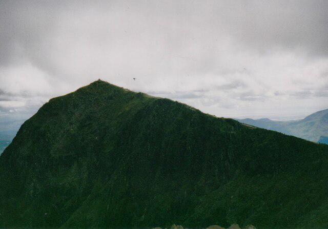
SH6051 : Yr Aran from the ridge to the east
Peter S Photo source
Overview
Yr Aran
Yr Aran is a 747.2 m mountain south of Yr Wyddfa in Eryri, with 238.4 m prominence. Its high point is a rock beside the cairn; the knoll 25 m northeast is lower. DoBIH
Walking
Explore Wild Wales describes a 10 km complete circuit from Rhyd Ddu, using the quarry track, northern ascent and southwest descent before returning to the original track. This is a mountain walk requiring fitness and navigation, with rough ground and quarry hazards. Full route
The summit overlooks Yr Wyddfa and Y Lliwedd. A separate Walking Britain route continues to Yr Wyddfa and returns by the Rhyd Ddu Path; its 13.8 km total belongs to that two-summit outing. Combined route
Landscape and travel
The quarry workings explain much of the approach’s industrial character. BGS identifies volcanic tuff at Rhos Boeth west of the summit; that sample is not a whole-mountain survey. BGS record
Use Rhyd Ddu station car park or check Sherpa S3 connections. Verify current parking, facilities and the last bus before setting out. National Park travel information
Sources checked 18 October 2026. No current on-foot inspection is claimed.
Explore routes near Yr Aran
Walks starting near this hill. Open a route to check its map, distance and full itinerary.
Beddgelert Forest: Derwen Circuit and Llyn Llywelyn
View route
Beddgelert Forest: Llyn Llywelyn Woodland Circuit
View route
Snowdon Pyg Track returning by Miner's Track
View route
Llyn Crafnant: Lakeside Circuit from the NRW Car Park
View route
Route planning notes
These notes describe possible approaches. Check a route's map and access information when planning your walk.
Yr Aran circuit from Rhyd Ddu
The published 10 km loop starts and finishes at Rhyd Ddu station car park. Follow the quarry track towards Bwlch Cwm Llan, climb the northern side of Yr Aran, descend southwest then north to the quarry stile, and retrace the track. Open mountain ground includes faint paths, wet patches and steep rocks. Use the full linked directions and map. Source: https://explorewildwales.co.uk/shorter-mountain-walks-in-eryri-yr-arran-from-rhyd-ddu/
Make a day of it, together
Find someone to share the walk with, or organise a day out along a route you like.
Photo Gallery
View all Photo could not load
SH6051 : Yr Aran from the ridge to the east
Peter S
 Photo could not load
SH6051 : Rusty post on Yr Aran
Hansjoerg Lipp
 Photo could not load
SH6051 : Looking South-east from Yr Aran
Hansjoerg Lipp
 Photo could not load
SH6051 : Clouds passing over Yr Aran
Peter S
 Photo could not load
SH6051 : On the South Ridge path, looking south towards Yr Aran
Bill Harrison
 Photo could not load
SH6051 : Yr Aran from Snowdon South Ridge
John Dyason
 Photo could not load
SH6051 : Looking east from Yr Aran
Hansjoerg Lipp
 Photo could not load
SH6051 : Yr Aran from the Watkin Path.
Peter S
 Photo could not load
SH6051 : Yr Aran from Cwm Llan
Peter S

SH6051 : Yr Aran from Bwlch Cwm Llan
Dave Dunford
Hill facts and local notes
Classifications
Elevation
747m
2,451 ft
Prominence
238m
Coordinates
53.0428, -4.0832
SH604515
OS Map
115
Explorer: OL17W
At the Summit
DoBIH records a rock beside the cairn at SH6044051531 as the summit. The small knoll 25 m northeast is 1.0 m lower.
Terrain & Geology
BGS records acid ash-flow tuff of the Snowdon Volcanic Group at Yr Aran, Rhos Boeth (SH5905 5231), west of the summit. This is a locality sample, not a summit-wide geological survey.
Views & Scenery
Clear-weather summit views include Yr Wyddfa (Snowdon), Y Lliwedd and Cwm Llan.
History & Heritage
Historical Significance
The Rhyd Ddu approach follows a former quarry track and passes disused slate workings around Bwlch Cwm Llan.
Getting There & Facilities
Parking
Rhyd Ddu station car park off the A4085, SH571526, is the start of the published circuit. Check current charges and capacity.
Public Transport
Eryri National Park lists Sherpa S3 at Rhyd Ddu Station, with connections from Caernarfon and via Beddgelert. Check the current timetable and return service.
Nearby Facilities
The route guide records toilets and a water-filling point at Rhyd Ddu car park. Check availability and carry your own supplies.
Safety Information
Known Hazards
- The upper circuit crosses faint or absent paths and steep rocky ground; carry a map and compass and know how to use them.
- Keep clear of deep, steep-sided quarry workings. Wet ground and summit rocks can be slippery.
- A ladder stile is part of the published approach; assess it before taking a dog. Check mountain weather and carry suitable clothing.
General Safety Tips
- Check weather conditions before setting out
- Carry appropriate clothing and equipment
- Let someone know your planned route
- Take a map, compass, and GPS device
- Carry emergency supplies: food, water, first aid kit, torch
Hills
Some common questions about the hills answered
Are there group walks up Yr Aran?
Many walkers use Walkmates to join or organise walks with others. You can check for group walks around Yr Aran through the maps
Are there other walkers around Yr Aran?
Activity varies by location and time, but Walkmates lets you see whether others have shared walks or shown interest in this area. Find other people through the walking friends search walking friends for Yr Aran search or of course create your own walk for Yr Aran
Can I organise a walk to Yr Aran?
Yes. If there aren’t any walks listed already, you can create a walk and make it available for others to join.
If you're signed up to Walkmates, you can create a walk to Yr Aran.
How do I find a walk up this hill?
There are often multiple ways to walk this hill, depending on experience and route preference. Walkmates helps you explore walks and routes that others have shared.
Can I suggest a new route up Yr Aran?
Yes. You can suggest or create routes to share with others. Walkmates focuses on the social side of walking, so routes are used to help people organise walks and explore areas together, rather than as detailed navigation tools or route libraries.
Other uses really appreciate knowledgeable walkers sharing their routes. Share your favourite route to Yr Aran here
The is an error or something incorrect about this hill. How do I let you know?
We always strive to keep the information on Walkmates as accurate as possible. If you find an error, please let us know through the contact form and we'll aim to correct it as quickly as possible
Community Discussion
Comments
Location
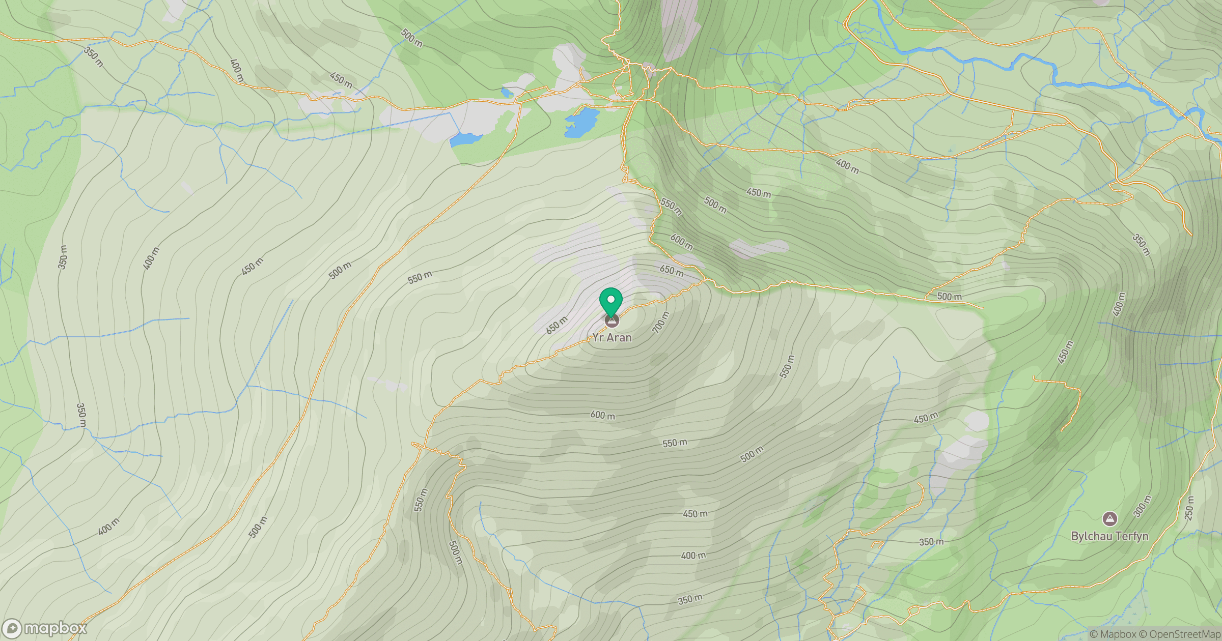
Grid reference: SH604515
View on OpenStreetMapOpens a map in a new tab, centred on the hill.
No comments yet. Be the first.