
Windy Standard
Good walks are even better shared.
Overview
Windy Standard: A Hiker’s Delight
Nestled snugly within the Southern Uplands of Scotland, Windy Standard reaches a respectable elevation of 732 meters. As the name suggests, the conditions can be windy—making it a quintessential spot for anyone looking to test their mettle against nature while enjoying stunning vistas.
Geology
The geological makeup of Windy Standard is predominantly Old Red Sandstone, a sedimentary rock that shapes the landscape and tells the tale of a world long gone, from arid deserts to rich marine environments. Those captivated by geology will find much to ponder here, especially when grappling with the exposed rock faces that constitute much of the summit.
Routes
Two popular routes lead to the summit:
- Clyde Muirshiel Regional Park – A moderate trek of about 8 km, this path lures hikers with its gentle slopes and rich greenery. Perfect for families or those wanting a leisurely stroll!
- From Locherben Road – For the more adventurous, this challenging 4 km route takes you straight up the steeper western slopes, providing both thrill and breathtaking views at the top.
Summit Features
Upon reaching the summit, you’ll be greeted by a trig point—an ideal post for that obligatory summit selfie. The surroundings provide fleeting moments to reflect on past hikes and future adventures.
Terrain
Prepare for a spirited mix of grassy hills and rocky outcrops, with some boggy patches to test your gaiter-wearing skills. Make sure to wear sturdy footwear to truly appreciate the terrain without feeling like you’re wrestling with mud!
Views
If views are your cup of tea, you won't be disappointed here! On clear days, the rolling hills and peaks of the Southern Uplands offer a canvas of greens and browns all the way to the Ayrshire coast. Spring and autumn are particularly delightful for both scenery and walking conditions.
Hazards
Diligent hikers should keep an eye on the weather forecast—conditions can change quicker than you can say 'tea and biscuits.' Ensure your gear is suited for gusty winds and potential drops in visibility.
Access
Although public transport to the area is limited, Kirkcudbright is the nearest town and offers a wealth of services, while Floors Farm car park is the ideal starting point for your adventure.
Nearby Summits
Windy Standard is surrounded by other peaks like Mullwharchar and Ben Ledi, perfect options for those wanting to extend their hiking exploits.
Get ready to don your hiking boots, pack your snacks, and prepare for a grand day out at Windy Standard!
Explore routes near Windy Standard
Public walks starting within 80 km of this hill. Nearby does not mean a route reaches the summit; check its map and access before setting out.
Carrick Forest Drive: Stinchar Bridge to Loch Doon
View route
Loch Trool: Full Loch and Oak Woodland Circuit
View route
Glentrool Water of Trool and Spout Head Trail
View route
Wood of Cree Waterfalls and Scrubland Circuit
View route
Route planning notes
These notes describe possible approaches, not verified navigable routes or permission to cross land. Check current paths, local access rules and conditions before setting out.
Clyde Muirshiel Regional Park
This popular route starts from the Clyde Muirshiel Regional Park, meandering through lush greenery before ascending to the summit with gentle yet steady gradients.
From Locherben Road
A shorter, steeper ascent directly from Locherben Road, this path will have your heart racing—though not as much as the views at the top! An exhilarating route for those looking for a challenge.
Make a day of it, together
Find someone to share the walk with, or organise a day out along a route you like.
Hill facts and local notes
Classifications
Elevation
537m
1,762 ft
Prominence
102m
Coordinates
55.3079, -4.3257
NS524040
OS Map
77
Explorer: 327
At the Summit
The summit features a prominent trig point, which is a favourite for those looking to solidify their ascent with a photo op. The surrounding area includes a few interesting rock outcrops where one could ponder life—or just the next cup of tea.
Terrain & Geology
Primarily composed of Old Red Sandstone, Windy Standard showcases intriguing sedimentary structures that speak to its ancient geological past. The summit is characterised by elements typical of the Southern Uplands, with exposures that tell stories of former environments, from desert landscapes to deep marine conditions.
Views & Scenery
On a clear day, you can capture magnificent views across the rolling hills of the Southern Uplands, and even catch glimpses of the distant Ayrshire coast and the iconic peaks of the Galloway Hills.
History & Heritage
Name Origin
The name 'Windy Standard' essentially evokes the mountain's character—its often gusty conditions have made it a notable marker in the landscape.
Historical Significance
Windy Standard has been a beloved destination for walkers and a key location within local folklore, often associated with tales of lost hikers seeking shelter from the brisk winds.
Getting There & Facilities
Check current local access restrictions, parking rules and transport timetables before travelling. These notes do not confirm public access to the summit.
Parking
Floors Farm car park, located a few miles from the starting point. Ample space available but can fill up quickly during weekends. Arrive early to nab a spot!
Public Transport
Public transport options are limited; however, buses operate from Stranraer to the nearest village, with a subsequent taxi required to reach the car park.
Nearby Facilities
There are no facilities at the summit itself, but nearby Kirkcudbright features cafes and public toilets, making it a pleasant stop for post-hike refreshments.
Safety Information
Known Hazards
- Beware of the occasional stark weather shift; the wind can pick up unexpectedly and visibility may drop. Always check the forecast before you head out!
General Safety Tips
- Check weather conditions before setting out
- Carry appropriate clothing and equipment
- Let someone know your planned route
- Take a map, compass, and GPS device
- Carry emergency supplies: food, water, first aid kit, torch
Hills
Some common questions about the hills answered
Are there group walks up Windy Standard?
Many walkers use Walkmates to join or organise walks with others. You can check for group walks around Windy Standard through the maps
Are there other walkers around Windy Standard?
Activity varies by location and time, but Walkmates lets you see whether others have shared walks or shown interest in this area. Find other people through the walking friends search walking friends for Windy Standard search or of course create your own walk for Windy Standard
Can I organise a walk to Windy Standard?
Yes. If there aren’t any walks listed already, you can create a walk and make it available for others to join.
If you're signed up to Walkmates, you can create a walk to Windy Standard.
How do I find a walk up this hill?
There are often multiple ways to walk this hill, depending on experience and route preference. Walkmates helps you explore walks and routes that others have shared.
Can I suggest a new route up Windy Standard?
Yes. You can suggest or create routes to share with others. Walkmates focuses on the social side of walking, so routes are used to help people organise walks and explore areas together, rather than as detailed navigation tools or route libraries.
Other uses really appreciate knowledgeable walkers sharing their routes. Share your favourite route to Windy Standard here
The is an error or something incorrect about this hill. How do I let you know?
We always strive to keep the information on Walkmates as accurate as possible. If you find an error, please let us know through the contact form and we'll aim to correct it as quickly as possible
Community Discussion
Comments
Location
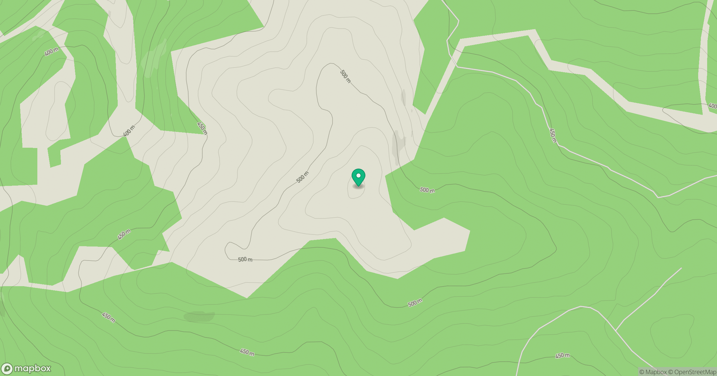
Grid reference: NS524040
View on OpenStreetMapOpens a map in a new tab, centred on the hill.
Hills within 30 km
Straight-line distance, not a walking route or confirmation of access.
No comments yet. Be the first.