
Craig Dhu
Good walks are even better shared.
Overview
Exploring Craig Dhu
Nestled within the picturesque Southern Uplands, Craig Dhu stands proud at 380 meters above sea level. This Marilyn is not just a hill; it’s a gateway to adventure!
Geology
The surrounding Silurian rocks tell a story of ancient oceans and tectonic shifts. With granite formations adding to the dramatic landscape, hikers can appreciate how millions of years have crafted this stunning terrain.
Routes
The popular Craig Dhu Circular Walk springs into action from Glentrool, offering an 8 km jaunt through delightful woodlands. With a moderate difficulty level, it's perfect for those looking to stretch their legs without breaking into a sweat.
Summit Features
At the top, the stone cairn awaits to greet you like an old friend, ready for a photo opportunity. Settle down for a break and take in the views; they are worth the climb!
Terrain
Expect a mix of grassy hills and rocky paths, with a few boggy spots to keep work boots relevant in all seasons. Just remember, every muddy shoe tells a story!
Views
Keep your eyes peeled for landmarks at the summit. The enchanting rolling hills of Galloway Forest Park surround you, while on particularly clear days, you might even catch a glimpse of the Isle of Man — now that’s something to brag about at the pub!
Hazards
Watch the skies — conditions can change in a blink! Also, tread carefully, as some paths are known for playing tricks during wet months.
Access
- Nearest Parking: Glentrool village has a quaint little parking lot that fills up fast on weekends, so arrive early.
- Public Transport: The bus service from Newton Stewart can get you close, but make sure to check the schedule – it’s as reliable as a British summer!
- Nearest Town: Enjoy the amenities of Newton Stewart, about 16 km away.
Facilities
Take a pit stop at the Glentrool Inn for a refreshing cup of tea and a toilet run. It’s always nice to enjoy a warm beverage after conquering a summit!
History
The name 'Craig Dhu' resonates with history, meaning 'Black Rock'. It not only reflects the geology but also the stories etched into the land by generations of hikers, hunters, and settlers.
In conclusion, whether you're drawn by the promise of stunning views or a good ramble, Craig Dhu offers a delightful experience for all. Tie on those hiking boots, grab your walking pole, and make some memories — nature is waiting!
Explore routes near Craig Dhu
Public walks starting within 80 km of this hill. Nearby does not mean a route reaches the summit; check its map and access before setting out.
Carrick Forest Drive: Stinchar Bridge to Loch Doon
View route
Loch Trool: Full Loch and Oak Woodland Circuit
View route
Glentrool Water of Trool and Spout Head Trail
View route
Wood of Cree Waterfalls and Scrubland Circuit
View route
Route planning notes
These notes describe possible approaches, not verified navigable routes or permission to cross land. Check current paths, local access rules and conditions before setting out.
Craig Dhu Circular Walk
A beautiful circular walk starting from the village of Glentrool, taking you through lush woodlands and up to the summit where you can enjoy panoramic views.
Make a day of it, together
Find someone to share the walk with, or organise a day out along a route you like.
Hill facts and local notes
Classifications
Elevation
415m
1,362 ft
Prominence
107m
Coordinates
55.2529, -4.4784
NX425982
OS Map
77
Explorer: 318
At the Summit
The summit of Craig Dhu features a well-preserved stone cairn and offers scenic views of the surrounding hills and valleys, making it a perfect spot for a picnic or a quick breather.
Terrain & Geology
The area around Craig Dhu is predominantly composed of Silurian sedimentary rocks, with some interesting formations of granite that give the landscape a rugged appearance. The contrasting geology contributes to the varied vegetation and rich biodiversity in the area.
Views & Scenery
From the summit, you can see the rolling hills of Galloway Forest Park and the distant peaks of the Rhinns of Galloway. On a clear day, the views extend even further, onlookers might spot the Isle of Man in the distance!
History & Heritage
Name Origin
The name 'Craig Dhu' translates to 'Black Rock', likely referring to the dark rocks prevalent in the area, a name that rolls off the tongue like a fine whisky.
Historical Significance
Craig Dhu has historical significance as part of the local lore and offers a glimpse into the ancient landscapes shaped by early settlers.
Getting There & Facilities
Check current local access restrictions, parking rules and transport timetables before travelling. These notes do not confirm public access to the summit.
Parking
There is a small parking area near the Glentrool village hall, suitable for about 10 cars. Arrive early during weekends to secure your spot!
Public Transport
The nearest bus service runs from Newton Stewart to Glentrool, though it's limited, so check schedules in advance.
Nearby Facilities
Public toilets are available in Glentrool village. The nearest café is the Glentrool Inn, where you can treat yourself to a hot drink after your hike!
Safety Information
Known Hazards
- Be wary of changing weather conditions, as fog can roll in quickly. Also, some paths may be muddy or slippery, especially in wet seasons.
General Safety Tips
- Check weather conditions before setting out
- Carry appropriate clothing and equipment
- Let someone know your planned route
- Take a map, compass, and GPS device
- Carry emergency supplies: food, water, first aid kit, torch
Hills
Some common questions about the hills answered
Are there group walks up Craig Dhu?
Many walkers use Walkmates to join or organise walks with others. You can check for group walks around Craig Dhu through the maps
Are there other walkers around Craig Dhu?
Activity varies by location and time, but Walkmates lets you see whether others have shared walks or shown interest in this area. Find other people through the walking friends search walking friends for Craig Dhu search or of course create your own walk for Craig Dhu
Can I organise a walk to Craig Dhu?
Yes. If there aren’t any walks listed already, you can create a walk and make it available for others to join.
If you're signed up to Walkmates, you can create a walk to Craig Dhu.
How do I find a walk up this hill?
There are often multiple ways to walk this hill, depending on experience and route preference. Walkmates helps you explore walks and routes that others have shared.
Can I suggest a new route up Craig Dhu?
Yes. You can suggest or create routes to share with others. Walkmates focuses on the social side of walking, so routes are used to help people organise walks and explore areas together, rather than as detailed navigation tools or route libraries.
Other uses really appreciate knowledgeable walkers sharing their routes. Share your favourite route to Craig Dhu here
The is an error or something incorrect about this hill. How do I let you know?
We always strive to keep the information on Walkmates as accurate as possible. If you find an error, please let us know through the contact form and we'll aim to correct it as quickly as possible
Community Discussion
Comments
Location
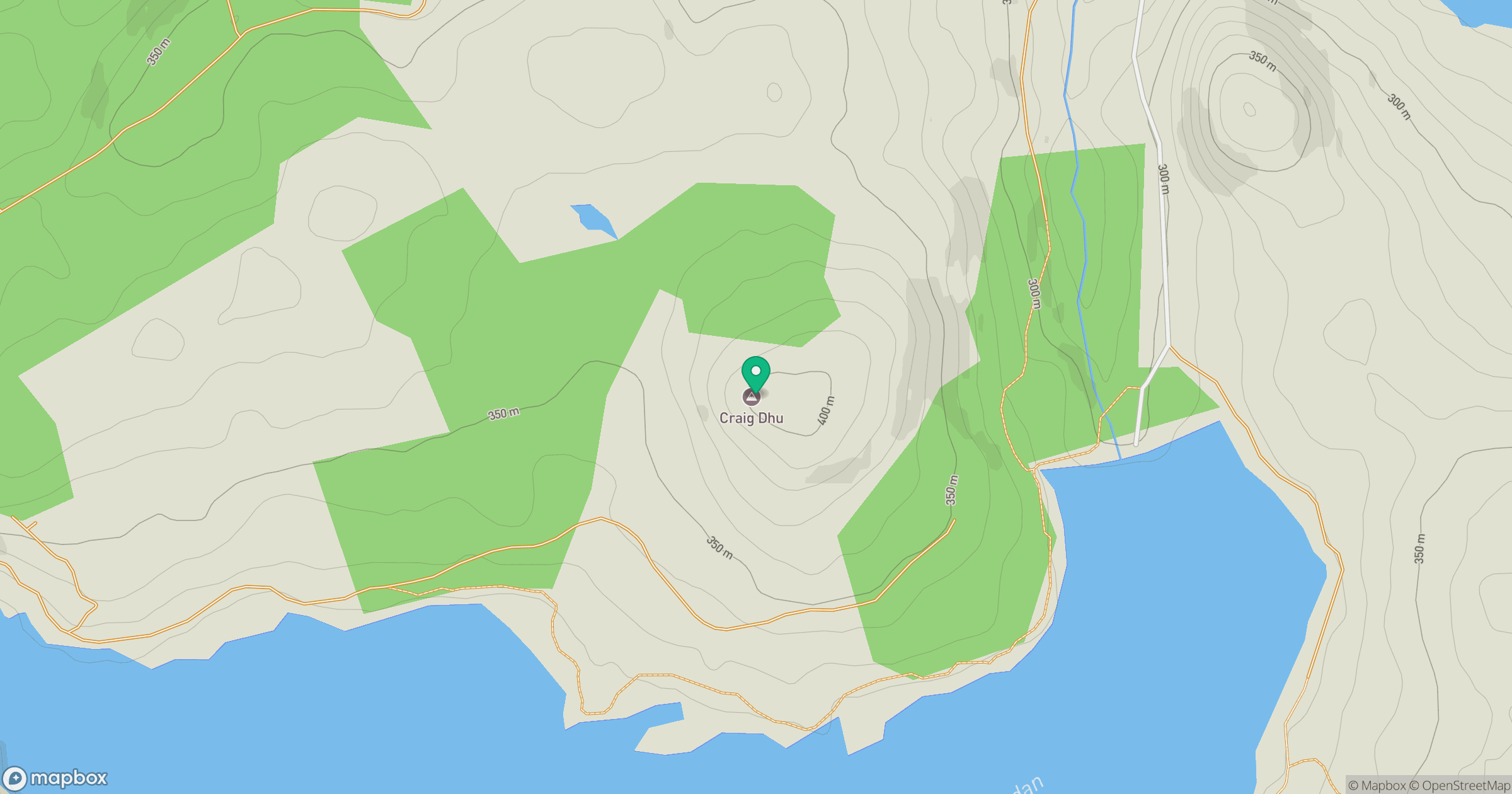
Grid reference: NX425982
View on OpenStreetMapOpens a map in a new tab, centred on the hill.
Hills within 30 km
Straight-line distance, not a walking route or confirmation of access.
No comments yet. Be the first.