
Waterhead
Good walks are even better shared.
Overview
Waterhead: An Unmissable Gem in the Lake District
Waterhead, standing proudly at an elevation of 438 meters, is a marvellous mountain nestled in the stunning Lake District. With its gentle slopes and impressive geological features, it is a popular destination for hikers of all levels.
Geology
Waterhead is a fascinating study of volcanic and sedimentary formations, primarily composed of rocks from the Borrowdale Volcanic Group. The unique geological history offers not just scenic beauty, but also a chance to marvel at Earth’s ancient processes.
Hikes and Routes
There are several routes to consider when visiting Waterhead. The Waterhead Circular Walk is a moderately challenging loop that boasts breathtaking vistas of the valleys below, best tackled in the warmer months. If you're feeling up to it, the Langdale to Waterhead path offers a more challenging experience through picturesque woodlands, perfect for those looking to stretch their legs and enjoy some wildlife spotting.
Preparation
As with any outdoor venture, preparation is key. The paths can range from easy to boggy, so sturdy shoes are a must. Don’t forget your camera; the view is worth a thousand words!
Summit Features
At the summit, keen walkers will find a charming cairn and a trusty trig point. It’s the perfect spot for a celebratory photo; just don’t get too close to the edge—while the views are cracking, the drop is less than ideal for a family portrait!
Terrain Type
Expect a delightful mix of rocky paths, grassy knolls, and the occasional waterlogged section that’ll keep you on your toes—well, hopefully just your toes!
Views
When you reach the peak of Waterhead, you're greeted with panoramic views of the surrounding landscapes. On a clear day, keep an eye out for Coniston Water, the Langdale Pikes, and the distant Scafell range.
Hazards
While Waterhead isn't a mountain to be taken lightly, the biggest hazards to watch out for are slippery pathways and sudden weather changes. And remember, that curious sheep might want to share its lunch with you!
Access and Facilities
Accessing Waterhead is straightforward; there’s free parking available at Waterhead. Public transport options are also convenient from nearby Ambleside, which ensures a hassle-free journey.
Facilities in Coniston include plenty of cafes and pubs ensuring a good meal after your endeavours. Just make sure you save some energy for the hike back!
Conclusion
Waterhead is undoubtedly a must-see for any outdoor enthusiast visiting the Lake District. With its stunning vistas, rich geology, and engaging trails, it’s one mountain that will leave you breathless—in more ways than one!
Whether you’re after a leisurely stroll or a more challenging trek, pack your bags and head to Waterhead!
Explore routes near Waterhead
Public walks starting within 80 km of this hill. Nearby does not mean a route reaches the summit; check its map and access before setting out.
Carrick Forest Drive: Stinchar Bridge to Loch Doon
View route
Loch Trool: Full Loch and Oak Woodland Circuit
View route
Glentrool Water of Trool and Spout Head Trail
View route
Wood of Cree Waterfalls and Scrubland Circuit
View route
Route planning notes
These notes describe possible approaches, not verified navigable routes or permission to cross land. Check current paths, local access rules and conditions before setting out.
Waterhead Circular Walk
A delightful loop around the northern slopes of Waterhead which offers magnificent views of the surrounding hills and valleys.
Langdale to Waterhead
A stunning path through lush woodlands and alongside tranquil waters leads you to the foot of Waterhead, with diverse wildlife en route.
Make a day of it, together
Find someone to share the walk with, or organise a day out along a route you like.
Hill facts and local notes
Classifications
Elevation
473m
1,552 ft
Prominence
131m
Coordinates
55.2343, -4.4498
NX443960
OS Map
77
Explorer: 318
At the Summit
The summit features a modest cairn and a metal trig point, which are perfect for those Instagram snaps.
Terrain & Geology
The mountain is primarily composed of volcanic rocks from the Borrowdale Volcanic Group with a substantial layer of sedimentary rock at its base, giving rise to interesting rock formations and rich soil.
Views & Scenery
Stunning panoramas of Coniston Water, the Langdale Pikes, and the distant Scafell range can be appreciated from the summit.
History & Heritage
Name Origin
The name Waterhead refers to its position at the head of Coniston Water, historically significant as a transport route.
Historical Significance
Once renowned for its slate quarrying, the area is dotted with remnants of its industrial past.
Getting There & Facilities
Check current local access restrictions, parking rules and transport timetables before travelling. These notes do not confirm public access to the summit.
Parking
Free parking available at Waterhead near Coniston. Arrive early during peak seasons as spaces can fill quickly.
Public Transport
Regular bus services run from Ambleside to Coniston, with a short walk to the start of nearby trails.
Nearby Facilities
The nearby village of Coniston offers cafes, pubs, and public toilets, ensuring you’re well-fed and hydrated before you tackle the hill.
Safety Information
Known Hazards
- Slippery pathways, sudden weather changes, and occasional wildlife encounters (including curious sheep).
General Safety Tips
- Check weather conditions before setting out
- Carry appropriate clothing and equipment
- Let someone know your planned route
- Take a map, compass, and GPS device
- Carry emergency supplies: food, water, first aid kit, torch
Hills
Some common questions about the hills answered
Are there group walks up Waterhead?
Many walkers use Walkmates to join or organise walks with others. You can check for group walks around Waterhead through the maps
Are there other walkers around Waterhead?
Activity varies by location and time, but Walkmates lets you see whether others have shared walks or shown interest in this area. Find other people through the walking friends search walking friends for Waterhead search or of course create your own walk for Waterhead
Can I organise a walk to Waterhead?
Yes. If there aren’t any walks listed already, you can create a walk and make it available for others to join.
If you're signed up to Walkmates, you can create a walk to Waterhead.
How do I find a walk up this hill?
There are often multiple ways to walk this hill, depending on experience and route preference. Walkmates helps you explore walks and routes that others have shared.
Can I suggest a new route up Waterhead?
Yes. You can suggest or create routes to share with others. Walkmates focuses on the social side of walking, so routes are used to help people organise walks and explore areas together, rather than as detailed navigation tools or route libraries.
Other uses really appreciate knowledgeable walkers sharing their routes. Share your favourite route to Waterhead here
The is an error or something incorrect about this hill. How do I let you know?
We always strive to keep the information on Walkmates as accurate as possible. If you find an error, please let us know through the contact form and we'll aim to correct it as quickly as possible
Community Discussion
Comments
Location
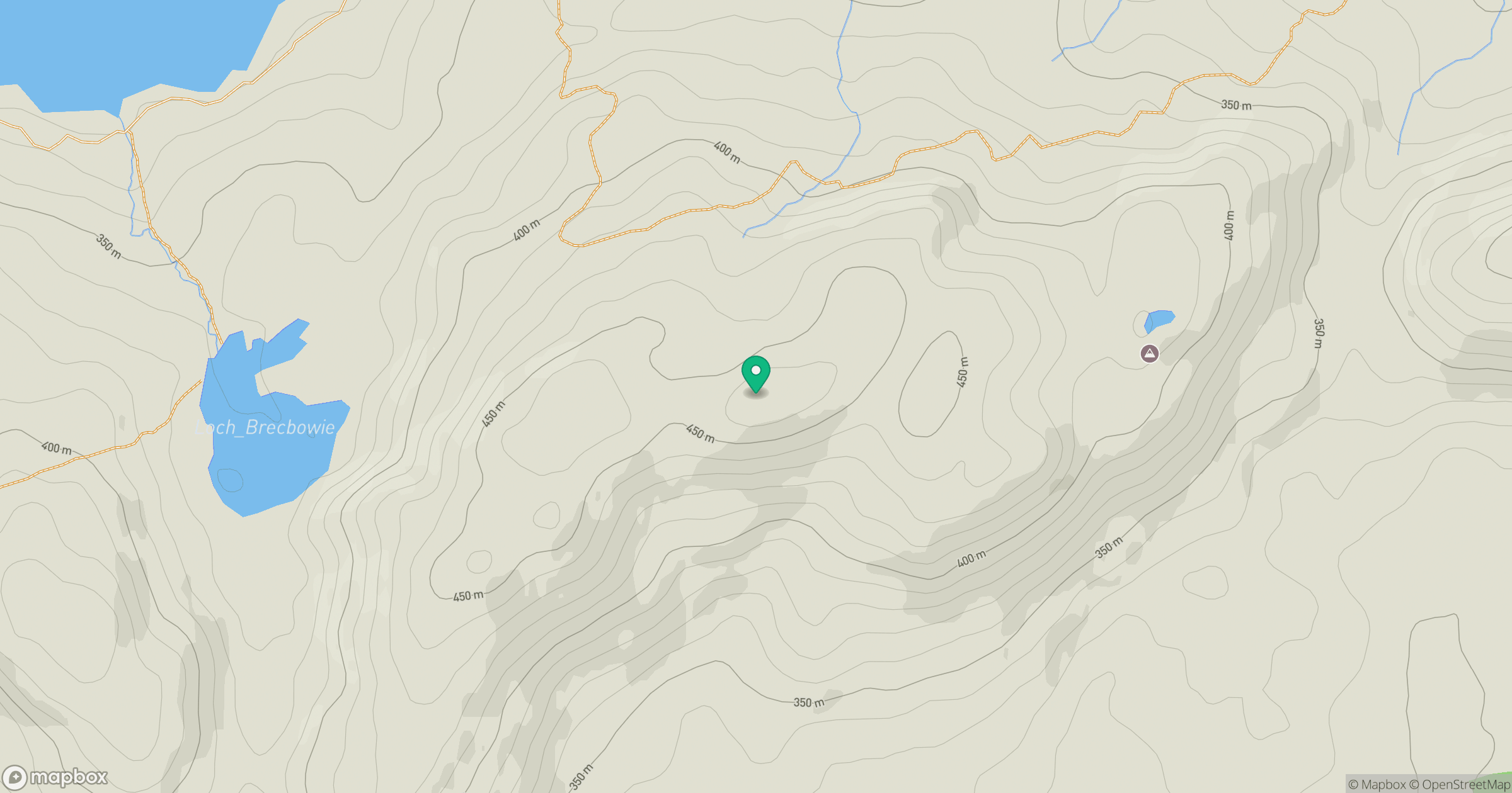
Grid reference: NX443960
View on OpenStreetMapOpens a map in a new tab, centred on the hill.
Hills within 30 km
Straight-line distance, not a walking route or confirmation of access.
No comments yet. Be the first.