

Waun Lefrith
Good walks are even better shared.
SN7921 : Waun Lefrith above Llyn y Fan Fach
John Dyason Photo source
Overview
Waun Lefrith
Waun Lefrith, standing at an impressive 782 meters, is a delightful Marilyn located in the picturesque Brecon Beacons National Park. Known for its gentle slopes and stunning panoramic views, it’s a favourite among hikers of various abilities.
Geology
This mountain is characterized by its layers of mudstone and sandstone, which have been shaped over millennia. This geological mix creates a unique terrain, complete with rocky outcrops and patches of lush heather. Perfect for those who love to explore the intricacies of nature!
Routes
The most popular route begins at the Tirabad Road, covering approximately 5 km and taking around 2.5 hours to complete. The path is moderate, presenting a few challenges but nothing that a good pair of boots can’t handle. Remember, it’s all about enjoying the journey, not just the destination!
Summit Features
Upon reaching the summit, you'll be greeted with a stone cairn that beckons for a quick photo op. It’s the perfect spot to sit back, take a breath, and soak in the breathtaking views.
Terrain Type
Expect a charming mix of grassy slopes and rocky areas. Parts of the path can be boggy, particularly after rainfall, so a pair of sturdy hiking boots is recommended. After all, nobody enjoys a soggy sock!
Views
From the top of Waun Lefrith, the views are nothing short of spectacular. Look to the east to catch a glimpse of Pen y Fan and Corn Du, the giants that dominate the landscape. The best time to enjoy these vistas is during the spring and autumn months when the air is crisp and the skies are clear.
Hazards
While Waun Lefrith is an accessible climb, be prepared for the unpredictable Welsh weather. Rain can come out of nowhere, transforming the path into a slippery challenge. Always check the forecast before setting off and carry a waterproof jacket, just in case!
Nearby Summits
For those feeling adventurous, why not tackle nearby Pen y Fan and Corn Du? Each peak offers its own unique features and spectacular views, making for an excellent adventure.
Access
The nearest parking is at the Tirabad layby, off the A470. Space can be limited, so it’s wise to arrive early. If you’re relying on public transport, head to Abergavenny and catch a bus to Tirabad.
Facilities
While there are no facilities directly at Waun Lefrith, the bustling town of Brecon is just a short drive away, providing ample opportunities for a warm drink and a bite to eat.
History
The name ‘Waun Lefrith’ means ‘the moor of the grey area.’ It perfectly captures the sometimes-misty conditions that can envelop the peak. Rich with culture and history, this mountain is a testament to the enduring spirit of the Welsh landscape.
Let Waun Lefrith be your next adventure—just don't forget to bring your sense of humour and an appetite for exploration!
Explore routes near Waun Lefrith
Walks starting near this hill. Open a route to check its map, distance and full itinerary.
Usk Reservoir: Glasfynydd Forest and Dam Circuit
View route
Aircraft Crash Site - Wellington Bomber and Vampire Jet (Black Mountain range)
View route
Pen y Fan via Corn Du from Storey Arms
View route
Ammanford Walk with Men Walking & Talking
View route
Route planning notes
These notes describe possible approaches. Check a route's map and access information when planning your walk.
Tirabad Road to Waun Lefrith
A well-trodden and scenic route that offers views of the surrounding hills and valleys.
Make a day of it, together
Find someone to share the walk with, or organise a day out along a route you like.
Photo Gallery
View all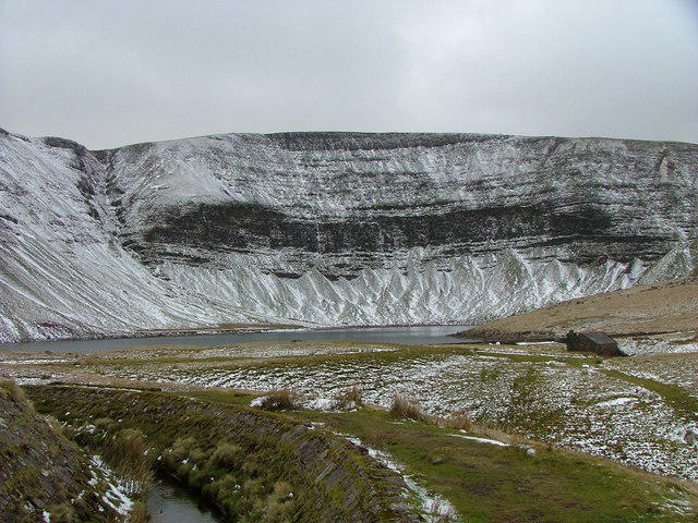 Photo could not load
SN7921 : Waun Lefrith above Llyn y Fan Fach
John Dyason
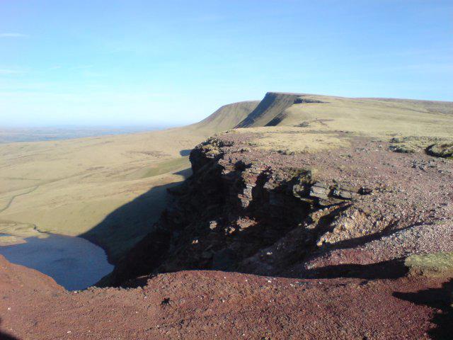 Photo could not load
SN7921 : Bannau Sir Gair
Hywel Williams
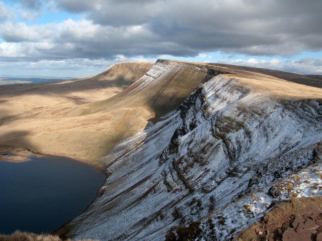 Photo could not load
SN7921 : Northern downfall of Black Mountain from Waun Lefrith
Trevor Littlewood
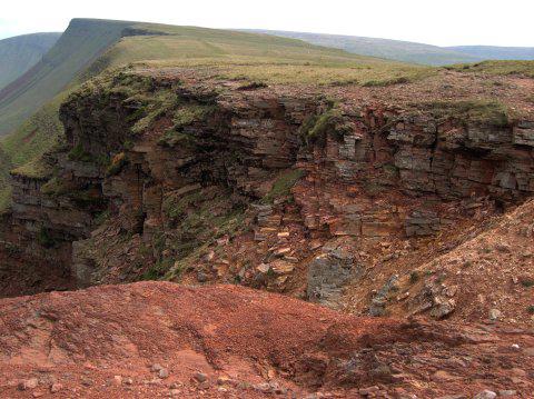 Photo could not load
SN7921 : Strata near the top of the Bannau Sir Gaer cliffs
Rudi Winter
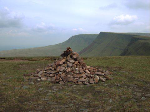 Photo could not load
SN7921 : Summit cairn on the western summit of the Bannau Sir Gaer
Rudi Winter
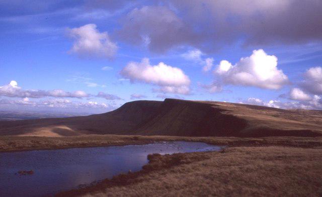 Photo could not load
SN7921 : Pool on Waun Lefrith
Richard Webb
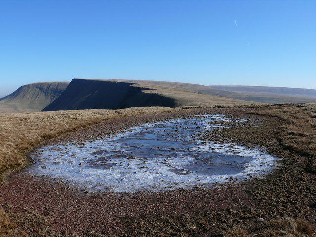 Photo could not load
SN7921 : Waun Lefrith
Ian Medcalf
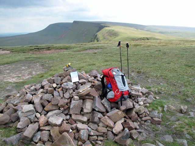 Photo could not load
SN7921 : Waun Lefrith
Rude Health
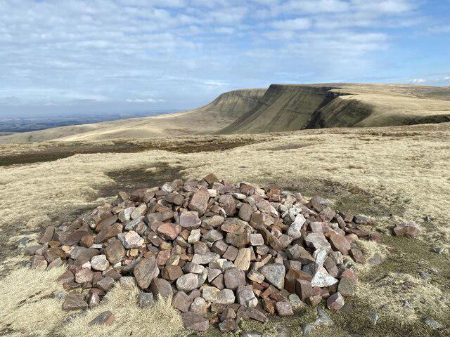 Photo could not load
SN7921 : Waun Lefrith
Alan Hughes
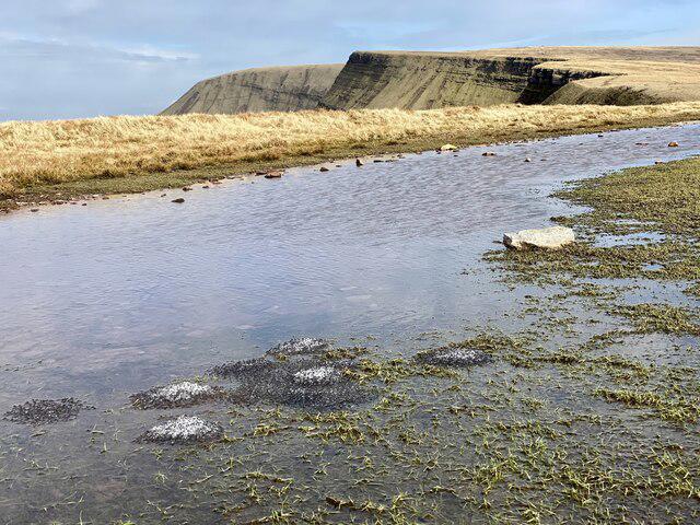 Photo could not load
SN7921 : Islands of frogspawn
Alan Hughes
Hill facts and local notes
Classifications
Elevation
676m
2,218 ft
Prominence
16m
Coordinates
51.8786, -3.7471
SN798214
OS Map
160
Explorer: OL12W
At the Summit
The summit is marked by a stone cairn, providing a perfect spot for a well-deserved break and a cheeky snack. Don't forget to take a selfie!
Terrain & Geology
Waun Lefrith is predominantly formed from mudstone and sandstone, layered over millions of years. The landscape features classic Welsh upland scenery with patches of heather and bog.
Views & Scenery
From the summit, you can admire the majestic peaks of Pen y Fan and Corn Du to the east, while the rolling hills of the surrounding landscape stretch out in all directions.
History & Heritage
Name Origin
The name 'Waun Lefrith' translates to 'the moor of the grey area,' a reflection of its often misty conditions.
Historical Significance
As part of the Brecon Beacons, this summit is steeped in Welsh folklore, associated with ancient legends and the spirit of the mountains.
Getting There & Facilities
Parking
Parking is available at the Tirabad layby, located just off the A470. Be sure to arrive early, as the spaces can fill up fast.
Public Transport
The nearest train station is in Abergavenny, from where you can catch a bus to Tirabad. It's a bit of a trek, but worth it for the views!
Nearby Facilities
Facilities are sparse in the immediate area, but Brecon boasts plenty of cafes, pubs, and shops to refuel before and after your hike.
Safety Information
Known Hazards
- Beware of sudden weather changes, as conditions can turn from sunny to soggy in a heartbeat. Slippery paths in wet weather can also pose a challenge.
General Safety Tips
- Check weather conditions before setting out
- Carry appropriate clothing and equipment
- Let someone know your planned route
- Take a map, compass, and GPS device
- Carry emergency supplies: food, water, first aid kit, torch
Hills
Some common questions about the hills answered
Are there group walks up Waun Lefrith?
Many walkers use Walkmates to join or organise walks with others. You can check for group walks around Waun Lefrith through the maps
Are there other walkers around Waun Lefrith?
Activity varies by location and time, but Walkmates lets you see whether others have shared walks or shown interest in this area. Find other people through the walking friends search walking friends for Waun Lefrith search or of course create your own walk for Waun Lefrith
Can I organise a walk to Waun Lefrith?
Yes. If there aren’t any walks listed already, you can create a walk and make it available for others to join.
If you're signed up to Walkmates, you can create a walk to Waun Lefrith.
How do I find a walk up this hill?
There are often multiple ways to walk this hill, depending on experience and route preference. Walkmates helps you explore walks and routes that others have shared.
Can I suggest a new route up Waun Lefrith?
Yes. You can suggest or create routes to share with others. Walkmates focuses on the social side of walking, so routes are used to help people organise walks and explore areas together, rather than as detailed navigation tools or route libraries.
Other uses really appreciate knowledgeable walkers sharing their routes. Share your favourite route to Waun Lefrith here
The is an error or something incorrect about this hill. How do I let you know?
We always strive to keep the information on Walkmates as accurate as possible. If you find an error, please let us know through the contact form and we'll aim to correct it as quickly as possible
Community Discussion
Comments
Location
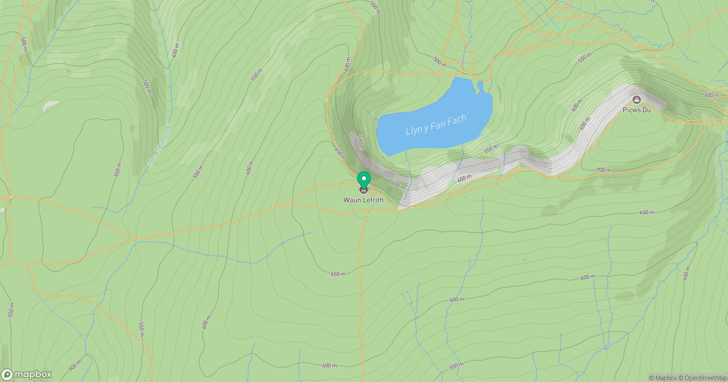
Grid reference: SN798214
View on OpenStreetMapOpens a map in a new tab, centred on the hill.


No comments yet. Be the first.