

Walla Crag
Good walks are even better shared.
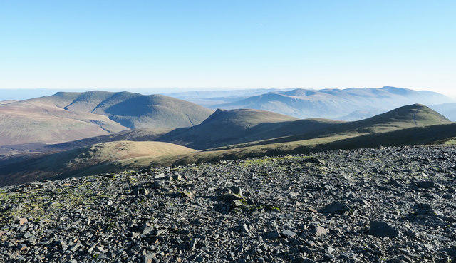
NY2721 : Towards Walla Crag
Dave Thompson Photo source
Overview
Walla Crag is a 379 m fell above the eastern shore of Derwentwater, near Keswick. Its rocky summit looks across the lake to Cat Bells and north towards Skiddaw. Woodland approaches lead to rough paths and a boggy plateau, with steep drops at the crag edge. Walks start in Keswick or at Great Wood car park; the Ashness Bridge circuit and the steeper Cat Gill route are different options.
Walla Crag
Walla Crag rises to 379 m above the eastern shore of Derwentwater, near Keswick. It is a Wainwright, Birkett, Synge and Fellranger, with 27 m of prominence. The summit is a rock beside a cairn, set back from the steep crag edge.
Choosing a route
The route card describes the National Trust's Great Wood–Walla Crag–Ashness Bridge circuit: 7.2 km, Moderate, with a published walking estimate of 2 hours. It approaches via Brockle Beck and Rakefoot and returns from Ashness Bridge along the lower path to Great Wood. Allow extra time for stops and conditions.
The shorter Great Wood circuit described by WalkLakes climbs Cat Gill and descends via Rakefoot. Its 4.7 km and 283 m ascent apply to that particular circuit. Cat Gill is steep and rough, with stone steps and drops beside the path.
Keswick Tourism's separate route starts at the Moot Hall in Market Square, climbs through Springs Wood, visits Walla Crag and Ashness Bridge, then returns beside Derwentwater. Its published figures are 6 miles, 3–4 hours and 1480 ft of ascent. Castlehead is a separate low hill; a diversion to its summit changes the walk. Continuing to Bleaberry Fell also makes a longer fell walk.
Terrain and safety
Expect rocky paths, gates, stiles and a boggy plateau that can stay wet even in otherwise dry conditions. Keep back from the crag edge and supervise children. The inland grassy approach beside the wall avoids the closer-to-the-edge rocky summit approach, but still includes wet ground and a stile. Lady's Rake is not a recommended walking ascent or descent.
For the Keswick lakeshore return, high water can make the shore near Ashness Gate difficult or unusable. Follow the roadside pavement alternative where needed, rather than forcing a flooded path. Take care on the lane below Ashness Bridge, which has no pavement. Check forecasts and carry suitable footwear, waterproofs and navigation equipment; snow, ice, strong wind and poor visibility can change the demands of the walk. Dogs should be on leads on the National Trust trail.
Access and surroundings
Great Wood National Trust car park is off the B5289 south of Keswick, postcode CA12 5UP. Charges apply, with validated free parking for members; overnight parking is not allowed. Stagecoach 78 serves Borrowdale from Keswick. When running, Keswick Launch calls at Ashness Gate, below Ashness Bridge. Check current services and last returns before relying on either.
Great Wood is ancient Atlantic oak woodland below the fell. Falcon Crag is separate from Walla Crag, beyond Cat Gill. The summit views include Derwentwater, Cat Bells, Keswick, Skiddaw and Bassenthwaite Lake. Keswick offers shops and places to eat; take food and water for the walk.
Geology and history
Walla Crag exposes Borrowdale volcanic rocks. It appears in Wainwright's Central Fells. A local legend associates Lady's Rake with the Countess of Derwentwater; this is folklore, not route advice.
References
Explore routes near Walla Crag
Walks starting near this hill. Open a route to check its map, distance and full itinerary.
Whinlatter dark skies walk
View route
Whinlatter dark skies walk
View route
Scafell Pike from Seathwaite via the Corridor Route
View route
Helvellyn via Striding Edge
View route
Route planning notes
These notes describe possible approaches. Check a route's map and access information when planning your walk.
Great Wood, Walla Crag and Ashness Bridge circuit
National Trust circular route from Great Wood car park via Brockle Beck and Rakefoot to Walla Crag, then Ashness Bridge and the lower woodland path back to Great Wood. Its published estimate is 7.2 km and 2 hours; allow time for stops and conditions. Wet, muddy and rocky sections, stiles and steep crag edges require care. Keep dogs on leads.
Make a day of it, together
Find someone to share the walk with, or organise a day out along a route you like.
Photo Gallery
View all Photo could not load
NY2721 : Towards Walla Crag
Dave Thompson
 Photo could not load
NY2721 : On Walla Crag
Michael Graham
 Photo could not load
NY2721 : On Walla Crag
Michael Graham
 Photo could not load
NY2721 : Stile near Walla Crag
mauldy
 Photo could not load
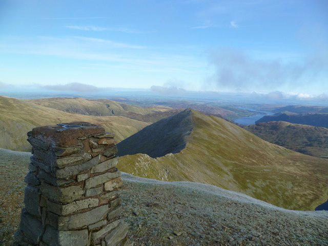
NY2721 : Summit Cairn, Walla Crag
Michael Graham
 Photo could not load
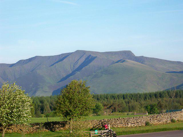
NY2721 : Walla Crag from Borrowdale
David Purchase
 Photo could not load
NY2721 : On Walla Crag
Michael Graham
 Photo could not load
NY2721 : On Walla Crag
Michael Graham
 Photo could not load
NY2721 : On Walla Crag
Michael Graham

NY2721 : Walla Crag
Chris Thomas-Atkin
Hill facts and local notes
Classifications
Elevation
379m
1,243 ft
Prominence
27m
Coordinates
54.5816, -3.1204
NY276212
OS Map
89 90
Explorer: OL4S
At the Summit
The highest point is a rock beside a cairn, set back from the crag edge. The rocky viewpoint overlooks Derwentwater and Keswick. Keep clear of the steep drops and supervise children closely.
Terrain & Geology
Walla Crag exposes volcanic rocks of the Borrowdale Volcanic Group, contrasting with the Skiddaw slate landscape to the north.
Views & Scenery
Derwentwater and its islands, Cat Bells and the north-western fells, Keswick, Skiddaw and Bassenthwaite Lake. Views depend on visibility.
History & Heritage
Historical Significance
Walla Crag is one of the fells in Wainwright's Central Fells. Lady's Rake is associated with a local escape legend about the Countess of Derwentwater; it should not be treated as a recommended walking route.
Getting There & Facilities
Parking
Great Wood National Trust car park, off the B5289 Borrowdale Road south of Keswick (CA12 5UP), is the start of the circular route below. Pay-and-display parking; National Trust members should validate their membership. No overnight parking. Follow the signed entrance and current on-site instructions.
Public Transport
Stagecoach 78 runs from Keswick into Borrowdale along the B5289. Keswick Launch serves Ashness Gate when operating, giving access via the lane to Ashness Bridge. Check current bus and boat timetables, service notices and last returns; sailings depend on weather. Walla Crag can also be reached on foot from Keswick.
Nearby Facilities
Keswick has shops and places to eat before or after the walk. Carry food and water for the fell; do not rely on refreshments on the summit routes.
Safety Information
Known Hazards
- Steep drops at the summit and crag edge. Keep children closely supervised and dogs on leads; do not use Lady's Rake as a walking ascent or descent.
- Cat Gill has steep, rough steps and drops beside the path. Wet rock can be slippery, and the plateau has persistent boggy patches.
- On the separate Keswick–Ashness Bridge–lakeshore circuit, high lake levels can obstruct or make the shore near Ashness Gate awkward. Use the roadside pavement alternative described by Keswick Tourism when necessary; do not force a flooded shore path. The lane down from Ashness Bridge has no pavement.
- Check the forecast and carry suitable footwear, waterproofs and navigation equipment. Turn back if wind, visibility or water conditions make your route unsafe.
Seasonal Hazards
Snow and ice can make rocky steps and exposed ground hazardous. Heavy rain can raise streams and Derwentwater, affecting crossings and lakeshore routes. The National Trust asks for dogs on leads on its Walla Crag trail to protect sheep and ground-nesting birds.
General Safety Tips
- Check weather conditions before setting out
- Carry appropriate clothing and equipment
- Let someone know your planned route
- Take a map, compass, and GPS device
- Carry emergency supplies: food, water, first aid kit, torch
Hills
Some common questions about the hills answered
Are there group walks up Walla Crag?
Many walkers use Walkmates to join or organise walks with others. You can check for group walks around Walla Crag through the maps
Are there other walkers around Walla Crag?
Activity varies by location and time, but Walkmates lets you see whether others have shared walks or shown interest in this area. Find other people through the walking friends search walking friends for Walla Crag search or of course create your own walk for Walla Crag
Can I organise a walk to Walla Crag?
Yes. If there aren’t any walks listed already, you can create a walk and make it available for others to join.
If you're signed up to Walkmates, you can create a walk to Walla Crag.
How do I find a walk up this hill?
There are often multiple ways to walk this hill, depending on experience and route preference. Walkmates helps you explore walks and routes that others have shared.
Can I suggest a new route up Walla Crag?
Yes. You can suggest or create routes to share with others. Walkmates focuses on the social side of walking, so routes are used to help people organise walks and explore areas together, rather than as detailed navigation tools or route libraries.
Other uses really appreciate knowledgeable walkers sharing their routes. Share your favourite route to Walla Crag here
The is an error or something incorrect about this hill. How do I let you know?
We always strive to keep the information on Walkmates as accurate as possible. If you find an error, please let us know through the contact form and we'll aim to correct it as quickly as possible
Community Discussion
Comments
Location
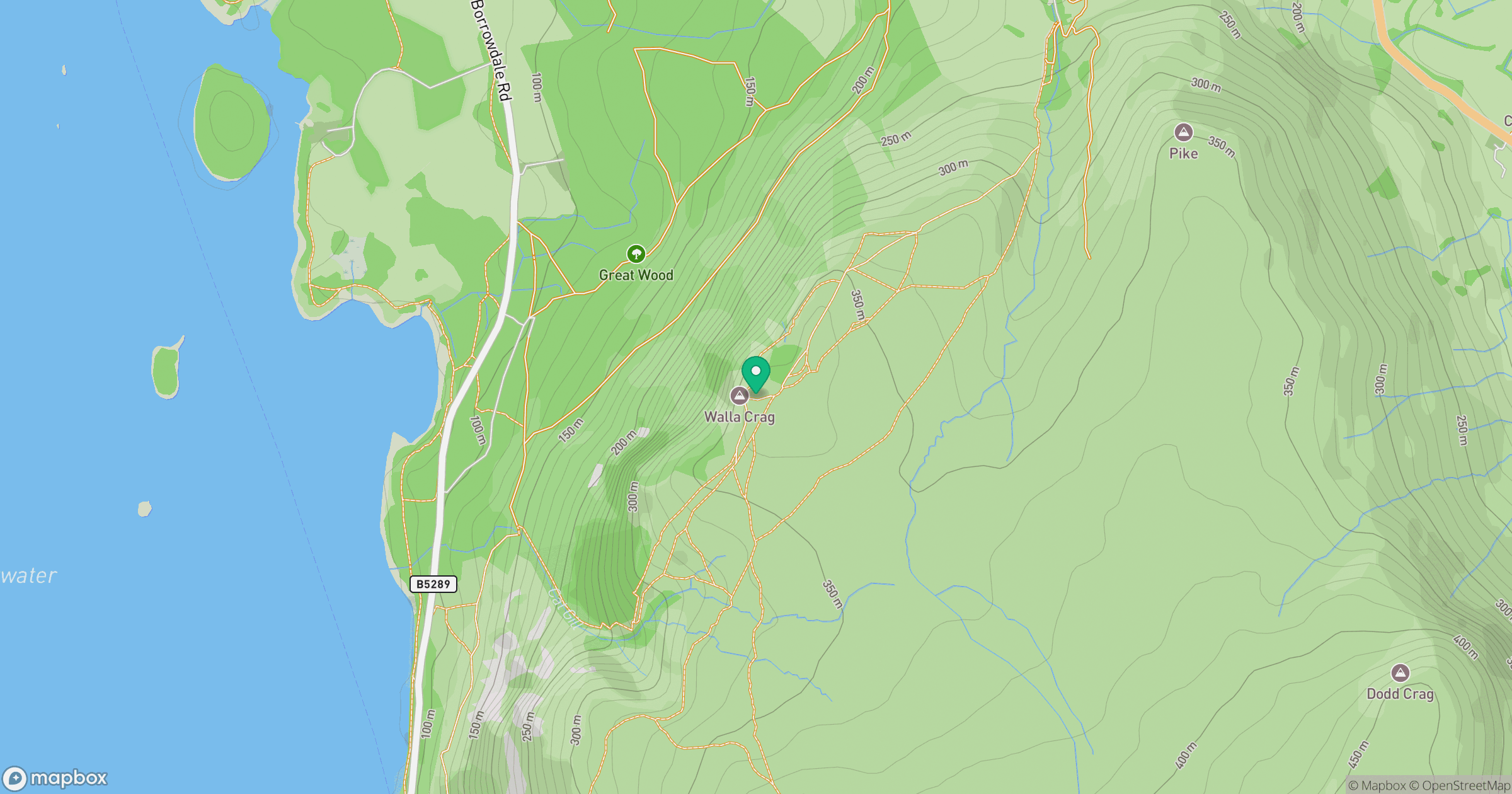
Grid reference: NY276212
View on OpenStreetMapOpens a map in a new tab, centred on the hill.
No comments yet. Be the first.