

Grisedale Pike
Good walks are even better shared.
NY1922 : Grisedale Pike
Helen Wilkinson Photo source
Overview
Grisedale Pike is a 790.3 m Wainwright above Braithwaite in the north-western Lake District. Its pointed skyline leads to a rocky summit with views towards the Skiddaw fells and surrounding mountains. The ascent via Kinn and Sleet How becomes steep, loose and exposed near the top. Routes from Whinlatter, the Hopegill Head circuit and the longer Coledale Horseshoe have different starts, returns and demands.
Grisedale Pike
Grisedale Pike rises to 790.3 m above Braithwaite in the north-western Lake District. The exact summit is NY 19841 22547 (DoBIH 2386). It is a rocky mountain objective with steep approaches and exposed high ground.
Summit and geology
DoBIH records a cairn. Summit photographs show that the cairn can be absent and that an OS triangulation marker is set in a low concrete block. The bedrock is mainly the Ordovician Kirk Stile Formation’s mudstone and siltstone, part of the Skiddaw Group.
Choosing a route
The five route records describe complete returns. The Braithwaite out-and-back uses Kinn and Sleet How; the Hobcarton End return begins at Revelin Moss. The Coledale Hause variant omits Hopegill Head. The longer Hopegill Head circuit returns down Coledale, while the northern circuit returns from Ladyside Pike through the forest.
The Coledale Horseshoe is a separate outing. WalkLakes’ 15 km itinerary continues from Grisedale Pike over Hopegill Head and Sand Hill to Coledale Hause, then crosses Crag Hill, Sail and Outerside before returning to Braithwaite. Its published ascent is 1,178 m. Adding Grasmoor, Wandope, Scar Crags, Causey Pike or Barrow changes those figures. The source’s minimum moving time is not a recommended full-day allowance.
Access and safety
The mountain routes involve loose rock, steep drops and exposed ridges. The northern circuit also includes rock slabs below Hopegill Head; Coledale returns include a beck crossing. Carry mountain navigation and weather protection, and turn back if conditions exceed your experience.
Forestry England’s notice updated 16 October 2026 reports work and diversions in north-east Whinlatter. It does not name a Grisedale Pike summit closure. This is not an all-routes clearance: check the current notice and on-site signs before using the forest. The old Hobcarton closure notice concerns work in 2023. Revelin Moss’s easy yellow trail is a forest walk, not a summit ascent.
Parking is limited at Mall Quarry above Braithwaite. Revelin Moss is a separate paid car park. Check parking signs, seasonal buses and the last return; café and toilet facilities are at Whinlatter Visitor Centre, with pubs in Braithwaite.
Industrial history
Force Crag Mine below the fell operated for lead, zinc and barytes until 1991. It is on National Trust land, with a treatment scheme addressing polluted mine drainage. Do not enter mine workings or assume the buildings are open.
Explore routes near Grisedale Pike
Walks starting near this hill. Open a route to check its map, distance and full itinerary.
Whinlatter dark skies walk
View route
Whinlatter dark skies walk
View route
Derwentwater Walk: full lakeside circuit from Keswick
View route
Scafell Pike from Seathwaite via the Corridor Route
View route
Route planning notes
These notes describe possible approaches. Check a route's map and access information when planning your walk.
Revelin Moss, Hopegill Head and Ladyside Pike circuit
Start at Revelin Moss car park. Ascend through the forest to Hobcarton End and Grisedale Pike, then continue over Hobcarton Crag to Hopegill Head. Descend the steep rock slabs towards Ladyside Pike and return through Swinside Plantation, Whinlatter Pass and Hobcarton Plantation to Revelin Moss. go4awalk route c169 gives 10.5 km, 784 m of ascent and about 5 hours for this complete circuit. It needs mountain navigation and confidence on exposed rock; check forestry diversions before setting off.
Braithwaite and Coledale Hause circuit
From Mall Quarry car park above Braithwaite, climb via Kinn and Sleet How to Grisedale Pike. Follow the southwest ridge path towards Hobcarton Crag, then take the left-hand path to Coledale Hause. From the hause descend into Coledale, cross the beck only when safe and join the Force Crag Mine road back to the same car park. This variant omits Hopegill Head.
Revelin Moss via Hobcarton End, out and back
Start at Revelin Moss car park and follow the forest approach to Hobcarton End, then continue along the northern ridge to Grisedale Pike. Return over Hobcarton End and retrace the same forest approach to Revelin Moss. This reverses the ascent section of go4awalk c169 and does not include Hopegill Head or Ladyside Pike. Check forestry notices and use a detailed map at track junctions.
Braithwaite, Grisedale Pike and Hopegill Head circuit
Start and finish at Mall Quarry car park above Braithwaite. Climb Kinn and Sleet How to Grisedale Pike, follow the ridge over Hobcarton Crag to Hopegill Head, then descend over Sand Hill to Coledale Hause. Return down Coledale, crossing the beck near Force Crag Mine before following the mine road to the car park. WalkLakes gives 13 km and 875 m of ascent for this complete circuit. Allow ample time for rough rock, crag edges and the beck crossing.
Braithwaite via Kinn and Sleet How, out and back
From Mall Quarry car park on the Whinlatter road above Braithwaite, take the stepped fell path to Kinn, continue along Sleet How and climb the steep, loose rocky ridge to Grisedale Pike. Return carefully down the same ridge, through Kinn and the initial woodland to the same car park. This is the direct Braithwaite return, not the Revelin Moss forest trail.
Make a day of it, together
Find someone to share the walk with, or organise a day out along a route you like.
Photo Gallery
View all Photo could not load
NY1922 : Grisedale Pike
Helen Wilkinson
 Photo could not load
NY1922 : Grisedale Pike
David Brown
 Photo could not load
NY1922 : Winter on the Summit of Grisedale Pike 791m
Iain Lees
 Photo could not load
NY1922 : Grisedale Pike
Trevor Littlewood
 Photo could not load
NY1922 : On Grisedale Pike
Michael Graham
 Photo could not load
NY1922 : Hobcarton Head
Michael Graham
 Photo could not load
NY1922 : Disused fence posts near Grisedale Pike summit
Graham Robson
 Photo could not load
NY1922 : Shelter, Grisedale Pike
Michael Graham
 Photo could not load
NY1922 : On Hobcarton Head
Michael Graham

NY1922 : Grisedale Pike from Lord's Seat
Stephen Craven
Hill facts and local notes
Classifications
Elevation
790m
2,593 ft
Prominence
191m
Coordinates
54.5918, -3.2421
NY198225
OS Map
89 90
Explorer: OL4S
At the Summit
The rocky summit is at NY 19841 22547. DoBIH records a cairn, but its size and presence can change. Dated summit photographs also show an OS triangulation marker set in a low concrete block; do not expect a prominent trig pillar. A small windshelter lies below the summit.
Terrain & Geology
Grisedale Pike belongs to the Ordovician Skiddaw Group. Its Kirk Stile Formation rocks are mainly thinly layered mudstone and siltstone, originally deposited as fine sediment in a marine basin. Geological research identifies these sedimentary rocks on the fell, and the BGS places the formation’s type area through Whinlatter Pass and Sleet How.
Views & Scenery
In clear weather the summit overlooks the Skiddaw fells, the Vale of Keswick and surrounding Lakeland ridges, including the onward skyline towards Hopegill Head. Cloud can hide the views even when the valleys are clear.
History & Heritage
Historical Significance
Force Crag Mine in Coledale below Grisedale Pike was worked for lead, zinc and barytes between 1835 and 1991. The surviving industrial site is on National Trust land. A mine-water treatment scheme filters metal-contaminated drainage before it reaches Coledale Beck.
Getting There & Facilities
Parking
Mall Quarry car park on the B5292 above Braithwaite (NY227238) is the usual start for Kinn and Sleet How. Space is limited; the National Park asks visitors not to park on the road here when it is full. Braithwaite School may offer parking at weekends and during school holidays; follow local signs. Revelin Moss is a separate paid Forestry England car park for northern approaches. Check current charges, closing times and forestry notices.
Public Transport
Stagecoach X5 serves Braithwaite from Keswick. Seasonal 77/77A services also serve Braithwaite and Whinlatter Visitor Centre. Check the operator’s current timetable and last return before travelling; allow time to walk from the village stop to the fell path. The visitor centre is a different starting point from Mall Quarry.
Nearby Facilities
There are no visitor facilities on the mountain or the Coledale mine track. Braithwaite has pubs; Whinlatter Visitor Centre has a café and toilets, subject to opening hours. Carry food and water. Mine buildings are not a public shelter and are only accessible on advertised opening days.
Safety Information
Known Hazards
- The final Sleet How ascent has loose rock, steep steps and drops on both sides; wet rock and strong wind increase the risk.
- Stay back from the crag edges around Hobcarton Crag and Hopegill Head. The Ladyside Pike circuit includes steep rock slabs.
- Coledale returns cross a beck using a ford or stepping stones. Do not attempt an unsafe crossing when water is high.
- Carry a map, compass, waterproofs, warm layers, food and water. Follow forestry closures and diversions; keep dogs controlled near livestock and steep drops.
Seasonal Hazards
Snow and ice make the steep ridges substantially more serious. Winter routes require suitable equipment and skills; allow for short daylight and check a mountain forecast.
General Safety Tips
- Check weather conditions before setting out
- Carry appropriate clothing and equipment
- Let someone know your planned route
- Take a map, compass, and GPS device
- Carry emergency supplies: food, water, first aid kit, torch
Hills
Some common questions about the hills answered
Are there group walks up Grisedale Pike?
Many walkers use Walkmates to join or organise walks with others. You can check for group walks around Grisedale Pike through the maps
Are there other walkers around Grisedale Pike?
Activity varies by location and time, but Walkmates lets you see whether others have shared walks or shown interest in this area. Find other people through the walking friends search walking friends for Grisedale Pike search or of course create your own walk for Grisedale Pike
Can I organise a walk to Grisedale Pike?
Yes. If there aren’t any walks listed already, you can create a walk and make it available for others to join.
If you're signed up to Walkmates, you can create a walk to Grisedale Pike.
How do I find a walk up this hill?
There are often multiple ways to walk this hill, depending on experience and route preference. Walkmates helps you explore walks and routes that others have shared.
Can I suggest a new route up Grisedale Pike?
Yes. You can suggest or create routes to share with others. Walkmates focuses on the social side of walking, so routes are used to help people organise walks and explore areas together, rather than as detailed navigation tools or route libraries.
Other uses really appreciate knowledgeable walkers sharing their routes. Share your favourite route to Grisedale Pike here
The is an error or something incorrect about this hill. How do I let you know?
We always strive to keep the information on Walkmates as accurate as possible. If you find an error, please let us know through the contact form and we'll aim to correct it as quickly as possible
Community Discussion
Comments
Location
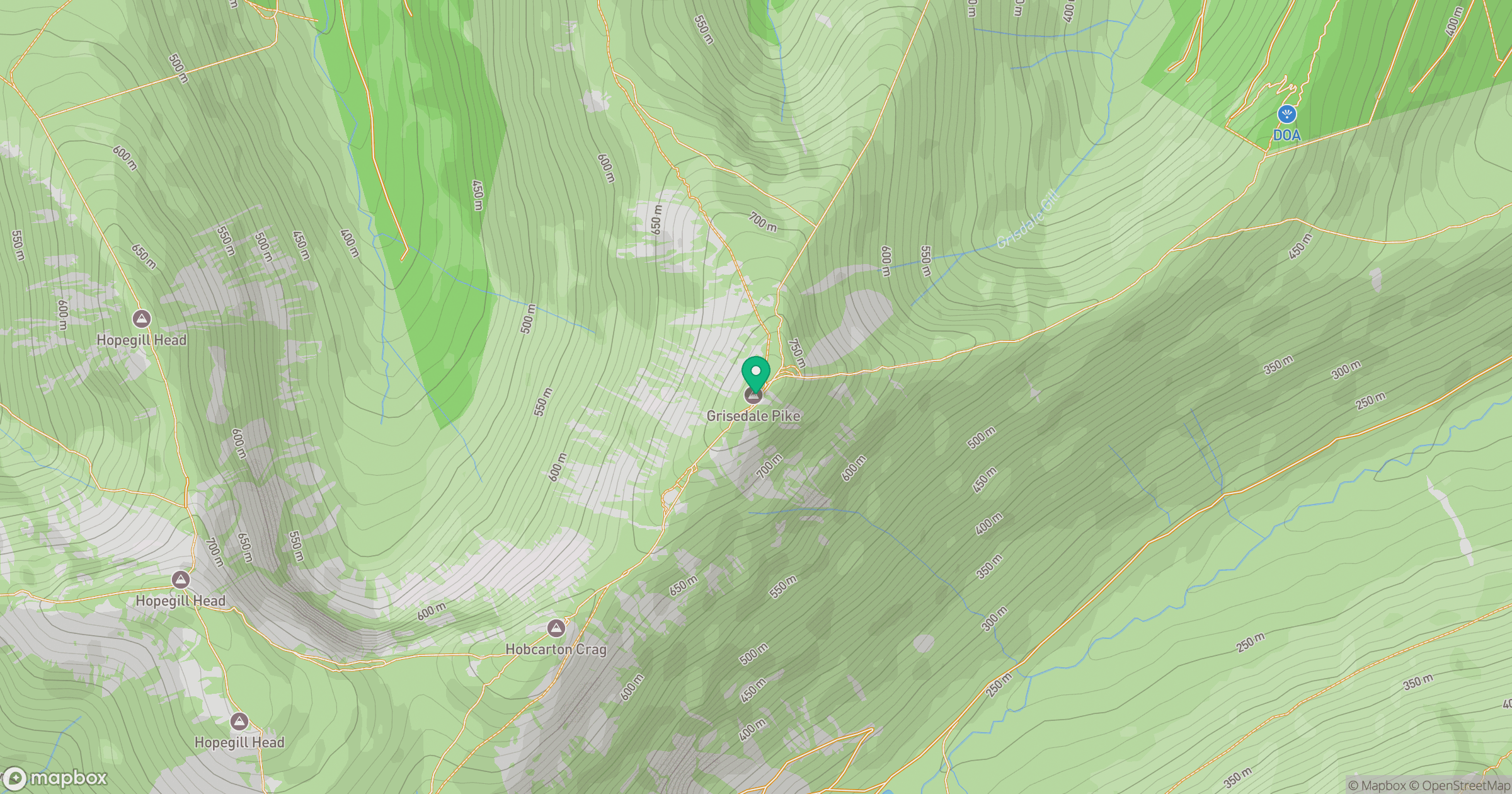
Grid reference: NY198225
View on OpenStreetMapOpens a map in a new tab, centred on the hill.
Nearby Hills
Crag Hill [Eel Crag]
839m
Grasmoor
852m
Fleetwith Pike
649m
High Stile [Grey Crag - High Stile]
806m
Pillar
892m
No comments yet. Be the first.