

Skiddaw
Good walks are even better shared.
Overview
Skiddaw rises north of Keswick in the Lake District Northern Fells. Its 930.4 m summit can be reached by the popular Jenkin Hill path or more demanding ridge and northern approaches. All routes require preparation for exposed mountain conditions.
Skiddaw
Skiddaw is a 930.4 m mountain north of Keswick in the Lake District Northern Fells. The familiar Jenkin Hill approach and the quieter northern and western routes offer very different days. A broad path does not remove the risks of high winds, cold or poor visibility.
Summit and landscape
A trig pillar, toposcope and stone shelter stand in the summit area. The Database of British and Irish Hills places the highest rock about 5 m south of the trig pillar, between the pillar and shelter. Several subsidiary tops lie along the ridge, so identify the main summit carefully in cloud. DoBIH
Clear-weather views include Derwent Water, Bassenthwaite Lake and the surrounding Lakeland fells, with distant views towards the Solway Firth and southern Scotland. Visibility is weather-dependent. Keswick Tourism
The Skiddaw Group consists mainly of ancient marine mudstone, siltstone and sandstone. The rocks are chiefly early to middle Ordovician in age and include the slaty rocks familiar around Keswick; their age does not mean the present mountain landform is 500 million years old. British Geological Survey
Route planning
These are planning summaries, not turn-by-turn navigation instructions. Numbers apply only to the itinerary named. Allow for weather, daylight, stops and the slowest member of the group.
- Jenkin Hill with Little Man return: Gale Road to Skiddaw by the main path, returning over Little Man and Lesser Man. WalkLakes gives approximately 10.1 km and 699 m ascent for this variant. The publisher's time is a minimum, so no typical duration is asserted here. Route source
- Ullock Pike from Ravenstone: This western ascent crosses Ullock Pike and Longside Edge to the Carl Side area, followed by steep loose ground to Skiddaw. The descent and return need to be planned. UKHillwalking
- Bakestall from Peter House Farm: Approach Whitewater Dash on the Cumbria Way, then climb Birkett Edge, Bakestall and Broad End to Skiddaw. Returning the same way and descending via Sale How and Skiddaw House make different outings. Choose a complete mapped itinerary; no common distance or duration covers both. Example northern circuit
- Lonscale Fell variants: The Cumbria Way contours below the summit above Glenderaterra. Including the summit requires an additional chosen ascent; some lines are steep and rough. A complete route and descent must be specified before attaching totals. Trail Magazine's longer circuit also includes Little Man, Carl Side and Dodd and is a different itinerary from an unspecified Lonscale ascent. Trail Magazine route
- Skiddaw House and Bakestall circuit: Gale Road to Skiddaw House, Whitewater Dash, Bakestall and Skiddaw, returning over Little Man and Lesser Man by Jenkin Hill. WalkLakes gives approximately 16.8 km and 890 m ascent. Its published time is a minimum; plan your own allowance. This defined circuit does not cross Sale How. Route source
Access and facilities
Gale Road (Latrigg) car park is reached by the minor road above Applethwaite; the car park is small and the road can be icy. Starting from Keswick avoids relying on a high-level parking space. Dodd Wood has a paid car park off the A591 opposite Mirehouse, with toilets and a tearoom. Parking near Peter House Farm is limited; keep access clear and follow local signs. Skiddaw House access, Forestry England
Penrith railway station connects with Keswick by Stagecoach X4/X5 buses. Check the current timetable, exact stop and last return for the route chosen. The high Gale Road car park should not be assumed to have a bus service. Stagecoach
Keswick provides shops, food and public toilets. Skiddaw House is an independent YHA-affiliated hostel accessible on foot or by mountain bike. Book accommodation in advance and check opening arrangements; it is not an open bothy or a guaranteed daytime refuge. Skiddaw House
History and name
The origin of the name is debated; an Old Norse interpretation involving a projecting crag and a hill or mound has been suggested. A definite translation as 'the seat of the hill' is unsupported. The Jenkin Hill path served Victorian pony-borne visitors. UKHillwalking
Skiddaw House dates from around 1829 and originally accommodated a keeper and a shepherd before its later use as a walkers' hostel. Cumbria County History Trust
Safety
The exposed high ground can be difficult to navigate in cloud. Loose slate can be slippery; western approaches include steep slopes and ridges. Northern and eastern circuits pass remote, sometimes wet ground and steep crags. Carry navigation equipment and know how to use it, and take warm waterproof clothing, food, water, a torch and emergency supplies. Mobile reception can be unreliable. Cumbria Wildlife Trust
Snow and ice may require winter skills, an ice axe and crampons. Check the mountain forecast, daylight and conditions, and turn back if the route exceeds your experience. British Mountaineering Council winter advice
Reviewed 15 October 2026. Conditions, access and transport can change.
Explore routes near Skiddaw
Walks starting near this hill. Open a route to check its map, distance and full itinerary.
Derwentwater Walk: full lakeside circuit from Keswick
View route
Binsey from Binsey Lodge Direct Out and Back Wainwright
View route
Whinlatter dark skies walk
View route
Whinlatter dark skies walk
View route
Route planning notes
These notes describe possible approaches. Check a route's map and access information when planning your walk.
Jenkin Hill Path with Little Man return
From Gale Road (Latrigg) car park, follow the Jenkin Hill path around Little Man to the main Skiddaw summit. Return over Little Man and Lesser Man before rejoining the Jenkin Hill path to the car park. WalkLakes publishes approximately 10.1 km for this specific variant. Its stated time is a minimum, so allow extra for conditions, stops and your pace. Starting in Keswick adds distance and ascent.
Skiddaw via Ullock Pike from Ravenstone
The Ravenstone approach climbs to Ullock Pike, traverses Longside Edge and Long Side, and reaches Skiddaw by the steep, loose path above Carlside Tarn, with a possible visit to Carl Side. This describes an ascent, not a complete circular route. Choose and map the descent and arrange the return before setting out. Check parking permission or public transport rather than assuming hotel parking is available.
Skiddaw via Bakestall and Whitewater Dash
From the Peter House Farm area, follow the Cumbria Way towards Whitewater Dash (Dash Falls), then climb steep Birkett Edge to Bakestall and continue over Broad End to Skiddaw. Keep away from Dead Crags. A return by the same route and a longer circuit via Sale How and Skiddaw House are different itineraries; select and map one before setting out.
Skiddaw via Lonscale Fell: route planning
Lonscale Fell can be included in a longer Skiddaw walk from Keswick, but the Cumbria Way traverses its flank above Glenderaterra rather than crossing its summit. A summit ascent and complete return must be chosen on a detailed map. Some approaches, including the north-east spur, involve steep rough ground and rocks and should not be described as a moderate alternative.
Skiddaw House and Bakestall circuit from Gale Road
This defined circuit follows the Cumbria Way from Gale Road around Lonscale Fell to Skiddaw House, then continues to Whitewater Dash. Climb Birkett Edge and Bakestall, continue over Broad End to Skiddaw, and return over Little Man and Lesser Man to the Jenkin Hill path and Gale Road. WalkLakes publishes approximately 16.8 km and 890 m ascent. Its time is a minimum, not a typical duration. This circuit does not use Sale How. Skiddaw House is a bookable hostel, not an open bothy.
Make a day of it, together
Find someone to share the walk with, or organise a day out along a route you like.
Photo Gallery
View all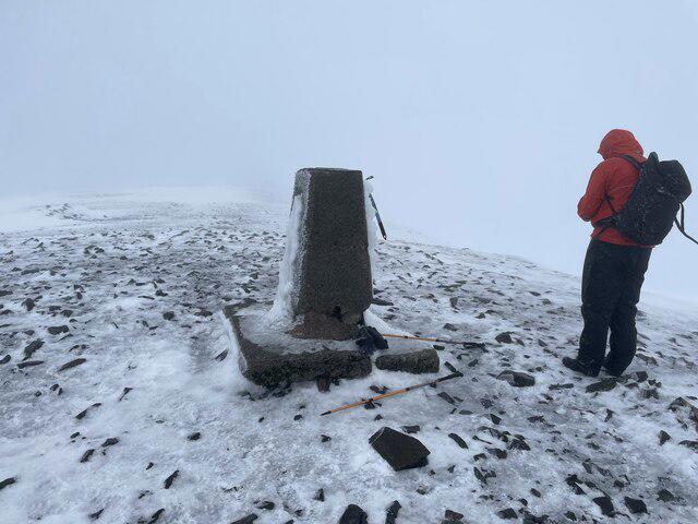 Photo could not load
NY2629 : Skiddaw Trig Point
Chris Thomas-Atkin
 Photo could not load
NY2629 : Skiddaw Man
Steven Brown
 Photo could not load
NY2629 : The top of Skiddaw
Ian Greig
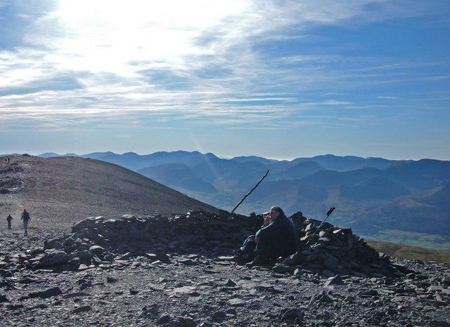 Photo could not load
NY2629 : Skiddaw Summit
michael ely
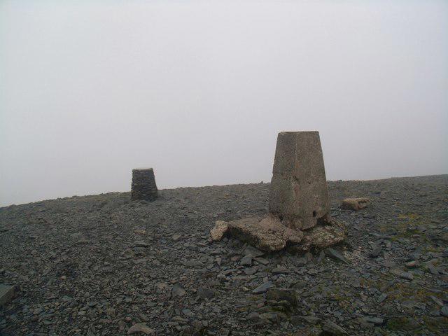 Photo could not load
NY2629 : Summit of Skiddaw
Euan Nelson
 Photo could not load
NY2629 : Skiddaw at sunset
Mike Quinn
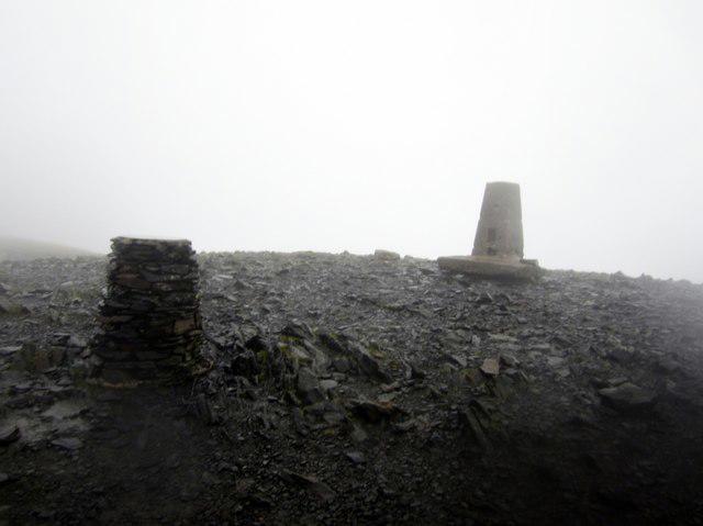 Photo could not load
NY2629 : The summit of Skiddaw
Graham Robson
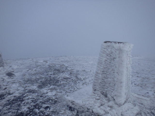 Photo could not load
NY2629 : Trig Pillar, Skiddaw
Michael Graham
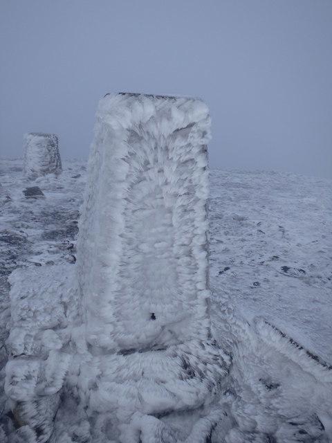 Photo could not load
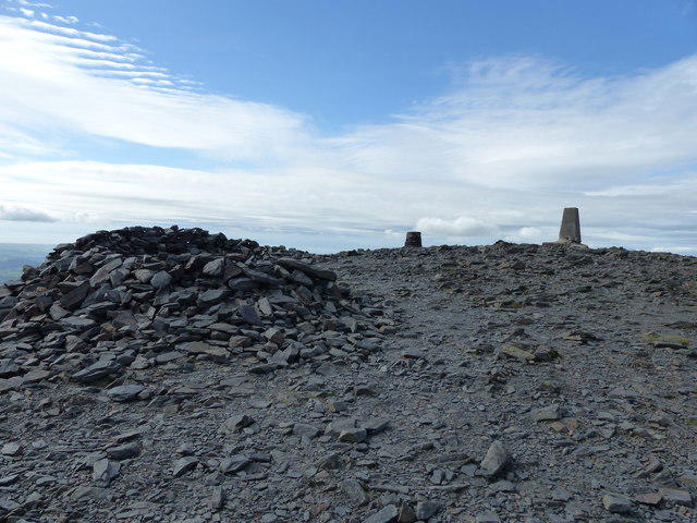
NY2629 : Trig Pillar and Viewfinder, Skiddaw
Michael Graham
NY2629 : Skiddaw summit
Anthony Foster
Hill facts and local notes
Classifications
Elevation
930m
3,052 ft
Prominence
706m
Coordinates
54.6514, -3.1478
NY260290
OS Map
89 90
Explorer: OL4S
At the Summit
A trig pillar, toposcope and stone shelter mark the summit area. The Database of British and Irish Hills identifies the highest point as a rock about 5 m south of the trig pillar, between the pillar and shelter.
Terrain & Geology
Skiddaw is formed from rocks of the Skiddaw Group, chiefly mudstone and siltstone with sandstone beds. These ancient marine sediments are mainly early to middle Ordovician in age; deformation and low-grade metamorphism produced the rocks traditionally called Skiddaw Slates.
Views & Scenery
In clear weather the summit area gives wide views across the Lake District, including Derwent Water and Bassenthwaite Lake, with more distant views towards the Solway Firth and southern Scotland. Cloud can hide the panorama.
History & Heritage
Name Origin
The origin of 'Skiddaw' is uncertain. An Old Norse derivation involving a projecting crag and a hill or mound is often suggested; 'the seat of the hill' is not an established translation.
Historical Significance
The Jenkin Hill route was used by Victorian visitors travelling up the mountain on ponies. Skiddaw House was built around 1829 as a keeper's lodge and shepherd's house and later became a walkers' hostel.
Getting There & Facilities
Parking
Gale Road (Latrigg) car park, approximately NY280253, is the high starting point for the Jenkin Hill path, reached by the minor road above Applethwaite. It is small and can fill up; keep the access road clear. Dodd Wood has a paid car park off the A591 opposite Mirehouse for western approaches. Parking near Peter House Farm is limited. Do not assume hotel or village parking is available without checking permission and local signs.
Public Transport
Penrith railway station has Stagecoach X4/X5 connections to Keswick. A walk can start in Keswick; do not assume buses serve the high Gale Road car park. Services towards Bassenthwaite and Mirehouse can help with western approaches. Check current stops, timetables and the last return for your route.
Nearby Facilities
Keswick has cafes, pubs, shops and public toilets. Dodd Wood has toilets and the Old Sawmill Tearoom, subject to opening hours. Skiddaw House is an independent, YHA-affiliated hostel reached on foot or by mountain bike; accommodation requires advance booking. Do not rely on it as an open bothy or guaranteed daytime shelter. Carry food, water and emergency equipment.
Safety Information
Known Hazards
- Strong winds, cold and low cloud affect the exposed summit ridge. Carry a map and compass and know how to use them; several subsidiary tops can confuse navigation in mist.
- Loose slate and steep paths can be slippery, particularly between Carl Side and the Skiddaw summit ridge. Ullock Pike and Longside Edge are more demanding than the main Jenkin Hill approach.
- Northern and eastern circuits include remote, sometimes boggy ground. Keep away from the cliffs of Dead Crags and Lonscale Crags, and do not improvise descents.
Seasonal Hazards
Snow and ice can turn summer paths into serious winter terrain. Appropriate winter skills, an ice axe and crampons may be necessary. Check the mountain forecast, allow for short daylight and avoid conditions beyond your experience. The narrow road to Gale Road car park can also be icy.
General Safety Tips
- Check weather conditions before setting out
- Carry appropriate clothing and equipment
- Let someone know your planned route
- Take a map, compass, and GPS device
- Carry emergency supplies: food, water, first aid kit, torch
Hills
Some common questions about the hills answered
Are there group walks up Skiddaw?
Many walkers use Walkmates to join or organise walks with others. You can check for group walks around Skiddaw through the maps
Are there other walkers around Skiddaw?
Activity varies by location and time, but Walkmates lets you see whether others have shared walks or shown interest in this area. Find other people through the walking friends search walking friends for Skiddaw search or of course create your own walk for Skiddaw
Can I organise a walk to Skiddaw?
Yes. If there aren’t any walks listed already, you can create a walk and make it available for others to join.
If you're signed up to Walkmates, you can create a walk to Skiddaw.
How do I find a walk up this hill?
There are often multiple ways to walk this hill, depending on experience and route preference. Walkmates helps you explore walks and routes that others have shared.
Can I suggest a new route up Skiddaw?
Yes. You can suggest or create routes to share with others. Walkmates focuses on the social side of walking, so routes are used to help people organise walks and explore areas together, rather than as detailed navigation tools or route libraries.
Other uses really appreciate knowledgeable walkers sharing their routes. Share your favourite route to Skiddaw here
The is an error or something incorrect about this hill. How do I let you know?
We always strive to keep the information on Walkmates as accurate as possible. If you find an error, please let us know through the contact form and we'll aim to correct it as quickly as possible
Community Discussion
Comments
Location
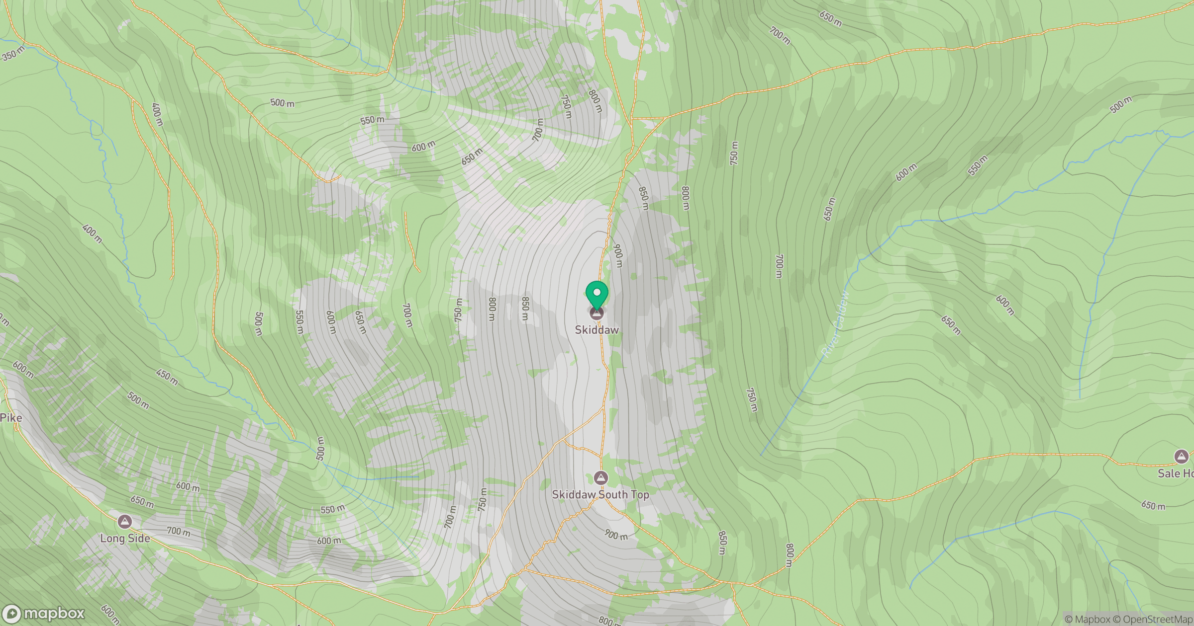
Grid reference: NY260290
View on OpenStreetMapOpens a map in a new tab, centred on the hill.
Nearby Hills

Blencathra - Hallsfell Top
868m
Grisedale Pike
790m
Crag Hill [Eel Crag]
839m
Grasmoor
852m
Fleetwith Pike
649m
No comments yet. Be the first.