

Tryfan North Top
Good walks are even better shared.
SH5958 : Y Derlwyn with Y Garn and Glyder Fawr in the background
Eric Jones Photo source
Overview
Tryfan North Top: An Adventurous Ascent
Nestled in the heart of Snowdonia National Park, Tryfan North Top rises majestically at an elevation of 917 meters. It’s among the standout peaks in the region, well-known for its thrilling scrambles and picturesque views.
Geology
The rugged landscape of Tryfan is predominantly formed from volcanic rock, specifically igneous granophyre. This geological background not only creates stunning visual features but also supports unique ecosystems.
Access
Parking: The nearest car park is located at Ogwen Cottage (SH 640 560). This popular site has ample space, but it pays to arrive early, especially during weekends.
Public Transport: Regular bus services run from nearby towns like Bangor, making it feasible for those venturing without a vehicle.
Nearest Town: The charming village of Bethesda is a stone's throw away, providing various amenities.
Routes
Two main routes are popular among hikers: the North Ridge Route—a challenging scramble—and the West Face Route, which offers a quieter alternative.
Summit Features
Reaching the top, you’ll encounter a substantial rock cairn and the infamous ‘Adam and Eve’ boulders, challenging your scrambling skills while providing a quintessential Tryfan photo opportunity.
Terrain
Expect rocky, steep paths with sections of loose scree. It’s advisable to have sturdy footwear and a healthy appreciation for the mountain's temperament!
Views
From the summit, feast your eyes on breathtaking panoramas of the Carneddau and Glyderau ranges, and on clear days, the distant Isle of Anglesey comes into view. Spring and autumn make for particularly stunning vistas.
Hazards
Be aware of loose rocks and steep drops. The weather can also be quite temperamental in the mountains—it's wise to carry layers and check forecasts before heading out.
Nearby Summits
While you're in the area, don’t miss the chance to explore nearby peaks such as Tryfan itself and Glyder Fach, both offering their own unique challenges and rewards.
History
The name 'Tryfan' hints at its three peaks, and its significance stretches beyond its physical form, engraved in Welsh folklore and mountaineering history.
In conclusion, whether you're a seasoned climber or a curious adventurer, Tryfan North Top offers an exhilarating experience that balances beauty and challenge, with views that will make your heart soar.
Don’t forget your camera, and maybe a friend—because nothing screams ‘adventure’ like having someone to blame for getting lost!
Explore routes near Tryfan North Top
Walks starting near this hill. Open a route to check its map, distance and full itinerary.
Snowdon Pyg Track returning by Miner's Track
View route
Beddgelert Forest: Derwen Circuit and Llyn Llywelyn
View route
Beddgelert Forest: Llyn Llywelyn Woodland Circuit
View route
Llyn Crafnant: Lakeside Circuit from the NRW Car Park
View route
Route planning notes
These notes describe possible approaches. Check a route's map and access information when planning your walk.
North Ridge Route
A classic ascent that offers exhilarating scrambling and stunning views, starting from the Ogwen Valley.
West Face Route
A less frequented path that provides a more secluded experience, perfect for adventurous hikers.
Make a day of it, together
Find someone to share the walk with, or organise a day out along a route you like.
Photo Gallery
View all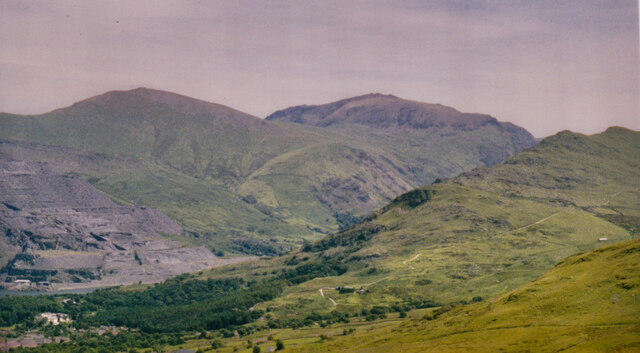 Photo could not load
SH5958 : Y Derlwyn with Y Garn and Glyder Fawr in the background
Eric Jones
Hill facts and local notes
Classifications
Elevation
577m
1,893 ft
Prominence
20m
Coordinates
53.1016, -4.0980
SH596580
OS Map
115
Explorer: OL17W
At the Summit
The summit is crowned by a large rock cairn, and you might spot the notorious 'Adam and Eve' boulders, a popular climbing challenge for many enthusiasts.
Terrain & Geology
The mountain is largely composed of volcanic rock, specifically igneous granophyre, giving it a rugged appearance and providing a unique ecological habitat.
Views & Scenery
Panoramic views of the surrounding Carneddau mountains, Glyderau, and down to the Ogwen Valley. On a clear day, the Isle of Anglesey and even a glimpse of the Irish Sea can be seen.
History & Heritage
Name Origin
The name 'Tryfan' is thought to derive from the Welsh 'tryfan' meaning 'three peaks'.
Historical Significance
The mountain is famous not only for its rugged beauty and challenging climbs but also for its role in Welsh folklore and its prominence within early mountaineering culture.
Getting There & Facilities
Parking
Parking available at the Ogwen Cottage car park (SH 640 560), which accommodates a significant number of vehicles, but arrives early to avoid disappointment!
Public Transport
Bus services operate from nearby towns such as Bangor and Llanberis, making it accessible for those without a car.
Nearby Facilities
Cafés and toilet facilities can be found at Ogwen Cottage. Bethesda has shops and additional amenities worthy of a pre-hike visit.
Safety Information
Known Hazards
- Loose rocks and steep drops; ensure you stay on marked paths and watch your footing.
- Weather can change rapidly, leading to potential risks of hypothermia in cooler months.
General Safety Tips
- Check weather conditions before setting out
- Carry appropriate clothing and equipment
- Let someone know your planned route
- Take a map, compass, and GPS device
- Carry emergency supplies: food, water, first aid kit, torch
Hills
Some common questions about the hills answered
Are there group walks up Tryfan North Top?
Many walkers use Walkmates to join or organise walks with others. You can check for group walks around Tryfan North Top through the maps
Are there other walkers around Tryfan North Top?
Activity varies by location and time, but Walkmates lets you see whether others have shared walks or shown interest in this area. Find other people through the walking friends search walking friends for Tryfan North Top search or of course create your own walk for Tryfan North Top
Can I organise a walk to Tryfan North Top?
Yes. If there aren’t any walks listed already, you can create a walk and make it available for others to join.
If you're signed up to Walkmates, you can create a walk to Tryfan North Top.
How do I find a walk up this hill?
There are often multiple ways to walk this hill, depending on experience and route preference. Walkmates helps you explore walks and routes that others have shared.
Can I suggest a new route up Tryfan North Top?
Yes. You can suggest or create routes to share with others. Walkmates focuses on the social side of walking, so routes are used to help people organise walks and explore areas together, rather than as detailed navigation tools or route libraries.
Other uses really appreciate knowledgeable walkers sharing their routes. Share your favourite route to Tryfan North Top here
The is an error or something incorrect about this hill. How do I let you know?
We always strive to keep the information on Walkmates as accurate as possible. If you find an error, please let us know through the contact form and we'll aim to correct it as quickly as possible
Community Discussion
Comments
Location
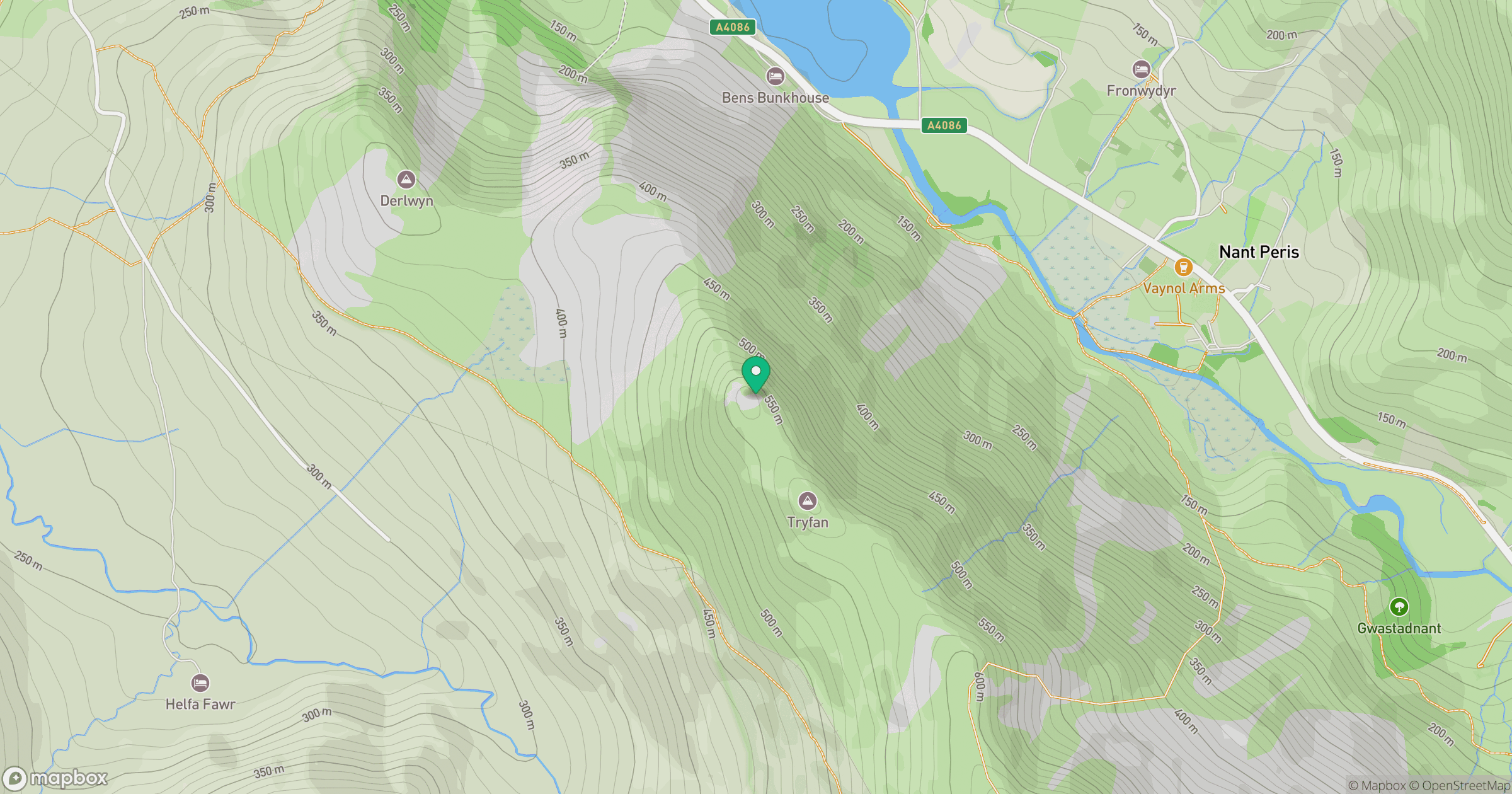
Grid reference: SH596580
View on OpenStreetMapOpens a map in a new tab, centred on the hill.
No comments yet. Be the first.