

Troweir Hill
Good walks are even better shared.
Overview
Troweir Hill Hike: A Journey into the Southern Uplands
Troweir Hill, standing proudly at 319 meters, may not be the highest mountain in the Southern Uplands, but it certainly has charm! Nestled near Newton Stewart, this hill offers a delightful outing for both seasoned hikers and newcomers alike.
Geology
Troweir Hill is primarily composed of sandstone, which intricately weaves through the tapestry of larger rock formations from the Carboniferous era. Its sturdy layers make for excellent hiking platforms, and the geological diversity is a point of interest for geology enthusiasts.
Routes
- From Troweir Farm: A relatively easy yet rewarding trek, this route spans approximately 4.5 km and takes roughly 2.5 hours. You’ll be led through beautiful verdant meadows before ascending steadily to the summit. Keep your eyes peeled for local wildlife!
- Glenmidge Approach: For those keen on a bit of a challenge, this route offers a trek of about 6 km. Expect to navigate some steep climbs, with an overall time of around 3.5 hours. Just remember, the views from the top are like icing on the cake!
Summit Features
At the summit, you’ll be greeted by a humble but iconic stone cairn, a cherished marker for many hikers. The views are absolutely glorious, showcasing a panorama that would impress even the most seasoned mountain goat.
Terrain
As you ascend, you’ll traverse a mixture of grassy slopes and rocky outcrops, interspersed with patches of boggy land. Proper footwear is key unless you're keen on a new bog-themed adventure.
Views
The hill rewards its climbers with breathtaking views over the Galloway Hills. The peaks of Merrick can be particularly striking, making it a great spot for photography enthusiasts.
Hazards
While Troweir Hill is accessible, always stay alert to rapidly changing weather. Slipping on rocks and muddy paths is all part of the fun unless you’d rather avoid an unexpected dip in the squishy ground.
Nearby Summits
For those looking to extend their adventure, nearby summits like Merrick (843 meters) and Benyellary (693 meters) offer additional challenges and stunning views.
Access
Accessing Troweir Hill is a doddle with parking available at Troweir Farm. The nearest public transport drops you off in Newton Stewart, and from there, it’s a short drive or a good walk to the starting point.
Facilities
Post-hike, indulge in the local eateries in Newton Stewart—they can be quite the treat after a day spent in the great outdoors! Facilities including toilets are at your disposal in town, ensuring you’re well taken care of.
History
Troweir comes from the Gaelic language, meaning 'heavily wooded', perfect given the lush green surroundings. Historically, this hill has played an important role for locals, serving as both a navigational aid and a refuge for those working the land.
Whether you choose to tackle this hill for a casual outing or a well-deserved escape, Troweir Hill is a delightful slice of the Southern Uplands that showcases Scotland's natural beauty magnificently.
Explore routes near Troweir Hill
Public walks starting within 80 km of this hill. Nearby does not mean a route reaches the summit; check its map and access before setting out.
Carrick Forest Drive: Stinchar Bridge to Loch Doon
View route
Glentrool Water of Trool and Spout Head Trail
View route
Loch Trool: Full Loch and Oak Woodland Circuit
View route
Wood of Cree Waterfalls and Scrubland Circuit
View route
Route planning notes
These notes describe possible approaches, not verified navigable routes or permission to cross land. Check current paths, local access rules and conditions before setting out.
From Troweir Farm
This route takes you from Troweir Farm through a well-marked track leading to the summit, allowing you to embrace the lush green landscapes.
Glenmidge Approach
A beautiful path winding through forests and open moorland, featuring some steep sections that promise to get your heart racing.
Make a day of it, together
Find someone to share the walk with, or organise a day out along a route you like.
Photo Gallery
View all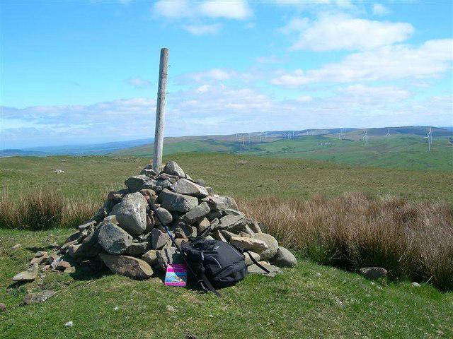 Photo could not load
NX2196 : Towards The Wind Farm
Mary and Angus Hogg
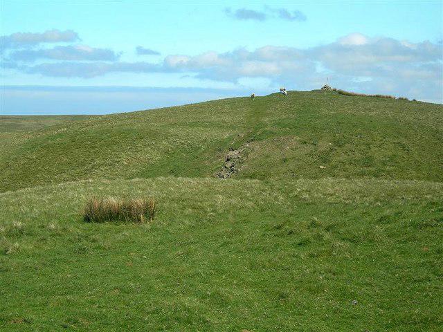 Photo could not load
NX2195 : Getting Near The Top
Mary and Angus Hogg
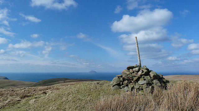 Photo could not load
NX2196 : Troweir Hill (summit cairn)
Raibeart MacAoidh
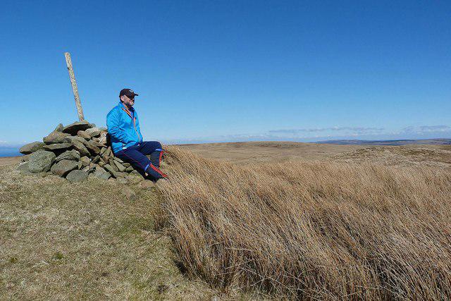 Photo could not load
NX2196 : Troweir Hill (summit cairn)
Raibeart MacAoidh
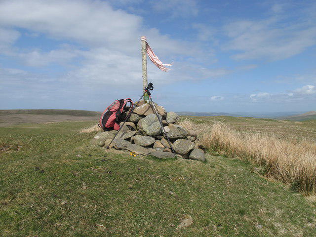 Photo could not load
NX2196 : Troweir Hill
Rude Health
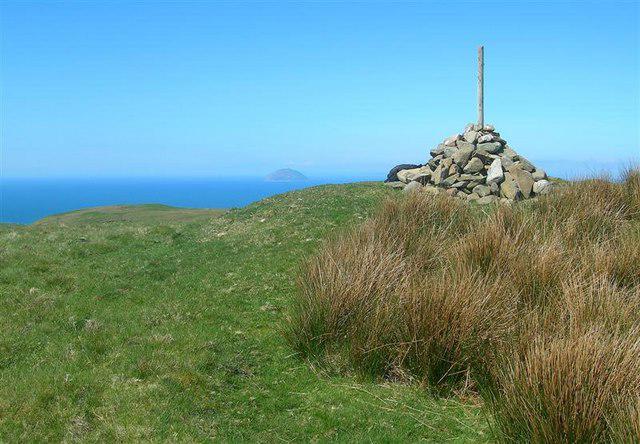 Photo could not load
NX2196 : Troweir Cairn
Mary and Angus Hogg
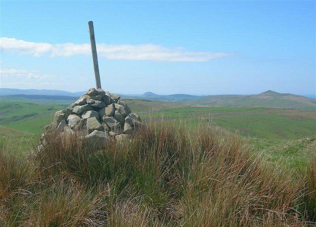 Photo could not load
NX2196 : Towards Knockdolian
Mary and Angus Hogg
Hill facts and local notes
Classifications
Elevation
296m
970 ft
Prominence
149m
Coordinates
55.2259, -4.8139
NX211960
OS Map
76
Explorer: 317 326S
At the Summit
The summit features a simple but iconic stone cairn, serving as a beacon for weary hikers. There's also a lovely view of the surrounding hills which is decidedly Instagram-worthy.
Terrain & Geology
Troweir Hill is primarily composed of sandstone, providing a solid base for hikers. The rock formations in the area are part of the older Carboniferous geological period, making them both fascinating and somewhat resistant to erosion.
Views & Scenery
From the summit, hikers can enjoy panoramic views of the Galloway Hills, with the rugged contours of Merrick and other prominent peaks dominating the horizon.
History & Heritage
Name Origin
The etymology of Troweir is derived from Gaelic 'Tromair', meaning 'heavily wooded', which is quite fitting given the surrounding vegetation.
Historical Significance
Historically, Troweir Hill has been a local landmark for centuries, guiding travelers and serving as a point of refuge for sheep herders.
Getting There & Facilities
Check current local access restrictions, parking rules and transport timetables before travelling. These notes do not confirm public access to the summit.
Parking
Parking is available at Troweir Farm with a small car park capable of accommodating several vehicles. Ensure to park considerately.
Public Transport
The nearest bus service runs from Newton Stewart to Troweir, but check local schedules as they can be infrequent.
Nearby Facilities
While Troweir itself doesn’t offer facilities, Newton Stewart has several cafes and pubs for a well-deserved pint or hearty meal after your hike. Toilets can be found in town.
Safety Information
Known Hazards
- Variable weather conditions can change rapidly, so be prepared for everything from sunburn to unexpected rain showers. Slippery rocks and muddy paths can also be a challenge.
General Safety Tips
- Check weather conditions before setting out
- Carry appropriate clothing and equipment
- Let someone know your planned route
- Take a map, compass, and GPS device
- Carry emergency supplies: food, water, first aid kit, torch
Hills
Some common questions about the hills answered
Are there group walks up Troweir Hill?
Many walkers use Walkmates to join or organise walks with others. You can check for group walks around Troweir Hill through the maps
Are there other walkers around Troweir Hill?
Activity varies by location and time, but Walkmates lets you see whether others have shared walks or shown interest in this area. Find other people through the walking friends search walking friends for Troweir Hill search or of course create your own walk for Troweir Hill
Can I organise a walk to Troweir Hill?
Yes. If there aren’t any walks listed already, you can create a walk and make it available for others to join.
If you're signed up to Walkmates, you can create a walk to Troweir Hill.
How do I find a walk up this hill?
There are often multiple ways to walk this hill, depending on experience and route preference. Walkmates helps you explore walks and routes that others have shared.
Can I suggest a new route up Troweir Hill?
Yes. You can suggest or create routes to share with others. Walkmates focuses on the social side of walking, so routes are used to help people organise walks and explore areas together, rather than as detailed navigation tools or route libraries.
Other uses really appreciate knowledgeable walkers sharing their routes. Share your favourite route to Troweir Hill here
The is an error or something incorrect about this hill. How do I let you know?
We always strive to keep the information on Walkmates as accurate as possible. If you find an error, please let us know through the contact form and we'll aim to correct it as quickly as possible
Community Discussion
Comments
Location
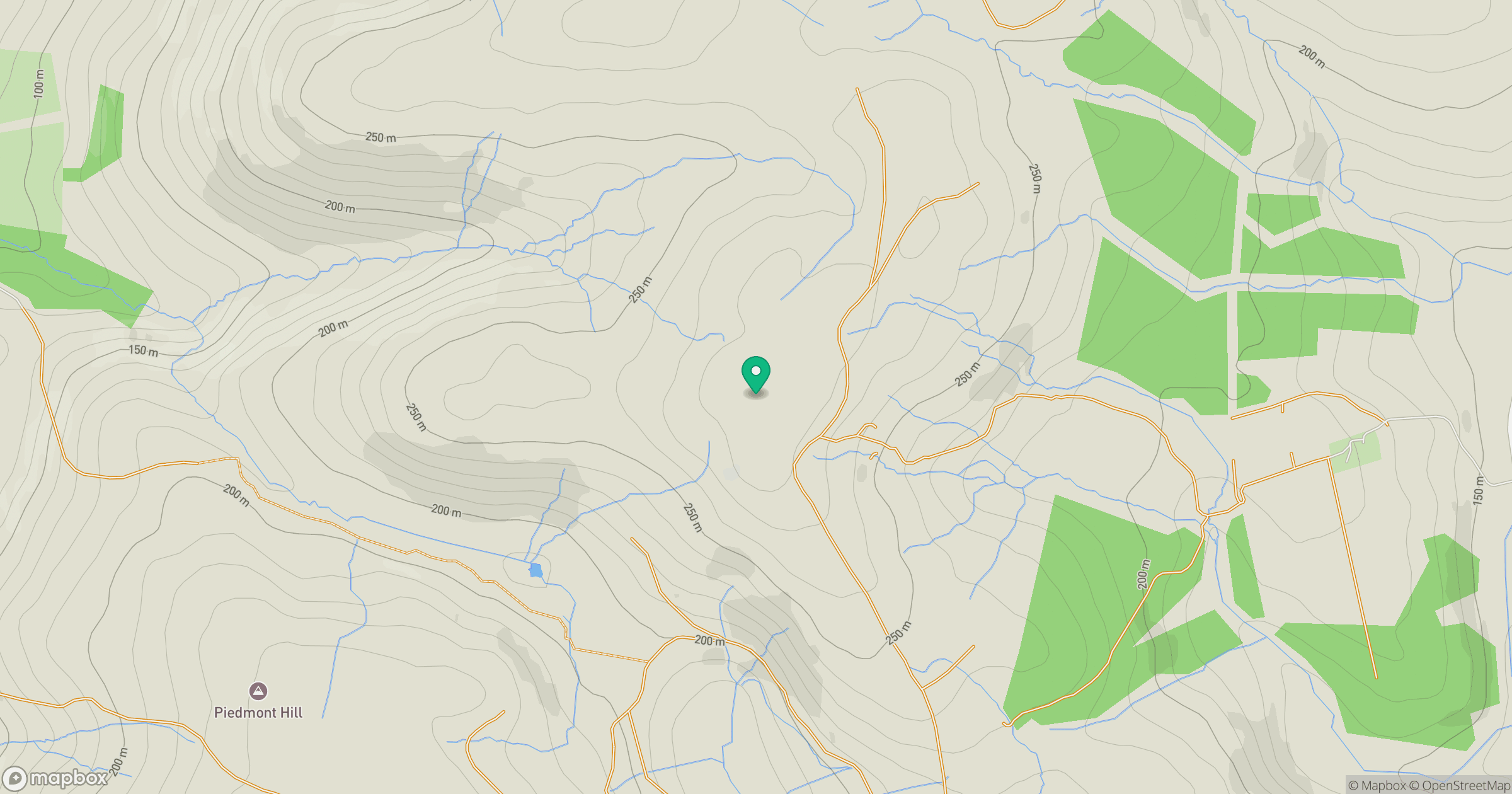
Grid reference: NX211960
View on OpenStreetMapOpens a map in a new tab, centred on the hill.
Hills within 30 km
Straight-line distance, not a walking route or confirmation of access.
No comments yet. Be the first.