
Kirk Hill
Good walks are even better shared.
Overview
Kirk Hill: A Hidden Gem in the Scottish Borders
Nestled in the picturesque Scottish Borders, Kirk Hill stands proudly at 229 meters, boasting a modest yet rewarding prominence of 45 meters. Like the clever fox that knows its way around the woods, this hill offers a delightful escape for hikers looking to stretch their legs and breathe in the fresh air.
Geology
The hill is draped in fascinating volcanic rock formations that whisper stories of ancient lava flows. Hiking here is akin to taking a trip back in time as you observe the geological wonders shaped by millennia of nature's artistry.
Access
Getting to Kirk Hill is a breeze. The nearest parking can be found at the community hall in Kirk Yetholm, which is a stone's throw from the starting point of our loop trail. If public transport is more your speed, be aware that services from Kelso are limited, so it may be wise to check ahead; a taxi could save you a bit of hassle!
The Route
The Kirk Hill Loop provides a modest 4.5 km jaunt that will take approximately 2.5 hours to complete, depending on how often you stop for those oh-so-important photo ops. The trail is classified as moderate, meaning it’s suitable for most hikers but do lace up those boots properly; we wouldn’t want you face-planting into the heather!
Terrain and Summits
As you meander through the grassy terrain, watch for rocky outcrops and the occasional bog, which can feel like a sneaky trap set by Mother Nature herself. Upon reaching the summit, you’ll be greeted by a humble stone cairn, a reminder that sometimes simplicity is key.
Views
Oh, the views! From this elevated perch, you can feast your eyes on the Cheviot Hills to the south, creating a stunning backdrop against the rolling landscape. For the avid adventurer with a keen eye, the Eildon Hills make a delightful appearance on clear days. The best times to experience this visual banquet are during the spring and autumn months, when the foliage transforms into a painter's palette.
Hazards
While Kirk Hill may not be Everest, it comes with its own set of challenges; be prepared for slippery rocks and unexpected muddy patches, especially after a downpour. We've all been there, and it's an experience that can evoke a good chuckle… or a most embarrassing slip!
Facilities
Once you’ve conquered the hill, why not reward yourself with a hearty meal or a slice of cake in Kelso? The town, just a short drive away, offers plenty of facilities that are sure to tickle your fancy—public toilets included!
Conclusion
Kirk Hill may not be the highest peak, but it offers a beautiful blend of nature, history, and good old-fashioned Scottish countryside charm that's sure to delight any hiker willing to take the plunge. So grab your boots, bring your sense of adventure, and hit the trail—it's a climb worth every step!
Last updated: 2023-10-01
Explore routes near Kirk Hill
Public walks starting within 80 km of this hill. Nearby does not mean a route reaches the summit; check its map and access before setting out.
Carrick Forest Drive: Stinchar Bridge to Loch Doon
View route
Glentrool Water of Trool and Spout Head Trail
View route
Loch Trool: Full Loch and Oak Woodland Circuit
View route
Wood of Cree Waterfalls and Scrubland Circuit
View route
Route planning notes
These notes describe possible approaches, not verified navigable routes or permission to cross land. Check current paths, local access rules and conditions before setting out.
Kirk Hill Loop
A scenic loop trail starting from the small parking area near the entry of the woods, leading hikers through lush greenery and eventually ascending to the summit with panoramic views.
Make a day of it, together
Find someone to share the walk with, or organise a day out along a route you like.
Hill facts and local notes
Classifications
Elevation
259m
850 ft
Prominence
137m
Coordinates
55.3023, -4.7326
NS266043
OS Map
76
Explorer: 326S
At the Summit
The summit sports a simple stone cairn which, while not impressive, serves as a humble marker for those who reach the top. The panoramic views are the real trophy.
Terrain & Geology
Kirk Hill is predominantly composed of volcanic rock formations, with remnants of ancient lava flows. The area showcases a fascinating interplay of geological processes that unfolded millions of years ago, offering insight into the region's tectonic history.
Views & Scenery
From the summit, enjoy sweeping views of the Cheviot Hills to the south and the rolling landscape of the Scottish Borders. On a clear day, the iconic Eildon Hills can also be spotted in the distance.
History & Heritage
Name Origin
The name 'Kirk' is derived from the Old Norse word 'kirka', meaning church, reflecting the historical presence of ecclesiastical structures in the vicinity.
Historical Significance
Kirk Hill has been a point of interest for local folklore and is often a destination for countryside walks, resonating with both history and local culture.
Getting There & Facilities
Check current local access restrictions, parking rules and transport timetables before travelling. These notes do not confirm public access to the summit.
Parking
Parking is available at the foot of the hill, near the community hall in the village of Kirk Yetholm. It’s a small car park, so arrive early to nab a space.
Public Transport
Limited public transport is available, with the nearest bus service connecting from Kelso. Check local schedules as they may not run frequently.
Nearby Facilities
While facilities near Kirk Hill are limited, Kelso offers cafes, restaurants, and public toilets for hikers. Be sure to fuel up before your adventure!
Safety Information
Known Hazards
- Watch out for slippery rocks and muddy paths, especially after rain. Occasional deep heather and bracken can obscure the footpath.
General Safety Tips
- Check weather conditions before setting out
- Carry appropriate clothing and equipment
- Let someone know your planned route
- Take a map, compass, and GPS device
- Carry emergency supplies: food, water, first aid kit, torch
Hills
Some common questions about the hills answered
Are there group walks up Kirk Hill?
Many walkers use Walkmates to join or organise walks with others. You can check for group walks around Kirk Hill through the maps
Are there other walkers around Kirk Hill?
Activity varies by location and time, but Walkmates lets you see whether others have shared walks or shown interest in this area. Find other people through the walking friends search walking friends for Kirk Hill search or of course create your own walk for Kirk Hill
Can I organise a walk to Kirk Hill?
Yes. If there aren’t any walks listed already, you can create a walk and make it available for others to join.
If you're signed up to Walkmates, you can create a walk to Kirk Hill.
How do I find a walk up this hill?
There are often multiple ways to walk this hill, depending on experience and route preference. Walkmates helps you explore walks and routes that others have shared.
Can I suggest a new route up Kirk Hill?
Yes. You can suggest or create routes to share with others. Walkmates focuses on the social side of walking, so routes are used to help people organise walks and explore areas together, rather than as detailed navigation tools or route libraries.
Other uses really appreciate knowledgeable walkers sharing their routes. Share your favourite route to Kirk Hill here
The is an error or something incorrect about this hill. How do I let you know?
We always strive to keep the information on Walkmates as accurate as possible. If you find an error, please let us know through the contact form and we'll aim to correct it as quickly as possible
Community Discussion
Comments
Location
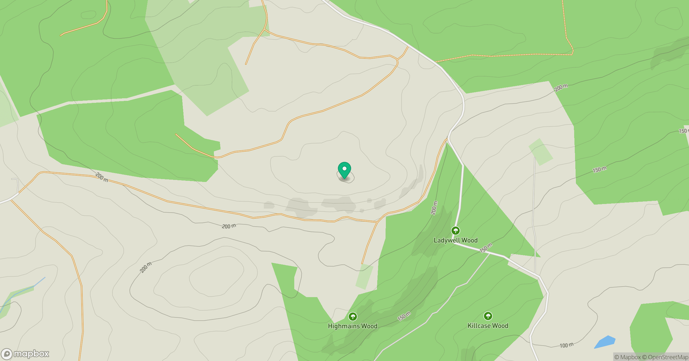
Grid reference: NS266043
View on OpenStreetMapOpens a map in a new tab, centred on the hill.
Hills within 30 km
Straight-line distance, not a walking route or confirmation of access.
No comments yet. Be the first.