

Tennyson Down
Good walks are even better shared.
SZ3285 : Tennyson's Monument
Ian Capper Photo source
Overview
Tennyson Down is a 147 m chalk hill on the western Isle of Wight, above Freshwater Bay. The Tennyson Monument is the conspicuous landmark, while the unmarked true summit lies about 20 m east-north-east of it. Walks from High Down Chalk Pit can combine the summit with Freshwater Bay or the Needles headland. The open downs have steep approaches and unfenced cliffs.
Tennyson Down
Overview
Tennyson Down is a 147 m chalk hill on the western Isle of Wight, above Freshwater Bay. The Tennyson Monument is the conspicuous landmark, while the unmarked true summit lies about 20 m east-north-east of it. Walks from High Down Chalk Pit can combine the summit with Freshwater Bay or the Needles headland. The open downs have steep approaches and unfenced cliffs.
Summit and views
The true summit is unmarked ground at SZ325853, about 20 m east-north-east of the Tennyson Monument. The granite memorial cross is the main landmark. DoBIH records the nearby trig point as destroyed, so it should not be used as an expected summit marker.
Wide views across West Wight and the surrounding sea, with the mainland visible in clear conditions. Continue west to the dedicated Needles viewpoint for the close view of the chalk stacks.
Geology and terrain
Tennyson Down is part of the chalk ridge running across the Isle of Wight. Its rolling downland ends in steep chalk cliffs to the south and west, while a scarp slopes down to the north. Chalk grassland, gorse and patches of woodland form a varied landscape.
Chalk grassland, exposed downland paths, woodland-edge paths, steep steps, gates and stiles.
Walking routes
High Down Pit, Freshwater Bay and summit circuit
From High Down Chalk Pit (SZ324855), follow T24 east below the woodland. At the four-way junction descend left; near Tennyson’s Bridge turn right alongside the golf course. Turn right at the road, passing St Agnes and Dimbola Lodge. Enter the field on the right, climb through the skyline gate and curve uphill to the monument. Visit the unmarked summit 20 m ENE, then return to the cross. Descend north through the woodland gap on T27 to the starting car park.
High Down Pit, summit and Needles circuit
Start at High Down Chalk Pit (SZ324855). Climb T27 to the monument and visit the unmarked summit 20 m ENE. Return to the cross, head west past the aerial building’s right side, then descend to the Coastguard Station road and signed Needles viewpoint. Back on the road, turn left onto the steps before New Battery towards Old Battery. Continue towards Alum Bay; take T25 at the sharp left bend. Pass the farm, climb to the replica beacon and descend T24 to the starting car park.
Hazards and access
Cliff edges are unfenced. Keep well back from the edge and stay on established paths; coastal erosion affects this chalk headland.
Strong winds can make the open downs and headland difficult. Chalk paths and the steep steps from High Down Chalk Pit are slippery when wet; take particular care on the descent.
Routes cross grazing land and include gates and stiles. Keep dogs on leads around livestock and wildlife and follow the seasonal ground-nesting-bird restrictions shown on site.
For extensions beyond these circuits, Headon Warren footpath T16 and Afton Down footpath F35 were listed as closed by the council when checked on 17 October 2026. Follow the council’s current notices and on-site signs; these are separate from the Tennyson Down summit circuits.
High Down Chalk Pit car park is at the end of High Down Lane, reached by turning off the Alum Bay road at the High Down Inn. The National Trust trail starts here at its published grid reference SZ324855. Freshwater Bay is another starting area, but it is not the nearest parking for the short quarry approach.
Southern Vectis 7 links Newport and Yarmouth with Freshwater, Totland and Alum Bay; 12 serves Freshwater Bay. The seasonal Needles Breezer links Yarmouth, Freshwater Bay and the Battery, advertised for 23 March–1 November 2026. Tennyson Road works divert 7/12/Breezer from 12 October 08:00 to 23 October 17:00, 2026. Check the operator’s current stops and timetable; these services do not establish a stop at High Down Pit.
Facilities
The Needles Old Battery has toilets and a tearoom for visitors to that attraction; admission applies. These facilities are on the western headland, not at the summit or High Down Chalk Pit. Check the Battery’s opening arrangements before relying on them.
Nearby summits and features
Headon Hill (120 m) and West High Down (140.6 m) are separate nearby hills.
Tennyson Monument, the Needles viewpoint, Needles Old Battery and New Battery, and the prehistoric earthworks on the downs.
History and name
Named after Alfred, Lord Tennyson, the poet laureate who lived at nearby Farringford and walked on the downs.
Tennyson rented nearby Farringford in 1853 and bought it in 1856. The granite memorial cross was erected in 1897 on the former Nodes Beacon site. The down also preserves prehistoric earthworks: Historic England identified an oval enclosure using lidar in 2014, and recorded that cliff erosion had already removed part of it.
Explore routes near Tennyson Down
Walks starting near this hill. Open a route to check its map, distance and full itinerary.
Wilverley Inclosure Walk, New Forest
View route
Ventnor Downs Dakota Crash Memorial Circuit
View route
Commoners’ Ways: Kingston, Corfe Castle and Blashenwell
View route
Badbury Rings and The Oaks from Heron Drove, Dorset
View route
Route planning notes
These notes describe possible approaches. Check a route's map and access information when planning your walk.
High Down Pit, Freshwater Bay and summit circuit
From High Down Chalk Pit (SZ324855), follow T24 east below the woodland. At the four-way junction descend left; near Tennyson’s Bridge turn right alongside the golf course. Turn right at the road, passing St Agnes and Dimbola Lodge. Enter the field on the right, climb through the skyline gate and curve uphill to the monument. Visit the unmarked summit 20 m ENE, then return to the cross. Descend north through the woodland gap on T27 to the starting car park.
High Down Pit, summit and Needles circuit
Start at High Down Chalk Pit (SZ324855). Climb T27 to the monument and visit the unmarked summit 20 m ENE. Return to the cross, head west past the aerial building’s right side, then descend to the Coastguard Station road and signed Needles viewpoint. Back on the road, turn left onto the steps before New Battery towards Old Battery. Continue towards Alum Bay; take T25 at the sharp left bend. Pass the farm, climb to the replica beacon and descend T24 to the starting car park.
Make a day of it, together
Find someone to share the walk with, or organise a day out along a route you like.
Photo Gallery
View all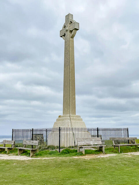 Photo could not load
SZ3285 : Tennyson's Monument
Ian Capper
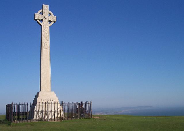 Photo could not load
SZ3285 : Tennyson's Monument
Bob Embleton
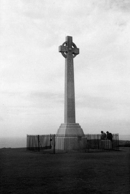 Photo could not load
SZ3285 : Tennyson's Monument, Tennyson Down, Isle of Wight
Christine Matthews
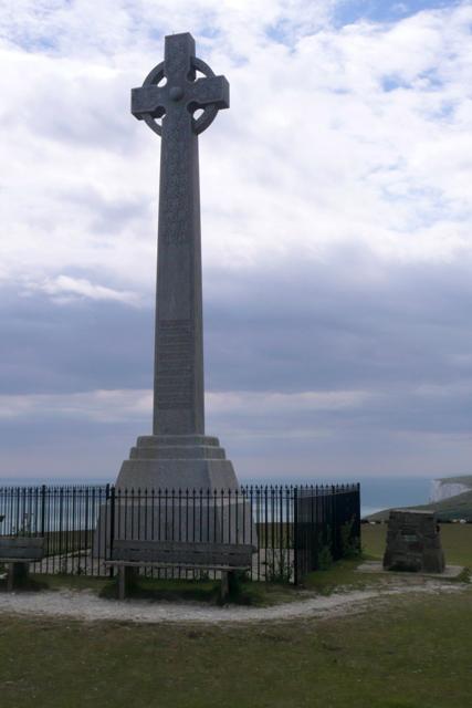 Photo could not load
SZ3285 : Tennyson's Monument
Graham Horn
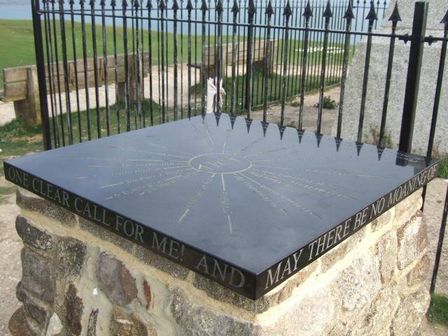 Photo could not load
SZ3285 : The toposcope on Tennyson Down
David Smith
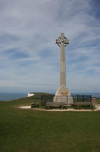 Photo could not load
SZ3285 : Tennyson Monument
Anne Burgess
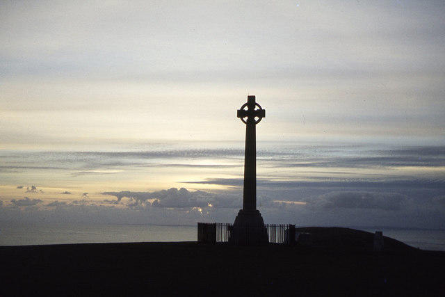 Photo could not load
SZ3285 : Dusk at Tennyson Down
Colin Park
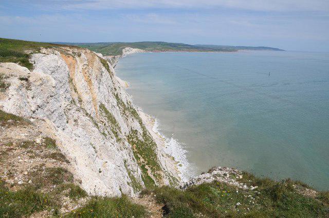 Photo could not load
SZ3285 : Highdown Cliffs
Philip Halling
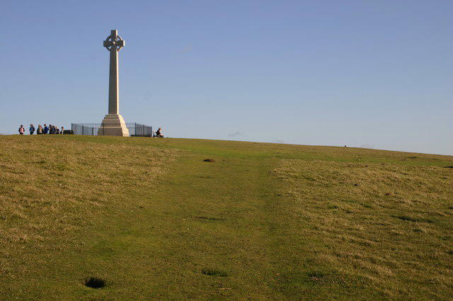 Photo could not load
SZ3285 : Tennyson's Monument
Shaun Ferguson
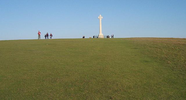
SZ3285 : Tennyson's Monument
Bob Embleton
Hill facts and local notes
Classifications
Elevation
147m
482 ft
Prominence
145m
Coordinates
50.6667, -1.5414
SZ325853
OS Map
196
Explorer: OL29W
At the Summit
The true summit is unmarked ground at SZ325853, about 20 m east-north-east of the Tennyson Monument. The granite memorial cross is the main landmark. DoBIH records the nearby trig point as destroyed, so it should not be used as an expected summit marker.
Terrain & Geology
Tennyson Down is part of the chalk ridge running across the Isle of Wight. Its rolling downland ends in steep chalk cliffs to the south and west, while a scarp slopes down to the north. Chalk grassland, gorse and patches of woodland form a varied landscape.
Views & Scenery
Wide views across West Wight and the surrounding sea, with the mainland visible in clear conditions. Continue west to the dedicated Needles viewpoint for the close view of the chalk stacks.
History & Heritage
Name Origin
Named after Alfred, Lord Tennyson, the poet laureate who lived at nearby Farringford and walked on the downs.
Historical Significance
Tennyson rented nearby Farringford in 1853 and bought it in 1856. The granite memorial cross was erected in 1897 on the former Nodes Beacon site. The down also preserves prehistoric earthworks: Historic England identified an oval enclosure using lidar in 2014, and recorded that cliff erosion had already removed part of it.
Getting There & Facilities
Parking
High Down Chalk Pit car park is at the end of High Down Lane, reached by turning off the Alum Bay road at the High Down Inn. The National Trust trail starts here at its published grid reference SZ324855. Freshwater Bay is another starting area, but it is not the nearest parking for the short quarry approach.
Public Transport
Southern Vectis 7 links Newport and Yarmouth with Freshwater, Totland and Alum Bay; 12 serves Freshwater Bay. The seasonal Needles Breezer links Yarmouth, Freshwater Bay and the Battery, advertised for 23 March–1 November 2026. Tennyson Road works divert 7/12/Breezer from 12 October 08:00 to 23 October 17:00, 2026. Check the operator’s current stops and timetable; these services do not establish a stop at High Down Pit.
Nearby Facilities
The Needles Old Battery has toilets and a tearoom for visitors to that attraction; admission applies. These facilities are on the western headland, not at the summit or High Down Chalk Pit. Check the Battery’s opening arrangements before relying on them.
Safety Information
Known Hazards
- Cliff edges are unfenced. Keep well back from the edge and stay on established paths; coastal erosion affects this chalk headland.
- Strong winds can make the open downs and headland difficult. Chalk paths and the steep steps from High Down Chalk Pit are slippery when wet; take particular care on the descent.
- Routes cross grazing land and include gates and stiles. Keep dogs on leads around livestock and wildlife and follow the seasonal ground-nesting-bird restrictions shown on site.
- For extensions beyond these circuits, Headon Warren footpath T16 and Afton Down footpath F35 were listed as closed by the council when checked on 17 October 2026. Follow the council’s current notices and on-site signs; these are separate from the Tennyson Down summit circuits.
General Safety Tips
- Check weather conditions before setting out
- Carry appropriate clothing and equipment
- Let someone know your planned route
- Take a map, compass, and GPS device
- Carry emergency supplies: food, water, first aid kit, torch
Hills
Some common questions about the hills answered
Are there group walks up Tennyson Down?
Many walkers use Walkmates to join or organise walks with others. You can check for group walks around Tennyson Down through the maps
Are there other walkers around Tennyson Down?
Activity varies by location and time, but Walkmates lets you see whether others have shared walks or shown interest in this area. Find other people through the walking friends search walking friends for Tennyson Down search or of course create your own walk for Tennyson Down
Can I organise a walk to Tennyson Down?
Yes. If there aren’t any walks listed already, you can create a walk and make it available for others to join.
If you're signed up to Walkmates, you can create a walk to Tennyson Down.
How do I find a walk up this hill?
There are often multiple ways to walk this hill, depending on experience and route preference. Walkmates helps you explore walks and routes that others have shared.
Can I suggest a new route up Tennyson Down?
Yes. You can suggest or create routes to share with others. Walkmates focuses on the social side of walking, so routes are used to help people organise walks and explore areas together, rather than as detailed navigation tools or route libraries.
Other uses really appreciate knowledgeable walkers sharing their routes. Share your favourite route to Tennyson Down here
The is an error or something incorrect about this hill. How do I let you know?
We always strive to keep the information on Walkmates as accurate as possible. If you find an error, please let us know through the contact form and we'll aim to correct it as quickly as possible
Community Discussion
Comments
Location
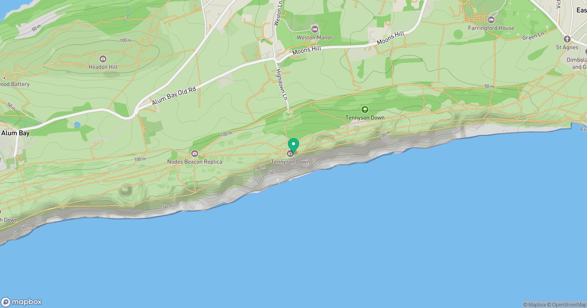
Grid reference: SZ325853
View on OpenStreetMapOpens a map in a new tab, centred on the hill.
Nearby Hills
Glastonbury Tor
158m
Leith Hill
294m
Ditchling Beacon
248m
Worcestershire Beacon
425m
Titterstone Clee Hill
533m
No comments yet. Be the first.